M 5.9 Lake Tennyson Sat, Feb 10 1990
This earthquake occurred in North Canterbury near Lake Tennyson.
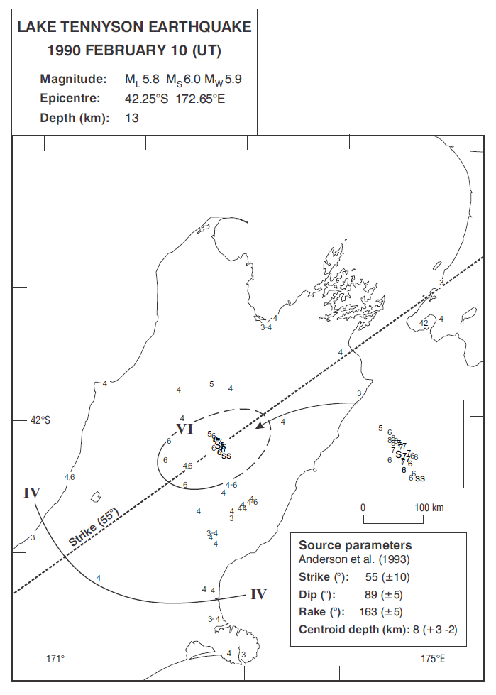
Isoseismal map of the Lake Tennyson earthquake. Courtesy Atlas of isoseismal maps of New Zealand earthquakes (2nd edition): Downes, G.L.; Dowrick, D.J.
- Magnitudes: ML 5.8, MW 5.9, MS 6.0
This earthquake occurred in North Canterbury near Lake Tennyson and was followed within the next 30 minutes by aftershocks of ML 5.5 and 5.3. In the following week, portable digital equipment recorded over 4,000 aftershocks. The main shock shattered mountain ridges in the vicinity and snapped beech trees in the surrounding forest1. It was felt from Akaroa through to Whanganui.
1Seismological Observatory [New Zealand] Bulletin E 174, 1990. New Zealand Seismological Report 1988