
10 June 1886: Tarawera eruption
131 years ago today the largest historic eruption in New Zealand's history occurred, claiming 106 lives.
Early on the morning of 10 June 1886 the residents of the Rotorua District started to feel earthquakes, the number of events and strength of the shaking was also increasing. Earthquake swarms are not uncommon in the Taupo Volcanic Zone, however this one was different, as Mt Tarawera was to start erupting at 2 am. Sheet lightening, explosions and growing eruption clouds characterised the views from Rotorua. The eruption started near the summit of Ruawahia Dome (meaning split or cloven hole or cave) and moved northeast through Wahanga Dome (bursting open). Shortly after, the rift started to open to the south through Tarawera Dome (burnt peak or cliff). This portion of the eruption led to tall eruption clouds loaded with scoria that were primarily blown northward over the Bay of Plenty and out to sea. Several ships offshore of the North Island later reported encountering the effects of the eruption. The explosions were heard as far afield as Auckland and Nelson.
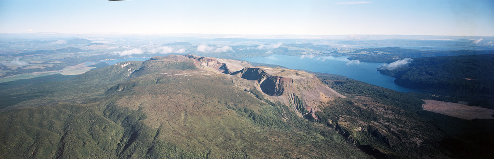
1886 Rift through the Tarawera summit domes
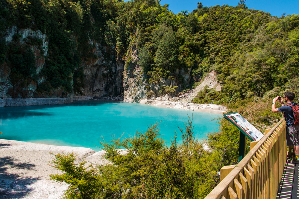
About 3 hours after the eruption started the focus moved to the Lake Rotomahana area, where a large geothermal system existed which fed hot water to the Pink and White Terraces. Here the style of the eruption changed from magmatic (driven by magma) to phreatomagmatic (mixed steam and magma). The largest and most explosive eruptions were generated by this phase of the eruption as the magma interacted with the geothermal system. These eruptions formed a mud like deposit and were probably responsible for most of the 106 deaths. The former lakes Rotomahana (hot lake) and Rotomakariri (cold lake) had their basins excavated and a new large crater complex was formed. The terraces were destroyed, although portions have recently been discovered at 40 m depth. Soon after, the craters started to fill with rain water and today they are the home to the modern Lake Rotomahana. Many geothermal features are present around the lake shores today.
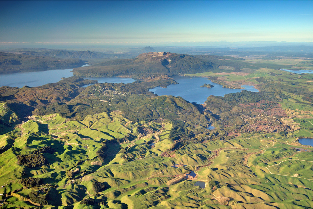
Tarawera-Waimangu
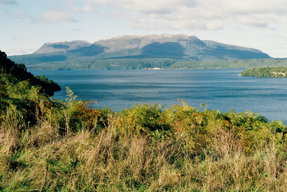
Tarawera from West
The third phase of the eruption saw the rift open south from Lake Rotomahana to the Waimangu valley area, opening a series of craters where none had existed before. Soon craters existed along a rift 17 kilometres long from Mt Tarawera to Waimangu. Two of the craters formed at Waimangu erupted scoria, while the rest were formed by steam driven eruptions and collapse. The Waimangu area has been the focus of many steam driven hydrothermal eruptions, including the famous Waimangu Geyser. In April 1914, a particularly large steam eruption killed four guests at the nearby accommodation house. The latest eruption was in May 2016 from three vents within Raupo Pond Crater. Two of the larger craters are now homes to crater lakes (Frying Pan and Inferno). The water level of Inferno Crater Lake is known to rise and fall through 8-10 m over a 38-day period.
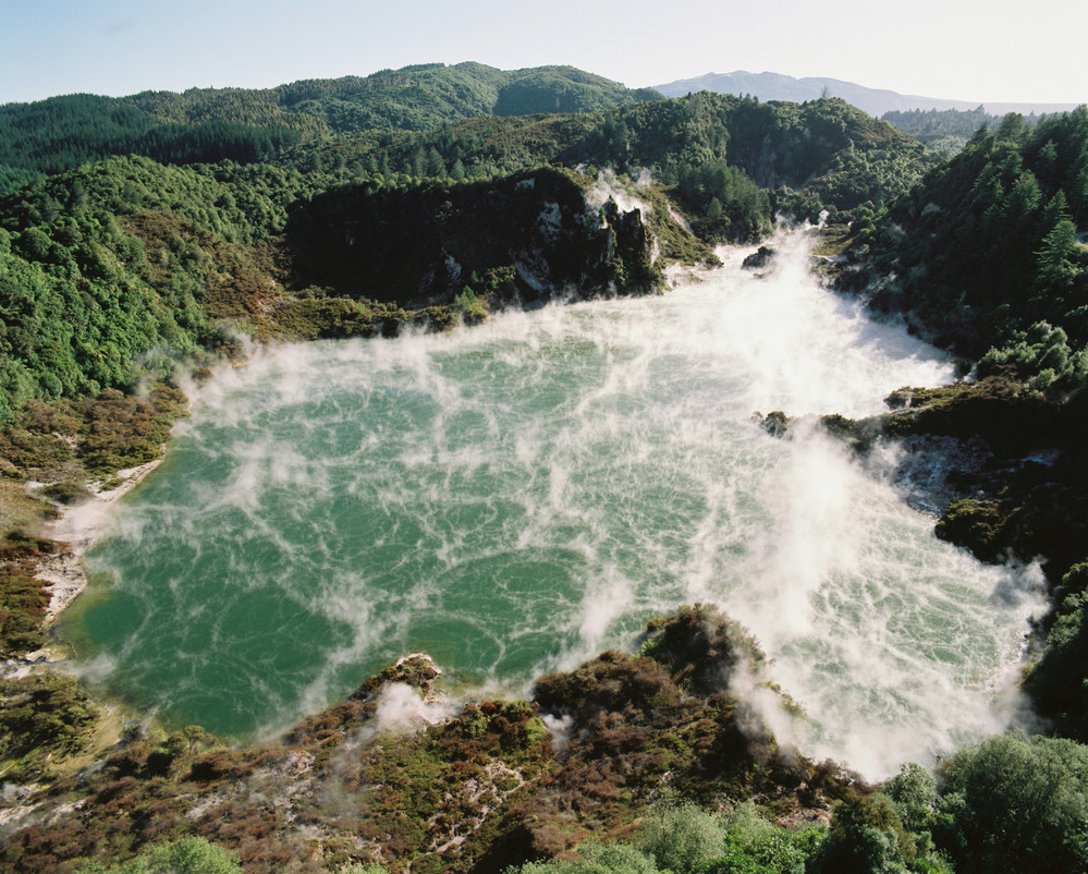
Frying Pan
Inferno
Mt Tarawera is one of two lava dome complexes that make up the Okataina Volcanic Centre east of Rotorua. The other is known as Haroharo. The two dome complexes lie within a caldera volcano. Several eruptions have occurred from the Tarawera area to build up the domes (18,000; 15,000; 11,000 and 600 years ago). The GeoNet project monitors the Tarawera area for signs of reawakening.