
Submarine eruption in Tonga gives us a chance to test our satellite analysis techniques
Submarine eruptions rarely happen close to New Zealand, so when the eruption happened off Tonga in August, GeoNet got a chance to test our satellite data analysis tools.
Being able to understand what has happened at an offshore, submarine volcano is an important part of our monitoring role.
Satellite data has allowed us to pinpoint the source area of the August 2019 eruption, track the pumice raft and identify further volcanic activity at another site nearby. One thing we know using the satellite data, is that this eruption has come from a different site than the Sept-Oct 2001 eruption from Unnamed seamount about 50 km NW of Vava’u in Tonga.
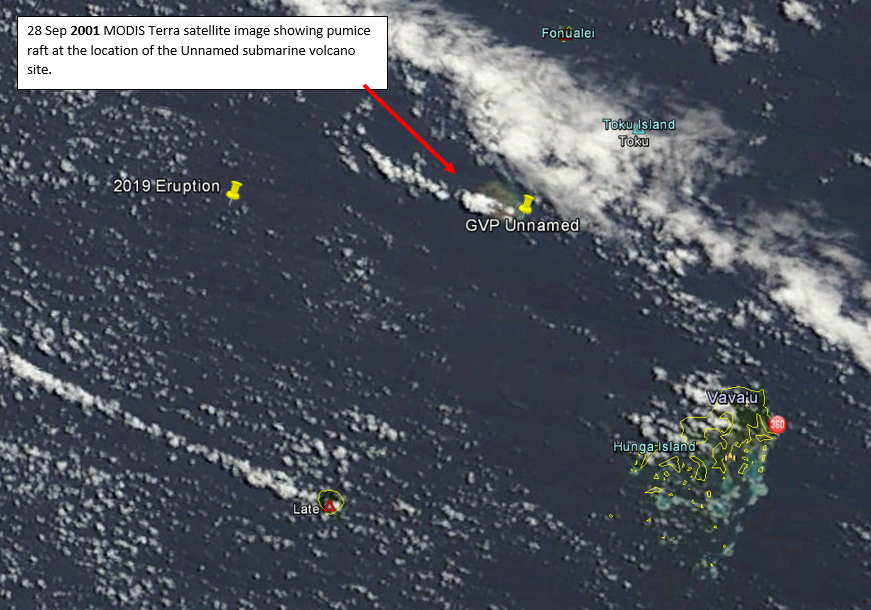
MODIS Terra satellite image showing the location of the pumice raft produced in 2001 and the location of the 2019 eruption. The Global Volcanism Program (GVP) Unnamed seamount is not responsible for the August 2019 pumice raft.
At that GVP Unnamed site, we did observe discoloured sea on 12 August (Sentinel-2 satellite data). Interestingly, this discolouration is separate from the main August 2019 pumice raft and is most likely geothermal activity rather than an eruption.
Dr Salman Ashraf who has been processing the satellite data comments: “This is some of the most exciting data I have worked with and gives me confidence that should a submarine eruption occur in New Zealand waters we would be able to monitor the progress of the eruption.”
The 2012 Havre seamount eruption (800 km north of New Zealand) – the largest deep-sea eruption in over a century – produced a pumice raft that covered over 400 square kilometres. This eruption was the catalyst for developing a tool to analyse these events. The August 2019 raft was only 60 square kilometres.
If a submarine eruption occurred closer to New Zealand, our scientists would use this tool to track a pumice raft and anticipate where it might drift. They could then advise other agencies such as Maritime New Zealand and regional councils on what possible effects such a raft might have on our harbours and coastlines.
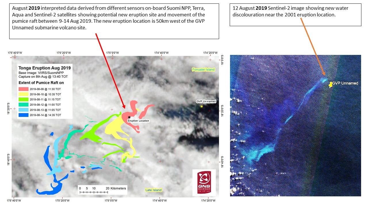
The migration of the August 2019 pumice raft (left). The Sentinel-2 image (right) shows some other volcanic activity (likely geothermal) at the GVP Unnamed seamount on 12 August.
Using the data analysis tool, our scientists have been able to keep tabs on the pumice raft and can now confirm that it has made its way to Fiji and beyond.
Attributable to: Dr Salman Ashraf – Remote Sensing Scientist, GNS Science
Media contact: Brad Scott – 07 374 8211