
Tech Tales: Raoul Island Revisited
To round out the week that started with World Tsunami Awareness Day, we thought it fitting to share about our field technicians’ latest trip to our northernmost tsunami gauge site, Raoul Island.
Our field techs Kris, Merijn and Matthew journeyed up to Raoul Island in the Kermadecs in September to continue the work they started in February. Their primary job this time was to install a brand new, 2.4m satellite dish that will keep sending timely data back to New Zealand and minimise the effect weather can have on data transmission.
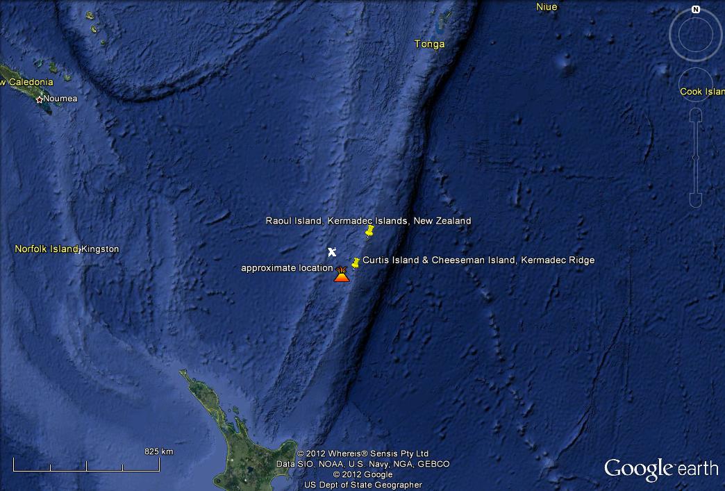
The location of the Kermadec Islands, volcanic islands located along the Kermadec Ridge, relative to New Zealand (Source: US Navy).
The new dish provides a more reliable delivery of critical volcano, earthquake and tsunami monitoring information. Raoul Island is one of our most important monitoring sites as it is located north of New Zealand in the Kermadec Ridge, nearly half-way to Tonga. This strategic location means the information we receive from our monitoring stations is really important. If a large earthquake were to occur in the Pacific, our Raoul Island tsunami gauge would give us information about any tsunami caused by the earthquake and act as an early warning system for New Zealand.
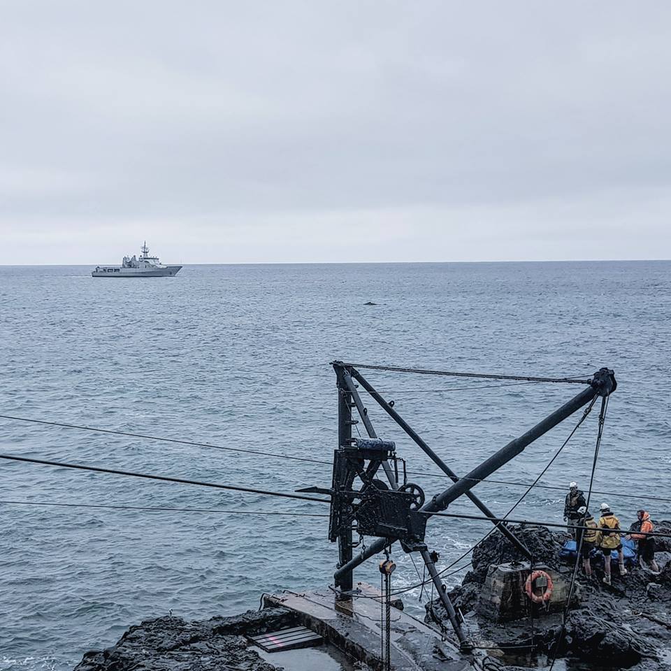
How to get on and off the island, including whale watching!
Time is of the essence on these resupply missions and with only five full days on the island to complete their task, the technicians set out amidst the rain to get the job done. The site had already been prepared for the installation in February. After assembling the new dish and checking the connection to the mainland, the team performed maintenance on some of our monitoring equipment and instruments on the island to keep them running at their peak.
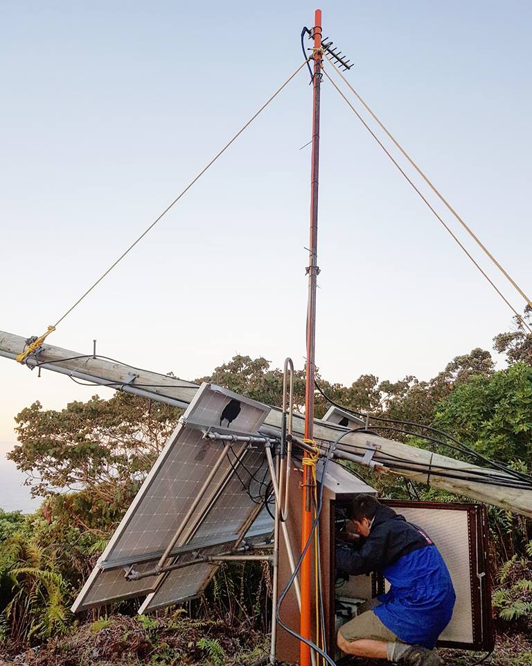
All the data from the various sites on Raoul travels through a communications hub located high up Mt Moumoukai, so the team started there. This monitoring site is ideally located - up high to charge up the solar panels that power the site, relatively free of obstructions so it can transmit data to our other sites on the island, and yet still close enough to the active crater to monitor volcanic activity.
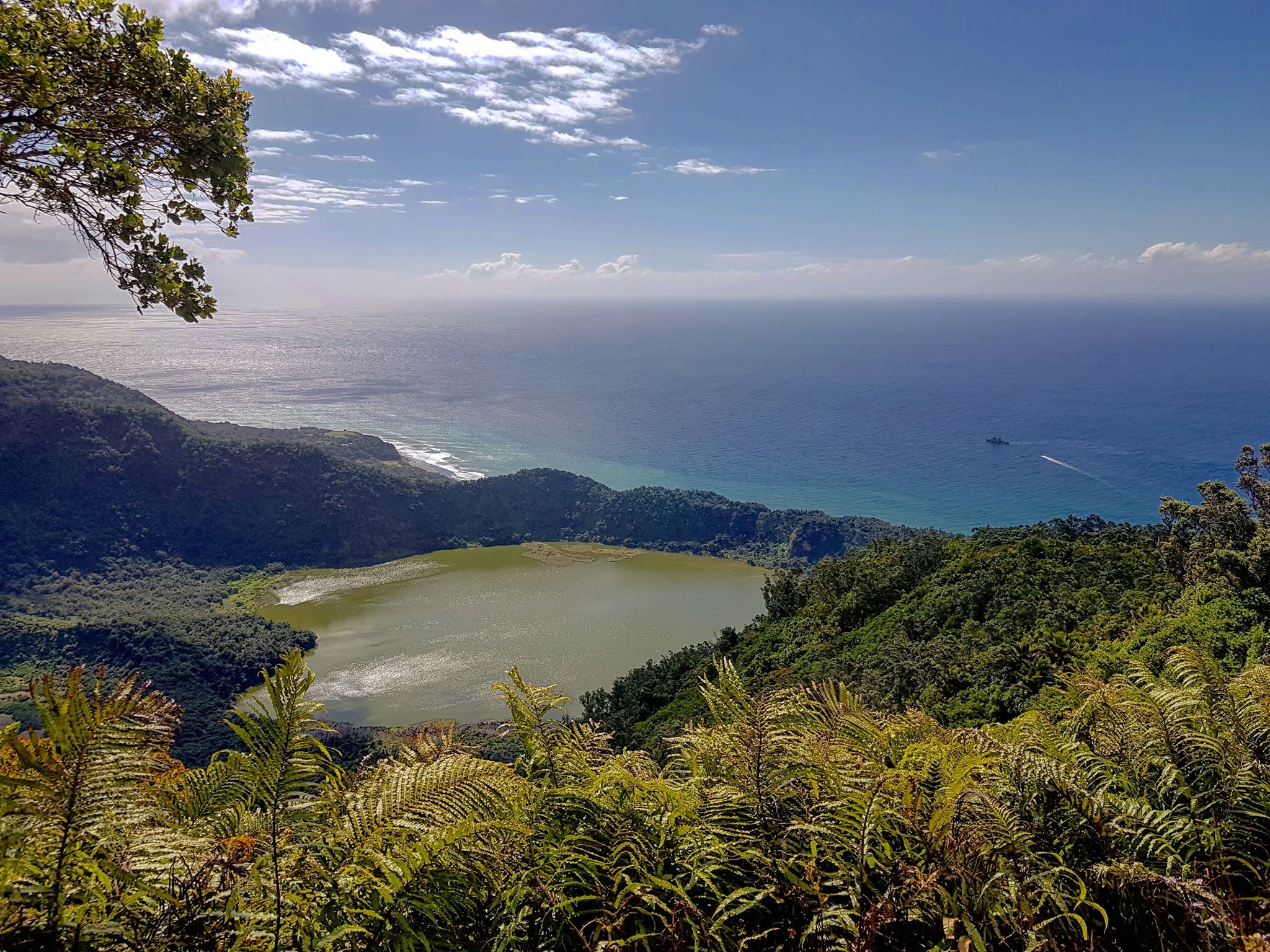
View from Crater Rim
They found that the antenna mast had sustained weather damage and repairs were needed on this trip, as the antenna is vital to our volcano info data transmission.
After review of the active caldera by a Volcano Duty Officer, the team got permission to enter the crater to check on the Green Lake site. As they were descending into the crater, a M6.9 earthquake struck, centred 300km south-west of Raoul Island. It was a timely reminder of the earthquake risk in the region and why the monitoring equipment is so important in locating nearby earthquakes.
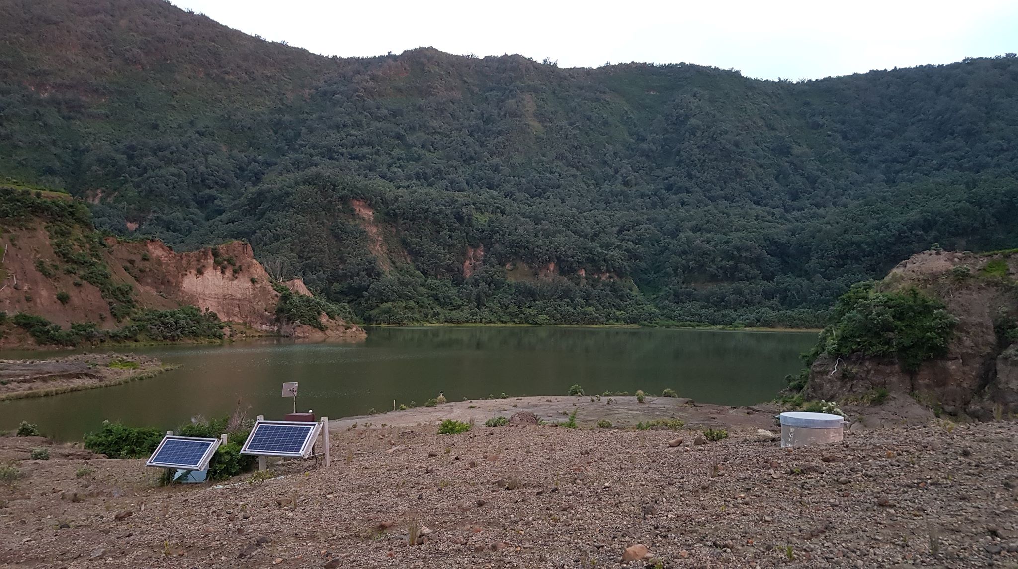
Green Lake
Raoul Island is a two-day boat journey from Auckland, so the repairs to the mast had to be done using what little resources were on the island. Popping up to the shops was not an option! But with a bit of Kiwi (and GNS) ingenuity, the team knocked up a new antenna (which has more than a passing resemblance to the Wellington Wind Wand!) and repaired the radio link between the Boat Cove tsunami gauge and the new Mt Moumoukai mast. New Zealand’s early warning tsunami system is back to peak performance!
Wellington Wind Wand-esque Antenna
These trips to Raoul Island are integral to our monitoring capabilities – but in the limited time they have, our teams need to work hard to get all work completed and operational. There are no roads on the island and carrying heavy gear around the volcanic landscape to our various sites is required. Follow the below link to check out the incredible drone footage taken on this trip and explore the island and our monitoring sites.
We would like to take this opportunity to thank the other organisations who made the journey with us. Without the help of The Royal New Zealand Navy, Maritime New Zealand, DoC and MetService the successful completion of our tasks would not have been possible.
Words, photos and video by Kris O’Brien for GeoNet/GNS Science.