
Ngauranga, now Ngaio. Wellington keeps slipping and sliding. An update on the Ngaio Gorge slip.
Over the last few days, the commute for residents of Wellington's suburb of Ngaio has been very inconvenient due to a large slip on Ngaio Gorge Road. Our experts have provided us with an update.
Early last Saturday morning, our Landslide team received a call from roading contractors at Downer Group. They were in the Ngaio Gorge to clear a small slip from a cut slope (a slope that had been formed for road widening) that came down overnight, but were concerned that it was still moving and might be dangerous, and wanted our help to evaluate the stability and safety of the slope.
GNS Science landslide team members, Chris Massey and Sally Dellow, arrived on site at 11:00 am and with an engineer from Coffey, contractors from Downer and Wellington City Council (WCC) engineers, they carried out a walkover to assess the site's stability.
Several open cracks were observed on the slope, and to get a closer look at what was happening on the slope, Will Ries (GNS Science) flew a drone over the site. Cracks were visible above and adjacent to the area from where material had already fallen.
The police in consultation with WCC and engineers at site decided that it was not safe to re-open the road as small volumes of debris continued to fall from the slope every few minutes or so, and given the extent of the cracking, it was thought that there was potential for a much larger volume to fall from the slope.
This was a good call, because on Sunday morning between 7:30 and 8:00 am, a much larger volume of material fell from the slope, depositing about 1,300 cubic metres of rock and debris, including large boulders, onto both lanes of the road, blocking it completely.
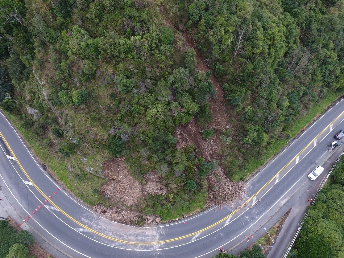
Photo from the drone taken on Saturday morning showing the extent of the first landslides. The landslide to the left came down early on Saturday, and had already been partially cleared by contractors. The one to the right came down while the contractors were working (Photo: GNS Science).
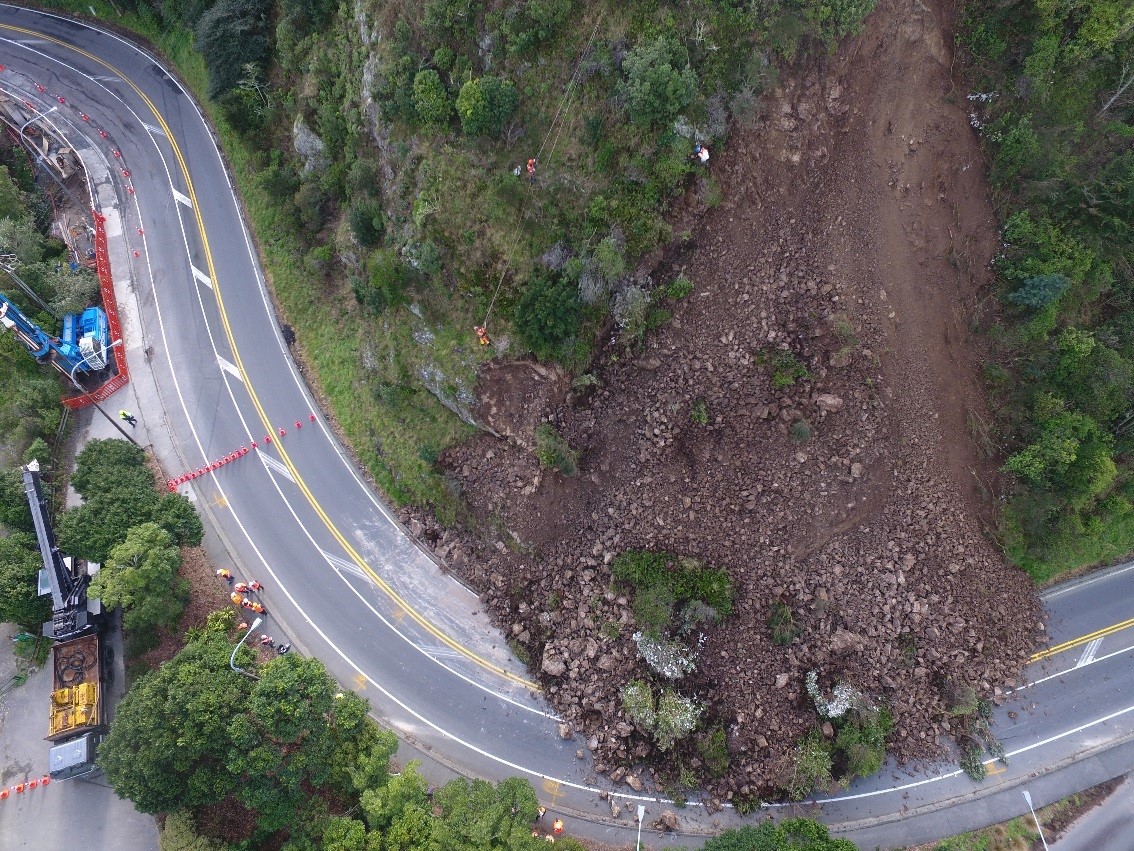
Photo from the drone taken on Sunday morning showing the large amount of additional rock and debris that come down early on Sunday morning (Photo: GNS Science).
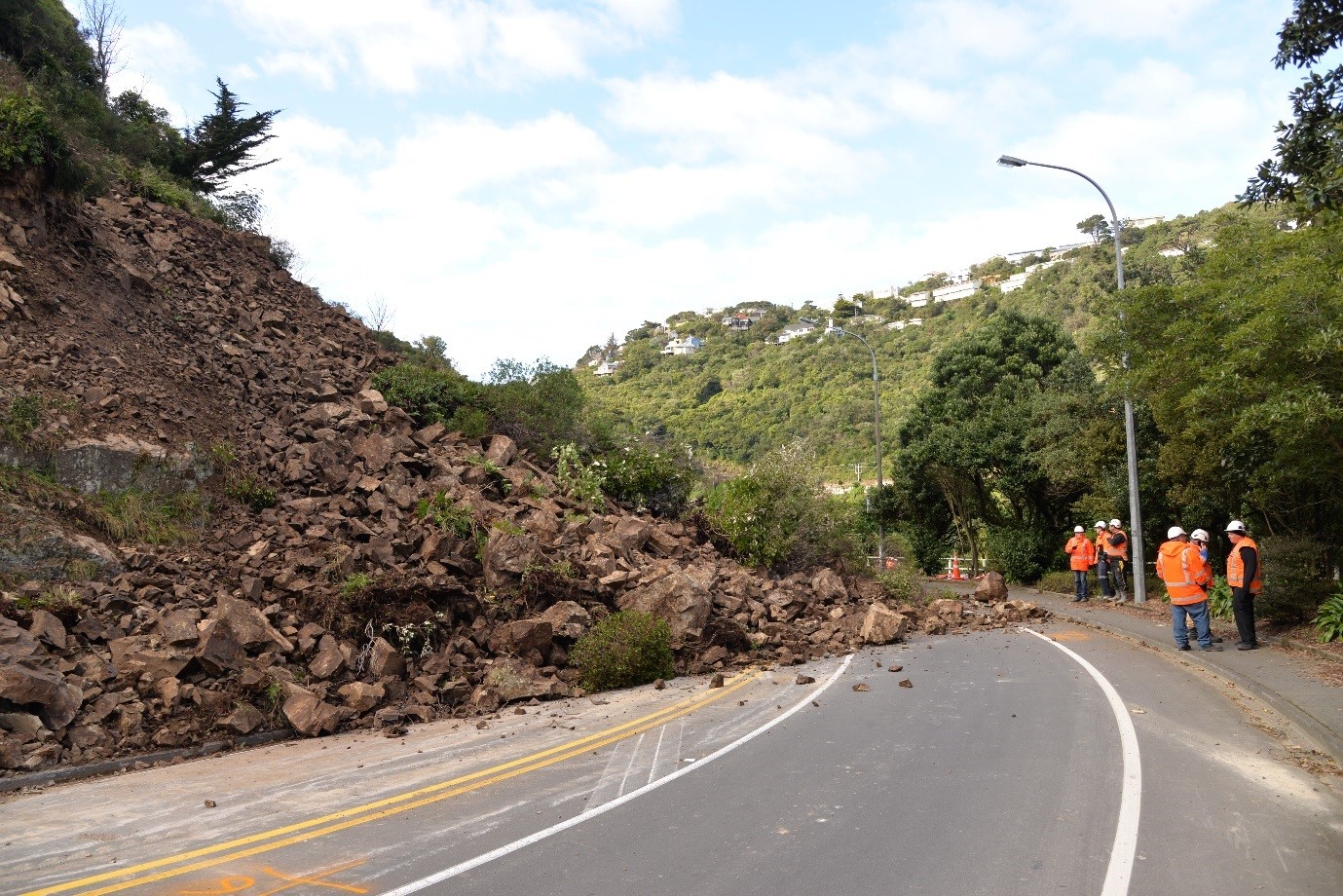
View from the road showing the scale of the landslide in relation to contractors on site (Photo: Chris Massey/GNS Science)
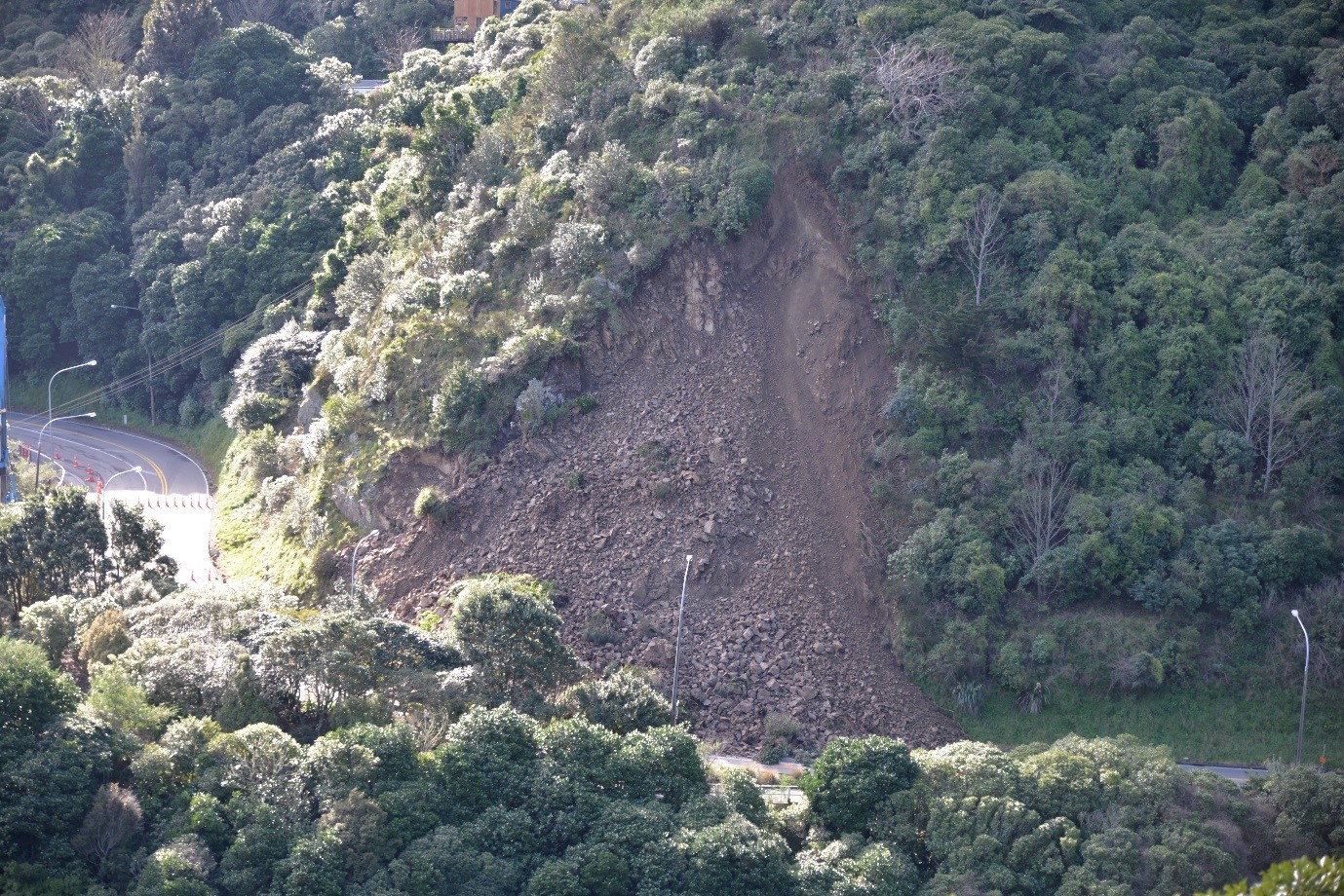
View from across the valley (Photo: Will Ries/GNS Science)
The landslide team was back out on Sunday morning with engineers from Opus consultants. The GNS team has used their laser scanner to build a detailed 3D model of the landslide. A difference model was produced to determine the volume of material involved in the landslide, and also, to provide a post landslide surface model of the slope to help engineers assess how best to remove the debris safely and stabilise the slope.
The difference model was created by subtracting the post-landslide slope surface derived using the laser scanner, from the pre landslide slope surface derived from the airborne LIDAR, commissioned by WCC in 2013. The volume of material is estimated to be about 1,300 cubic meters, which is much larger than the about 100 cubic meters of landslide debris that closed the southbound lanes of SH1 through the Ngauranga Gorge earlier in July.
GNS Science are providing information to WCC, Downer and Opus, as well as collecting information for our own research on modified slopes in Wellington.
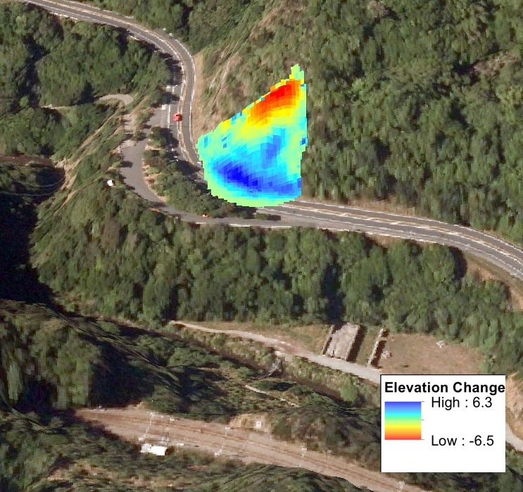
Three-dimensional change model for the landslide showing the source area where material was lost from (red and yellow) and the deposit (blue). The maximum depth of material loss and deposition was about +/- 6.5m.
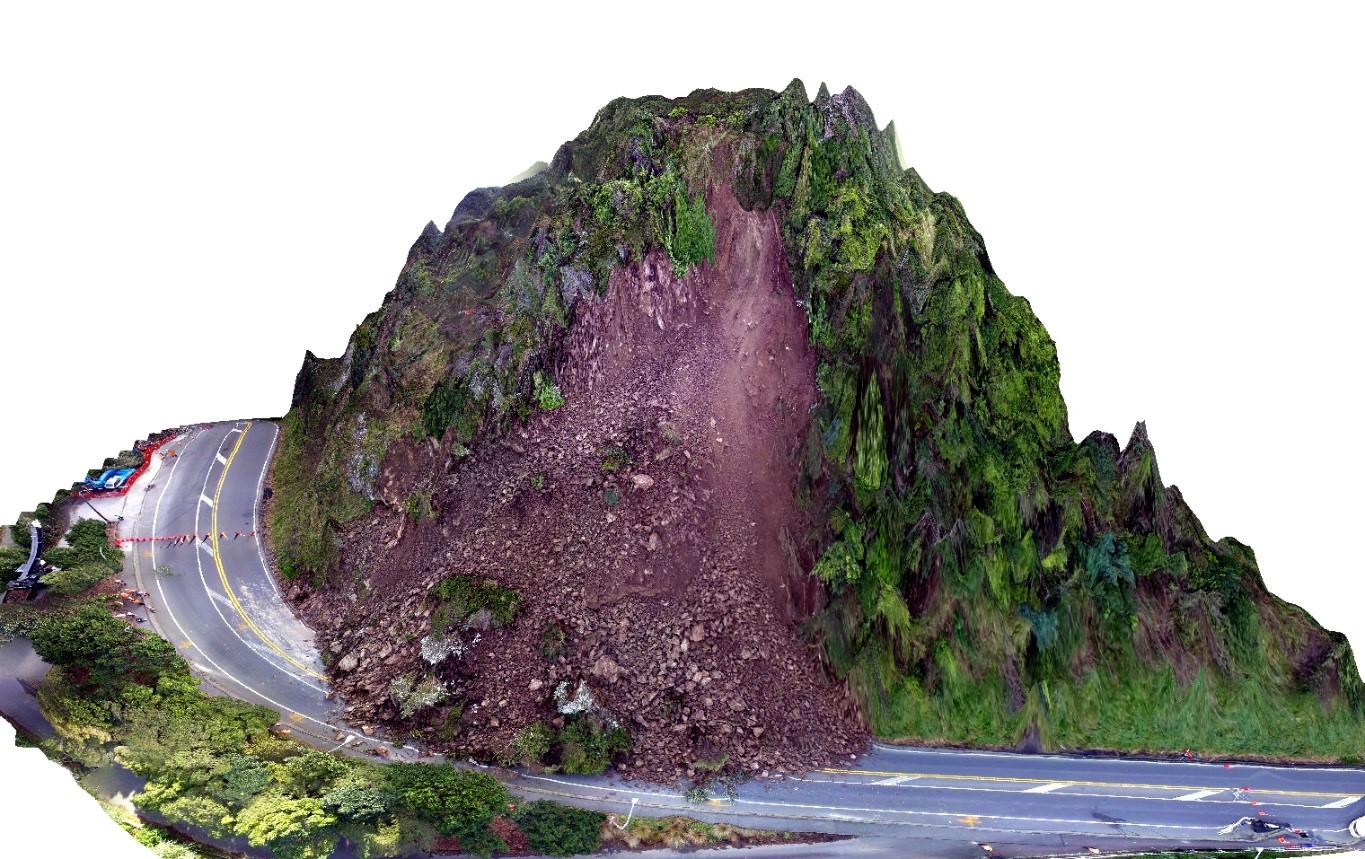
Three-dimensional model of the Ngaio Gorge landslide from across the valley (Will Ries / GNS Science)
The Ngaio Gorge landslide comes after a busy few weeks for the landslide team in Wellington, with the Ngauranga Gorge (link to GeoNet story here) being closed for several days by a landslide and, following a heavy downpour on Thursday night, multiple landslides were reported across the city, including two that closed roads and forced the evacuation of two homes, in Aro Valley and on Evans Bay Parade.
The first home, on Devon St in Aro Valley, was evacuated late on Thursday after a slip exposed the homes' foundations.
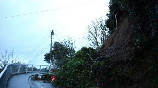
Devon Street landslide (Photo: Cameron Burnell / Stuff)
A second home was evacuated above Evans Bay Parade on Friday morning when a landslide brought down large amounts of soil and debris onto the city-bound lane near Point Jerningham, leaving the house’s deck foundations exposed.
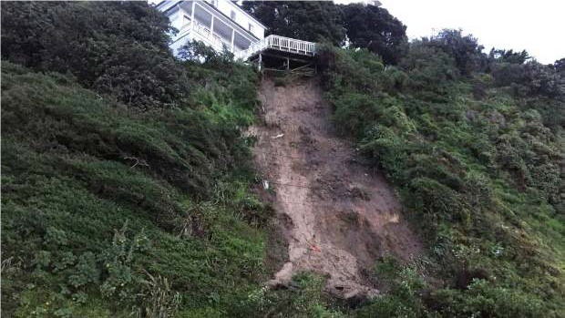
Evans Bay Parade slip (Photo: Ged Cann / Stuff)
NIWA reported that Wellington has had 166 per cent of its normal rainfall for July, with 228mm falling so far, making July 2017 the ninth-wettest July on record for Wellington. This was not as wet as July in 2006, which also caused many slips around Wellington.
There are other factors which could contribute to the high number of landslides recorded this year. Our landslide team will be investigating these as part of our ongoing research.