
Debbie and the landslide dams
Ex Tropical Cyclone Debbie has left a terrible path of destruction and sogginess throughout New Zealand this week.
Our thoughts are with those who have been affected by the flooding and landslides and with everyone working hard in the response and clean up. GeoNet’s landslide duty team has been kept busy, tracking where major landslides are occuring throughout the country. Several of North Canterbury and Marlborough’s landslide dams overtopped with the heavy rainfall but thankfully no one was directly impacted. Because Ex Tropical Cyclone Debbie has been such a major event, we’ve launched a GeoNet response to map and document the landslides that have occurred throughout the North Island and upper South Island. We’ll report back with our findings as we compile the information. In the meantime you can help us out by dobbing in landslides to info@geonet.org.nz. We’d love photos, but only take them if it is safe to do so – we don’t want any landslide martyrs.
Landslide dam breaches
We were particularly interested in how the North Canterbury and Kaikoura landslide dams would hold up to Debbie’s heavy rain – up to 200 mm of rain fell over four days in the Seaward Kaikoura Range.
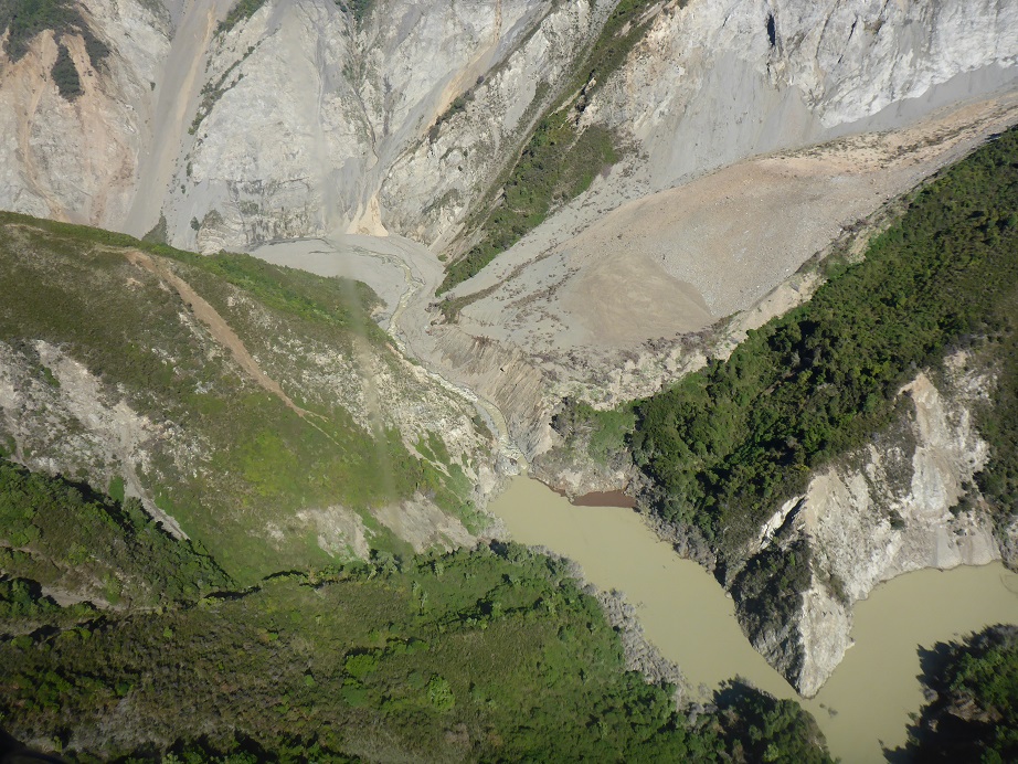
Water level recorders showed that the biggest landslide dam – the Hapuku dam – overtopped at around 2am on Thursday and this was confirmed by the Hapuku webcam at first light. But it wasn’t until yesterday that Environment Canterbury engineers and our landslide team were able to get up in the air to have a closer look at the Hapuku dam, and to see how the other landslide dams stood up to the deluge.
The Hapuku dam partially breached in what appears to be a combination of overtopping and erosion of seepage points on the dam face. The water level in the lake behind the dam dropped by about 2 metres and water is now flowing through a cut in the dam crest and down a natural spillway. As the river level drops upstream of the dam it is likely that the flow over the dam will stop as the lake level drops below the outlet level, but water will continue to seep through the dam as it did before.
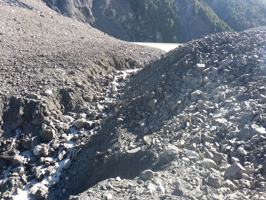
The Hapuku dam breach channel (photo: GNS Science)
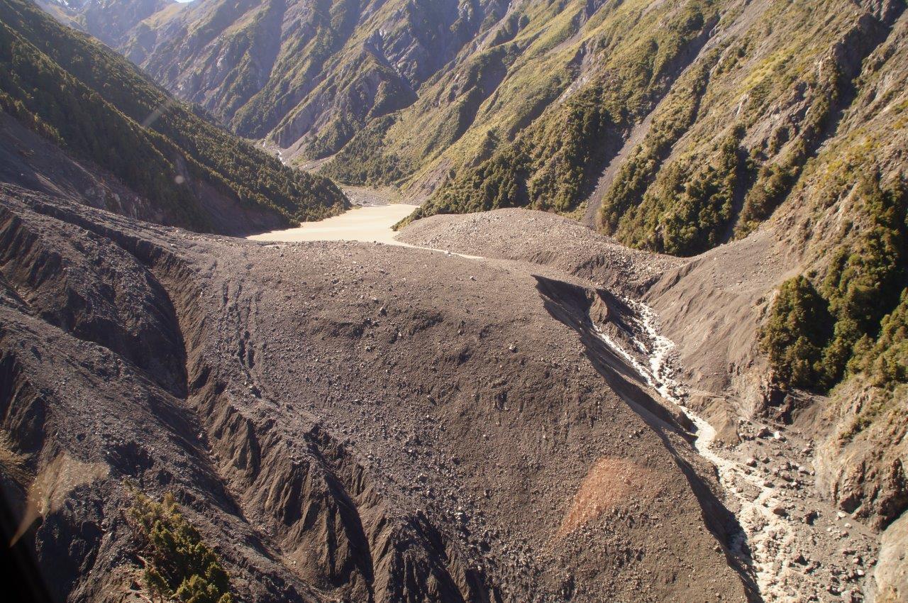
Hapuku dam breach looking upstream showing the natural spillway (photo: Environment Canterbury)
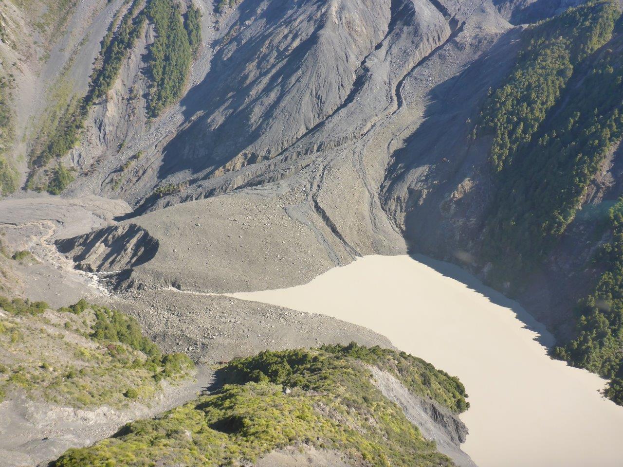
Hapuku dam breach looking downstream (photo: Environment Canterbury)
Landslide dams in the Ote Makura (Goose Bay), Linton and Conway rivers also partially breached as floodwater overtopped them, eroding channels through the landslide material. Flood waves from some of these breaches could be traced for some distance downstream – lines of debris a few metres above the river bed being a telltale sign – but the flood waves decreased fairly quickly there were no reports of damage. The risk posed by these dams is now significantly lower than it was. Environment Canterbury has updated its landslide dam webmap with this new information and photos.
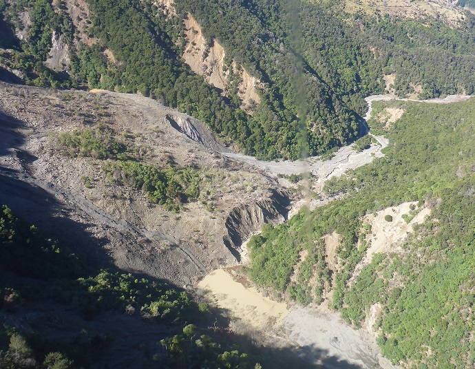
Linton dam breach looking downstream (photo: GNS Science)

Ote Makura (Goose Bay) dam breach (photo: Environment Canterbury)
Conway dam breach looking downstream (photo: GNS Science)
The GeoNet landslide team plans to survey the landslide dams over the next few weeks to get a better idea of how they breached. They will be comparing their computer models with what actually happened, and will be reassessing the risk that the dams may still pose to communities and infrastructure downstream.
Debris and mud flows
In addition to the landslide dams overtopping, the rain also picked up landslide debris initially triggered by the earthquake, creating debris flows that flooded parts of SH1 both north and south of Kaikoura and inundated part of a house at Rakautara. Floodwaters also ponded in areas where land had subsided on the downthrown side of the ruptured faults, particularly around the Kekerengu Fault.
An increase in landslides and debris flows during heavy rain is normal after an earthquake. This event is a reminder that people living near slopes and driving on roads in the area affected by the Kaikoura earthquake need to take extra care during rain.