Landslides and Landslide dams caused by the Kaikōura Earthquake
One hazard we don’t often get an opportunity to talk about at GeoNet is landslides. That’s a good thing, we aren’t complaining. But with the M7.8 Kaikōura Earthquake, landslides and land deformation have been at the forefront of risk to communities living in North Canterbury and Marlborough.
Our landslide and paleoseismology teams quickly took to the skies to spot landslides in the Kaikōuras and Southern Alps. After clocking hours upon hours in the skies, we estimate that there has been between 80,000 to 100,000 landslides triggered by the Kaikōura earthquake and aftershocks.
What we know so far
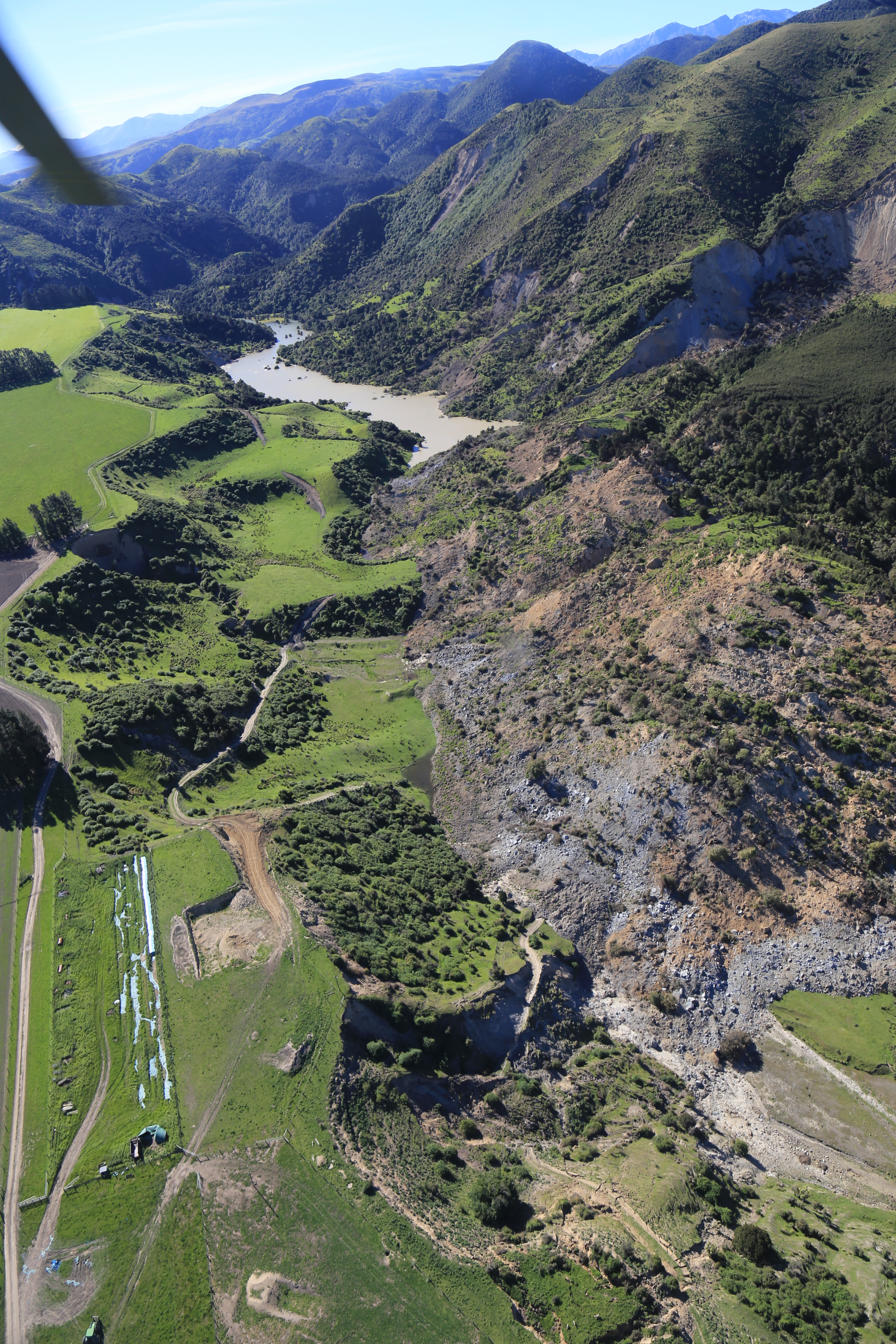
Certain areas have more landslides than others. In our flybys, the landslides begin just south from Cape Campbell, becoming more intense south of the Clarence River, with several large (100,000 – 500,000 m3) landslides disrupting both State Highway 1 and South Island Main Trunk railway (e.g. Ohau Point and Waipapa Bay areas). South of Kaikōura, on the steep slopes near Twin Tunnels, damage was similar to areas north of Kaikōura, again covering and or disrupting both State Highway 1 and railway.
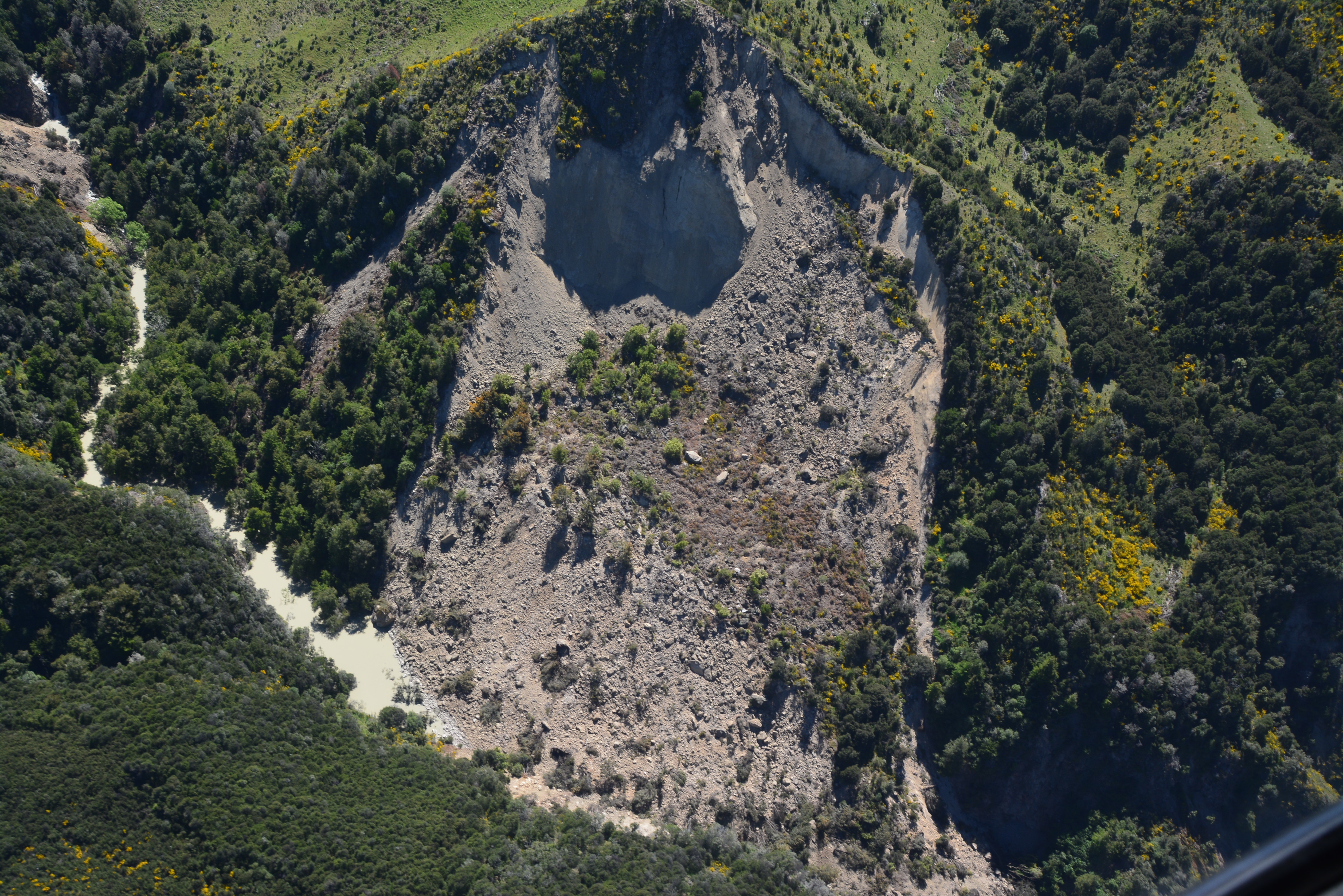
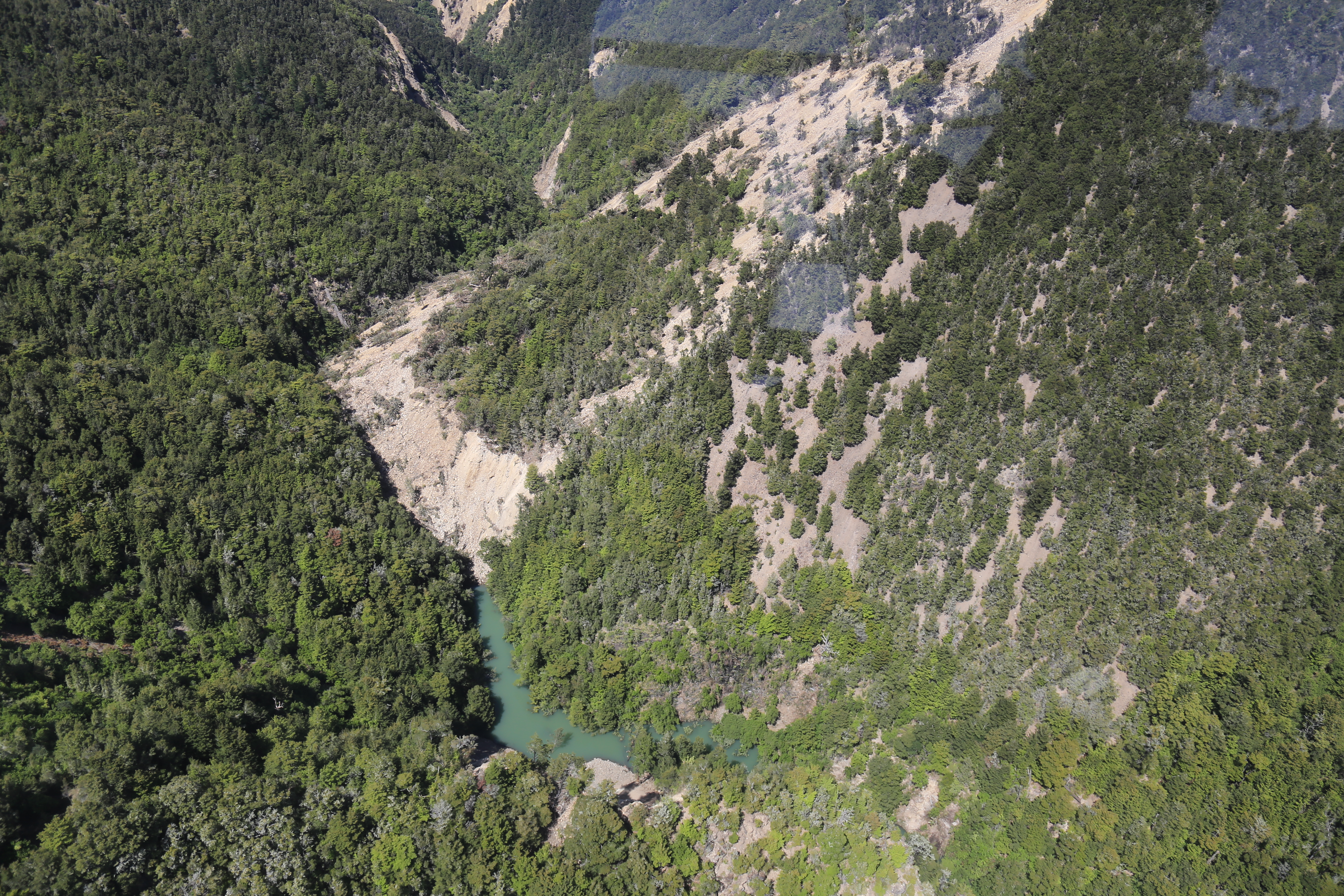
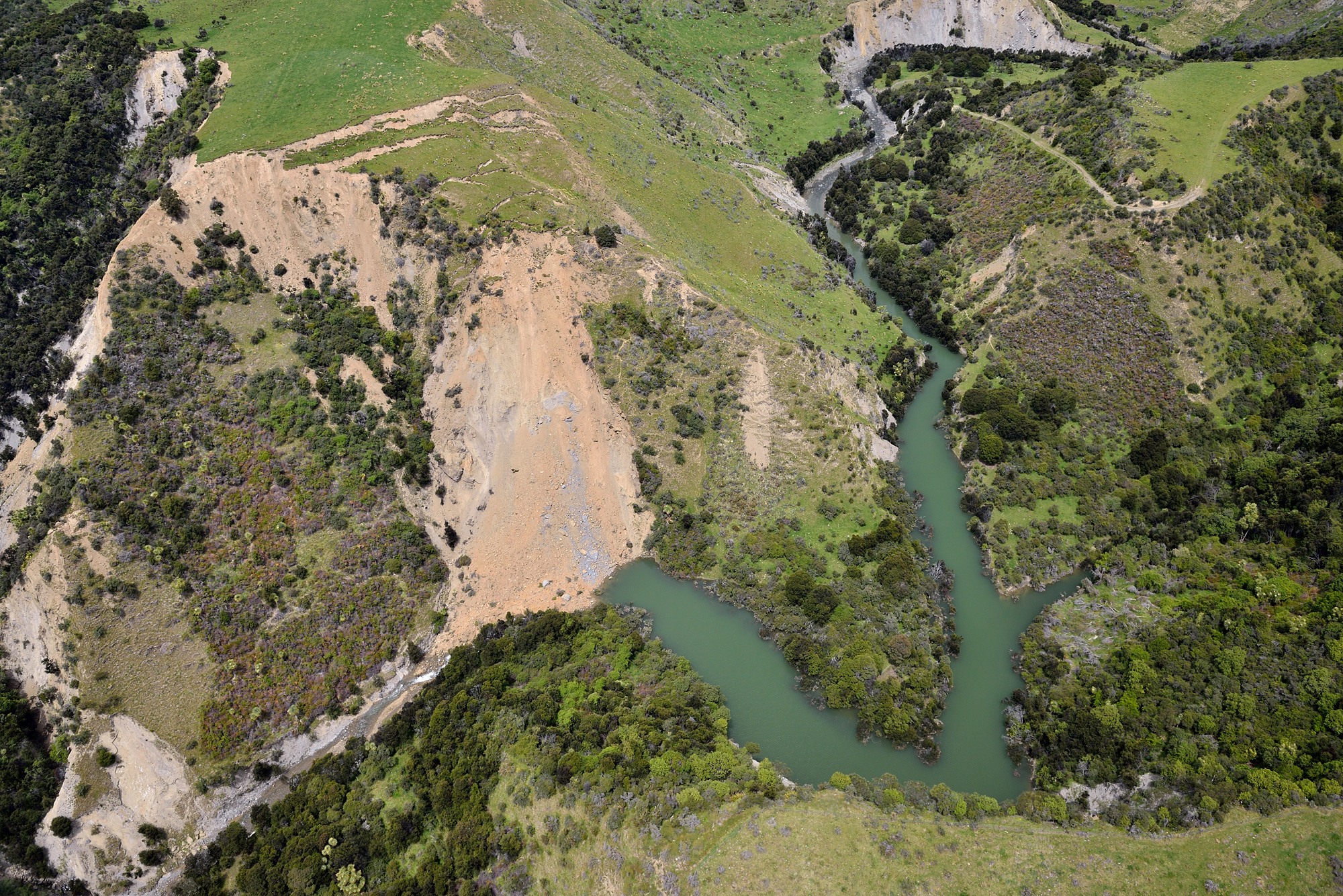
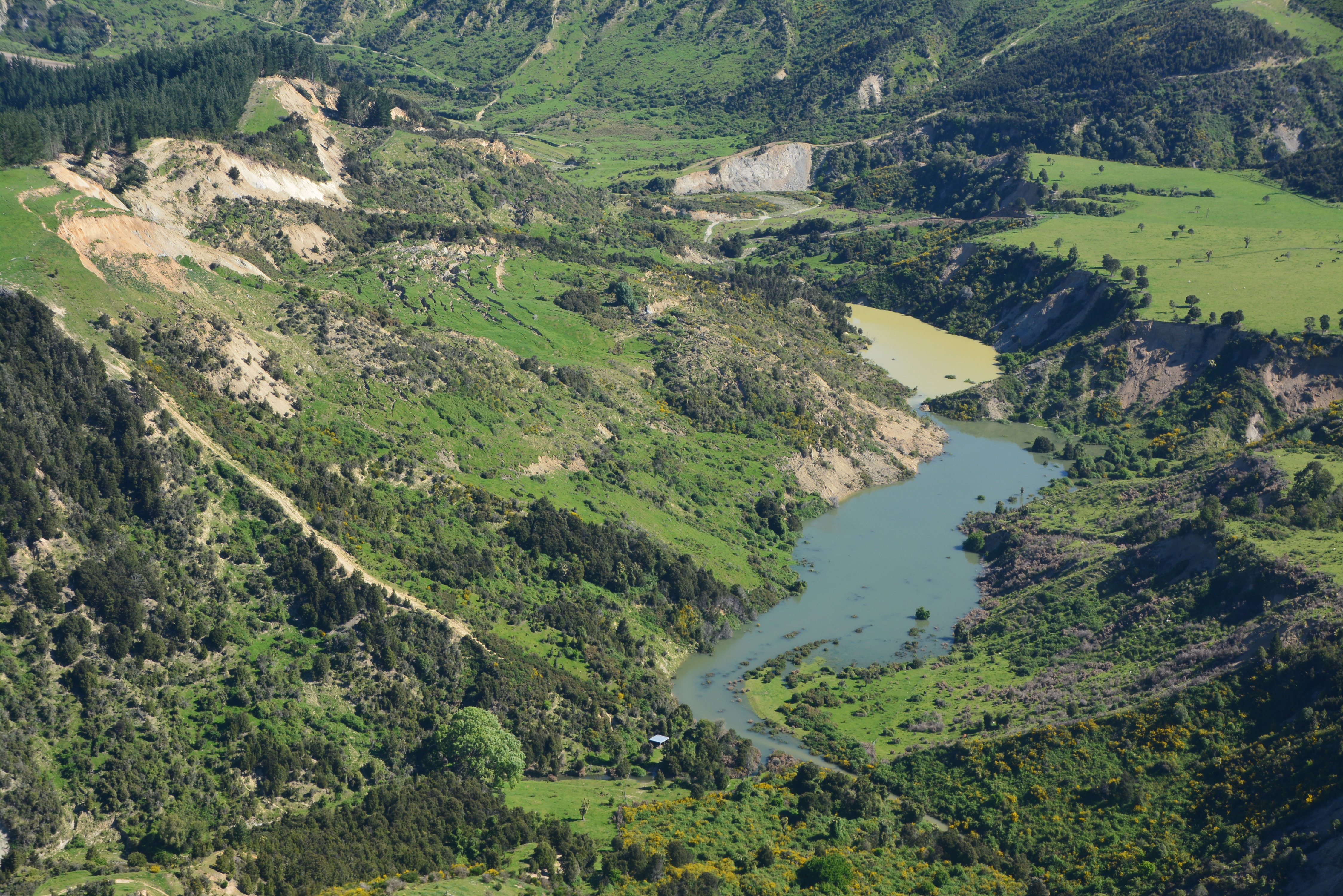
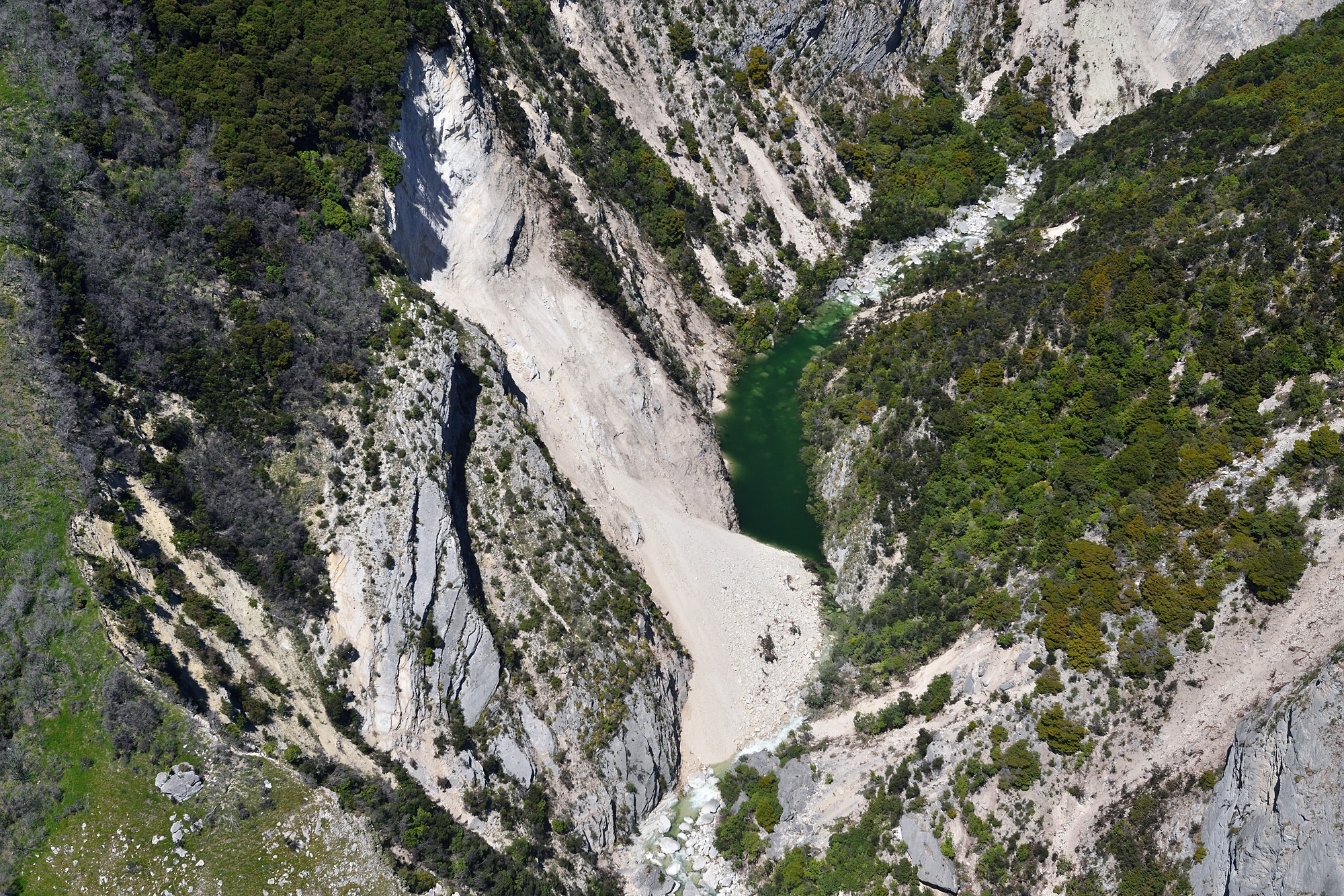
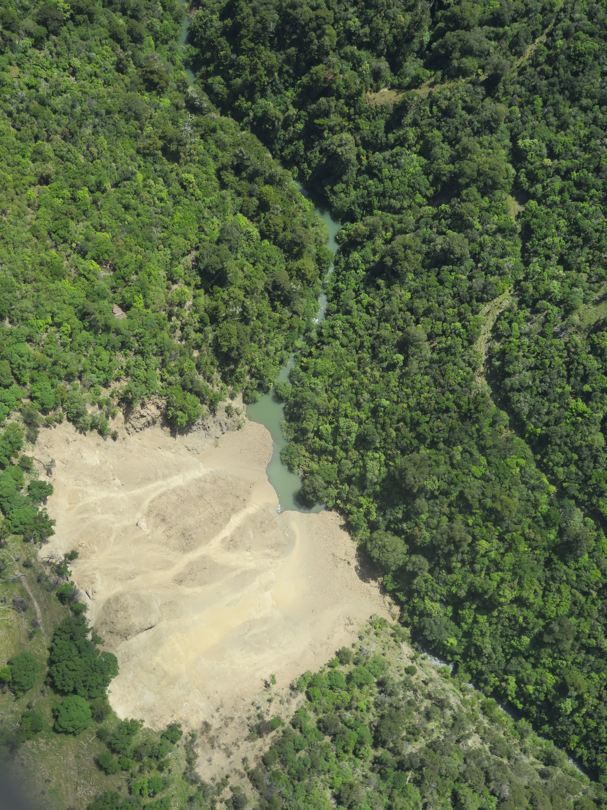
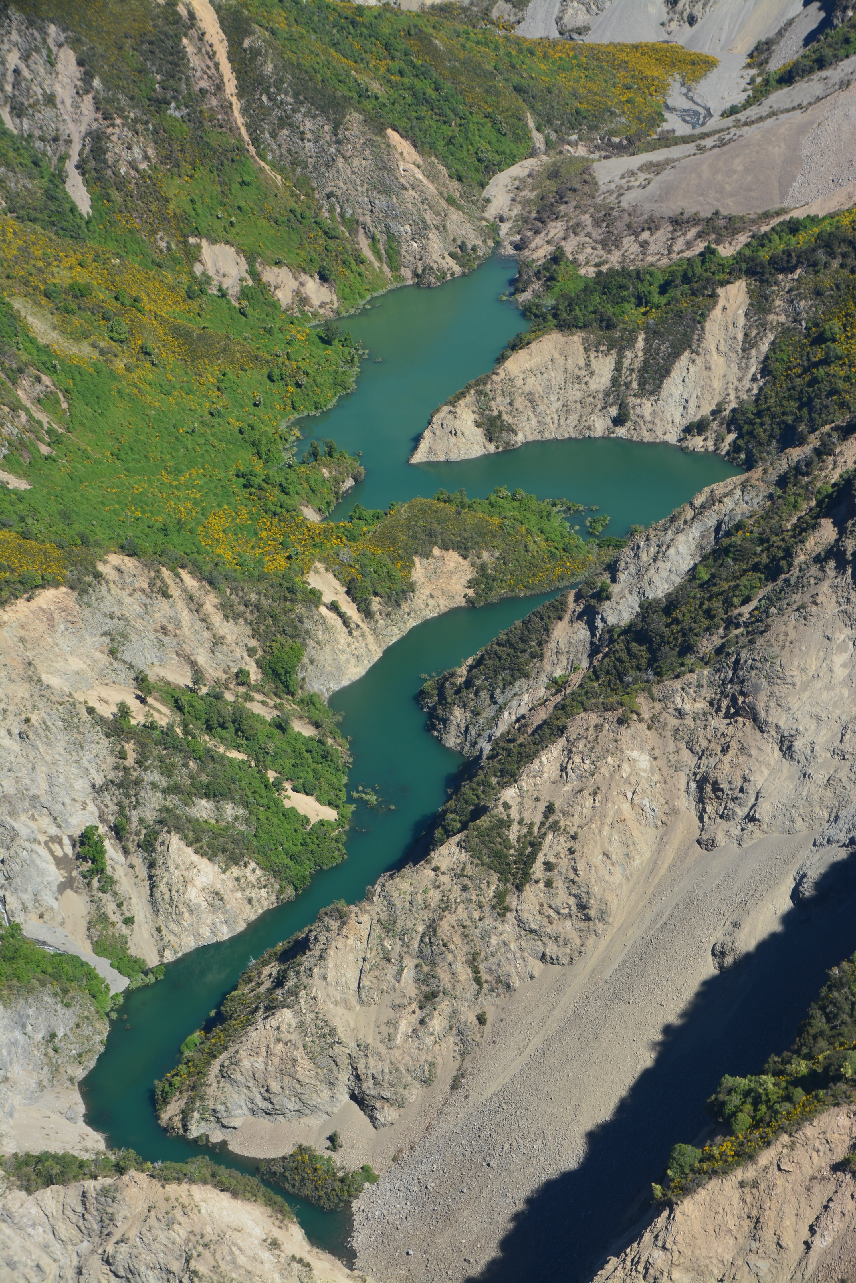
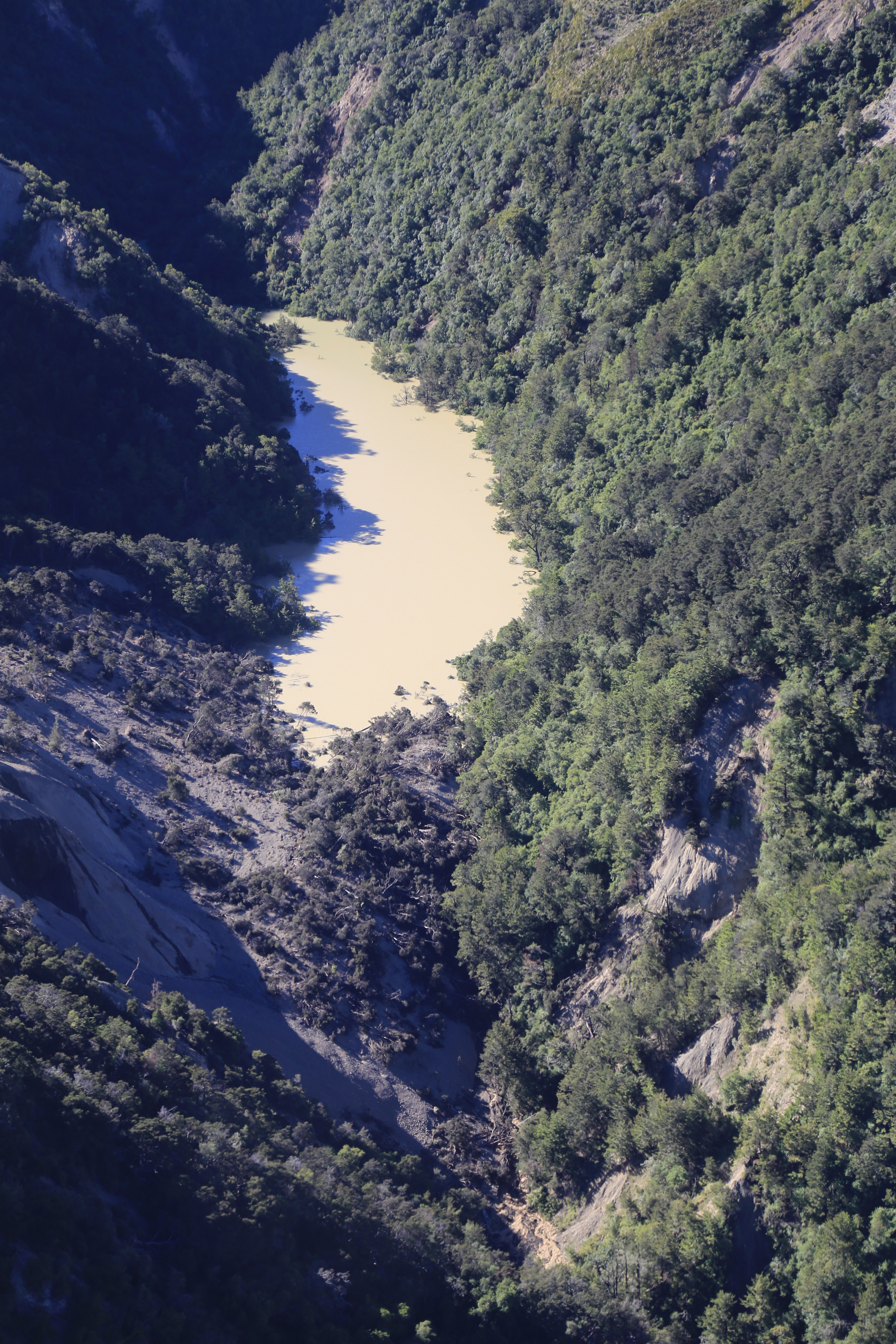
What are landslide dams?
A landslide forms a dam when the debris from the landslide blocks a stream or river. There are two parts to a landslide that dams a river, the landslide itself and the lake or pond that forms because of the landslide blocking the watercourse. There is a complex relationship between dam size, lake volume and landslide type that determines whether or not a dam will fail. Every landslide dam differs in terms of size and composition, so their behaviour over time varies. Landslide dams can last from a few minutes through to thousands of years. Failure modes of landslide dams include overtopping and headward erosion (when the downstream side of the dam erodes), piping (water flowing through the dam) and additional slope failure, particularly into the newly formed lake.
If a landslide dam rapidly fails, the flood wave of water starts off high near the dam, and rapidly lowers as it moves downstream. Alternatively, the dam may also gradually erode and the water level in the lake will decrease relatively slowly with no flood peak travelling downstream. Since the earthquake happened, GNS Science has been working to compile a complete inventory of landslide dams in the area affected by landslides after the earthquake. This work involves using remotely sensed (satellite) imagery, and a systematic search for landslides by flying over affected areas to locate landslide dammed lakes. So far 42 landslide dams have been identified and we expect to find a few more small ones.
Where are the landslide dams?
There have been 150 landslide dams identified so far in the Kaikōura area, most of these dams are small and pose little risk. However, we are monitoring 11 landslide dams because the may pose a risk to areas downstream (these 11 are Conway, Gelt, Hapuku, Leader upstream, Leader downstream, Linton, Medway, Ote Makura, Stanton, Towy, Waima). The landslide dams with the highest level of hazard are currently:
- Linton Stream, which has a large, leaking dam with a lake behind it
- Conway River (lower dam) – water is flowing through the dam which is helping to lower the lake level behind it, but there is still a potential for failure
- Hapuku River – the dam is formed by a rock, sand and silt avalanche. The lake is filling so the hazard will increase through time until it is full.
For maps and more information have a look at the great work Environment Canterbury have published
Gelt River

Hapuku River
Upstream section of the Leader River
Medway River
Stanton River
Waima River
What causes a landslide dam to fail?
The likelihood of dam failure is higher during periods of steady or intense rainfall, and for about 24 hours afterwards. There is more likely to be a rapid dam failure if there is a lot of water upstream of a small dam, whereas rapid dam failure is much less likely if there is a just a small amount of water upstream of a large dam.
Landslide dam failure
There are three different options for how long landslide dams last. These data are general and apply to all of the dams, so we can’t give any specific information on what might happen at each of the dams. At this stage, none of the dams look like they will overtop their river flood banks if they do fail rapidly. If rapid failure occurs without being associated with heavy rainfall then the level of the water will probably be a maximum of the level experienced during a 1 in 10-year flood - but no warning will be given.
Short lived landslide dams. Over half of dams (about 56 percent) fail within a month after forming. In this case, the dam remains in place until it is rapidly overtopped by water. Rarely, the dam may fail more slowly. The time between the dam overtopping and rapid failure can be between days and a month. As an example of rapid dam failure, the Poerua River dam failed in 1999. While this example shows what has happened in the past when a landslide dam rapidly failed, it’s important to note that this dam is larger than any of the dams seen in the Kaikōura area.
Medium lived landslide dams. Almost a third of landslide dams survive the initial overtopping but then eventually either fail rapidly because of downward or headward erosion, or fail slowly as water permeates through it, removing sediment over time until the dam has gone.
Long lived landslide dams. Some dams become a semi-permanent or permanent feature, forming a lake behind the dam. Examples of this are the Young River dam and the dam at Lake Waikaremoana, which formed the lake itself. Both of these dams are much larger than any of the dams seen in the Kaikōura area. The percentages in the above descriptions are from Costa and Schuster (1988).
On-going assessments of landslides and landslide dams
As the landslide data comes in it is being used to undertake dam-break modelling, which will help determine what will happen if a dam fails rapidly. This modelling is used to determine where the flood wave from rapid failure will go assuming normal river flow conditions. From this people and assets at risk can be identified and management plans put in place.
Landslide specialists at GNS Science are working hard to confirm the initial assessments, model the landslide dams, and determine what might happen if they fail. The information on this page will be updated as more data is collected and our understanding increases.
Ote Makura Stream

Linton River
Downstream section of the Leader River
Conway River
Towy River