National Advisory: Tsunami activity – expect strong and unusual currents and unpredictable surges at the shore following the M8.7 earthquake, Kamchatka Russia. For all information please visit NEMA (The National Emergency Management Agency) Only messages issued by NEMA represent the official warning status for New Zealand.

Small earthquake swarm south of Turangi
Our seismometer network has recorded a swarm of small earthquakes between Turangi and Lake Rotoaira over the last week.
We have located 28 earthquakes ranging in magnitude from M0.4 to 2.2 and in depth from 5-10 km. These earthquakes were too small to be widely felt – the largest event in the swarm was reported felt by only 13 people – or to cause any damage.
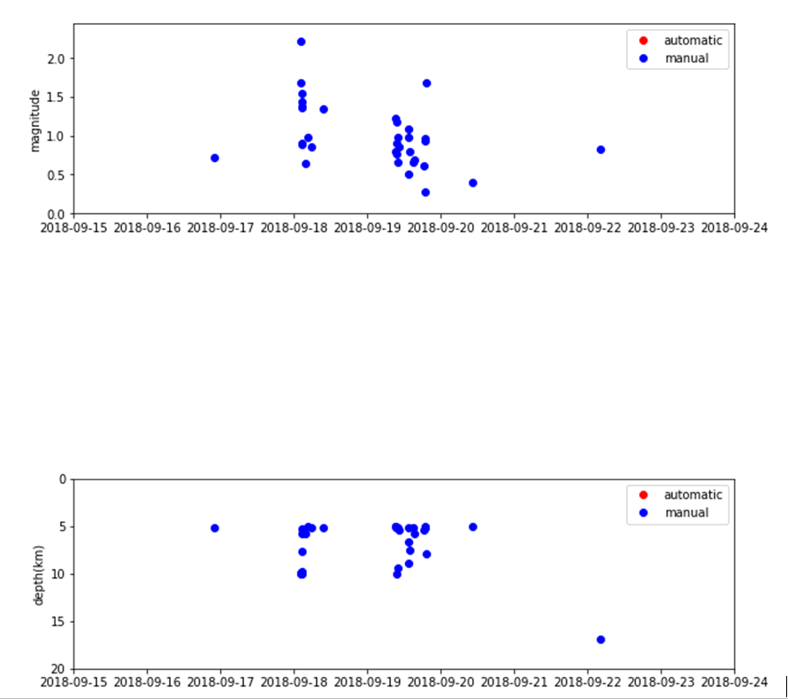
Time series plot showing the magnitude and depth of the earthquakes
Earthquake swarms are characterised as a cluster of similar-sized earthquakes, close together in time and location, usually with no one main or large event. In this swarm the largest earthquake is near the start of the swarm on 18 September and was followed by ten smaller earthquakes, more typical of a mainshock-aftershock sequence. Then about 24 hours later, on 19 September, a further sequence occurred with the largest earthquake towards the end.
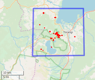
Map showing the location of the earthquakes
Earthquake swarms are common in this area as the Turangi-Rotoaira area forms the southern portion of the Taupo Fault Belt, a zone of faulting within the Taupo Volcanic Zone. The area is one of crustal extension, where the Taupo Volcanic Zone is getting wider. GNS Science geologists have mapped numerous active faults in the area. Many earthquakes swarms occur in this area being related to the faulting, volcanism and geothermal activity.
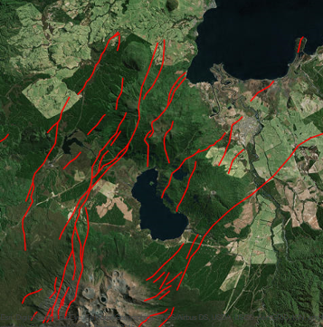
Map showing the active faults in the Turangi-Rotoaira area