
Small earthquake swarm south-east of Rotorua
A small swarm of earthquakes has occurred overnight south-east of Rotorua in the Waimangu area. We have recorded 17 earthquakes that are large enough to get locations.
The earthquakes range from M1.2 to M2.6, while the depths ranged between 3km and 6km, with one deeper at 14 km.
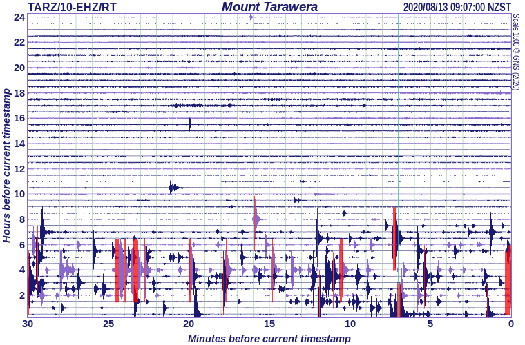
Mount Tarawera seismic drum
Earthquake swarms are common in the Taupo Volcanic Zone, and this swarm is similar to others that have occurred south of Rotorua in the Waimangu-Waiotapu area. GeoNet has located 79 earthquakes in this area in the last year.
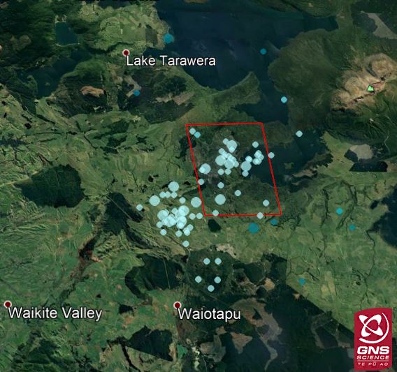
Location of today's swarm (in red box) with all earthquakes located in the area in the past year.
So, what is a “swarm”?
Swarms are often characterised by no one main or large earthquake, with many of the earthquakes being about the same size. Only two of the earthquakes in this swarm are larger than M2.0, some earthquakes are so small we can’t locate them.
These earthquakes are too small to be widely felt or cause any significant damage, this is also a remote area and very few local residents have reported feeling these earthquakes. The Waimangu area is about 25 km from Rotorua and is characterised by many active faults, and craters formed in the 1886 Tarawera eruption.
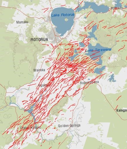
Map showing the active faults in the Rotorua area.
The current swarm has been ongoing for 6 hours with the most recent earthquake occurring at 9am, while some swarms last just a few hours, others can last longer.
GNS Science and our National Geohazards Monitoring Centre continue to monitor all activity throughout the Taupo Volcanic Zone.
Science information – Brad Scott and Yannik Behr Media enquiries - media@gns.cri.nz or 021 574 541