
The current eruption of Kīlauea: could it happen in Auckland?
The ongoing eruption in Hawai'i this week allows us the chance to think about a similar event here in New Zealand.
The current eruption of Kīlauea volcano on Hawai‘i has provided some spectacular footage of cracks opening in roads, fountains of glowing lava, and billowing clouds of gas - and has people wondering whether such activity could occur in Auckland.
We thought this would be a great opportunity to explain how this latest eruption on Hawai‘i compares with what we might expect in Auckland if our volcanic field reactivates.
Let’s get straight to the point: although we do not have a big active shield volcano like Kīlauea in Auckland (or anywhere in New Zealand for that matter!), we could certainly have an eruption that generates lava fountaining and lava flows from fissures like we are seeing at the moment at Kīlauea.
This is because the type of magma erupting from Kīlauea is the same as the type of magma that erupts from Auckland volcanoes. It is a basalt, which is a dark-coloured magma whose low silica content means it has a low viscosity and therefore forms lava fountains and flows when it reaches the surface.
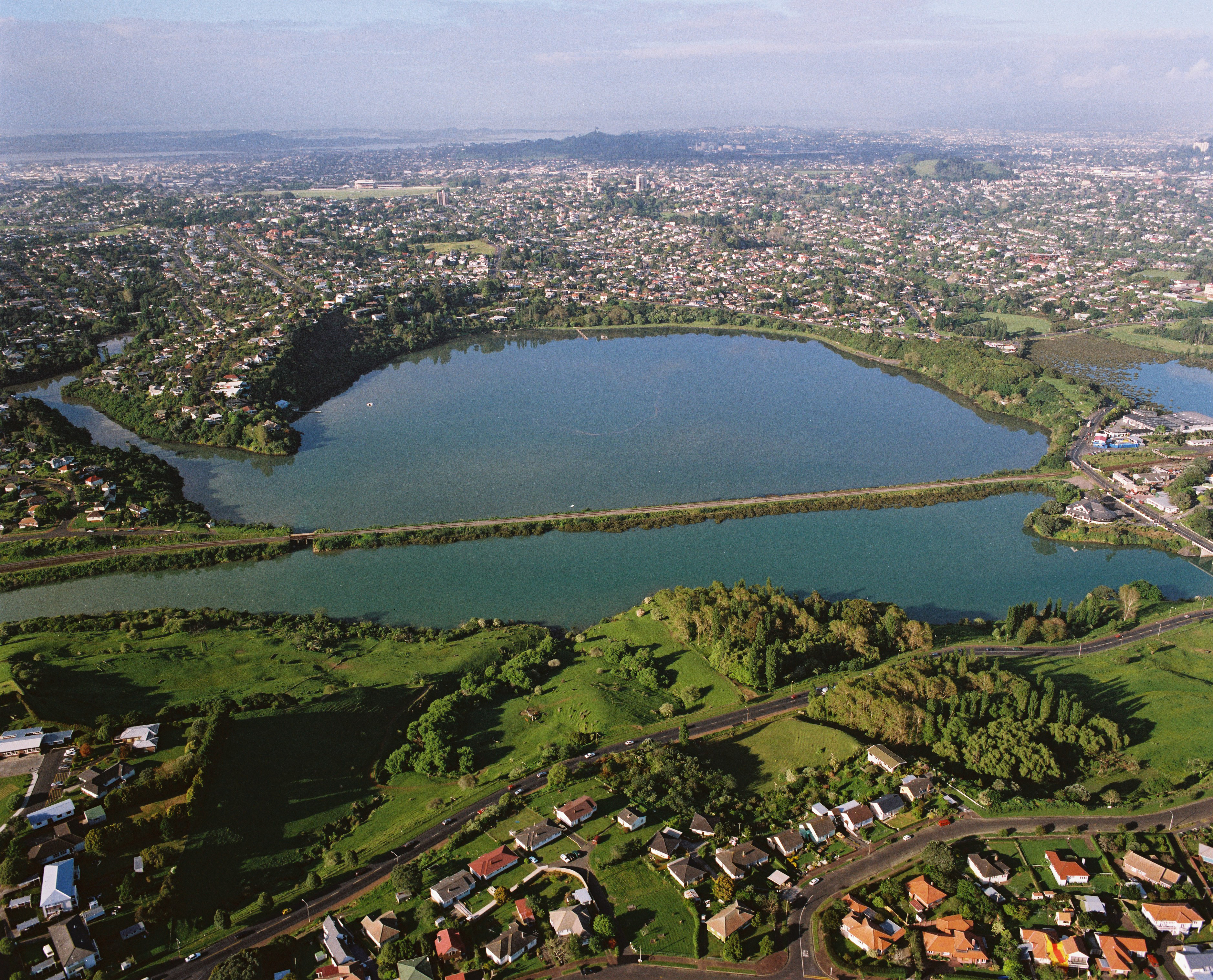
Aerial view of Orakei Basin, a typical maar volcano in Auckland. (GNS VML 2577)
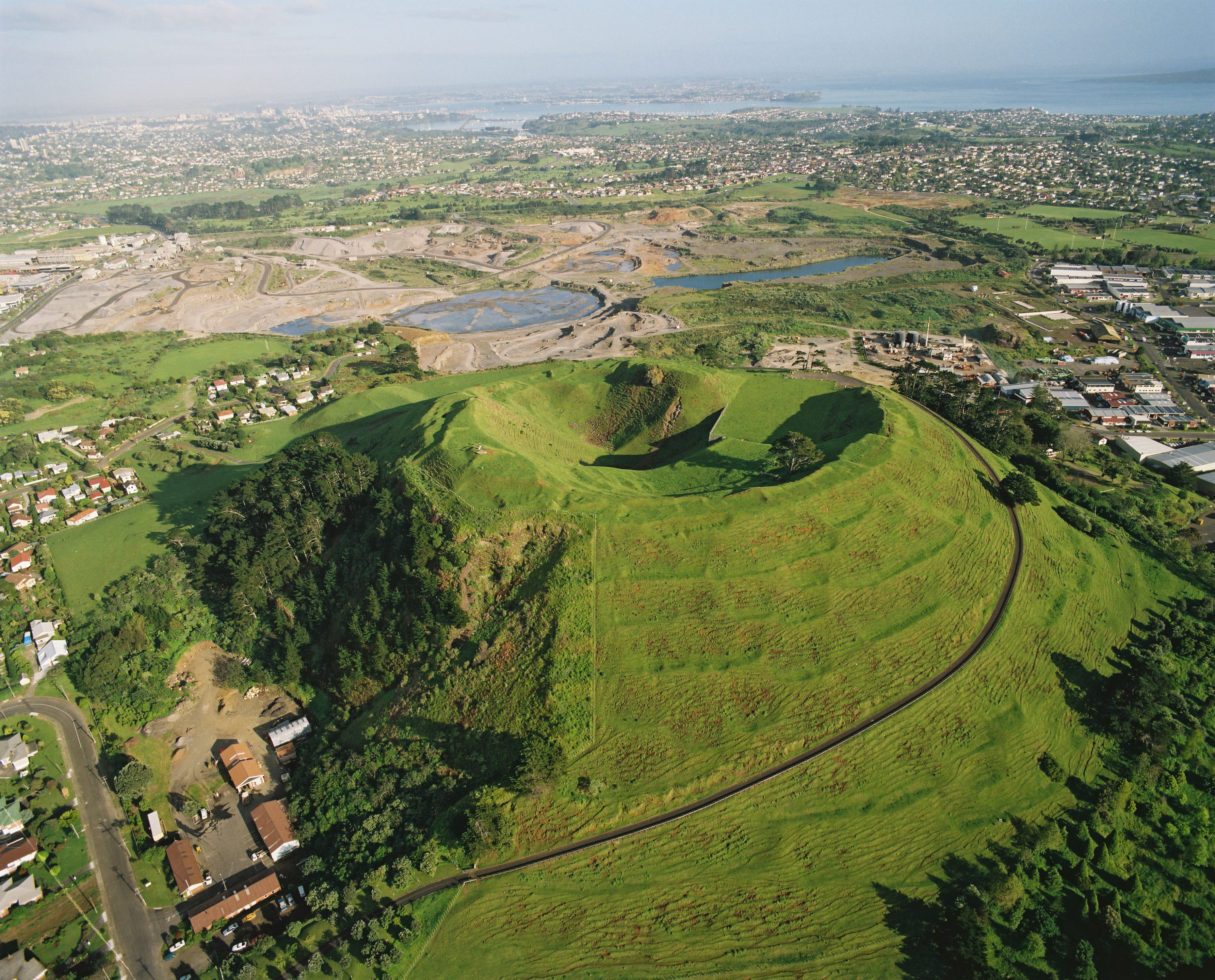
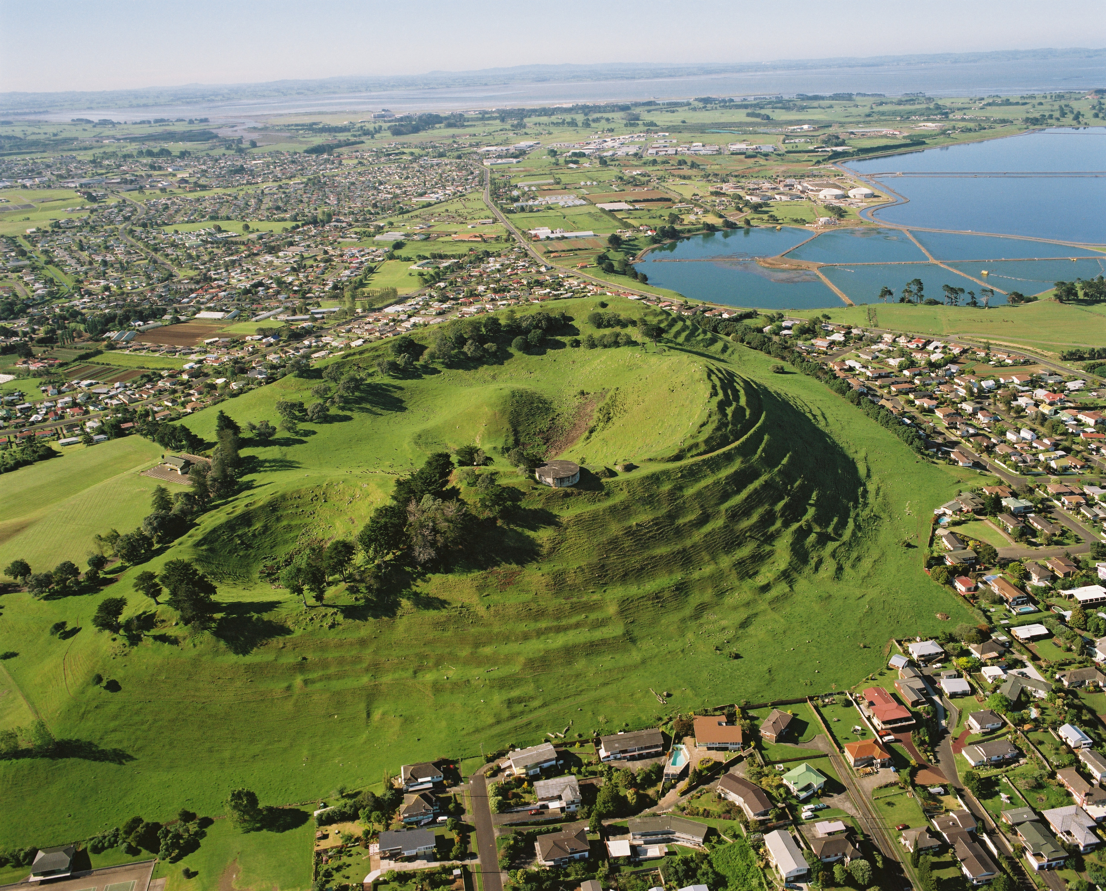
Aerial view of Maungarei (Mt Wellington) scoria cone in the Auckland Volcanic Field. (GNS VML 2563)
In addition to lava fountains and lava flows from fissures, the Kīlauea eruption has been associated with earthquakes, ground deformation (uplift and deflation), large amounts of gases (mostly SO2), ground cracking, and magma flowing underground.
All of these phenomena could be expected in a future Auckland eruption; indeed, we see evidence for subsurface transportation of lava through lava tubes all over Auckland in the form of lava caves (some great examples can be seen on Rangitoto).
The Kīlauea eruption is in fact an eerie analogue for how such an eruption could impact Auckland’s daily life. We are seeing steaming cracks opening in roads; lava blocking roads; lava burning houses, vegetation and power poles; people developing health problems from breathing in gases; power and water outages; and evacuation of some areas.
A better understanding of how a future eruption might affect Auckland, including how many people might need to be evacuated and how hazards such as lava flows and ash might impact on our lifelines (e.g. roads, water and electricity), is one of the key aims of the ongoing Determining Volcanic Risk in Auckland (DEVORA) research programme.
As it happens, one of DEVORA’s researchers, PhD student Sophia Tsang, has been studying Kīlauea’s past lava flows to learn lessons for Auckland. She is avidly following the current Kīlauea eruption, and says, “it is humbling to witness the reality of how devastating lava flows can be, and it makes me determined to learn more about lava flows so Auckland and other places can be better prepared for a future eruption”.
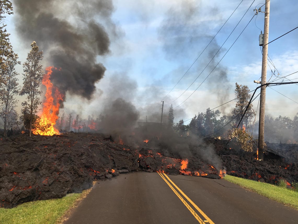
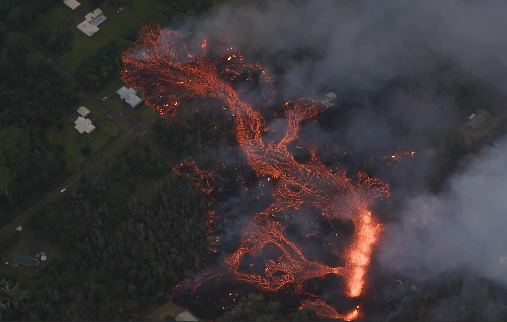
Lava from the 7th fissure to open threatened roads, electric infrastructure, and houses. The flow burns a power line and pole and he heat has also begun igniting trees in the area, leading to decreased air quality. (Photo courtesy of HVO/USGS).

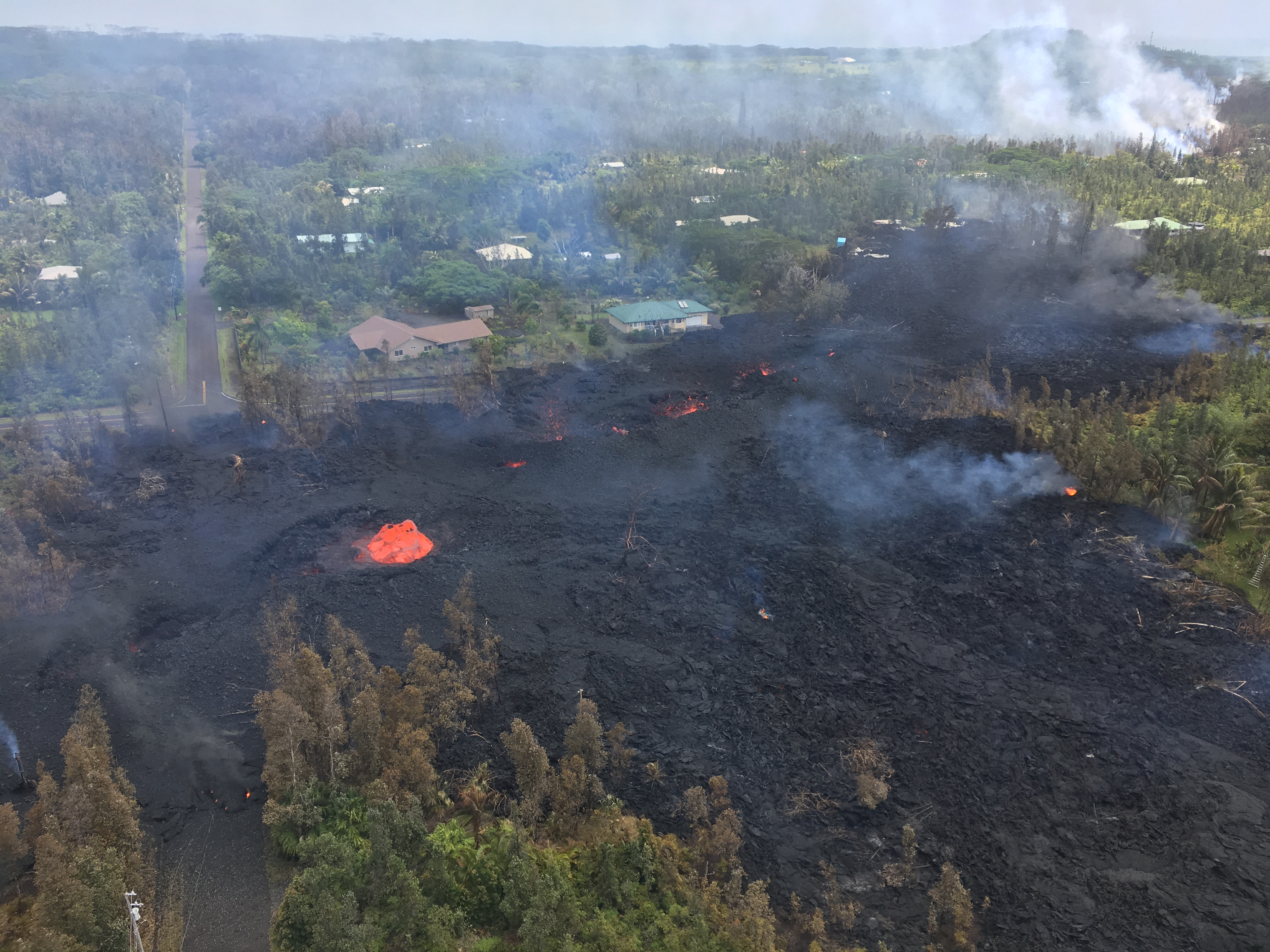
This fissure on Kīlauea has sourced a'a lava flows, one of the types of lava flows we see in the Auckland Volcanic Field. The lava flow has extended over 2 km, threatening and destroying houses and roads. (Photo by Ann Kalber of Tropical Visions Videos).
GeoNet closely monitors the Auckland Volcanic Field via a network of seismometers. GeoNet and DEVORA scientists work closely with Auckland Emergency Management to ensure that hazard management and evacuation plans are informed by up to date monitoring, research and experiences.
Auckland Emergency Management’s Principal Science Advisor Dr Angela Doherty says that the current situation in Hawaii is going to provide some important lessons for future planning. “While the first Aucklanders may have seen the most recent eruption in the Auckland Volcanic Field at Rangitoto 550 years ago, our population and city has grown greatly since then, so we are watching events in Hawai’i very closely. Scientists from the Hawaii Volcano Observatory and our counterparts at the County of Hawai’i Civil Defense are advising residents that they may face weeks or even months of disruption. Observations we can take from how things unfold in Hawai’i over this period will provide valuable information for our future volcanic contingency plans.”
The seventh fissure to open on Kīlauea this past week created a short lava flow that destroyed houses and electric power poles. Additionally, the volcanic gases released (VOG) have affected people's and animals' health. (Photo courtesy of HVO/USGS).
A lava flow released by one of the recent fissures in Leilani Estates in the Puna District of Hawaii threatens roads, houses, and infrastructure. (Photo by Ann Kalber of Tropical Visions Videos).
Geological background: Kīlauea vs the Auckland Volcanic Field Kīlauea is what we call a shield volcano, a large volcano with gentle slopes formed from steady accumulation of thin but extensive sheets of lava over long periods of time. The closest we have to the type of activity on Hawai‘i is Rangitoto, which is sometimes referred to as a miniature shield volcano. In contrast, the Auckland Volcanic Field (AVF) comprises at least 53 individual small volcanoes that have each erupted for a short period of time, with long gaps in between the formation of each volcano. The time between eruptions has been highly variable in the past, and it is unlikely that someone will experience an eruption in Auckland within their lifetime.
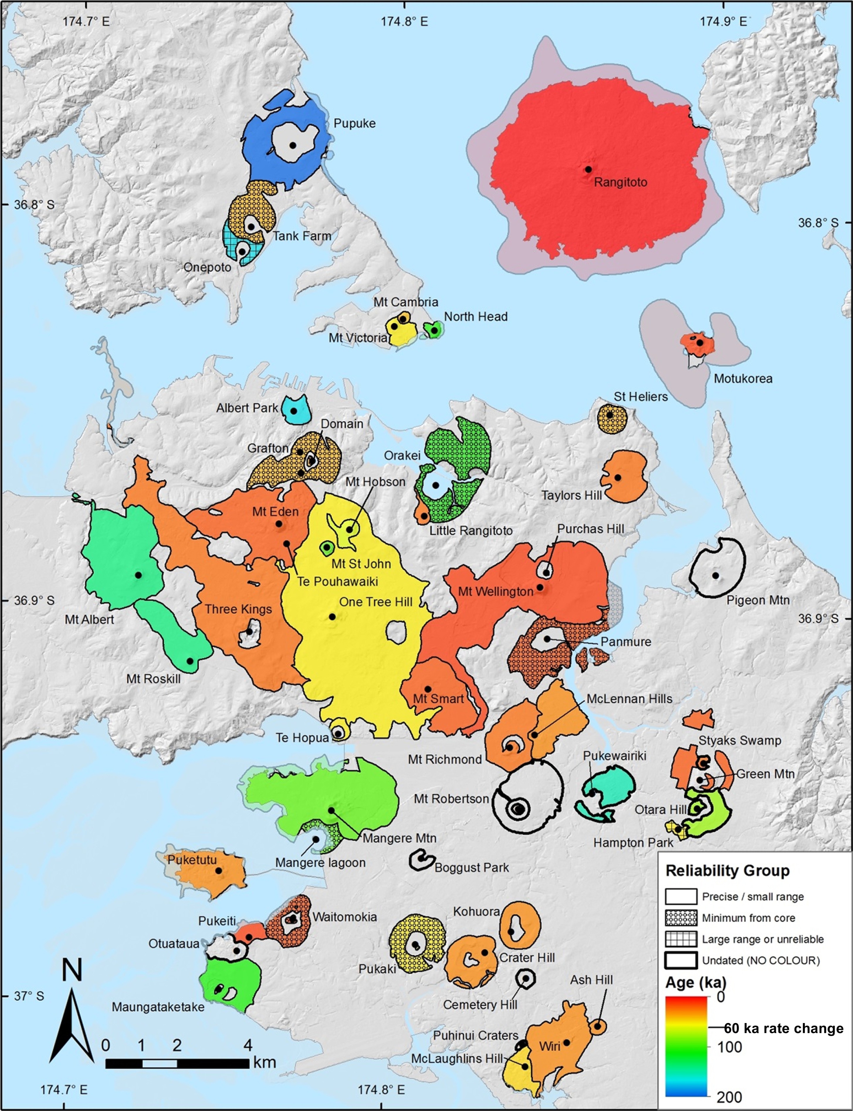
Auckland Volcano map agesVolcanic products of the Auckland Volcanic Field centres, coloured by their interpreted ages. (after Leonard et al. 2017)
Another difference is that whilst the current activity on Kīlauea is mainly effusive, meaning gentle extrusion of lava spatter and lava flows, the presence of abundant groundwater and seawater in Auckland means that in Auckland we can also get violent explosive eruptions when magma encounters water. Past eruptions in the AVF have typically started out with an explosive phase that generates fast-moving clouds of ash, gases and debris away from the vent and excavates a crater in the ground. Some eruptions stopped after this phase (e.g. those that formed Orakei Basin and Onepoto Domain), but others continued in a gentler, more effusive manner after the magma stopped interacting with water, leading to the development of scoria cones (e.g. Mt. Eden, Mt Mangere) and lava flows (e.g. at Meola Reef and on Rangitoto).
Aerial View of Mt. Mangere scoria cone in Auckland (GNS VML 2598).
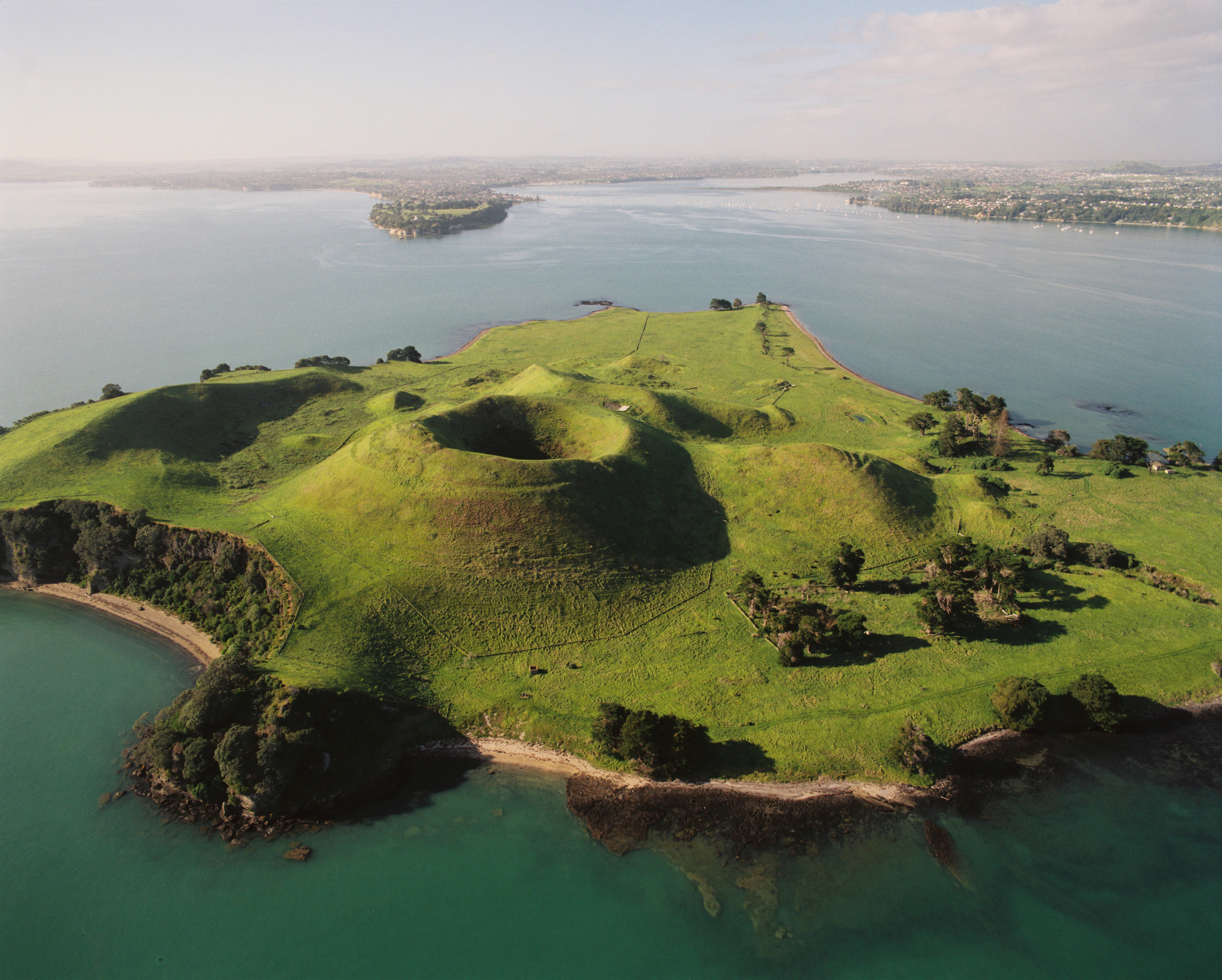
Aerial view of Motukorea (Browns Island) showing the scoria cone, tuff ring and lava flows. (GNS VML 10704)
The eruption on Kilauea was preceded by several days of warning signals including earthquakes, something we would also expect prior to an eruption in Auckland.
The DEVORA research programme DEtermining VOlcanic Risk in Auckland (DEVORA) is a multi-agency, transdisciplinary collaborative research programme led by volcanologists at the University of Auckland and GNS Science and funded by the New Zealand Earthquake Commission and Auckland Council. The project, now in its tenth year, aims to improve understanding of volcanic hazard and risk in Auckland. The findings have the potential to improve business decision-making and risk management, as well as make Auckland a safer place.