Te Maari: Ten-year anniversary of the 2012 eruption(s)
On 6 August 2012, after a few weeks of volcanic unrest, the Upper Te Maari Crater at Tongariro burst into eruption. The eruption ejected blocks kilometres away and a debris flow occurred down a valley to the west, with minor ashfall occurring as far away as Hawkes Bay. It then erupted again on 21st November later that same year. This was the first eruptive activity since September 1899 from the Te Maari craters.
Unrest – a sign of things to come
In July 2012 three swarms of earthquakes were recorded each lasting 1-4 days, this was followed by a marked decline in the number of earthquakes, 6 days before the eruption. In response to this activity, the volcano monitoring team conducted additional gas surveys and were able to recognise the arrival of magmatic gases. The team also installed portable seismic and GPS equipment which, along with background observations, enabled the team to recognise volcanic unrest and the Volcanic Alert Level at Tongariro was raised to Level 1 on 20 July.
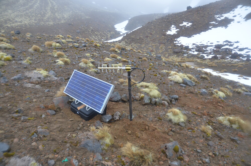
Seismograph deployment after 2012 earthquakes under Mount Tongariro
Eruption one
On 6 August 2012 at 11.52 pm an explosive eruption occurred at the Upper Te Maari Crater producing lightning, rumbling sounds and explosions with ballistic blocks. An ash cloud was generated to over 12 km elevation, depositing ash on the local community and as far away as Hawkes Bay. The first ashfall in NZ since 1996.
One of the main volcanic hazards produced in this eruption were volcanic ballistics - volcanic projectiles made of the rock cleared out when the vent formed. Around 13,000 ballistics were ejected, ranging in size from 10 cm to 3 m in diameter. These damaged a section of the Tongariro Alpine Crossing and Ketetahi Hut (~1.5 km away) leaving holes in the roof and floor of the hut. The eruption also produced violent and widespread “cold” pyroclastic density currents (PDCs) following unroofing of the pressurized hydrothermal system. The eruption involved flank collapse, land sliding along with directed jetting.
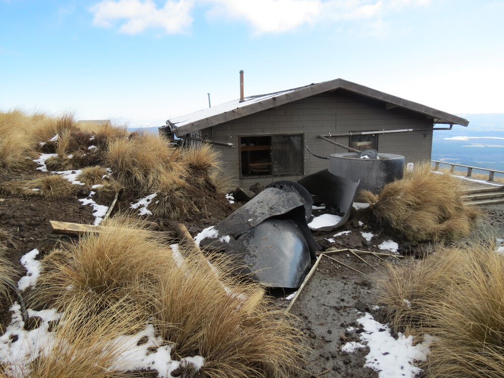
Ballistic block damage to the Ketetahi Hut from the 6 Aug eruption
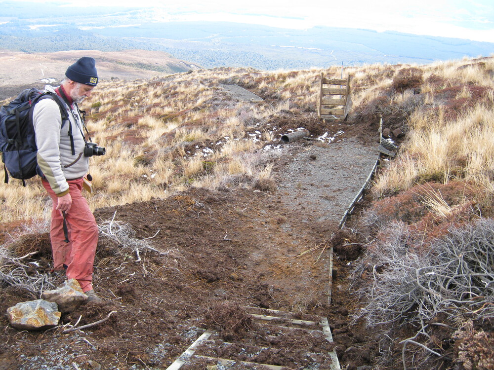
Brad Scott inspecting ballistic block damage to the Tongariro Alpine Crossing Track
Eruption two
A further eruption followed on 21 November 2012, from the Upper Te Maari crater, in the same area that erupted on 6 August. The eruption happened at 1:25 pm and lasted for less than 5 minutes although local earthquake activity continued for about 15 minutes.
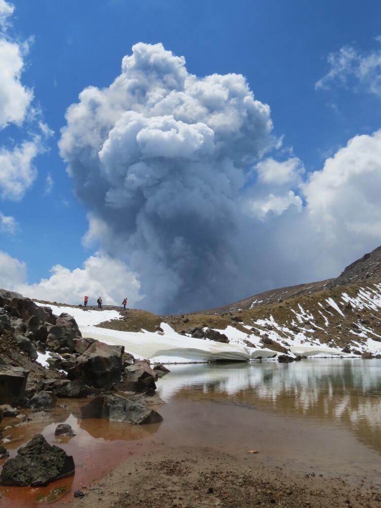
The 21 November 2012 eruption as viewed from the Emerald Lakes area.
Ash erupted during the first few minutes reached 3 km to 4 km height and was clearly seen from Taupo. The eruption did produce pyroclastic surges and ballistics. There were no directed rock blasts or debris flows like in the August eruption. Tongariro Eruption Video
History of the Volcano.
Tongariro is a massive complex of volcanic cones and craters formed by eruptions from at least 12 vents over more than 275,000 years. Erosion during the last Ice Age has worn away what was once a substantial mountain forming the world-famous hiking destination that it is today. The 2012 eruptions were the first from the Te Maari craters for 123 years, although other eruptions from Tongariro Volcanic Centre had occurred in 1934 (Red Crater) and 1975 (Ngauruhoe).
Following the eruptions research into historical eruptive activity at Mt. Tongariro showed eruptions also potentially occurred in 1846, 1855, 1886, and 1928, in addition to frequent eruptions from neighbouring Mt. Ngauruhoe. The number of recognised eruptions during the 1896–97 episode increased to 18, and the Red Crater area was found to be more active than previously appreciated.
Research and Lessons
Research by GNS, Massey, Victoria, Waikato, Otago, and Canterbury university scientists during the unrest and following the two eruptions helped develop a greater understanding of the Te Maari volcanic system. The eruptions were driven by molten material moving to shallow depths under the Te Maari craters. Some research focused on the debris flow (landslide) evolution and the activation of an explosion from the exposed hydrothermal system. GPS data was used to show that several processes occured in succession. The presence of two distinct dense ash-laden plumes near the vent were produced by the second and last phase of the main eruption. And also a gas-charged debris avalanche and a lateral blast, successively entraining hot and/or humid air, moved over 3 km away from the vent.
The eruptions generated a high level of public interest with a demand for information on volcanic hazards and impacts. This led to a move towards improved integration of hazard impact information, mapping, and communication via multi-agency consistent messages. A collaboration and alignment of both research, technical science, and hazard advice, with hazard maps playing an integral part to science communication during the eruption response.
The co-ordinated science and risk management response saw robust decisions being made about visitor and scientist safety, leading to new electronic warning signs on the Tongariro Alpine Crossing track being established by DOC, letting visitors know more about the volcanic risk and track status in near real time.
Although we can’t prevent natural hazards, we can prepare for them – and we should.
The Department of Conservation has information on volcanic risk in the Tongariro National Park.
The National Emergency Management Agency's (NEMA) Get Ready website has information on what to do before, during and after volcanic activity.
And Toka Tū Ake EQC has information on how to get your home, apartment, or rental prepared for a natural disaster.
Find out more about Tongariro volcano
Science information - Brad Scott Media enquiries - media@gns.cri.nz or 021 574 541