National Advisory: Tsunami activity – expect strong and unusual currents and unpredictable surges at the shore following the M8.7 earthquake, Kamchatka Russia. For all information please visit NEMA (The National Emergency Management Agency) Only messages issued by NEMA represent the official warning status for New Zealand.

Kaikōura two years on: The changed landscape
The M7.8 Kaikōura earthquake produced 25 fault ruptures and was one of the most complex earthquakes ever recorded worldwide. We take a look back at the last two years at how the surface ruptures have changed over time and what the landscape looks like now.
What happened?
In the days and weeks after the Kaikōura earthquake GNS scientists and our university partners began to get a picture of the widespread damage and landscape change across the Hurunui, Kaikōura and Marlborough regions. More than 20 faults ruptured the earth's surface, in a sequence that saw rupturing jump from fault to fault with such distance and speed as to change the landscape forever. Surface rupturing and huge landslides caused dramatic changes, and it’s changing still – as erosion and farming activities continue to alter the land.
Links to videos of the landscape and faulting damage in the days and weeks after the Kaikōura earthquake:
The Papatea Fault rupture at Waipapa Bay caused vertical displacement of around five metres and a horizontal displacement of many metres. The fault ruptured at a speed of around 3 kilometres per second, and the uplift occurred almost instantaneously. In the days after the quake we could see the severity of the rupture was phenomenal. Initially the fault rupture (clay shear zone) was a smooth vertical surface - as shown in the 2016 picture below.
“Right after the earthquake, the fault formed a vertical wall,” Dr Rob Langridge, GNS Science Earthquake Geologist, says. “Two years later the wall has degraded away and collapsed. It has sort of dissolved before our eyes”. Survey pins show this rock platform has been wearing down over the last two years and will continue to wear down over time.
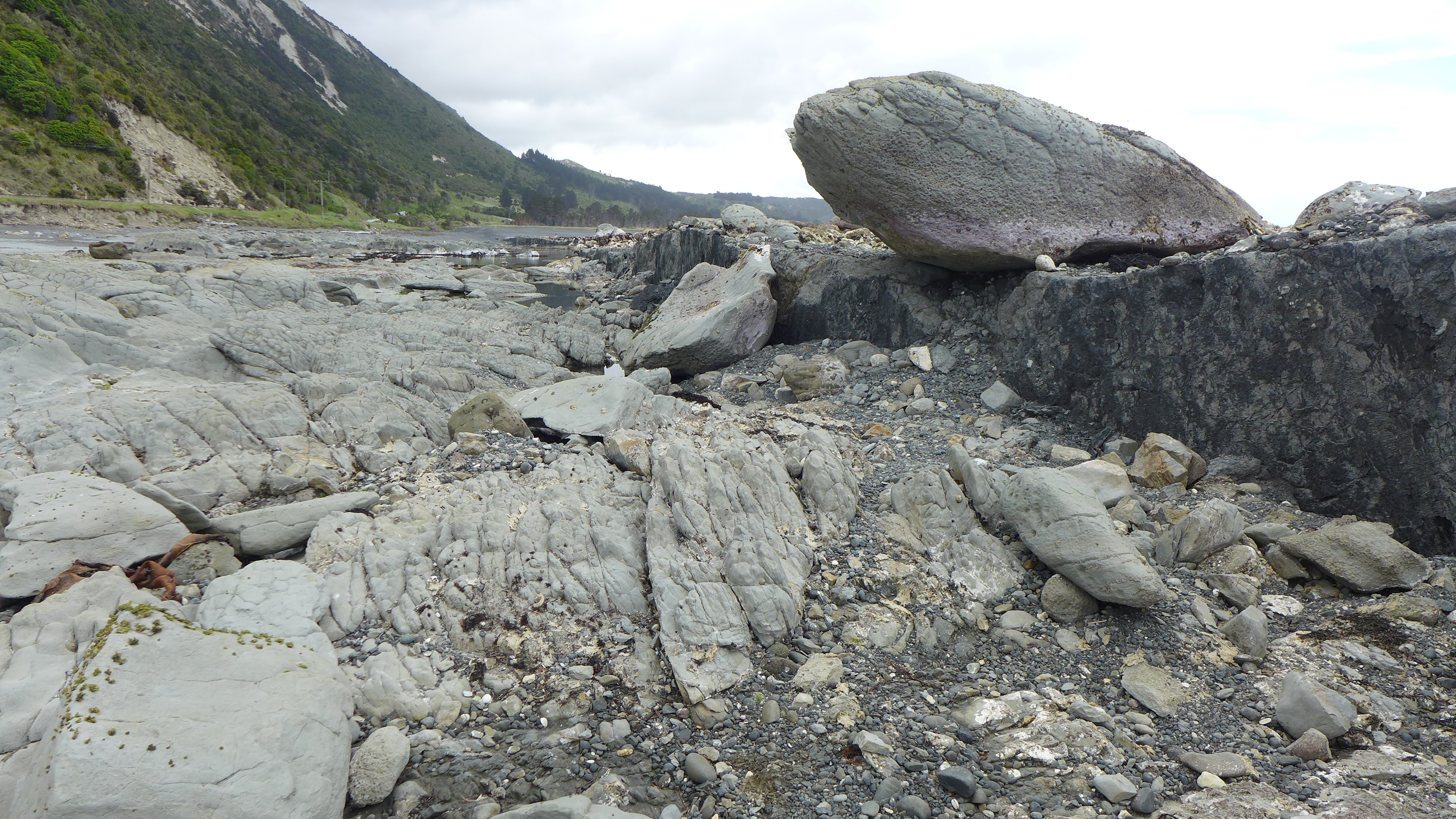
Papatea Fault 2016
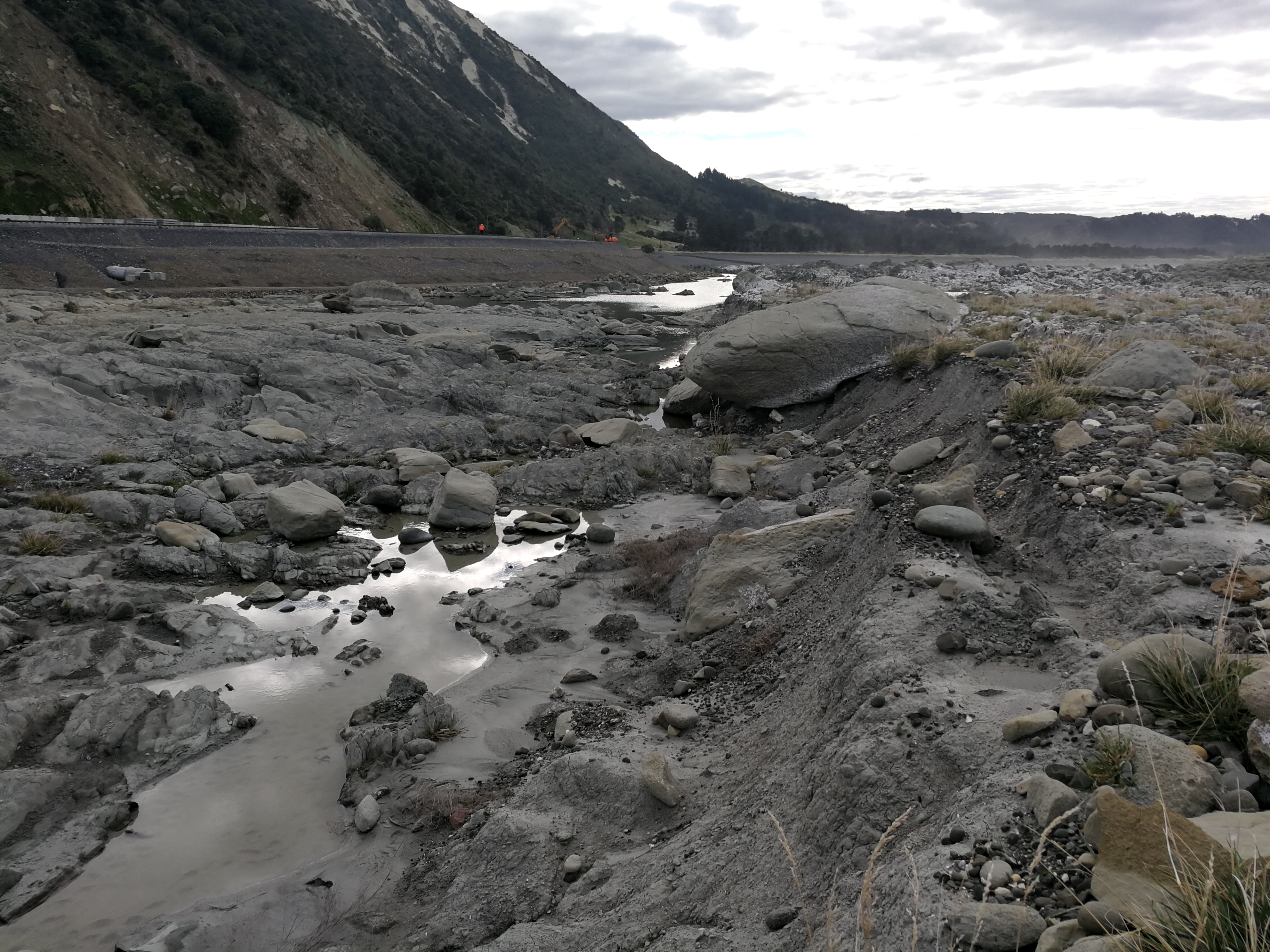
Papatea Fault 2018
How does it look now?
Dr Langridge explains in this video how the Papatea Fault looks now.
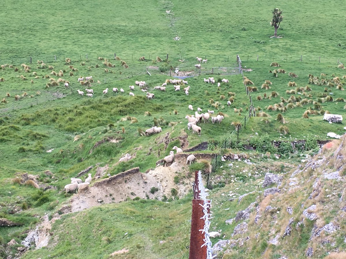
Further inland, the landscape has permanently changed too. Dr Langridge says of this area that “the change since the earthquake has been dramatic. The huge uplift on the Papatea Fault in the middle of the valley has meant that the Clarence (Waiautoa) River has poured onto the true left side of the valley and been actively eroding a prime piece of farmland known as Priam’s Flat”.
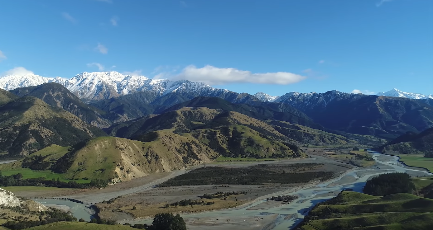
Clarence River - where the river flows now used to be farmland. The old river bed is in the centre of the picture.
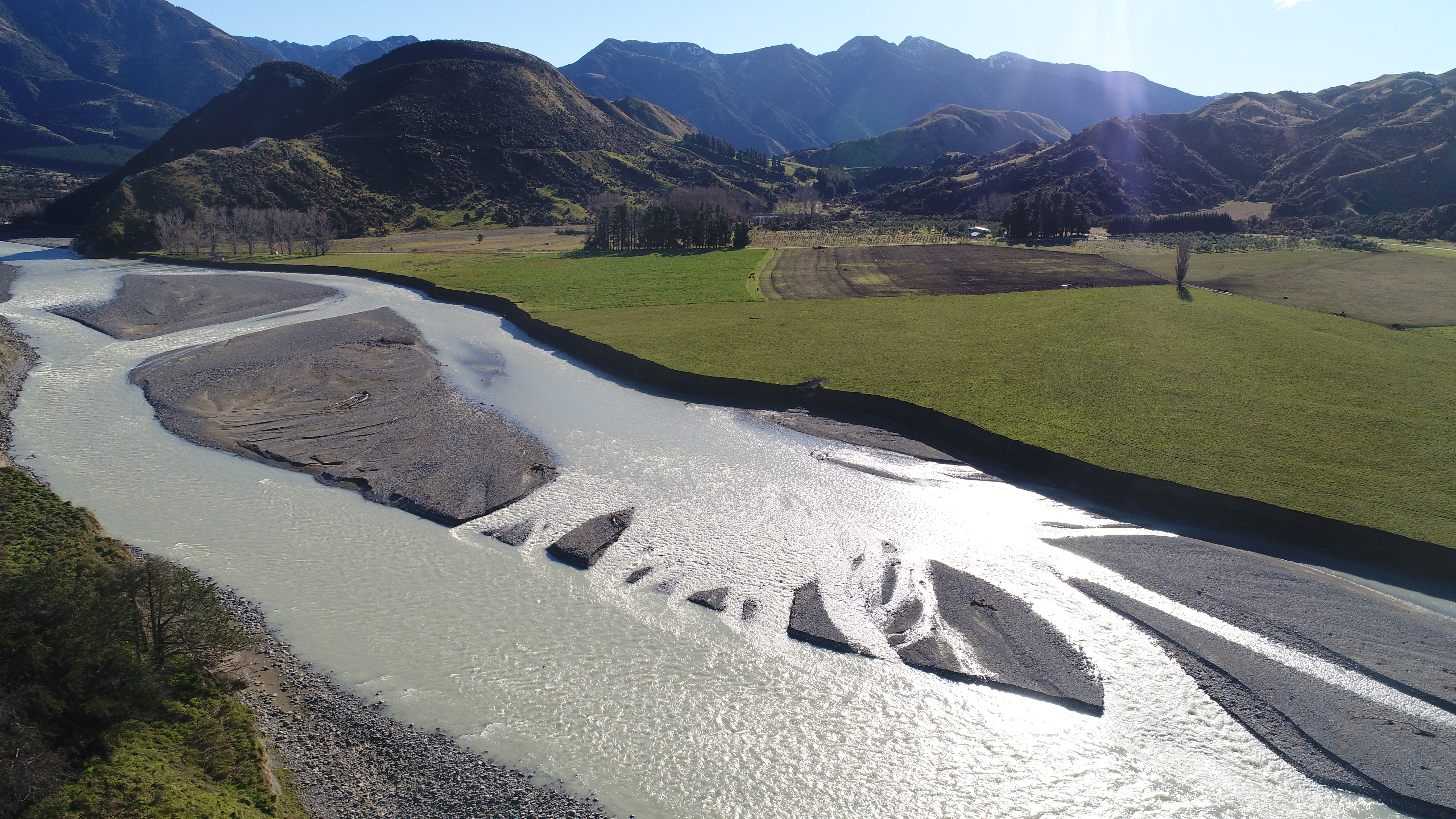
Erosion of farmland by the changed Clarence River course.
The changes wrought by the Kaikōura quake are slowly wearing down through rainfall, erosion, animal treading and human reworking. In other places, streams and rivers have eroded the landscape quite rapidly. It is impressive to see areas that appear benign to us at a human timescale being completely reworked by the forces of nature.
Kekerengu Fault 2018
What about the landslides?
The quake caused tens of thousands of landslides in a 10,000km2 area. Several of these caused landslide dams, while State Highway 1, the railways and accessways were all blocked in parts. A lot of hard work and engineering has gone into these repairs, which are still a work in progress.
The next article in our ‘Kaikōura two years on’ series will look at the landslides caused by this quake and how these still pose a risk today and for years to come.