
Tech Tales: Installations and earthquakes in the Deep South
Our team had been close to finishing installation of two new Fiordland sites in March, until the COVID-19 lockdown. In early June they were ready to head back - they just needed a few good days of weather, no easy ask in the middle of a Fiordland winter.
Finally, after keeping an eye on the weather for two weeks, sun and light winds were forecast, and the team booked their trip. Technicians Tim, John, Jackson and Matt arrived on Resolution Island on June 21st, the shortest day of the year. The remoteness, weather, and the lack of sunlight hours all made this a challenging build. Fortunately, the installation went well and on June 23rd all the instruments were installed, and the information was being fed back to the GeoNet Data Centre.
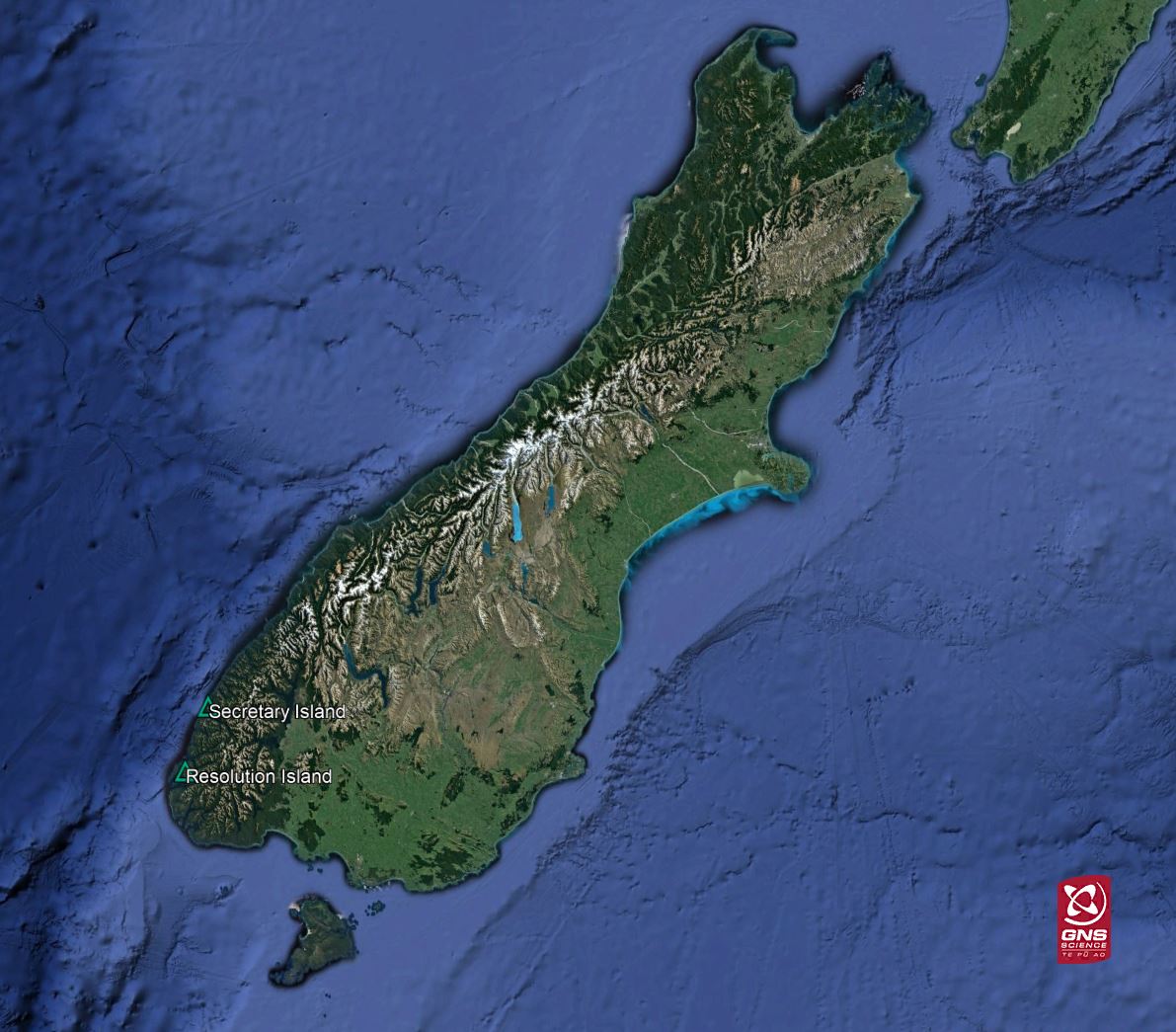
Location of Resolution and Secretary Islands
GNSS/GPS and Seismic instrumentation was installed at Resolution (RLNS, RLTN) and Secretary Islands (SCTS, SCTY), and a radio links them. The GNSS/GPS equipment consists of an antenna installed on a monument with 5 legs drilled deep into bedrock below and a receiver which is installed in a cabinet and captures satellite signals received by the antenna for later translation into millimetre-accurate positions of the antenna. This allows us to monitor with extreme precision how the land hosting the antenna moves over time. Both sites also had strong motion recorders installed in the base of the cabinet. The cabinets were installed by Environment Southland, with whom GeoNet has an agreement to use power and cabinet space.

GNSS/GPS antenna at RLTN with the cabinet in the background
These installations fill a gap in our Network and will provide valuable insight into how this area, which sits right on top of a subduction zone, is affected by tectonic forces. Fiordland is familiar with earthquakes, with 33 quakes over M5.0 occurring in the area in the last 10 years, (see below). This makes it one of New Zealand’s most seismically active regions. The combination of GPS/GNSS and strong motion sensors allows for the both seismic waves following an earthquake and the land movement caused by an earthquake to be measured, as well as those that occur between earthquakes, a powerful combination for hazard monitoring and research.
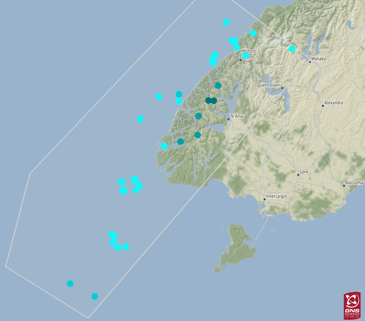
Earthquakes over M5.0 occurring in Fiordland in the last 10 years
Two days after the technicians finished the installation, a M5.9 earthquake occurred in Fiordland. The epicentre was conveniently close to RLNS which clearly recorded the event. (All technicians categorically deny any part or prior knowledge of this seismic event!).
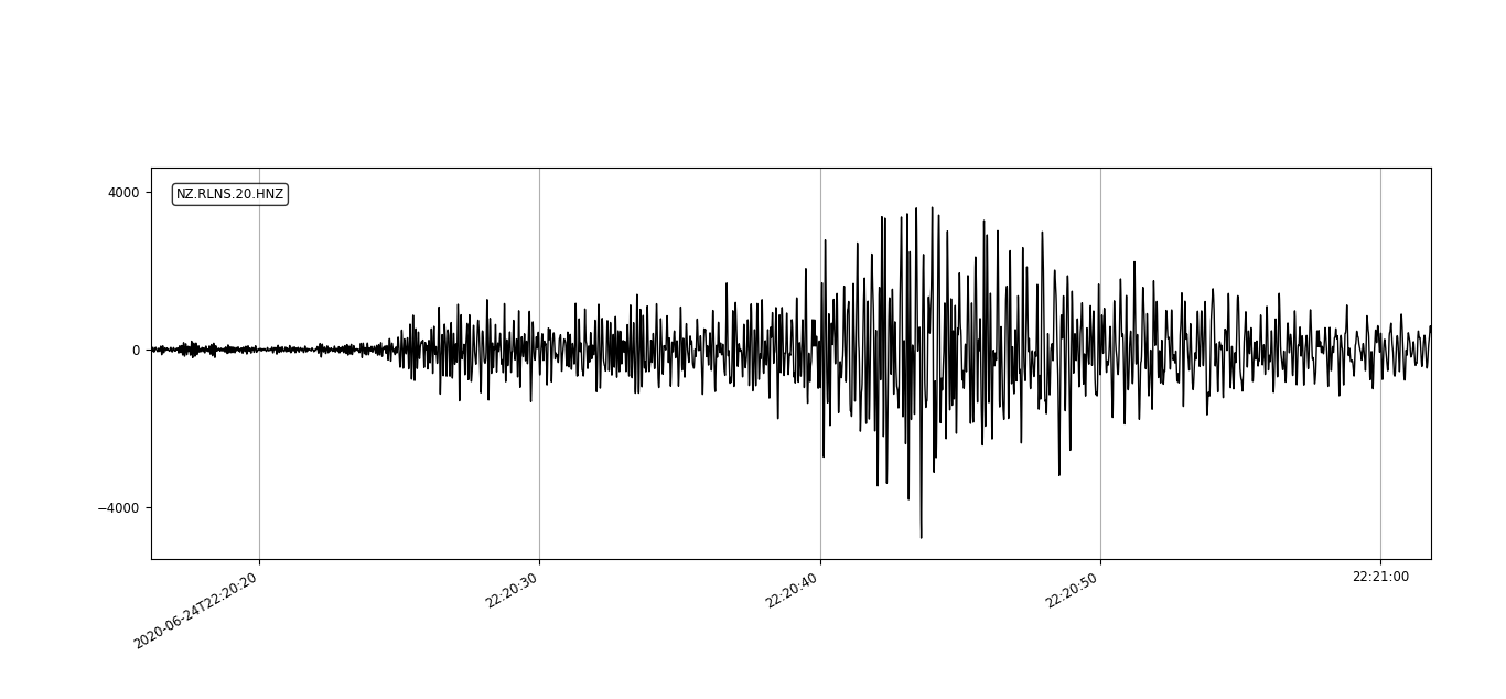
Seismic trace of the M5.9 Fiordland earthquake from RLNS

Hard work but gorgeous views in reward at Resolution Island
Words and photos: Tim McDougall for GeoNet/GNS Science Media enquiries: media@gns.cri.nz or 021 574 541