
Ex-Tropical Cyclone Gita – it's been a soggy, slip-filled week
The arrival of Ex-Tropical Cyclone Gita on home soil threw some harrowing weather conditions our way, with central parts of New Zealand being particularly hard hit.
Although New Zealand hasn’t experienced the widespread devastation that Tonga withstood at the mercy of Cyclone Gita last week, that doesn’t diminish what some people have dealt with over the last few days.
Footage from the intrepid locals who attempted to drive Takaka Hill as the road transformed into a fast-moving river, certainly caught my attention on Wednesday. But, while this is one of the stand-outs in terms of a dramatic storm that caused landslides that have cut Golden Bay off from civilisation (some of the hearty locals in Golden Bay may think this is a good thing!), the effects of Ex-Tropical Cyclone Gita have been felt widely.
By 7:30am Wednesday morning, 21 February, a state of local emergency had been declared by seven local authorities across New Zealand. This certainly hits home the state of play with what was happening in Taranaki, Nelson–Tasman, Buller District, Grey District, Westland District, Christchurch City and Selwyn District.
As the storm has subsided, the impacts and scars from landslides across regional landscapes have come clearer. Our landslide team are currently in the thick of it, so we can provide you with a nationwide update from some of the most affected areas.
Taranaki
In Taranaki, Civil Defence Emergency Management (CDEM) reported that while gusty winds brought down some large branches and debris, no road closures or major slips have been reported.
Manawatu
In the Manawatu, SH54 near Feilding was closed due to a slip near the intersection with Rangitikei Valley Road, and the clean-up is underway.
Wellington
In the Wellington area, Wainuiomata received the highest rainfall, with 110mm falling during Tuesday. This compared to 91mm in Newtown and 80mm at Wellington Airport. A total of 60mm was recorded in 12 hrs for some areas in Wellington, which a fair bit even on Wellywood standards. So much for prolonging what has been a glorious summer!
Wellington City Council has reported landslides affecting the Strathmore Ave in Strathmore, The Esplanade in Island Bay and Birdwood St in Karori.
A slip occurred on SH1 just north of Pukerua Bay. Violent seas undermined the bank at the Plimmerton fire station, and coastal erosion and debris temporarily closed SH1 between Pukerua Bay to Paekakariki.
Nelson-Tasman
The Nelson-Tasman region was one of the worst affected regions by Ex-Tropical Cyclone Gita, with over 200 mm of rainfall being recorded in the 12 hrs from 6am to 6pm on Tuesday.
Waingaro at Little Devil however, trumped the Nelson-Tasman rainfall stats with 211.5mm from 7am to 6pm on Tuesday, 2-3pm and 3-4pm both measured 46.1mm per hour, which is a crazy amount of rain!
Takaka at Canaan got 204.2mm, with the heaviest rainfall hours there at 2-3pm and 3-4pm: 41.1mm and 43.3mm respectively. Motueka at Woodmans received 180.1mm overall, with a whopping 54.6mm at 3-4pm. Riwaka at Takaka Hill measured a total of 146.9mm on Tuesday, with 29.7mm at 3-4pm.
SH60 from Riwaka to Takaka was closed just after 4pm on Tuesday due to fallen trees across the highway, slips and flooding at the turnoff to Kaiteriteri; the video footage I referred to above showed the road at the bottom of the hill resembling a river as the Riwaka River burst its banks. Riwaka Sandy Bay Road was closed by a large slip at the base of the hill.
Cobb Valley Rd was closed at the Takaka River Bridge approach due to a washout, and in total, Takaka Hill Road has been closed by 16 slips. This has isolated about 6000 locals and tourists in Golden Bay.
Here are some photos from Tasman District Council.
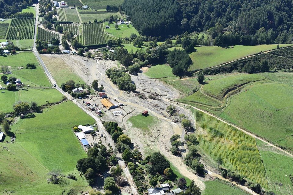
Stormflows from ex-Tropical Cyclone Gita have scoured out valleys in the Nelson-Tasman District (Source: Tasman District Council).
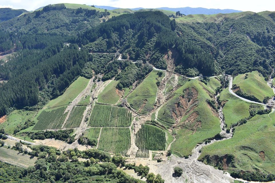
Scarred valleys where stormflows have ripped through and damaged property (Source: Tasman District Council).
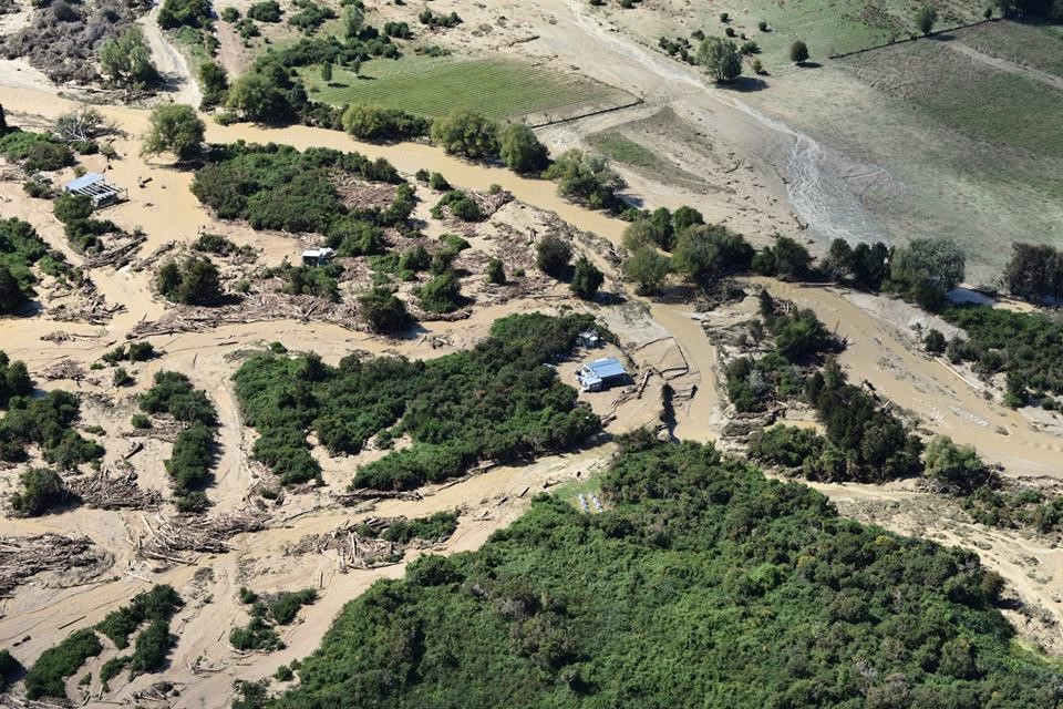
Storm runoff impacts in the Nelson-Tasman Region (Source: Tasman District Council).
You can also check out some drone footage of the landslides and debris flows on Takaka Hill here.
Marlborough
In Marlborough, severe rainfall caused a debris flow in the earthquake damaged catchment of the Papatea Stream.
Kaikoura
The forces at play in the region seem to not want Kaikoura to remain connected by road!
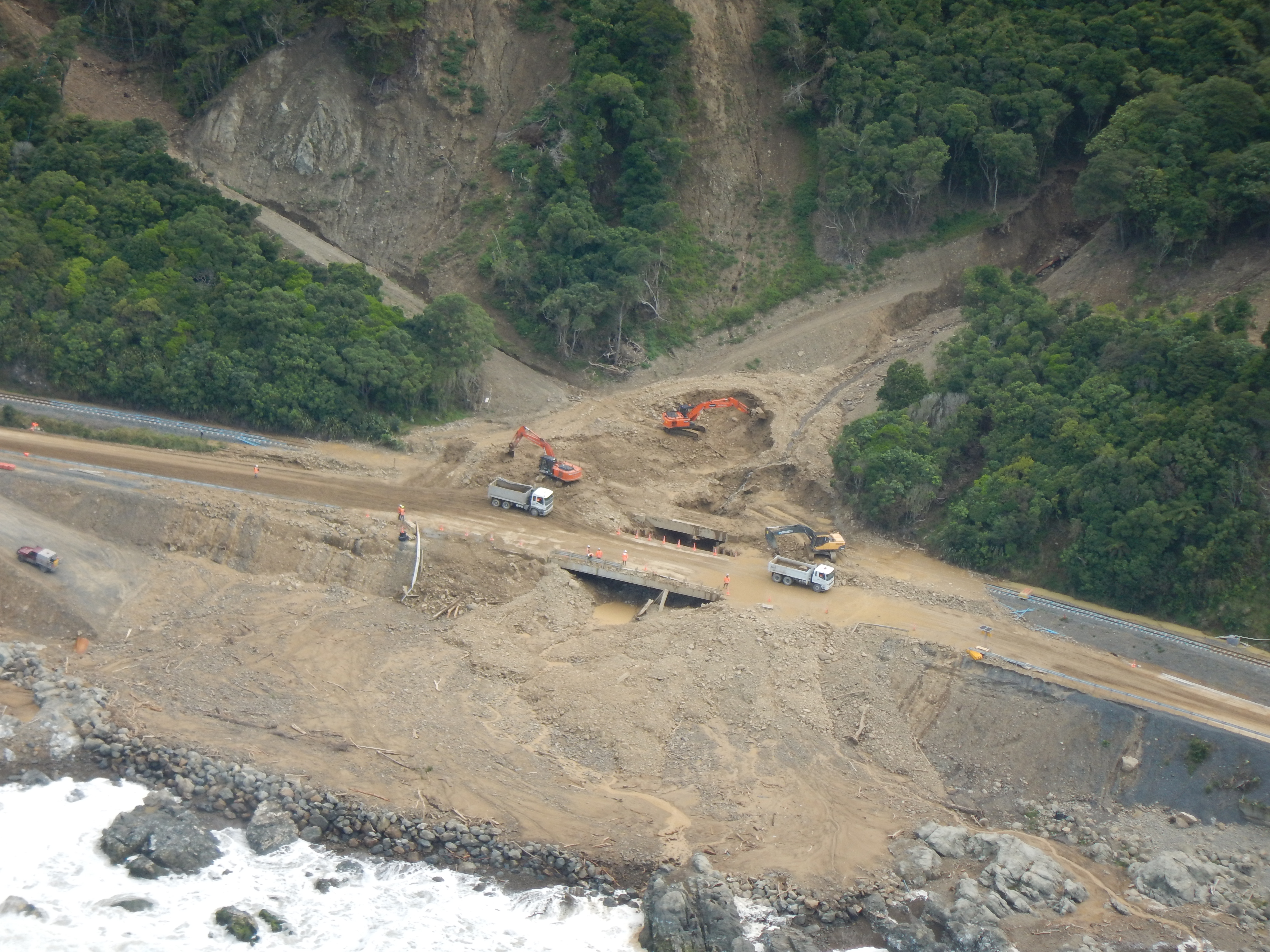
After reopening in December, State Highway 1 north and south of Kaikōura were closed on Tuesday 20 February due to heavy rain and the risk of slips and rock falls, after 202 mm of rain fell on the catchments surrounding Kaikōura in just 18 hours!
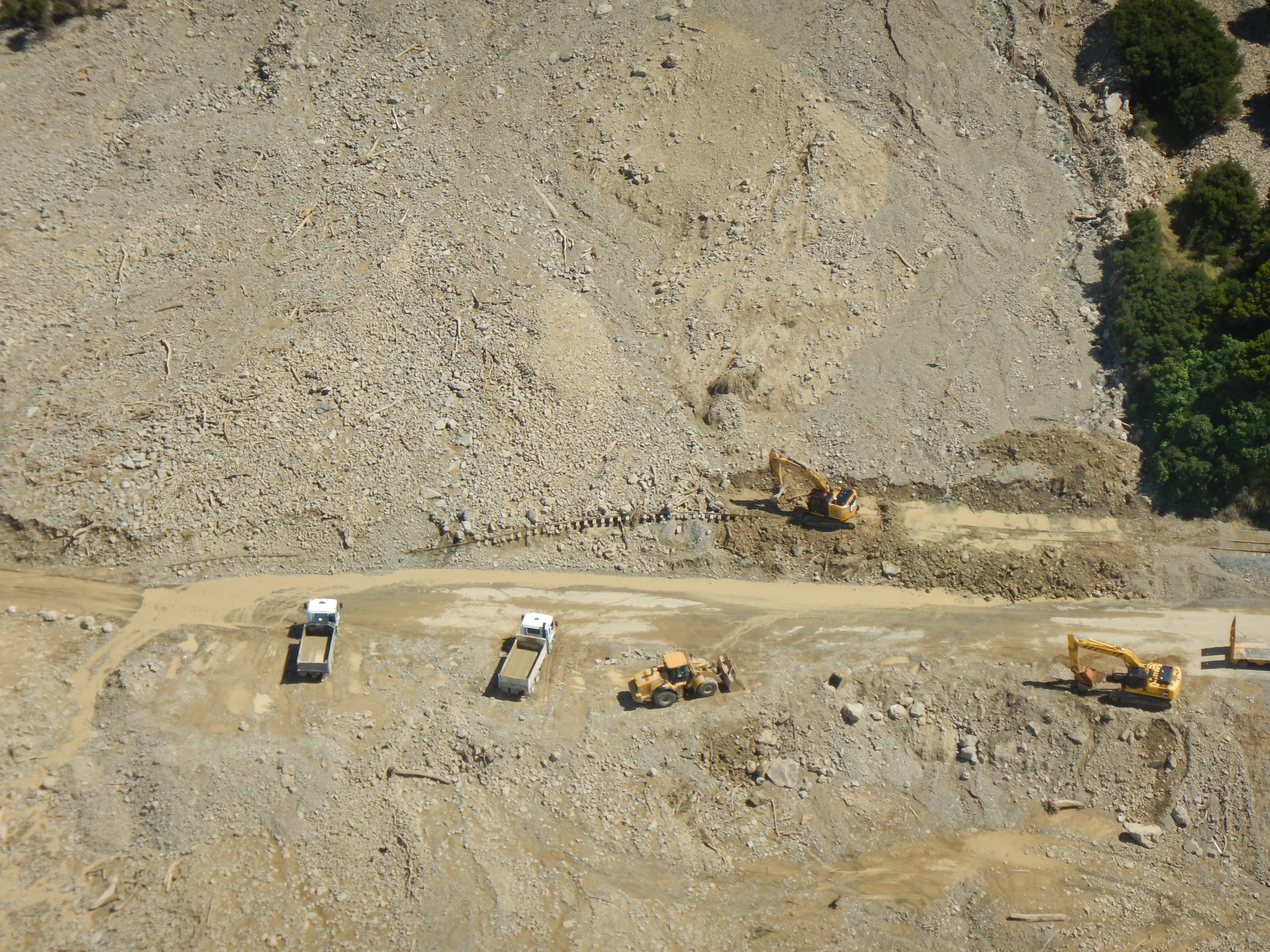
This foreseen risk of slips and rock falls certainly eventuated, as is illustrated by the selection of pictures provided by our Landslide Response Team, below.
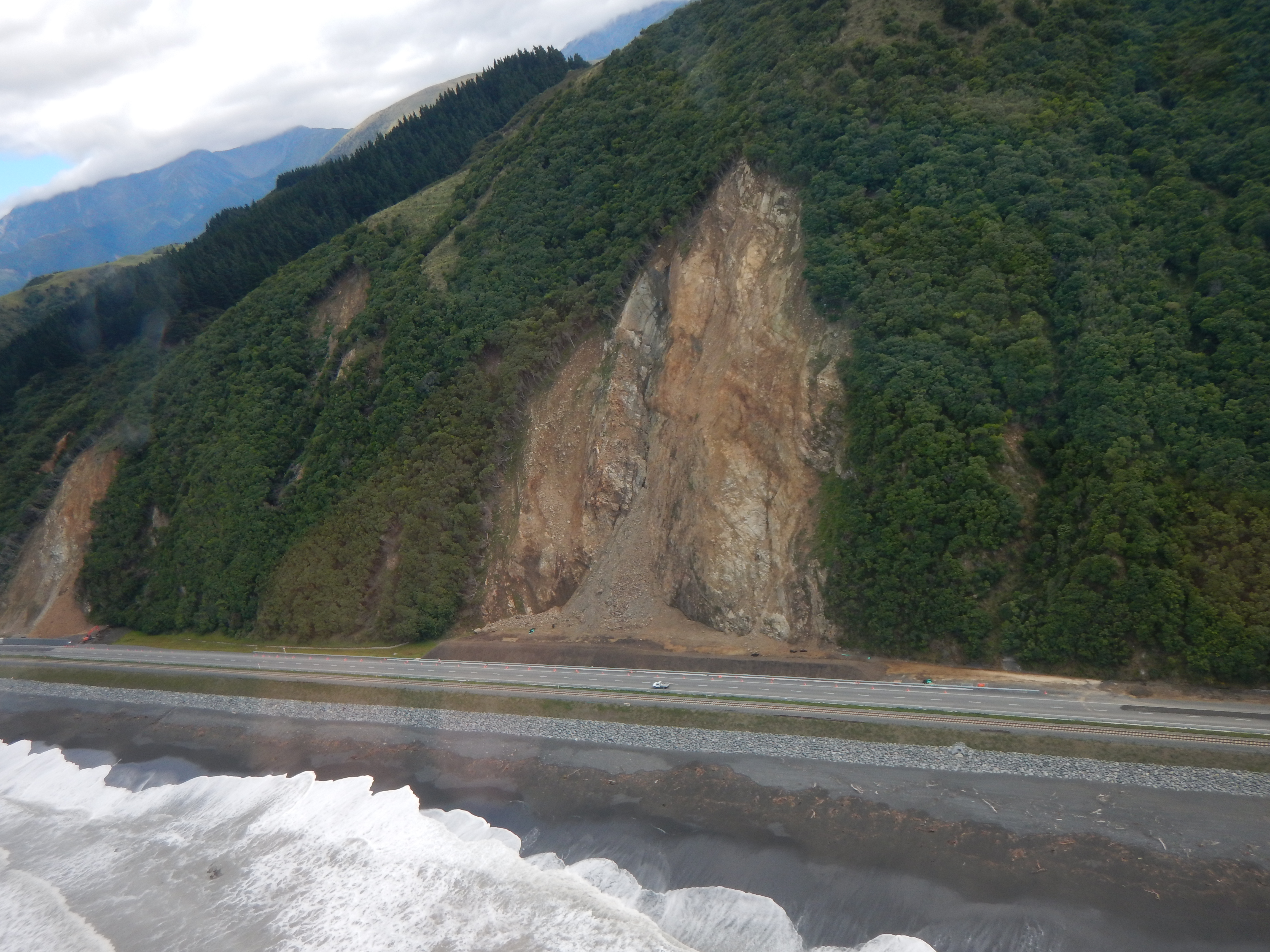
North of Kaikoura, SH1 was closed at Hapuku, several kilometres south of the road block at Maungamaunu, due to landslides and more slips occurred further up the coast including at Half Moon Bay, Ohau Point and Rosy Morn. South of Kaikoura SH1 was closed by landslides from Peketa to Goose Bay, and from Goose Bay to Ferniehurst, including a large landslide that covered the road between Hundalee and Oaro.
SH1 closed due to debris flow at Half Moon Bay, north of Kaikoura.
Cliff subsidence near Blue Duck Valley Road, north of Mangamaunu.
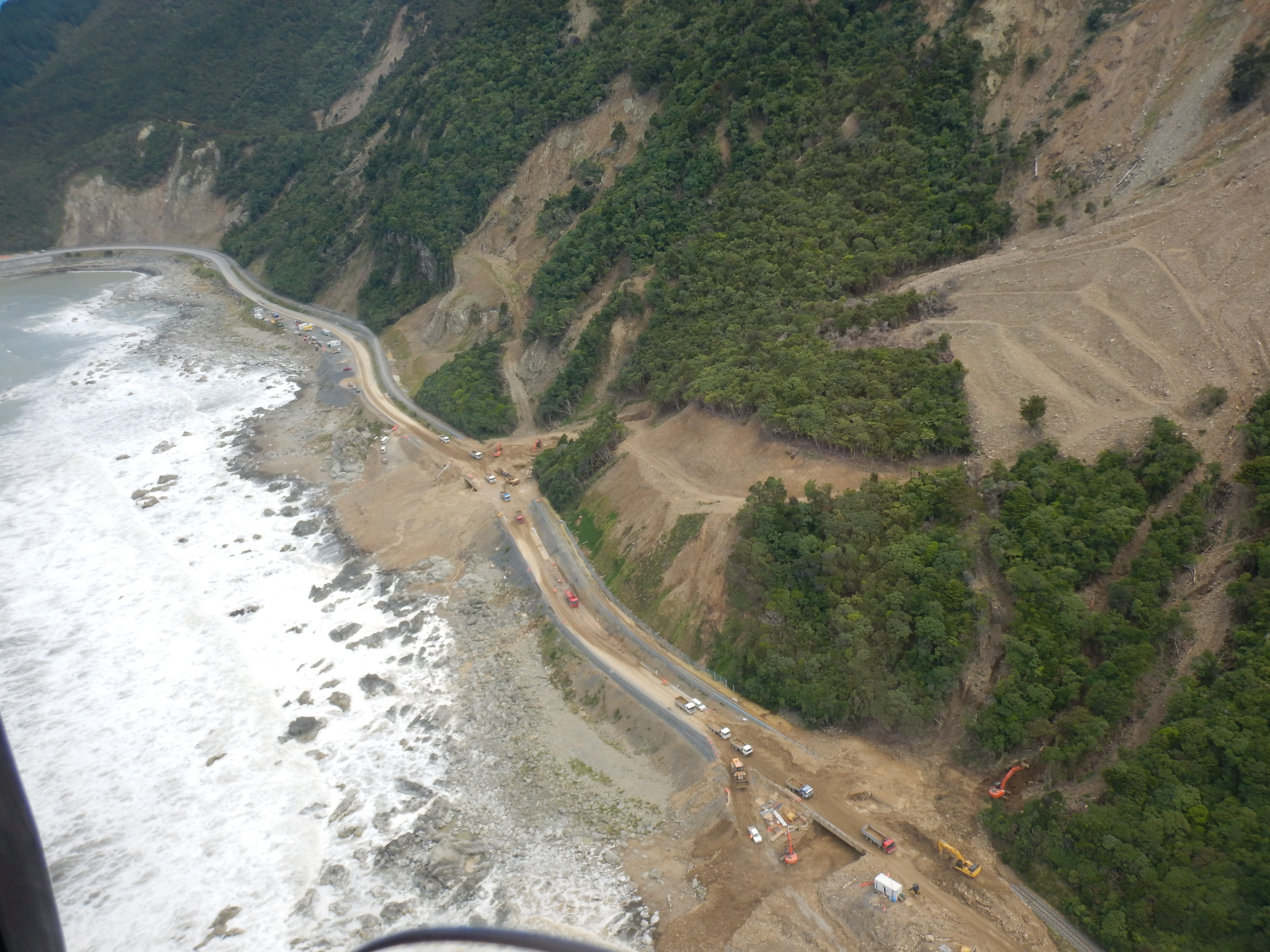
Road closures and damaged railway lines just south of Ohau Point.
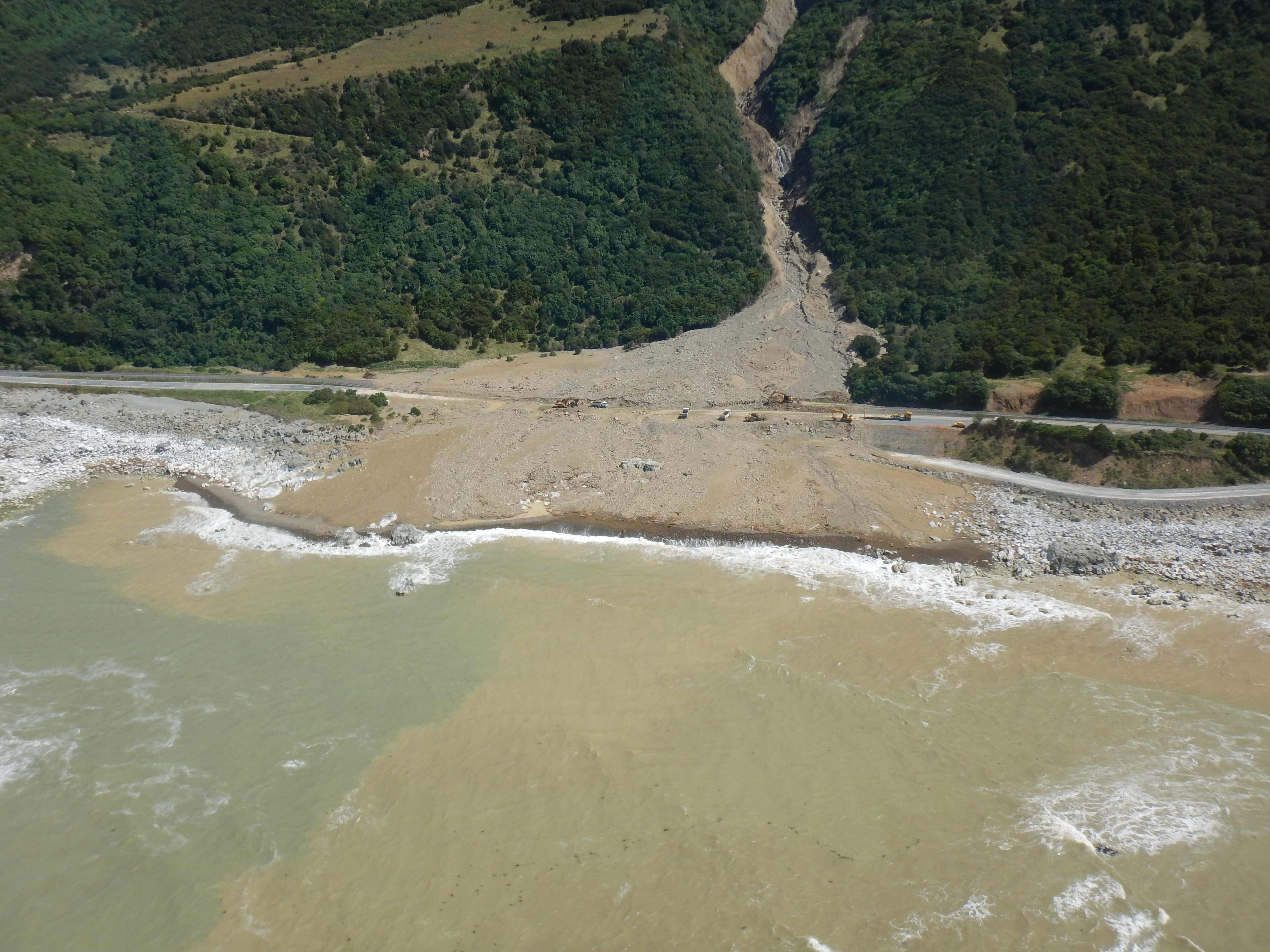
Debris flow north of Paparoa Point.
A big mess, once again. SH1 closure north of Paparoa Point.
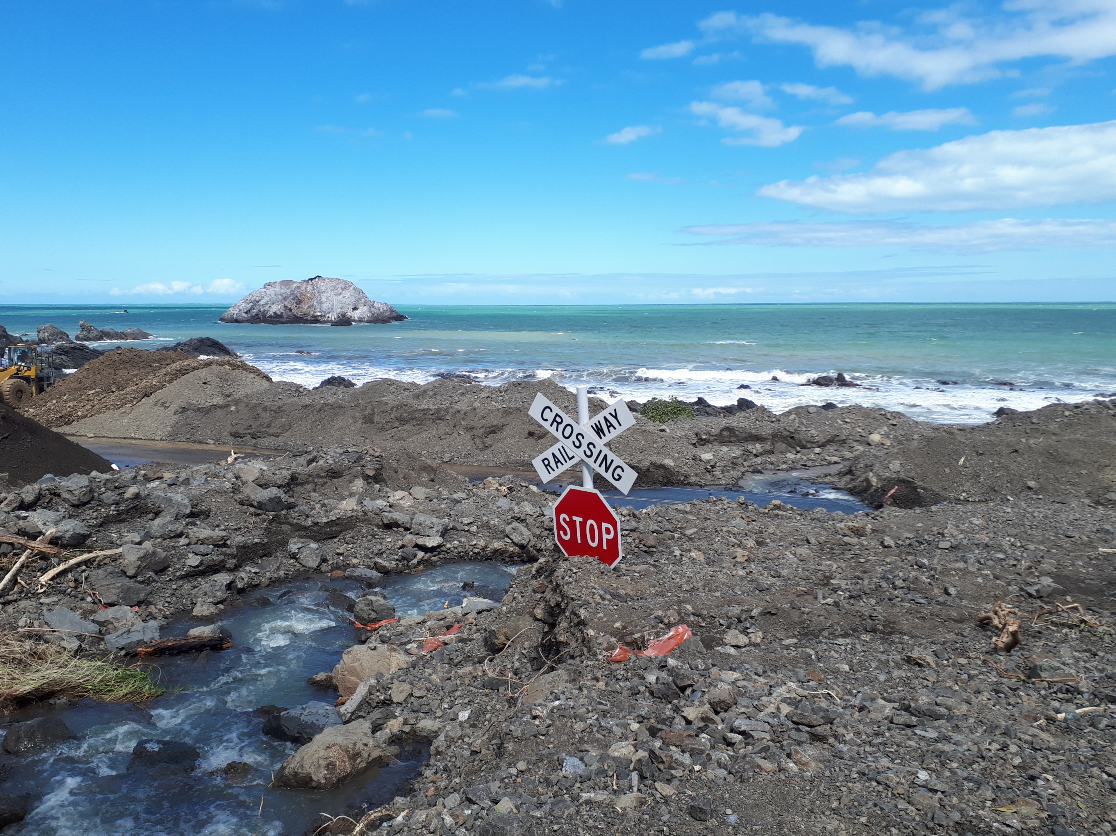
This level crossing at Rosy Morn isn't looking leveled in the way we'd like to see, or how it was a couple of days ago.
Storm impacts at Rosy Morn.
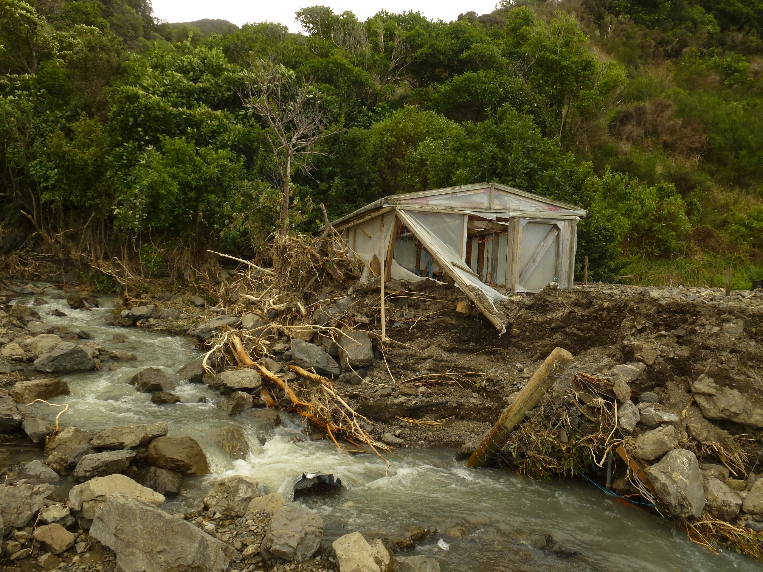
You may have already seen the Stuff.co.nz article about the landslip that has destroyed the two homes near Goose Bay, south of Kaikoura. GeoNet’s landslide response team have been on-site over the last couple of days and we will report back on the situation when we know more.
Our Landslide Response Team were activated rapidly, and have been in the field assessing the damage from landslides in the Kaikoura area. Some links are beginning to emerge between the instability of the Kaikoura landscape following the M7.8 2016 earthquake and the impacts of the heavy rain over the last week.
In particular, the response team were concerned about what such enormous quantities of rain could do to the landslide dams, such as the Hapuku dam, which were caused by the M7.8 earthquake. Our landslide scientists Dr Chris Massey and Dr Brenda Rosser flew over the Hapuku landslide dam yesterday and sent through these images.
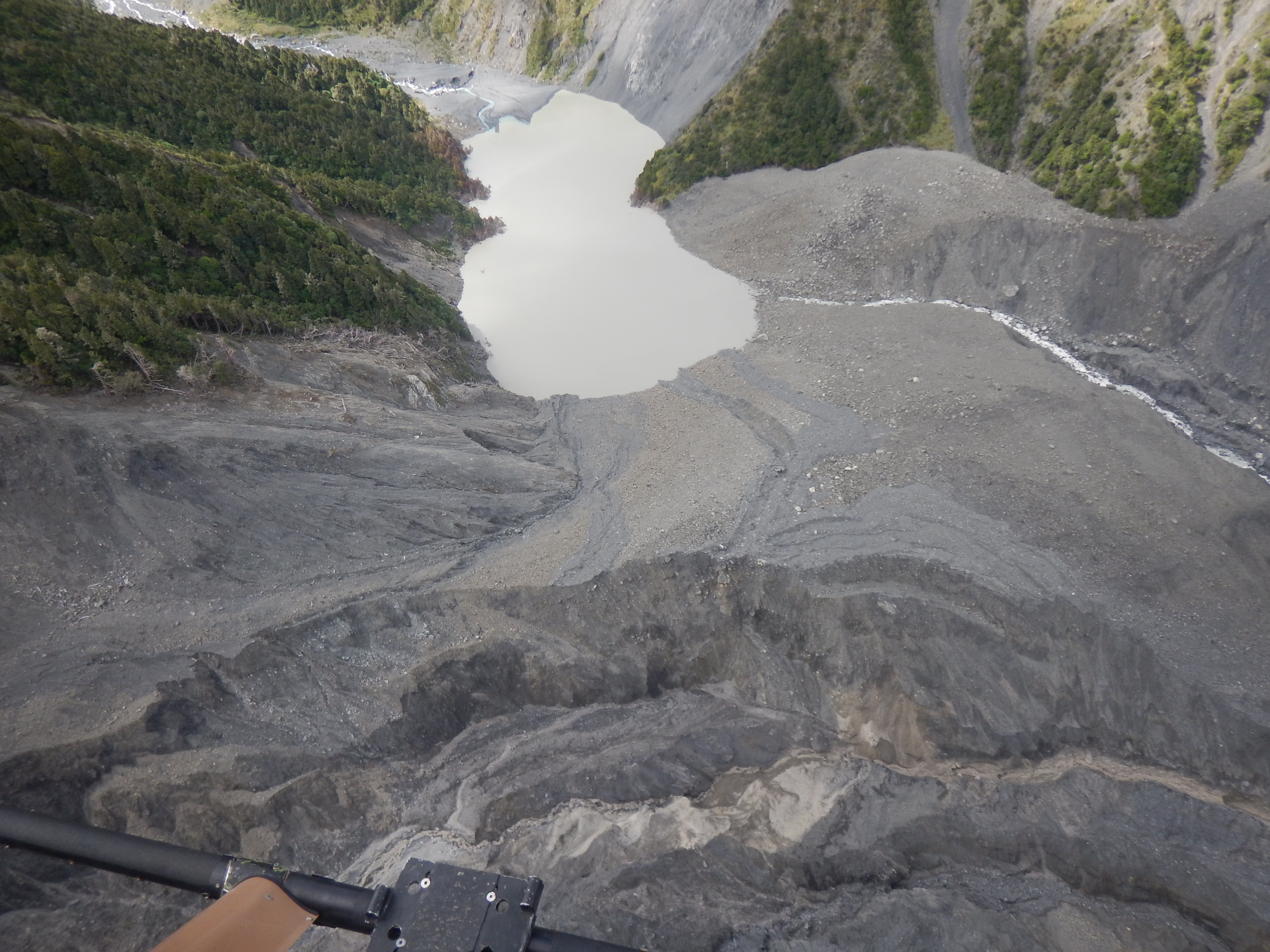
Changes to Hapuku landslide dam (caused by M7.8 Kaikoura earthquake) were identified during a flight on Thursday 22 February. Water has gathered behind the dam.
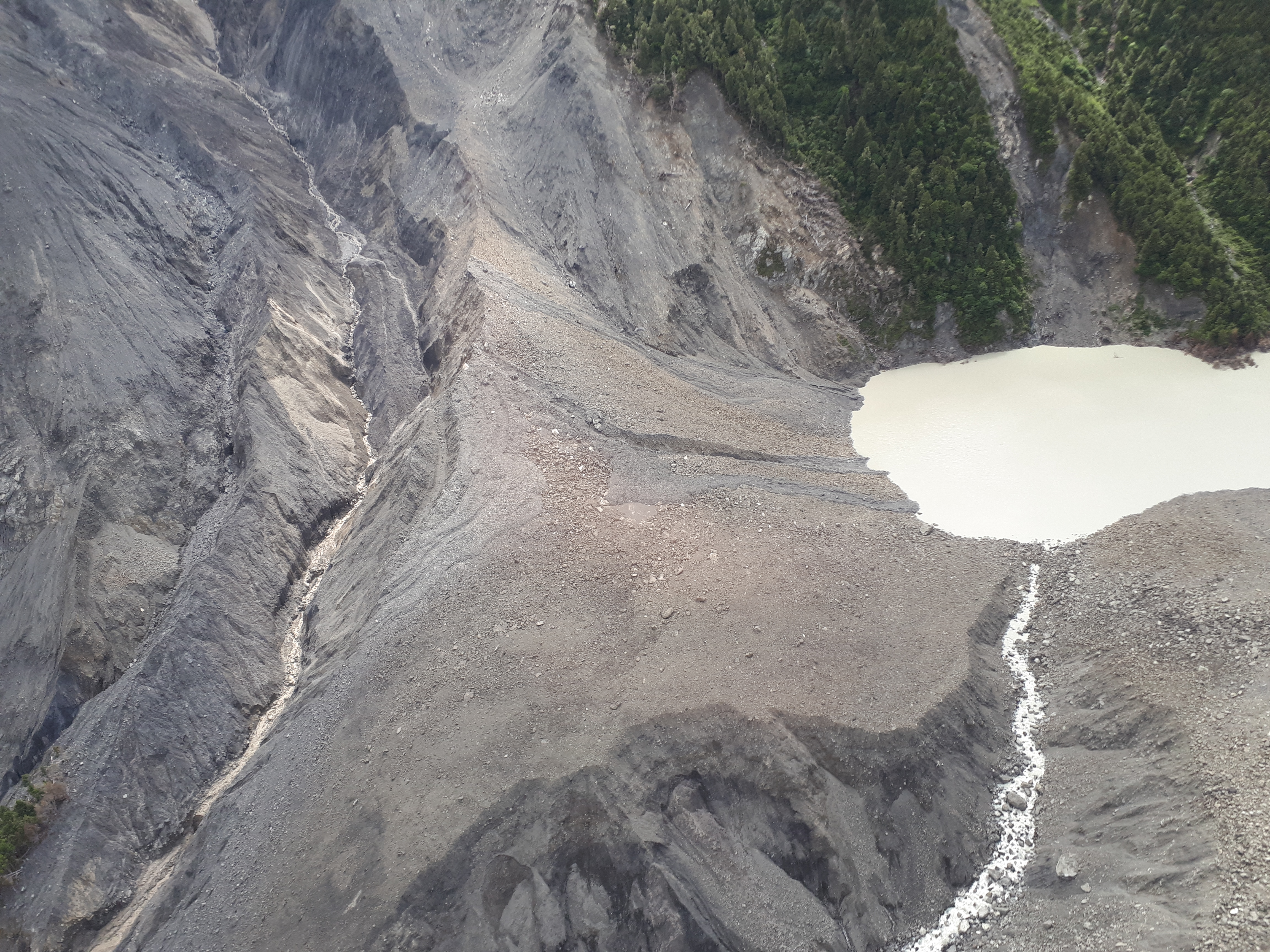
Hapuku landslide dam.
GNS Science's landslide scientists are now cranking into it, and are planning how to measure where the sediment and debris came from, how far it moved and where it ended up. They hope to answer these questions by running new LiDAR surveys (used to compile detailed topographic maps) across the affected areas and compare these against post-earthquake, but pre-Gita LiDAR data. The landslide team are also interested in how fast the material travelled, on the basis that fast-moving debris destroys buildings in its path (such as at Goose Bay), whereas slow-moving debris flows around buildings.
At the front of our scientists' minds is whether the impacts from Ex-Tropical Cyclone Gita were more severe because of the recent earthquake. To investigate this, they will be going back and analysing any data they can find from Cyclone Alison’s impacts on the Kaikoura coast in 1975 and comparing it with the data gathered over the last week.
While it currently looks a bit rough and SH1 is closed in multiple places, our scientists want to know how the new highway performed and work out whether a repeat event can be expected. Doing this will help engineers decide what improvements, if any, are needed to further enhance the resilience of the highway.
Canterbury
Canterbury has by no means got away scot-free. State Highway 79 closed between Geraldine and Fairlie due to Speechly’s Bridge being washed out and multiple slips, and SH 79 between Rangitata and Geraldine has been affected by surface water flooding.
The name Terrible Gully became apt as a debris flow roared down a shingle fan near the Rakaia Gorge, at the Terrible Gully fan on Double Hill Road. Some seriously good footage, which highlights the dynamism of an alluvial fan system at work, was captured on video by Joe Todhunter and Donna Field, who were at the right place at the right time to watch it unfold. You certainly wouldn’t want to be in the way of such a shingle filled torrent though!
Click here to watch the video:
Heavy Rain From Ex Cyclone Gita Turns Rakaia River into a River of Rock
Further inland, SH63 through Arthur's Pass was closed due to several landslides blocking the road.
West Coast
Although the West Coast region is accustomed to torrential rain, SH6 was reduced to a single lane at the Gates of Haast by a rockfall, and flooding and rockfalls affected the road between Haast and Kingston (SH6).
Otago
In Otago, SH8 was affected by flooding and rockfalls from Lindis Pass to Raes Junction, as well as SH85 between Kyeburn and Alexandra.
Let's hope that this weekend lets the country dry out!