A look back at the M7.8 Dusky Sound Earthquake with a newly available earthquake dataset.
A new scientific dataset for 2001-2011 recently released has enabled scientists to look back at previous events in more detail, improving the knowledge of local geology and helping understand how earthquake shaking travels through the ground. One such event is the 2009 M7.8 Dusky Sound earthquake.
The M7.8 Dusky Sound Earthquake
Today is the 13th anniversary of the M7.8 Dusky Sound earthquake. The earthquake's epicentre was in Dusky Sound at the south-west corner of the South Island. The mainshock was a large reverse faulting mechanism, resulting from the Australian plate pushing (subducting) beneath the Pacific plate upon which Fiordland lies. This is the largest and one of very few examples of this type of earthquake in New Zealand, making it an important earthquake for our understanding of hazards here.
Watch a short animation on New Zealand's plate boundary here.
Luckily, due to this rare type of earthquake, the energy from this quake was released more slowly, and the motion more ‘rolling’ than the usual sharp movements that cause damage with earthquakes of this size. The earthquake generated a tsunami, with our Jackson Bay tide gauge recording a 1m wave. It also resulted in the movement of the south-west of the South Island towards the west-south-west (in a direction somewhat to the south of Australia) with the largest about 350 mm of motion at Puysegur Point in south-west Fiordland. Following the Dusky Sound Earthquake temporary, portable seismometers were deployed in Fiordland to help locate aftershocks more accurately and to determine which part of the crust has ruptured, and how it might affect nearby faults.
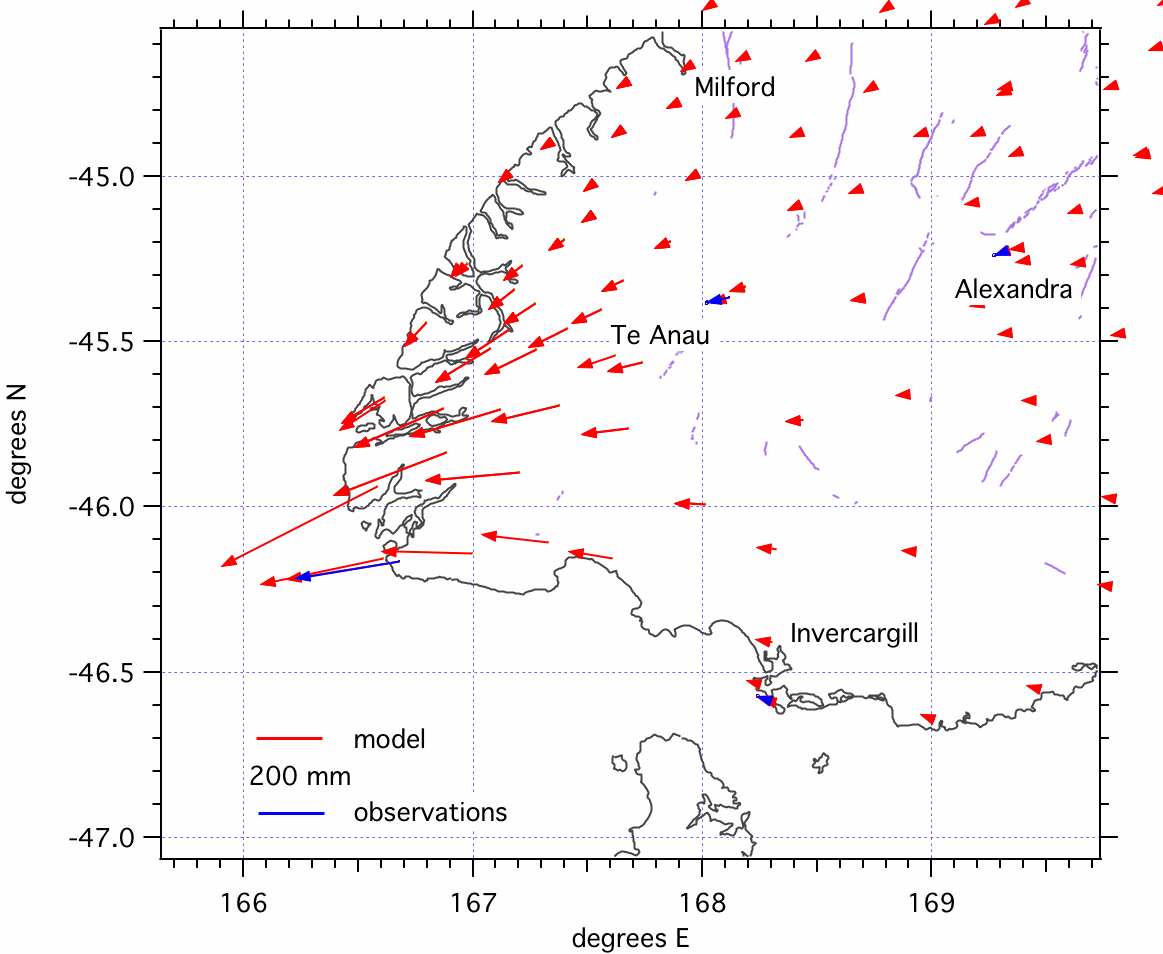
Horizontal motions caused by the Dusky Sound earthquake.
New Data
GNS scientists, including Donna Eberhart-Phillips, have used a combination of permanent and temporary seismometers throughout New Zealand to produce an earthquake dataset for 2001-2011, highlighting a very seismically active period for Fiordland and the southern South Island. This dataset has been used to update the seismic velocity model for the area (and the country) and improve our knowledge of the local geology. Seismic velocity models are used to understand how earthquake shaking travels through the ground.
Interestingly, this dataset captured valuable information about the Dusky Sound earthquake and a large portion of its aftershocks. Making detailed datasets like this freely available and accessible enables deep dives into seismically important periods, potentially unlocking new avenues of research. A good example is a recent paper on the basement geology of the southern South Island and its influence on the local tectonics. Along the plate boundary, the Fiordland block forms a crucial transition from the southern Alpine fault to the offshore Puysegur subduction zone and is a region with significant potential for large earthquakes (like the 2009 quake), which can potentially cause tsunamis.
This study clearly highlights how a greater number of permanent seismometers in the Fiordland area would improve earthquake locations in this remote and seismically active region and better support scientific research.
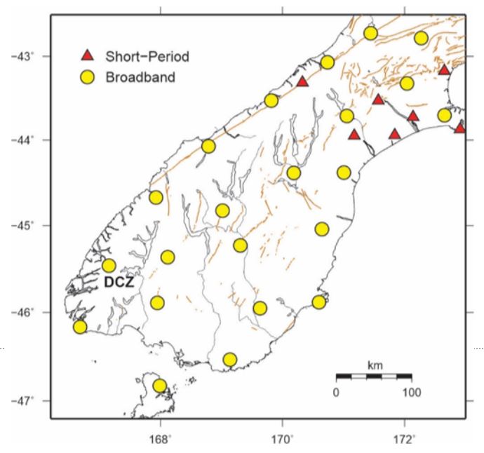
2019-2020 GeoNet sensor network in the southern South Island, with the Deep Cove site highlighted.
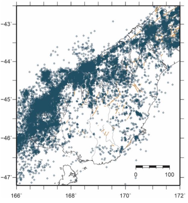
Crustal earthquakes (0-19 km depth) in the Fiordland region 2001-2011.
The Future
This is a region of active ongoing research – we are always seeking to better understand this seismically active part of New Zealand and the potential hazard implications from large earthquakes there. GNS scientists currently have another temporary deployment in Fiordland, and more datasets from recent South Island research projects will be released in future, such as DWARFS – the Dense Westland Arrays Researching Fault Segmentation project.
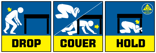
Drop, Cover and Hold
If you feel a Long or Strong earthquake, or receive an emergency mobile alert for a tsunami, Get Gone to higher ground, or as far inland as possible, immediately.
The National Emergency Management Agency (NEMA) has a great website with information on what to do before, during and after an earthquake.
And Toka Tū Ake EQC have really helpful information on how to get your home, apartment, or rental prepared for a natural disaster.
Attributable to: Dr. Jonathan Hanson, Science Operations and Data Team Leader
Media Contact: 021 574541 or media@gns.cri.nz