
Gisborne Landslide Response
Two members of the GNS Science Engineering Geology team travelled to Gisborne to determine the extent and impacts of landslides following heavy rain on 3 and 4 November 2021.
At least 26 houses were affected by slips in Gisborne City, and around 10 of these had to be evacuated due to the risks posed by the landslides. As much as 250-280 mm of rain fell in areas like Tolaga Bay and Pouawa over just 48 hrs.
A GNS Science Landslide Response, led by Brenda Rosser and Andrea Wolter, was initiated to collect information on the landslides and the damage they caused to houses in Gisborne. The landslide team were hosted by Gisborne District Council and local iwi Ngāi Tāmanuhiri, as two of the significant landslides were on Ngāi Tāmanuhiri land.
Andrea and Brenda visited several of the houses in Gisborne that were affected by landslides and surveyed the damage to properties. Most of the damage from landslides in this storm event in the urban area was caused by slippage – where landslides occurred below decks and near houses. Cracks have also opened around the existing landslides, suggesting that further movement is possible. Data gathered on this property damage will inform nation-wide research on risk to buildings from landslides. The data collected are particularly significant, as we currently do not have much information on slippage damage. The research will update and develop probabilities of levels of damage for different types of buildings and building materials as part of a Resilience to Nature’s Challenges programme.
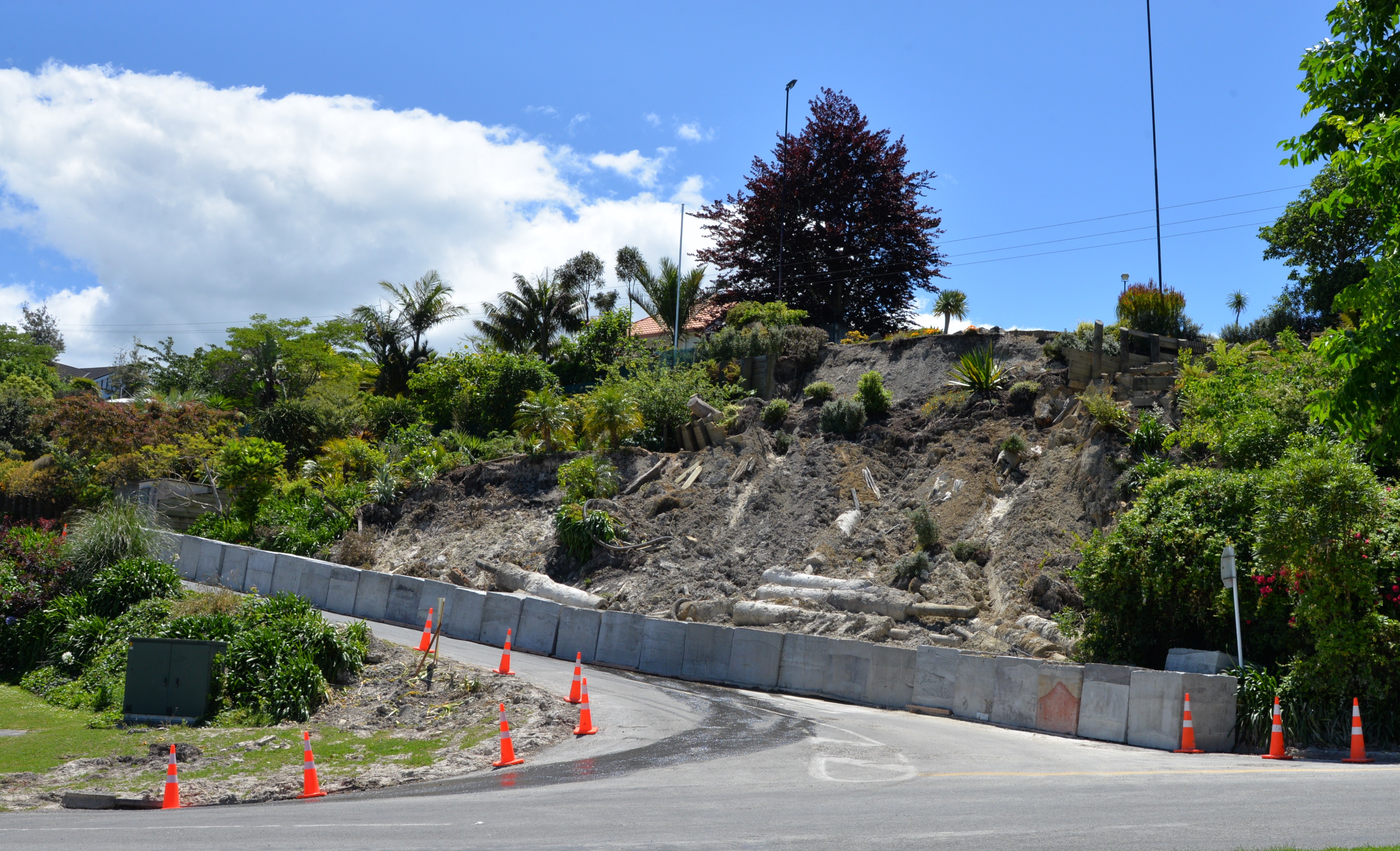
Landslide on Hill Rd in Gisborne
The team also undertook a helicopter reconnaissance flight of the areas where landslides were known to have occurred and the areas with the highest rainfall. A large landslide (possibly up to 5-8 million m3 in volume) was triggered on the coast south of Gisborne, near Whareongaonga. This landslide undermined the already damaged Wairoa to Gisborne rail line. Debris deposited into the sea changed the shape of the coastline (pictured). The landslide, and others adjacent to it, buried several wahi tapu sites including a historic Ngāi Tāmanuhiri pā site, Māra kai (food gardens) and taunga ika (fishing grounds). Rockfall on the slopes above the rail and open cracks on the rail platform highlight how hazardous this section of the coastline is.
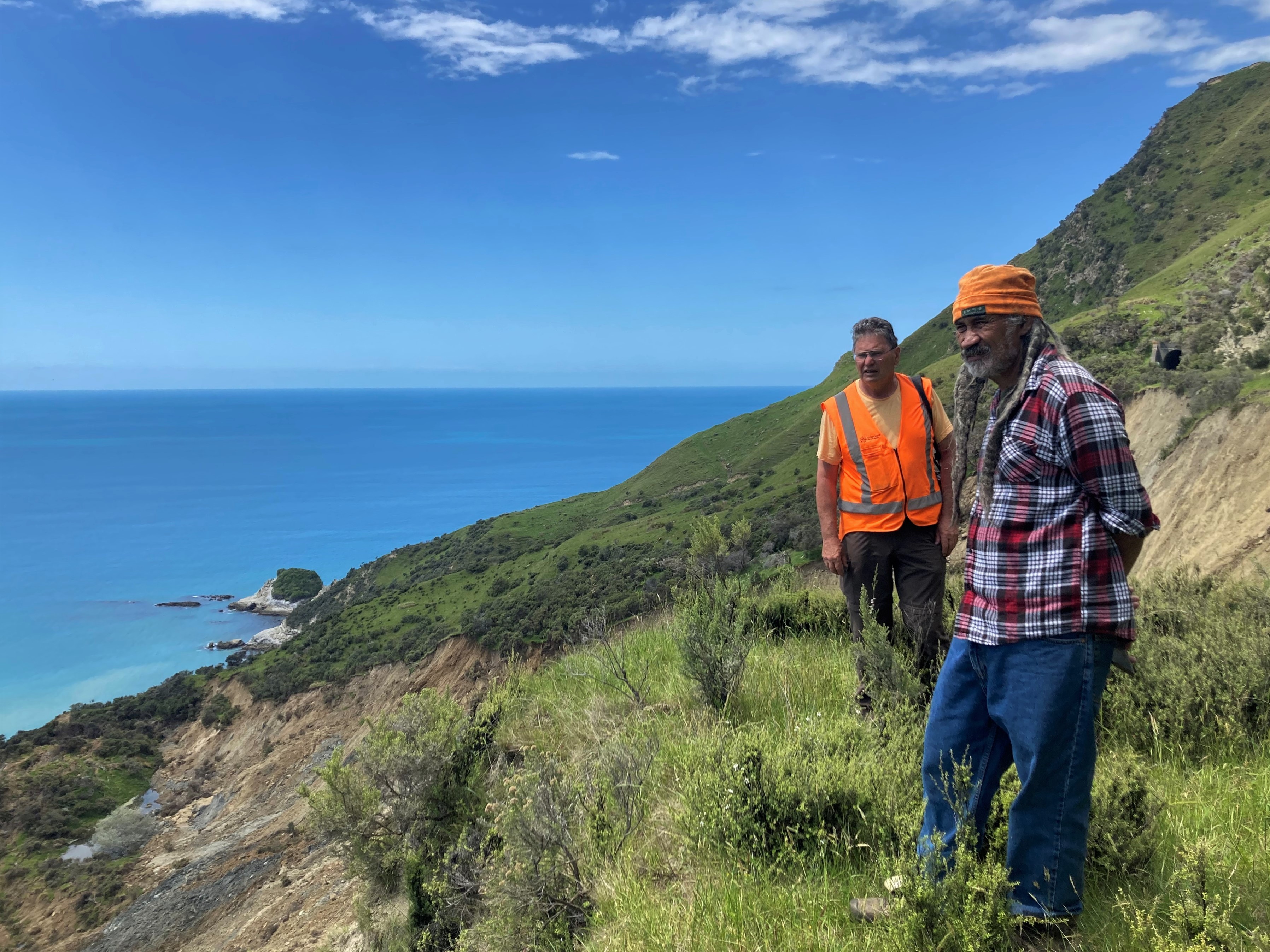
Murry Cave (Gisborne District Council) and Noel Pohatu (Ngāi Tāmanuhiri) at Whareongaonga
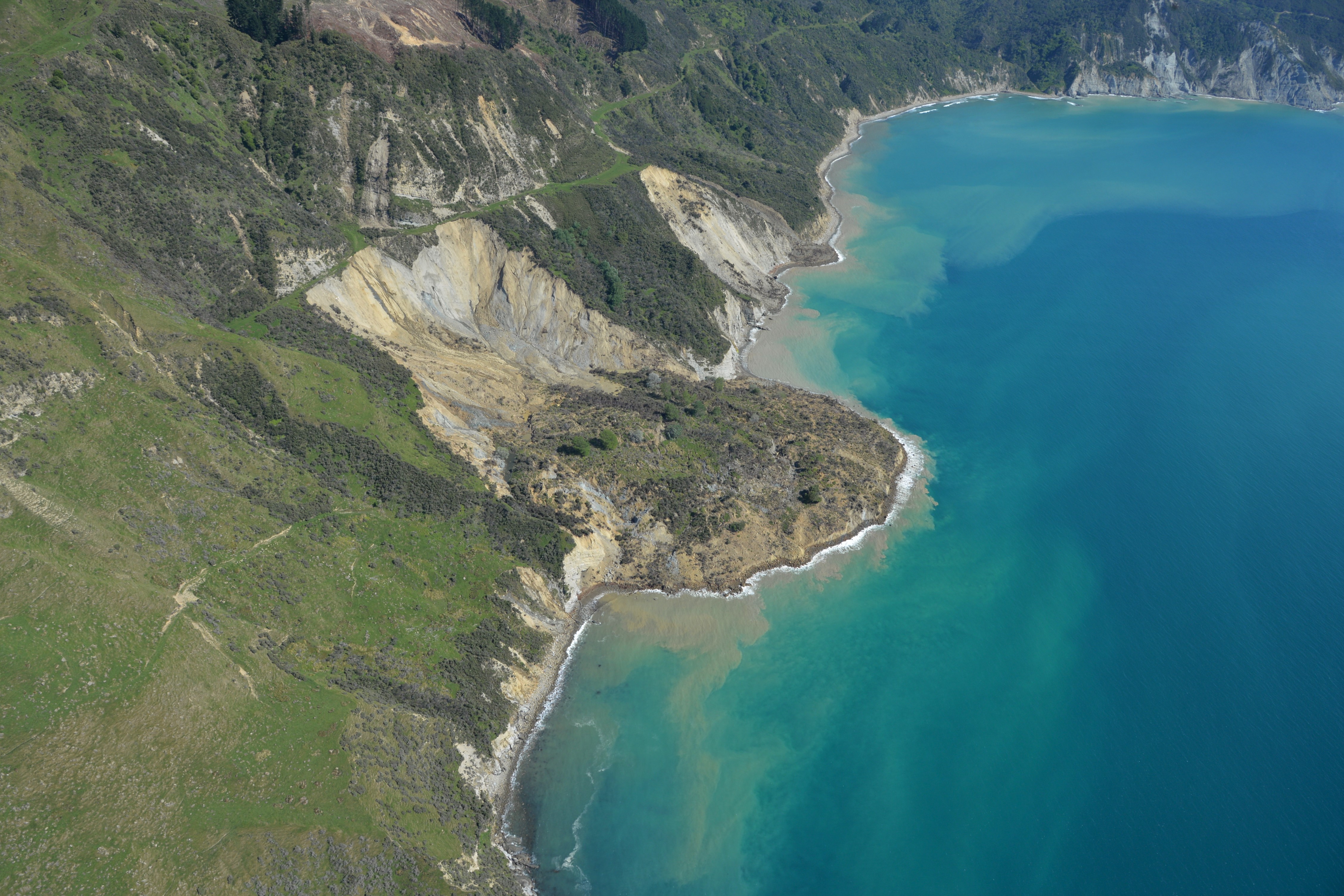
Whareongaonga landslides
The size of the Whareongaonga landslide is extreme for a rainfall-induced landslide. There are many large relict (old) landslides within in the Gisborne region, but until now we had thought that they were triggered by large earthquakes. This also makes this landslide of high scientific value to our team, as we are not aware of such a large (rapid) landslide being triggered by rainfall in the Gisborne region for a very long time.
Another large landslide, also on Ngāi Tāmanuhiri land, was reactivated near Waingake, a tributary to the Te Arai River in the Gisborne water supply catchment. This landslide is part of a large slow-moving earthflow that was initially reactivated at the end of September by heavy rainfall. The lower part of the earthflow failed rapidly and temporarily blocked the Waingake/Te Arai River, forming a landslide dammed lake upstream. Gisborne District Council (GDC) had diverted the river away from the toe of the landslide, however heavy rain associated with the early November storm reactivated the landslide, which again blocked the river. The landslide dammed lake has caused access issues for iwi and GDC staff to get into the water supply catchment and to several taiao (revegetation) projects. The Gisborne water supply pipeline is also close to the landslide toe. The landslide team are currently completing their report and talking with the council and Ngāi Tāmanuhiri about potential future work on these landslides.
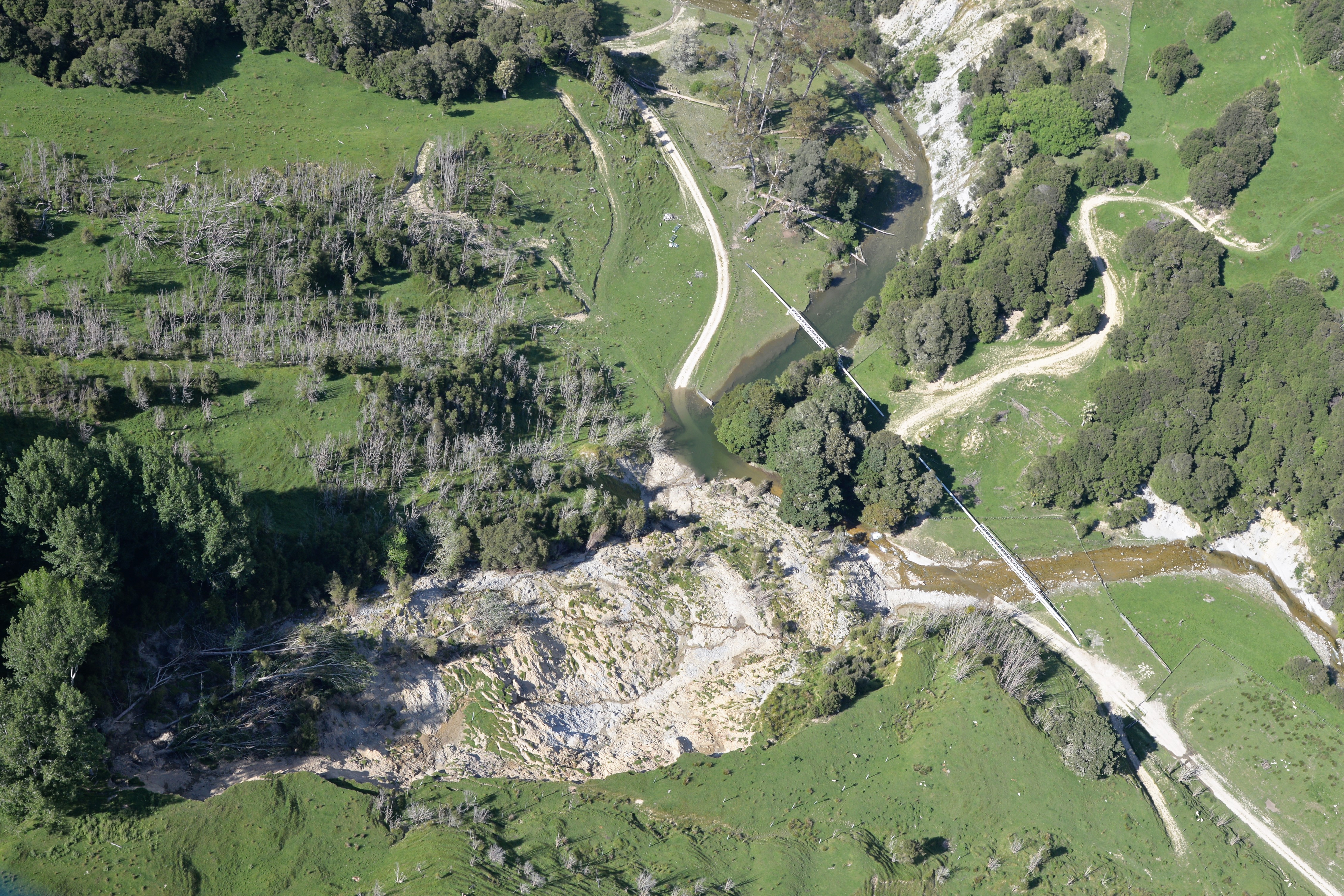
Part of Te Arai landslide that failed showing blocked river and water supply pipeline
Attributable to: Brenda Rosser, Andrea Wolter, GNS Science
Media contact: media@gns.cri.nz or 021 574 541