Kermadec Quake Confusion
Our seismic equipment is very sensitive and can detect seismic waves from earthquakes that happen far away. These distant events can cause confusion when they create false earthquakes. Today we look at Friday’s M6.9 Kermadec earthquake and why it caused “ghost” quakes, and why some earthquakes get deleted from GeoNet’s website and app.
What are ghost quakes?
Ghost quakes happen when our automatic earthquake location system, which is set up to best locate New Zealand earthquakes, interprets the waves arriving from a distant earthquake and reads them as numerous closer and smaller earthquakes. We work hard to quickly fix these automatic events, but they can cause concern and confusion.
In Friday’s case, when the Kermadec earthquake waves arrived at our northernmost seismic stations our automatic system decided it was a M4.5 earthquake in Pongaroa. When the earthquake waves arrived at seismic stations further south the automatic system didn't associate it with the 'first' earthquake because the arrival times didn't match up with what the system expected for an earthquake closer to New Zealand. Instead, it treated the waves as a separate earthquake, and created a M3.0 earthquake in Canterbury. As soon as our geohazard analysts spotted this error they deleted the ghosts and confirmed the real quake.

How the Kermadec earthquake looked with our New Shaking Layers Map
Ghost quakes are an unfortunate side effect of us wanting to get information out to you as quickly as possible. Instead of waiting for a person to manually check each earthquake before it goes up on our website or app, we allow our system to make these automatic decisions, which occasionally result in these misinterpreted events. If we make our automatic system too picky on the quakes it reports, we might not get information about real earthquakes out rapidly.
Rest assured if you see an earthquake on our website, or app, that has ‘deleted’ next to it, it was not a real earthquake – our analysts have checked!
Can’t see the earthquake on our website?
The next tricky part to this earthquake was that some people couldn’t see the real Kermadec earthquake on our website, and this comes down to its shaking intensity.
As we locate so many earthquakes every day, our Quakes page has a filter and defaults to show earthquakes of ‘Weak and above’ shaking intensity, as these are the events most likely to have been felt by most people.
Due to its size and distance from New Zealand, Friday’s Kermadec earthquake was classed as ‘unnoticeable’, requiring you to change the filter to ‘All’ to see this.
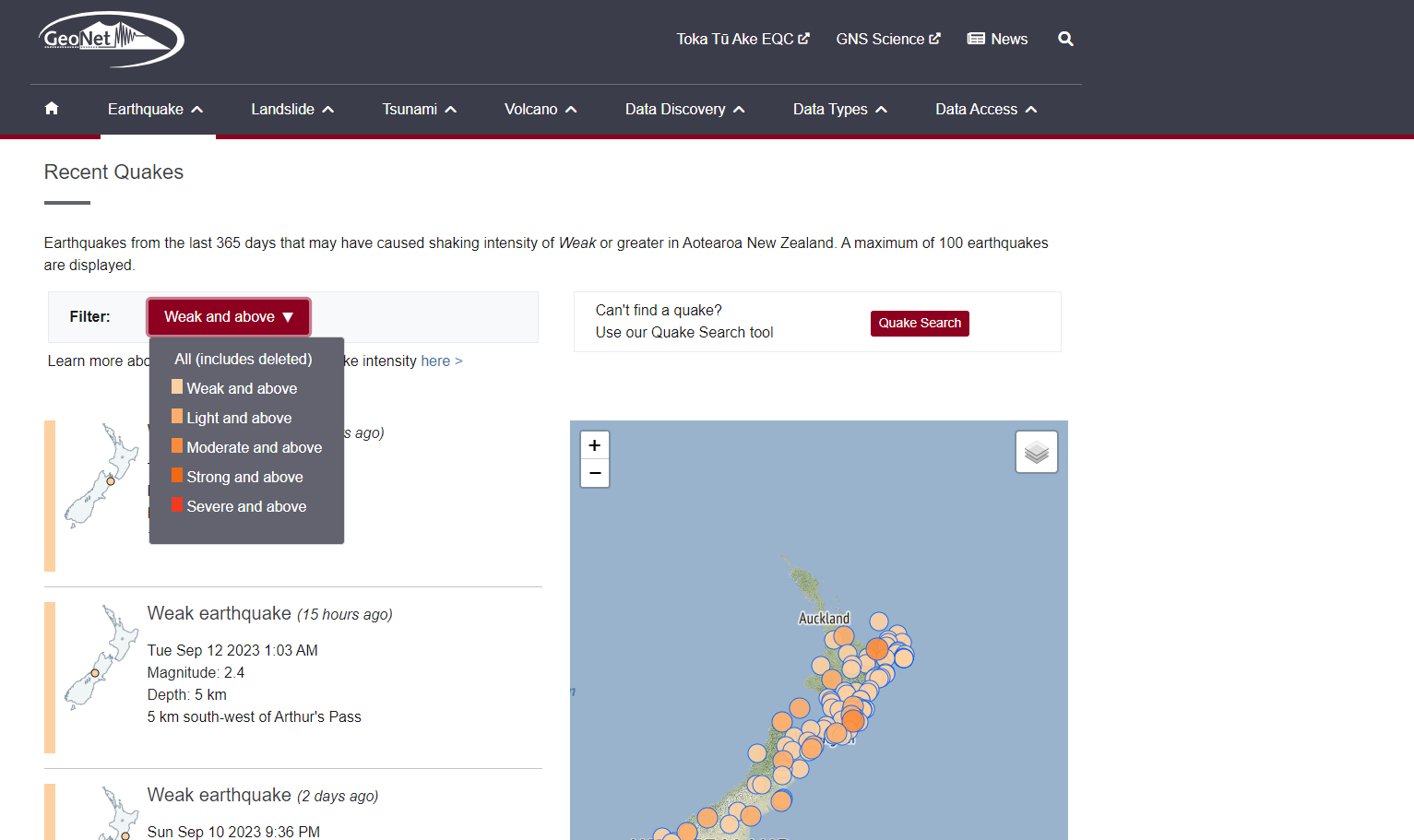
Filter on the Recent Quakes page
So, what is shaking intensity?
The size of an earthquake is often described using magnitude, which is the amount of energy released during an earthquake. However, not all the energy released in an earthquake will necessarily be felt at the surface, depending on the earthquake's size, depth, and the different types of geological material that energy must pass through to get to our sensors and to people.
In New Zealand, where earthquakes occur anywhere from right up near the surface right down to depths of over 600 km, the Modified Mercalli Intensity scale is a better indicator of an earthquake's effects on people and their environment.
We use a simplified version of the New Zealand Modified Mercalli Intensity scale, and we have added an Intensity term that generalises the description of the shaking. As you will see below ‘unnoticeable’ covers MMI 1 and 2 which are barely felt by people (we know this is tricky wording).

Simplified New Zealand MMI Scale
People will feel the same earthquakes differently based on number of different factors. These include the earthquake’s size and depth, where you are located relative to the earthquake, and the geological conditions of the area and the type of building they are in, or ground they are on.
When our system automatically characterises an earthquake’s shaking, it does this generically based on size and location because it cannot factor in all other possibilities that might change how individuals feel the shaking. Using Friday’s Kermadec event as an example, while over 4000 people reported feeling the shaking, most of the country did not.
We are always working on improving our website, recent improvements include better felt report maps and new shaking layers maps. Coming up we have some changes to the way we do felt reporting including an option that lets you tell us when you didn’t feel an earthquake we’ve located. Stay tuned!
Earthquakes can occur anywhere in New Zealand at any time. In the event of a large earthquake: Drop, Cover and Hold.
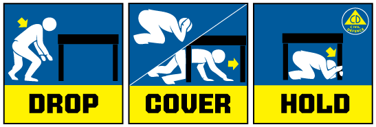
Drop, Cover and Hold
Remember Long or Strong, Get Gone : If you are near the coast and feel a strong earthquake that makes it hard to stand up OR a weak rolling earthquake that lasts a minute or more move immediately to the nearest high ground or as far inland as you can, out of tsunami evacuation zones.
Know what to do?
The National Emergency Management Agency (NEMA) has a great website with information on what to do before, during and after an earthquake.
Prepare your home. Protect your whānau.
There’s a lot we can do to make our homes safer and stronger for natural disasters. Toka Tū Ake EQC’s website has key steps to get you started.
Media Contact: 021 574 541 or media@gns.cri.nz