
Work in progress: Magma shutdown and database reshuffle, a metadata reboot is underway.
Metadata web app., Magma, and our old network maps are being discontinued today, but never fear - updates are here!
Magma is our equipment and metadata tracking web application. Simply put, Magma provides a way of accessing the metadata stored in our DELTA (Data Equipment pLanning Tracking Access) database.
DELTA has been our database for storing metadata (the 'data about our data') since the early days of GeoNet, and over time has become a bit of an 'everything database' – or, in plain terms, ‘an information dumping ground’. This information mash-up makes finding relevant metadata difficult, so we’re rebooting our database and database access systems to better suit the needs of our users.
As Magma is going away, so must its URLs: magma.geonet.org.nz and delta.geonet.org.nz. We apologise for this, but promise that any short term pain will be alleviated by our new database and database access system. This new system has been designed with data-users in mind, so metadata is now easier to access and discover.
Accordingly, the beastly DELTA has been broken into three pieces: one for the public containing site and instrument metadata, and two for information regarding the maintenance and operation of GeoNet’s remote field network (sorry – these two are for internal use only, but the info they contain is much more mundane anyway!).
Speaking of improving clarity – check out our new map style!
We’ve stripped down the content of all our maps and added topography to improve map readability and add context to earthquake and instrument locations. But that’s not all! We’ve also started improvements on our network instrumentation maps, but bear with us, this is still being developed.
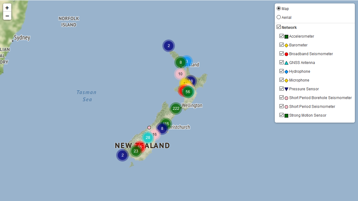
The default view of our new network instrumentation map.
At first the new instrument network map is a little overwhelming, but it’s easy to simplify. Hover your mouse over the layer symbol in the top right to expand the layer selection interface. Here you can curate the instrument types plotted and switch the map backdrop between topography and aerial photography.
The number of instruments of a certain type (colour) in a certain region (circle) are shown at distant zooms, giving a quick summary of which instruments are where and in what density. Zoom in to break these overview bubbles up and keep zooming to see individual instrument locations. Click one of these instrument symbols to get its corresponding site name and a detailed position of the site.
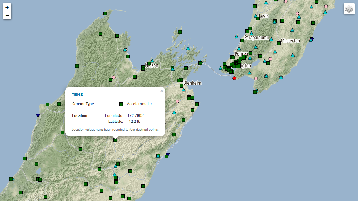
Instrument site name and location pop-up on a zoomed view of our new network instrumentation map.
Please note, we are still adding information to the map. It's a work in progress so some sites may still be absent.
It is also worth pointing out a couple of things to our advanced users:
You guys can now access all the information in the public delta repository here. This is home to all the metadata that it relevant for interpreting and processing our data. Previously, only a limited amount this metadata was available through the site information pages.
The data and code in the delta repository is used to generate the response files, StationXML and other metadata products available through the FTP site, however it is much easier (and encouraged) to use the FDSN station service to get this information. See here for more information.