
Why are the felt reports so far from the earthquake's epicentre?
We’ve had quite a few questions come through about why the felt reports for Sunday’s M4.3 quake weren’t located closer to the earthquake’s epicentre.
We've received 1949 felt reports for this event and although it was centred near Rotorua, the majority of the reports were located on the east and south of the North Island.
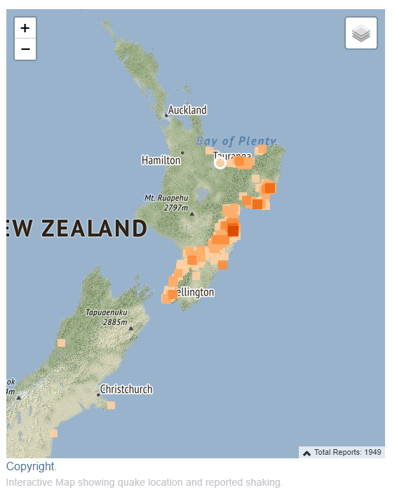
FeltReports
Deep North Island quakes, like Sunday’s quake, often produce little shaking near the epicentre. The North Island sits on the Australian Plate but these deep earthquakes occur in the Pacific Plate, which is subducting or diving under the North Island.
The 'slab' of subducting rock in the upper portion of the Pacific Plate is rigid (the dark brown area in the graphic below), and the surrounding rock (shown in yellow) is more 'mushy' - a mixture of rigid and molten rock.
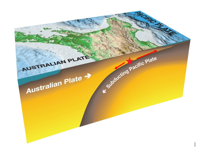
North Island Subduction Zone
Rigid rock is better at transmitting earthquake waves than mushy rock. So when an earthquake happens in or near this slab of subducting plate, most of the quake’s energy (and therefore shaking) travels up and along the slab to the surface - closer to the East Coast of the North Island.
The energy that travels straight up to the surface from 150km depth has to travel through the softer, semi-molten rock, which 'dampens' the waves. This means that fewer people around the epicentre will feel these types of earthquakes. The felt report map from Sunday's deep earthquake is a great illustration of this phenomena.