
Tech Tales – An urgent trip to Raoul Island
After plans to depart for Raoul Island for maintenance on 1 March were stalled due to COVID-19 alert level changes, our team had planned to depart for Raoul Island on 8 March. Then three large offshore earthquakes and tsunami occurred on 5 March.
Following the M7.4 and M8.1 Raoul Island earthquakes on 5 March, our communications links to Raoul Island were lost. The island’s location makes it one of Aotearoa New Zealand’s most vital sites for monitoring earthquakes and tsunami in the region. The sensors on Raoul Island are the only ones of their kind between mainland Aotearoa New Zealand and the nearby populous Pacific Islands of Norfolk Island, Tonga, and Fiji. So, it was critical that our team could get to the island and have communications up and running as soon as possible.
On Wednesday 10 March, after a busy few days of risk assessments and additional planning, a team from GNS Science, the New Zealand Defence Force (NZDF), Department of Conservation (DOC) contractors and MetService arrived at Raoul Island aboard the Royal New Zealand Navy vessel HMNZS Canterbury. GNS Science Remote Infrastructure Management team technician Merijn Thornton filled us in on the trip …
The three days travel on the ship were spent in meetings with the Navy and speculating what we would find at the island. A full risk assessment by GNS Science deemed it safe for our team to go onto certain areas of the island, and once we arrived a quick reconnaissance flight was taken to see how things looked. This found the island strewn with landslides, but no major damage to the buildings. An inspection was then done by a structural engineer, which alleviated any concerns that the buildings would be too damaged to enter. However, despite the mess, very little damage was found at all.
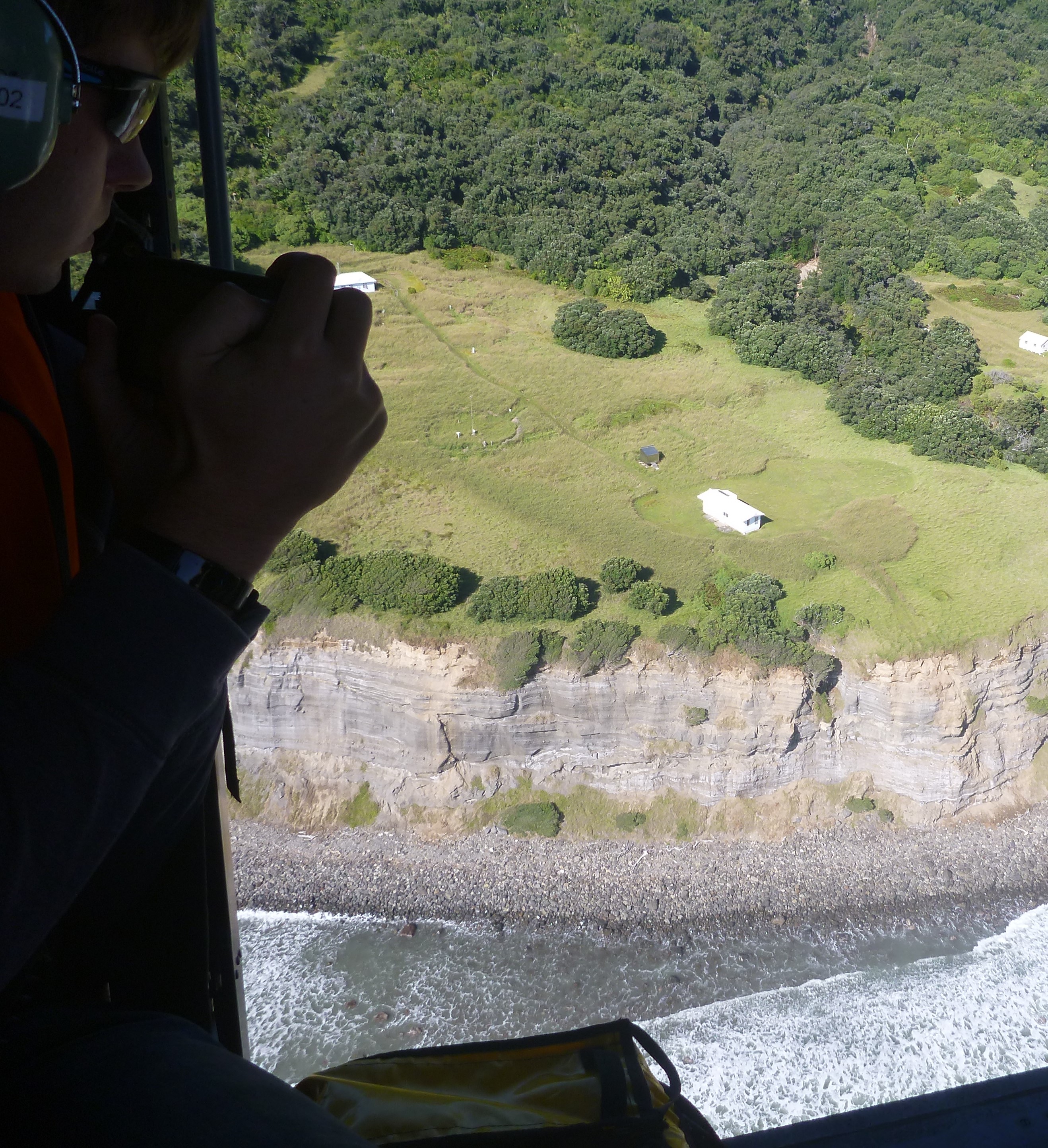
Merijn on the recon flight
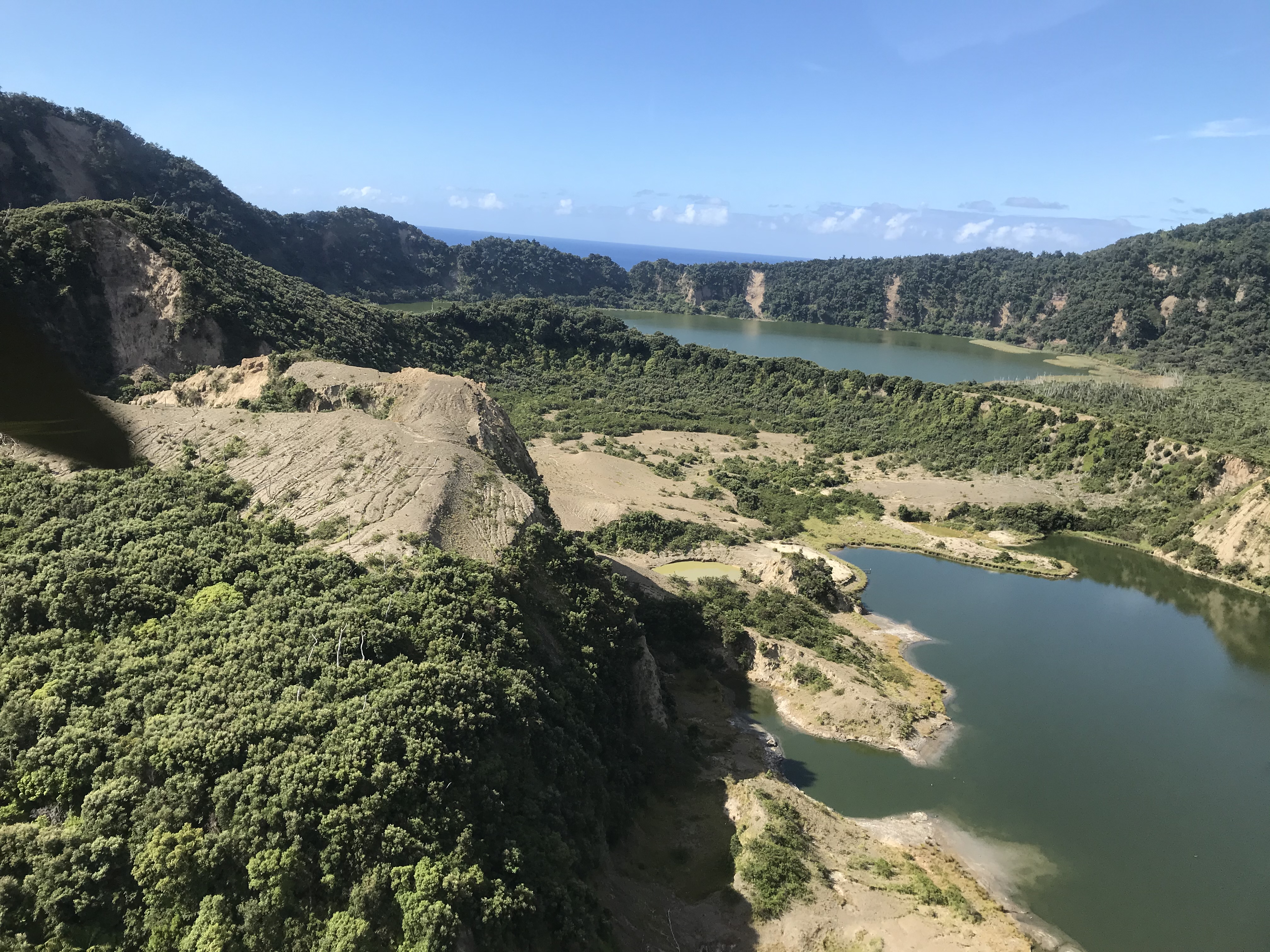
Multiple landslides were seen around Blue and Green Lakes in the caldera.
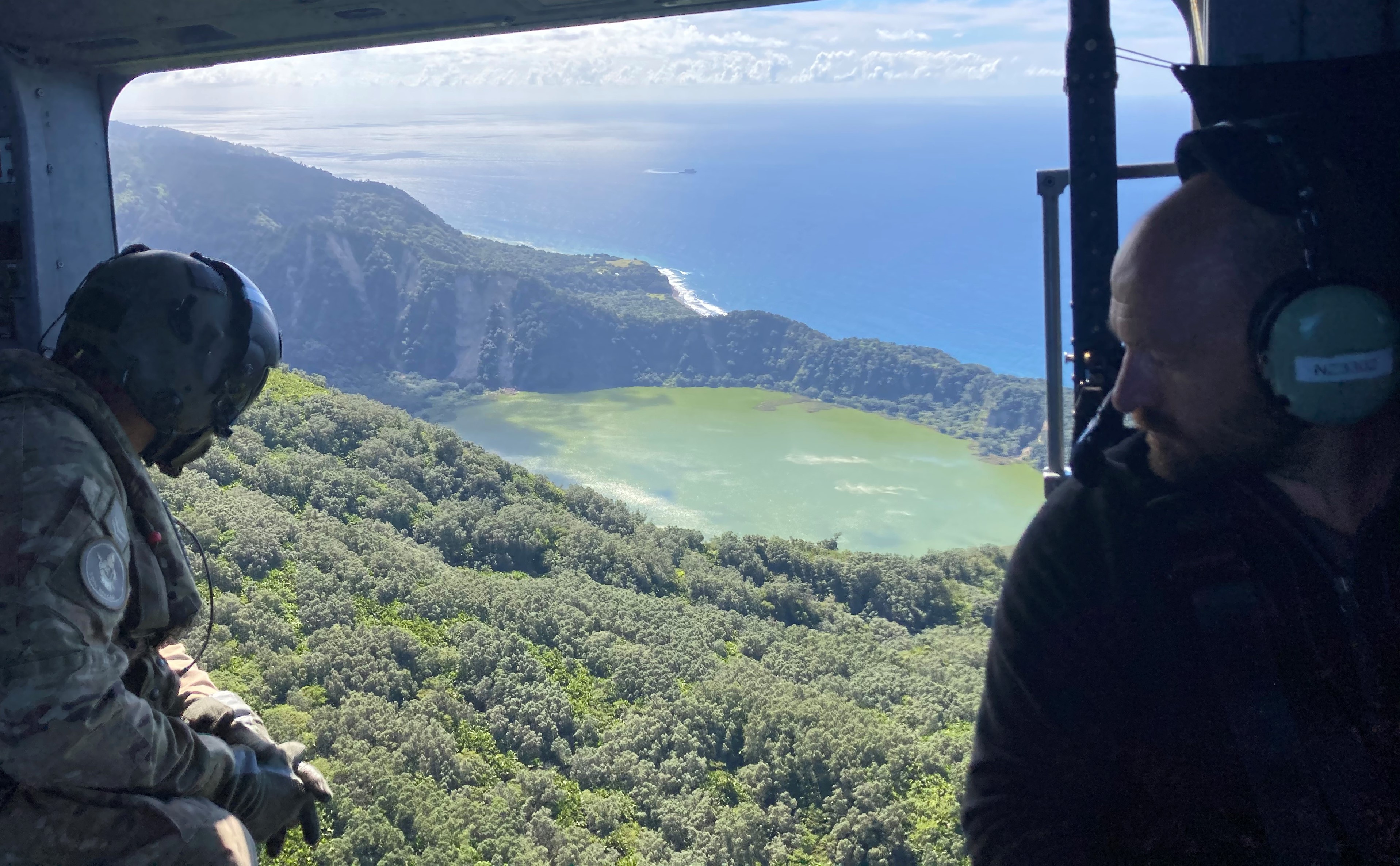
Tech Miles flying over of Blue Lake on Raoul Island, showing the landslides on the crater wall and the RNZN Canterbury at anchor in the background
Among the things that had fallen during the quake was our communications cabinet. It had tipped over, ripping out the bolts that secured it to the floor. We promptly restored power to the site and spent the rest of the time futureproofing it by adding extra security to the cabinet and adding a solar system as additional backup.
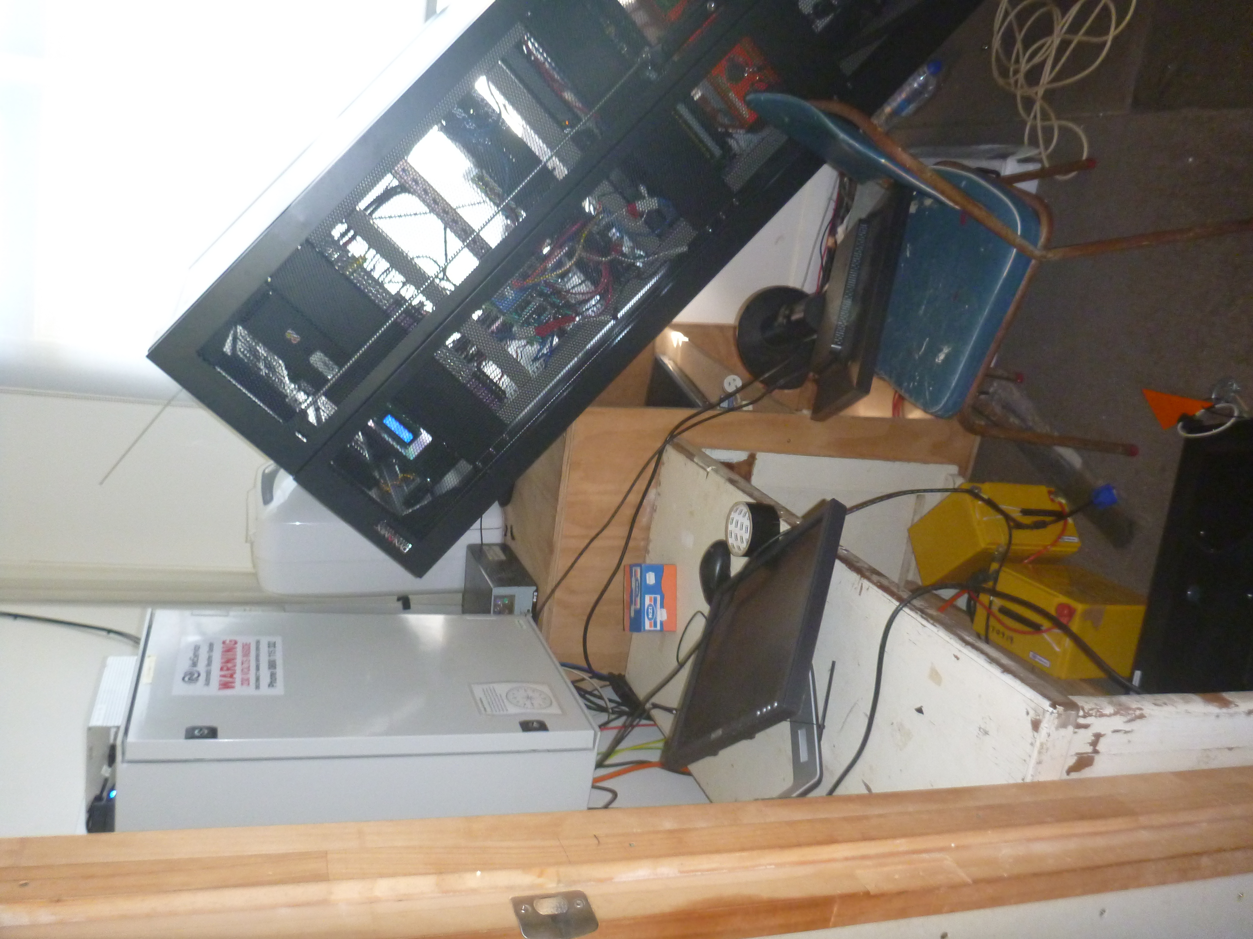
The GeoNet cabinet after the earthquakes.
A quick visit to our camera and repeater site up Mount Moumoukai revealed that some equipment connections also had been damaged as a result of the earthquake. It took a lot of work over two and a half days, but we had the island back up and running. On the trip back we slept.
The team were able to fully restore power and communications to all GeoNet instruments, but they found some data from the second earthquake had been lost.
“While it’s disappointing to have lost some data from the Raoul Island instruments, we can still learn plenty about the Kermadec events from the wider GeoNet and regional monitoring network, including the DART buoys,” GNS Science operations and data team leader Jonathan Hanson says.
GeoNet would like to thank NZDF for making our large-scale repairs to Raoul Island possible, as well as the Department of Conservation and MetService.
Attributable to: Merijn Thornton, GNS Science Remote Infrastructure Management team technician
Media enquiries: media@gns.cri.nz or 021 574 541