
Recent rain reactivates piping erosion near Rotorua
The formation of collapse holes, locally known as ‘tomos’ is very common in the Rotorua-Taupo area.
These form due to internal erosion in the soft pumice based soils, where water seeping into the ground is washing finer particles away creating a subsurface cavity and path for water to flow in. This regressive erosion of particles from downstream works upstream towards the surface until a continuous pipe is formed and collapse of the ground surface into the cavity occurs. There may be no external evidence, or only subtle evidence, that it is taking place. Many are discovered by tractors or fertiliser trucks driving across what appear as secure surfaces. They also appear at times of high rainfall, when water ponds in low lying areas or basins of internal drainage.
In the Earthquake Flat area 15 km southeast of Rotorua there is also a relationship between these collapse holes and active faults. They usually form at the base of the fault scarps or parallel to them, as faults are usual paths for water to flow into the ground. Deep pits are common. Reactivation and enlargement is also common during periods of high rainfall. During a high rainfall event last week in the Rotorua District one of these pipes was reactivated near Wilson Road (Tumunui). A linear feature about 230 m long has activated and crosses State High 5. On the east side of the road a feature about 80 m long has ‘always’ been present, 3-5 m wide and several meters deep. Now this feature extends under the highway and terminates as a tunnel in the hill side about 110 m west of the road. During the heavy rain on 23 June (over 30 mm) a small lake formed in the area flooding over the road. The pipe formed to the surface as the lake drained.
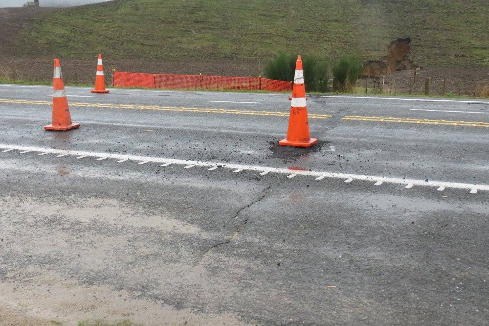
Cracking developing across the road surface
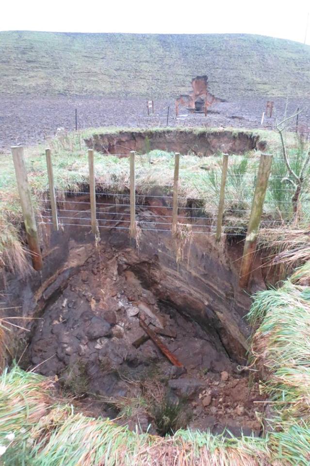
View into collapse hole at road edge on west side
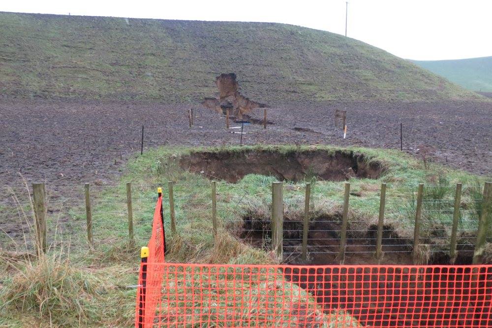
Collapse holes on west side of SH 5, note the pipe developing into the ridge
In 1967 part of State Highway 5 about 3 km south on Earthquake Flat collapsed under similar circumstances. In that location the collapse was along the strike of one of the active faults. The reactivation near Wilson Road is slightly different as the fault strikes at about 060, while the collapse pipe strikes at 090. Like Earthquake Flat, the Wilson Road area is also a basin of internal drainage. These basins are in fact craters formed about 60,000 years ago during the Earthquake Flat eruption. Earthquake Flat is the source of a moderate sized ignimbrite eruption. The area is also part of the Taupo Fault Belt (or Taupo Rift) and numerous active faults cross the area.
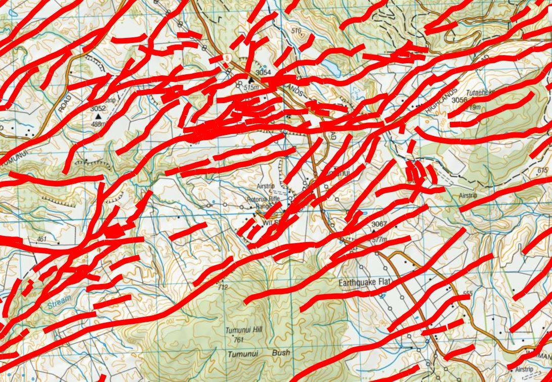
Fault map drawn from the GNS Science Active Faults database