
Hydrothermal systems at volcanoes: What can we learn from mapping them?
Detailed mapping of the plumbing beneath Tongariro’s scenic wonders gives new insights into the working of the volcano
Volcanic lakes, hot springs and gas vents provide windows into the underground workings of a volcano, and changes in these features are often the first indications that a volcano is waking up. At Tongariro, GeoNet volcanologists regularly sample the numerous hot springs, lakes and gas vents to determine the volcano’s state of unrest. Like any good plumber it’s important to know how one feature is connected to another and whether a change in one is representative of the overall state of the volcano. Two of the most active features at Tongariro are Ketetahi hot springs and Te Maari Crater, both of which produce steam plumes visible from the foot of the mountain.
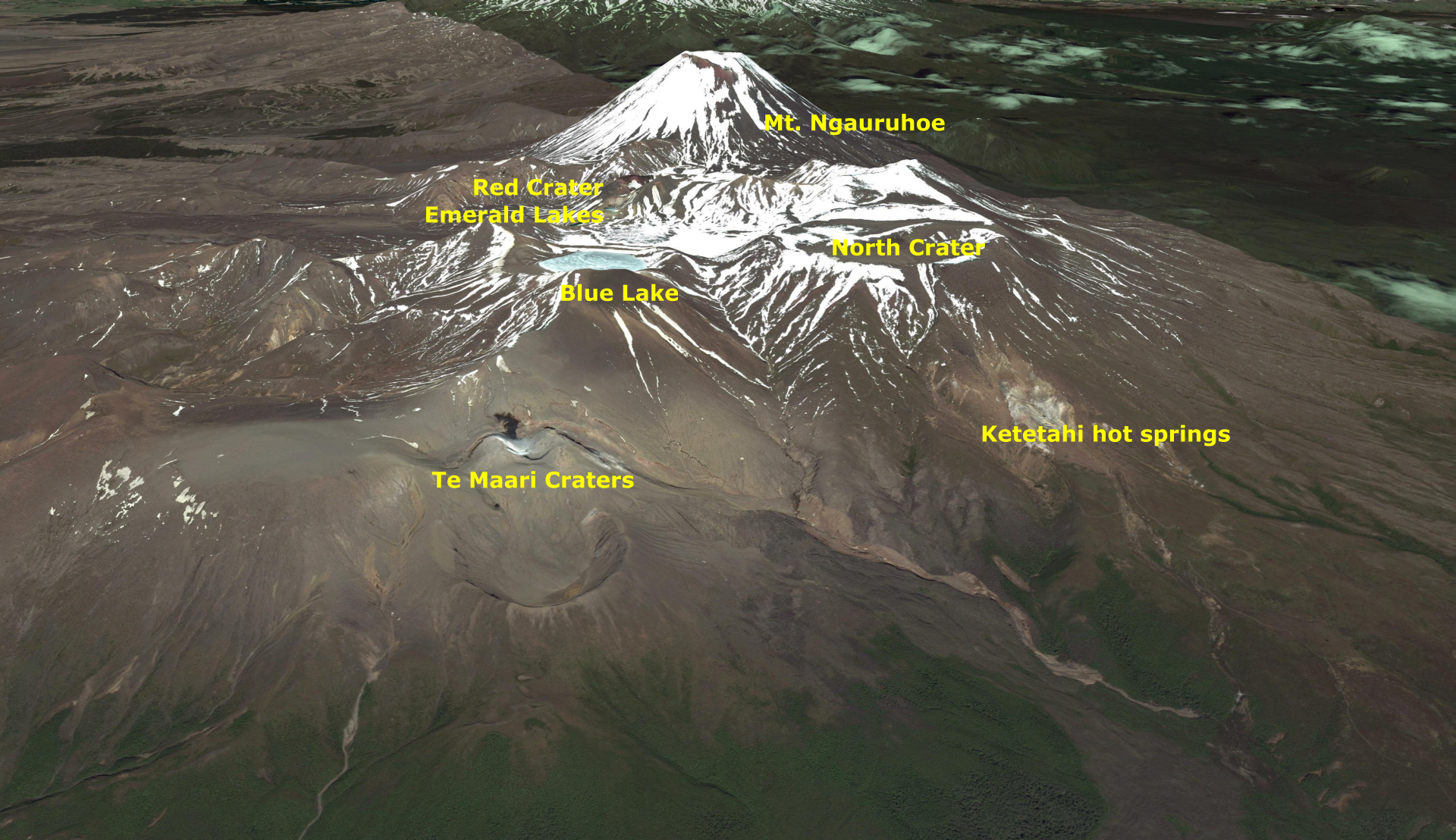
Google Earth view of Mt Tongariro showing the volcanic craters and vents.
At GeoNet we are always looking at how we can improve our monitoring programme. Researchers from GNS, University of British Columbia and University of Canterbury have recently published a research project that mapped the pattern of underground water flow, which has given us a better understanding of how the surface geothermal features connect to each other under the mountain. The study shows that while the closely spaced features like Ketetahi hot springs, Te Maari Crater, Red Crater and Emerald Lakes are part of the same hydrothermal system, they are not connected directly to each other at depth.
This has important implications for how we monitor Tongariro’s geochemistry. There are also implications for similar multi-vent volcanoes and it shows the importance of sampling a diverse array of features.
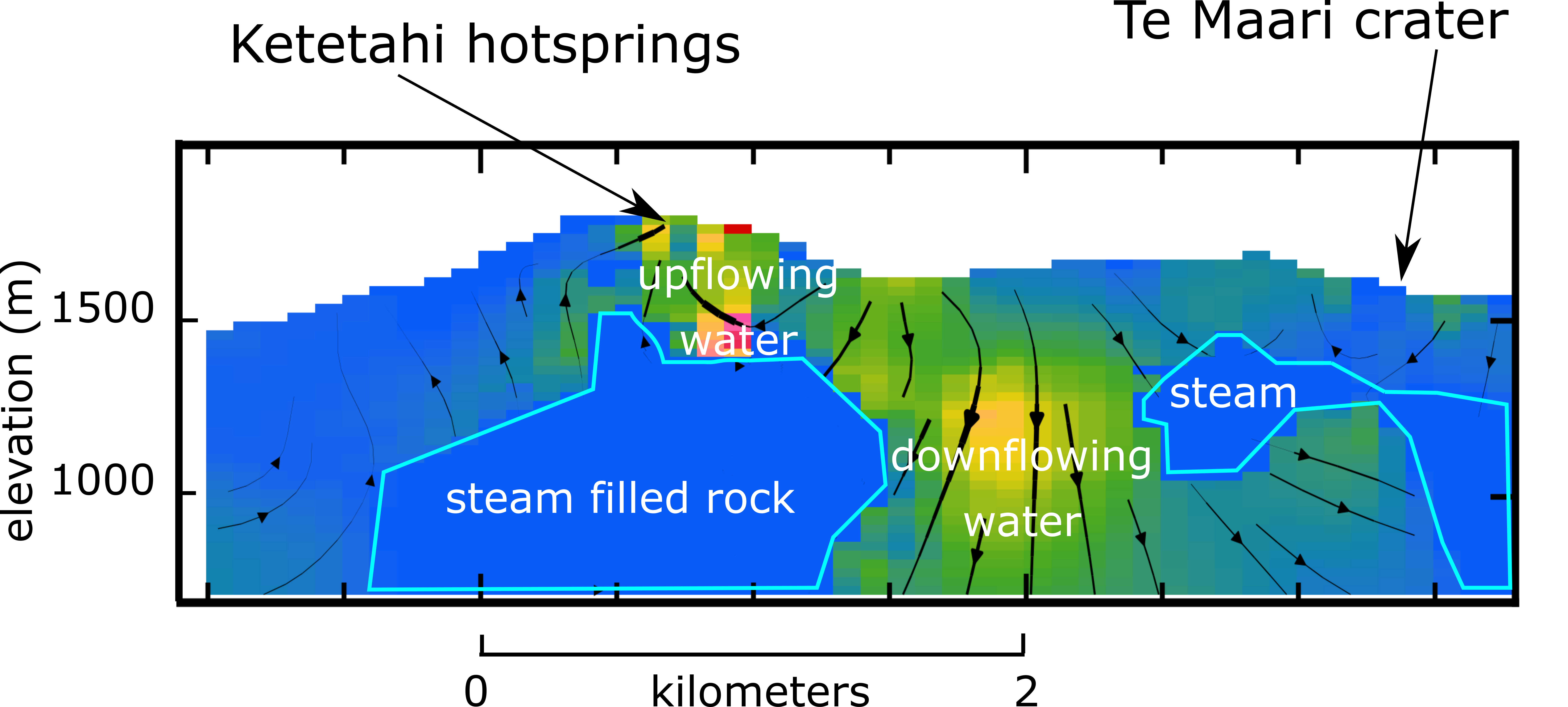
: Cross section of the area between Ketetahi hot springs and Te Maari Crater. The separation of Te Maari and Ketetahi is shown by a wide area of downflowing water. Water flows upwards under Ketetahi producing the hot springs.
The research project was based on the fact that water moving within a rock generates a small electrical charge, measurable at the ground surface as a voltage. By mapping voltage variations around the hydrothermal system at Tongariro and using a newly developed 3-D computer software the researchers could simulate the underground water movement. The model found varying degrees of water and steam within the hydrothermal system that are likely controlled by the rock’s ability to allow water movement. Importantly, the study found no lateral (sideways) connectivity between the various areas of hot springs and vents on the volcano.
The study shows that between Te Maari and Ketetahi there is a large area of downflowing groundwater, which provides an effective barrier separating the two features. This model helps to explain why we only saw changes in water and gas chemistry at Te Maari Crater immediately prior to the 2012 Te Maari eruptions, and didn’t see changes at other hot springs or vents. A large hydrothermal system exists at Tongariro, but we now know that features like Ketetahi, Te Maari and Red Crater are separate and can behave independently.