Moutohorā (Whale Island) - a protected geothermal sanctuary
Moutohorā (Whale Island) lies about 8 km off the Bay of Plenty coast, rising to 353 m above sea level. The small island is the remains of a complex volcano that has eroded over time, leaving two distinct peaks.
Today the island is a Wildlife Management Reserve for endangered birds and plants and has a protected geothermal system. Moutohorā hosts one of our GeoNet seismometers, and the island is one of the more unusual locations that our volcano chemistry team enjoys visiting to collect water and gas samples.
Fascinating surface geothermal features on the island include steaming ground and fumaroles, hot water seeps and hot springs. Geothermal features and gas emissions are also found on the seabed surrounding the island.
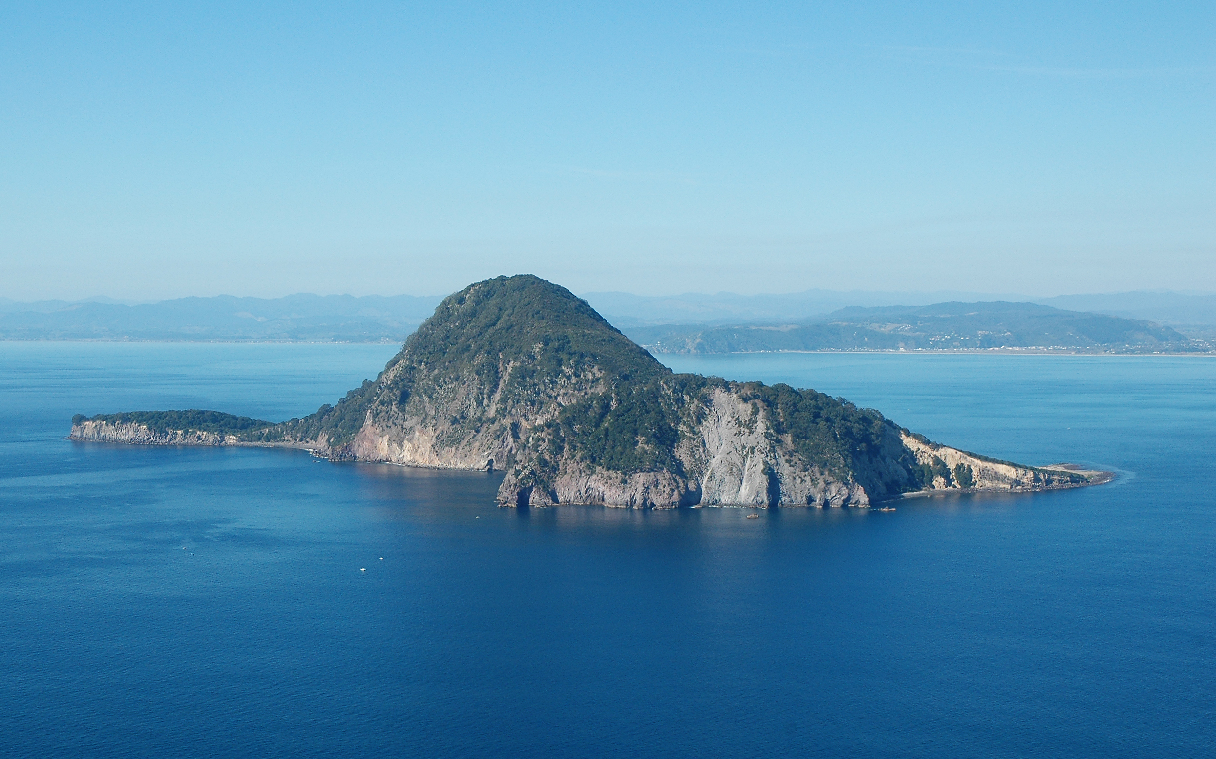
Moutohorā (Whale Island)
The volcano chemistry team occasionally visits Moutohorā.
A visit to the island requires a dedicated cleaning effort, with all equipment, bags, and shoes being inspected by the Department of Conservation biosecurity team to ensure they are free from contaminants like insects, seeds, or stowaway rodents.
Once on the island the team undertakes a soil gas survey and samples the fumaroles (gas vents) and hot springs. Soil gas emissions are measured with a purpose-built flux meter which measures carbon dioxide (CO2) and hydrogen sulphide (H2S). Discharge temperatures of the hot gases and spring waters are also measured. To sample the fumarolic gases, the gas is drawn into evacuated glass flasks and taken back to the laboratory for detailed analysis and interpretation.
Gases and associated heat are released from magma (molten rock) as it rises from great depths towards the surface in volcanoes. As the gases approach the surface, they interact with groundwater to form geothermal systems which may give rise to only hot springs at the surface. However, if ascending heat and gas flows are strong enough, the gases may reach to the surface where they discharge as high temperature fumaroles, or perhaps areas of diffuse gas emission on the flanks of the volcanoes. Measuring these surface emissions periodically allows scientists to detect changes in the level of activity of a volcanic system with time.
Watch a short video of the team in action on Moutohorā below:
What does the chemistry reveal about the island?
Back in the laboratory, chemical analysis of the hot spring fluids on Moutohorā island show they are largely dominated by seawater. However, gases from the fumaroles reveal a much deeper and hotter source which can be traced, in part, back to the parent magma which is still present deep beneath the volcano.
The predominant gas in volcanic fumaroles is water vapour. This water has its origins from both the deep magmatic heat source, but also the hydrothermal system through which the gas travels on its way to the surface. Carbon dioxide (CO2) is typically the next most prevalent gas emitted from volcanoes and is mainly derived from sub-crustal (mantle) sources.
Other gases of minor or trace concentrations are also present in volcanic emissions, many of which carry valuable information regarding the state of volcanic unrest posed by the host volcano. Analysis of the samples collected during this visit to Moutohorā reveal abundant methane, like most other geothermal systems in the Taupō Volcanic Zone, and other chemical parameters indicating that the volcano remains in a very low state of volcanic unrest at the present time.
Public access to Moutohorā is restricted to permit holders and approved tour parties. Please visit the DOC website for more information on visiting this island.
Media enquiries: media@gns.cri.nz or 021 574 541