New environmental and landslide web pages highlight recent advances in hazards monitoring
We have recently released new web page resources for landslide and volcano environmental monitoring and work on landslides at Fox Glacier Valley in Westland.
Over the last couple of years GeoNet has been building an environmental data collection system that we are using to improve our monitoring of landslide and volcano hazards. This week we have added two new resources to our website: a page that focuses on the application of this system to monitoring landslides at Fox Glacier Valley in Westland and a page describing the environmental data and how to access it.
Fox Glacier Monitoring
Fox Glacier in Westland has retreated more than 800 meters since 2009. The retreat of the glacier reduces support along the valley walls allowing the rock slopes that form the valley walls to relax, potentially resulting in an increase in landslides and rockfalls. We have placed crack-meters over cracks in the rock at four sites on the valley walls to monitor how the cracks open and close through time. Alongside this we are monitoring rainfall, humidity, and air temperature to understand how environmental changes affect crack movement.
Our fifth site in Fox Glacier Valley is located on the Alpine Gardens landslide, one of New Zealand's largest actively moving landslides. The rate of movement of the landslide is monitored via a GNSS sensor on the landslide. The environmental data collection system measures rainfall and soil moisture to understand how changes in environmental conditions affect the rate of movement of the landslide.
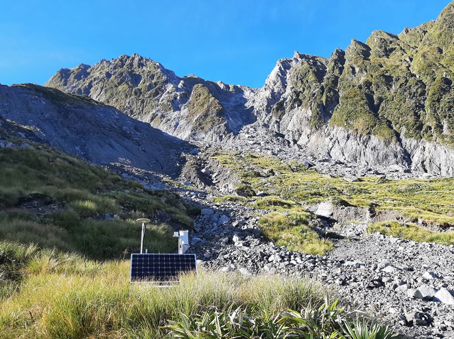
Alpine Gardens landslide with GeoNet station in foreground.
The rate of movement of the Alpine Gardens landslide fluctuates in response to rainfall events. On average, it moves 115 mm/day but on some days, it moves a lot faster, and on other days it doesn't move at all. After storms in March 2019 and December 2019, the landslide moved at approximately 500 mm/day for several days before slowing down.
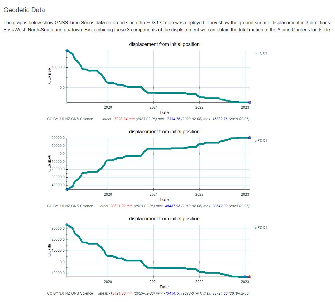
The graphs show GNSS Time Series data recorded since the FOX1 station was deployed. They show the ground surface displacement in 3 directions: East-West, North-South and up-down. By combining these 3 components of the displacement we can obtain the total motion of the Alpine Gardens landslide.
Chris Massey, who leads the Climate-Induced Landslides project which is jointly supporting the Fox Glacier Valley with GeoNet, said, “We’ve known rainfall, air temperature, humidity, and other factors can influence the rate of movement of a landslide, and the new data finally gives us the information to understand to what extent and in what situations these factors are important.”
Environmental Data
Our environmental data collection adds another dimension to the manual observations that have been the mainstay of landslide and volcano monitoring for many years. We use common, off-the-shelf data loggers and sensors to monitor cracks in slow moving landslides, soil moisture levels that may affect rates of landslide movement, hot spring temperatures, and the water level in volcanic lakes. Automated acquisition and collection of data from other features are in development.
We automatically acquire new observations every 10 minutes and send those to our data centre from where they are freely available to everyone. While specialised sensors aren’t available to measure everything we need for landslide and volcano monitoring, having a measurement every 10 minutes, 24 hours a day, 7 days a week means we are less likely to miss important changes and gives us a lot more confidence interpreting the data.
A landslide may be triggered by heavy rain or earthquakes, with homes near hills or steep slopes most at risk. If you live near a hill or steep slope, watch out for cracks or movement that could be a warning sign.
Follow Civil Defence’s advice on what warning signs to look out for, so you can act quickly if you see them.
Toka Tū Ake EQC has information on how to get your home, apartment, or rental prepared for a natural disaster.
Media contact: media@gns.cri.nz or 021 574 541