Wellington winter landslides
Multiple landslides have occurred around the country recently with winter rainfall setting in. Several notable landslides have occurred around Wellington City and Hutt Valley as the result of a period of continued rainfall, and our landslide team have been looking into them.
The rainfall hasn’t been particularly intense (rainfall intensity per storm event) in the Wellington region, but it has been persistent with 294 mm falling in July. We have had the wettest July on record (since records began in 1927 – MetService) and the rain has continued so-far into August.
The largest slip in the city occurred on The Terrace on Monday 8 August, affecting the stability of a house above, damaging a gas main and causing eight other houses to be evacuated.
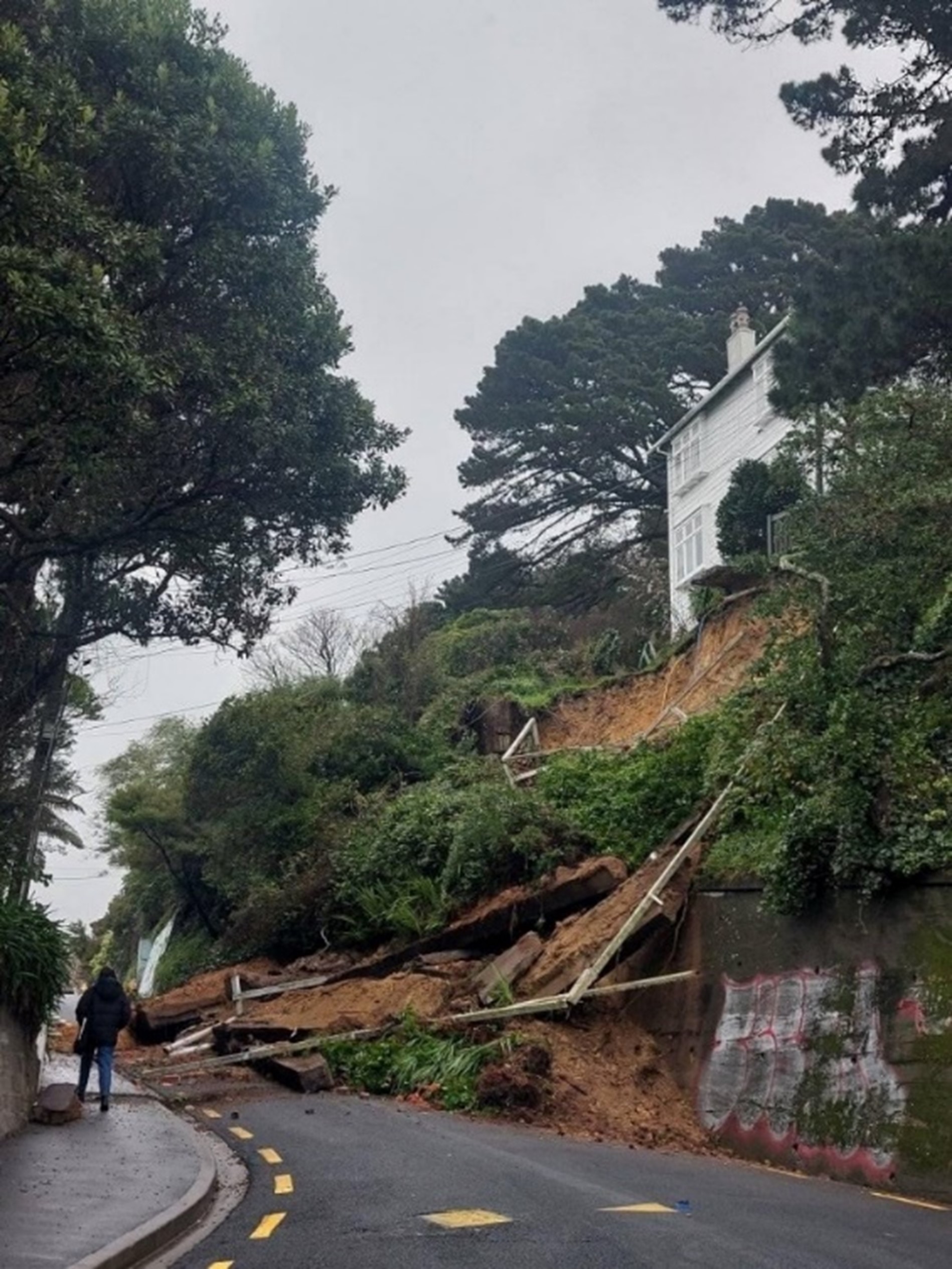
The Terrace. Photo/Wellington City Council.
Other landslides have affected properties in Stokes Valley and Karori, and several roads and paths around the city and Hutt Valley have been blocked by slips.
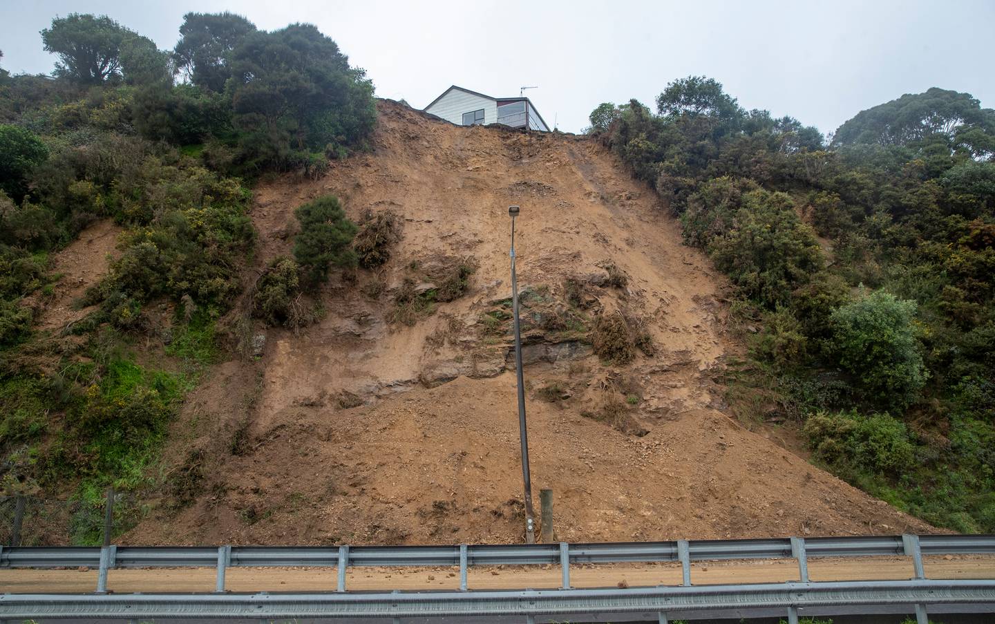
Stokes Valley. Photo/NZ Herald.
Lennel Road, Wellington. Photo/Wellington City Council.
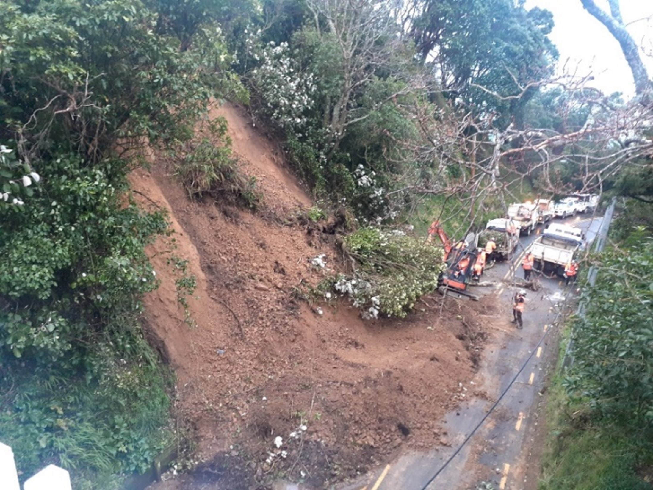
Another large slip (possibly up to 5,000 m3) occurred on SH58, near the Haywards substation at night on Friday 12 August. The landslide covered the two northbound lanes and closed SH58 for the night while road crews cleared the debris.
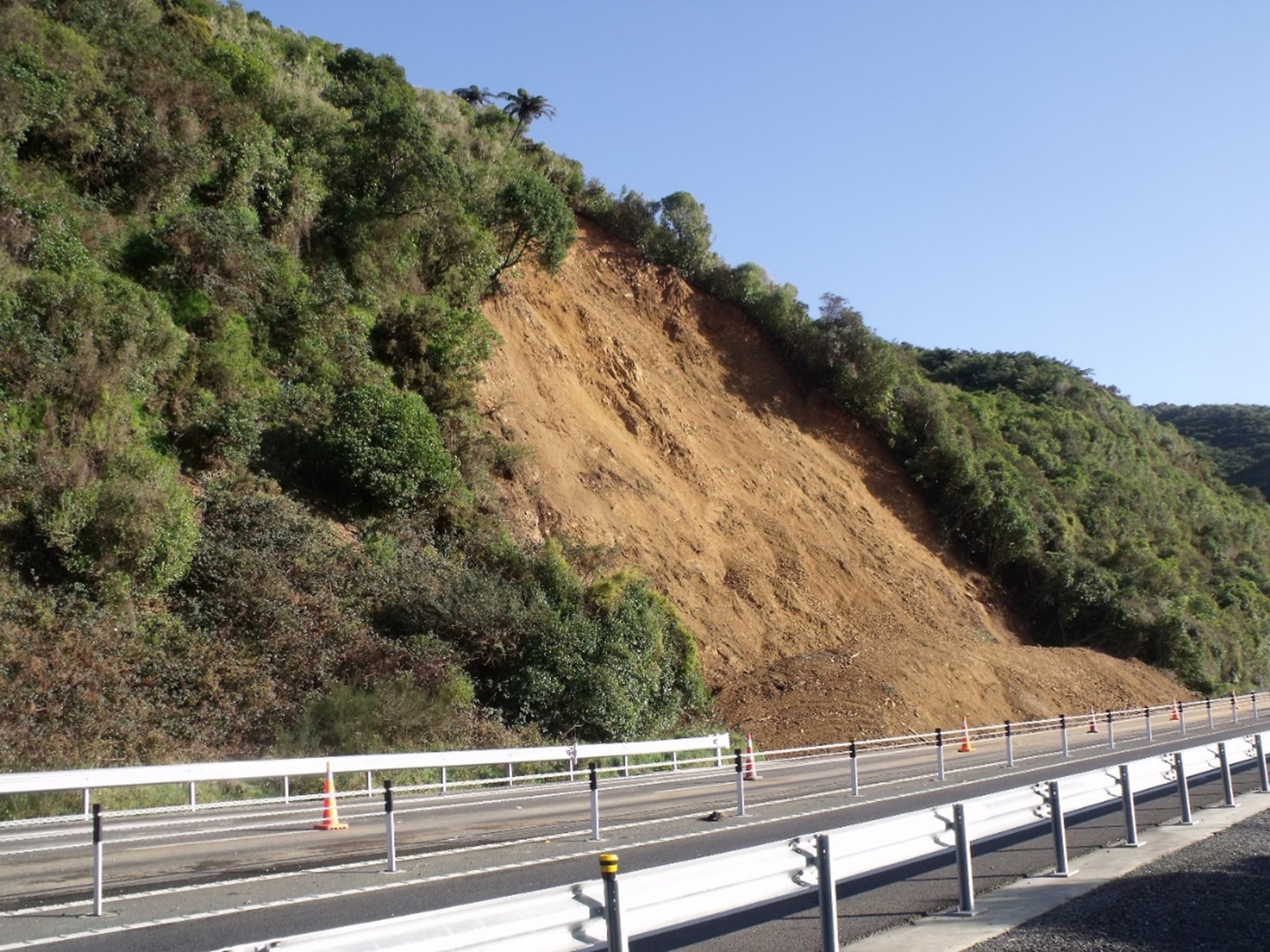
SH58, Haywards. Photo/GNS Science.
Wellington City Council reported 195 landslides in July, and 148 so far in August. The current landslides are primarily due to the long period of wet weather saturating the soil, but also due to the ground conditions in Wellington, where a lot of the ground has been modified by cutting and filling, some of which are 50+ years old. These cut slopes and fills were often constructed using outdated methods that have now been superseded by more robust earthwork methods. From our team’s work looking at historical landslides in Wellington, it appears that older cut slopes are more susceptible to landslides than younger ones.
Seen a landslide? 'Dob it in'
Please email us as much of the following as you can supply – we would be very grateful:
- Date and time of the slip/landslide
- Location – this can be a street address, distance from a landmark or road. Or pin on google earth/maps.
- Size – it would be useful to know if one person could clear the landslide or if heavy machinery would be needed.
- Type – was the landslide made up of rocks falling from a cliff, along a road or was it a flow of material rather than a fall? Was anything damaged?.
- Photos – these are very useful for us especially views showing the whole landscape.
You can send your landslide emails to: landslides@gns.cri.nz.
Are you Prepared?
A landslide may be triggered by heavy rain or earthquakes, with homes near hills or steep slopes most at risk. If you live near a hill or steep slope, watch out for cracks or movement that could be a warning sign.
National Emergency Management Agency's (NEMA) Get Ready website has information on what to do before, during and after a landslide.
And Toka Tū Ake EQC has information on how to get your home, apartment, or rental prepared for a natural disaster.
Attributable to: Brenda Rosser - GNS Science Engineering Geomorphologist
Media contact: media@gns.cri.nz or 021 574 541