
Hydrothermal eruptions: when geothermal systems get annoyed
Updated: Tue Jul 24 2018 12:00 AM
What are hydrothermal eruptions all about, is that normal for a geothermal system?
On Saturday afternoon a bus load of tourists was treated to one of the Taupo Volcanic Zone’s smaller and less common geological events, a hydrothermal eruption. Hydrothermal eruptions occur when superheated water trapped at shallow depths is converted to steam that disrupts the rocks holding it in place. The expanding steam has enough energy to toss out the rock, along with boiling water, steam and mud. These hydrothermal eruptions are usually short lived – Saturday’s one was less than a minute - and only affected the local area.
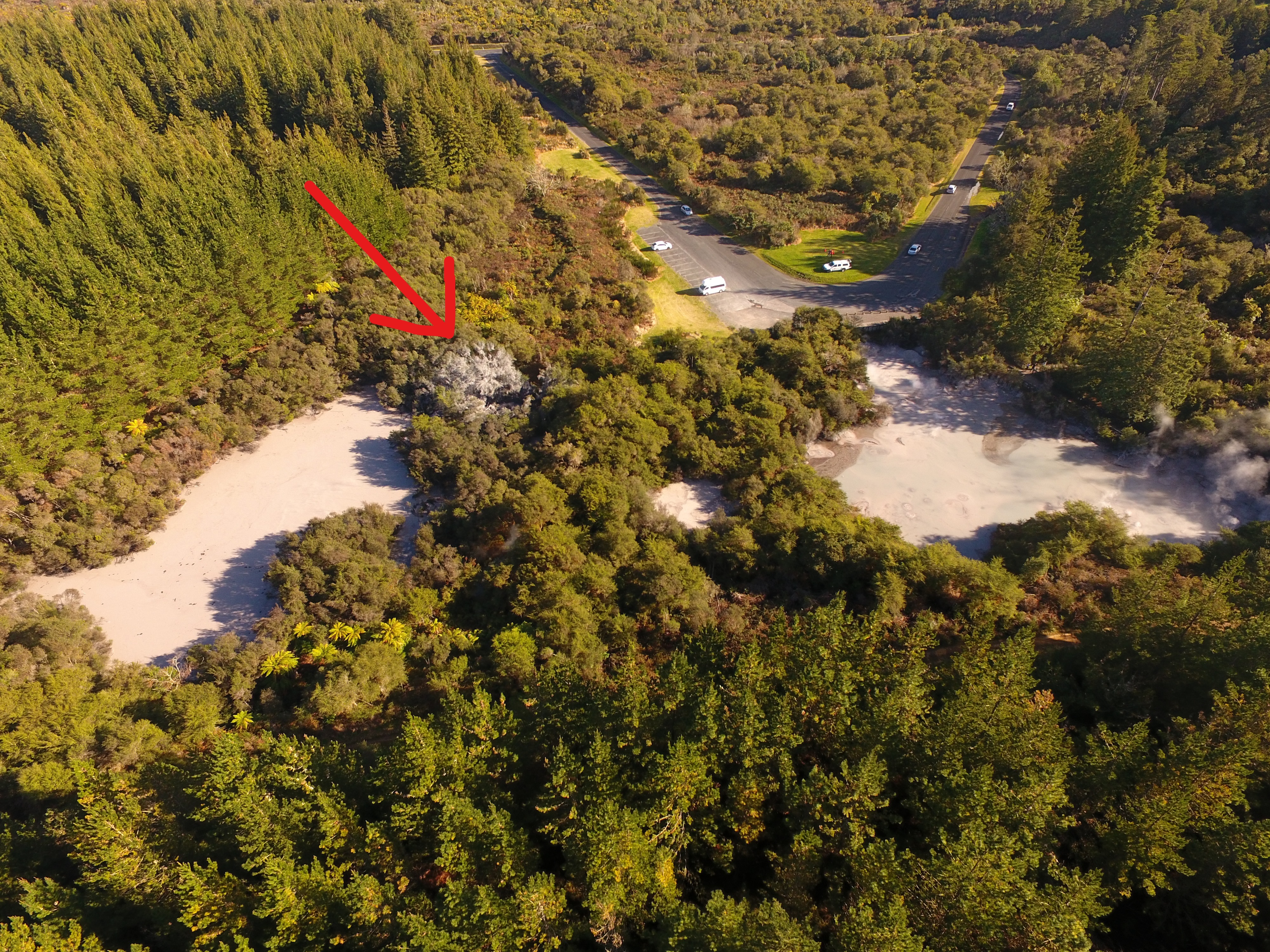
View of the area where the eruption happened (arrowed) at Waiotapu.
In the Rotorua-Taupo area there are many large and hot geothermal systems related to the caldera volcanism and faulting. Past caldera eruptions involved lots of molten rock (magma) – spewing out anywhere from 5-8 cubic kilometres to over 200 cubic kilometres. These large eruptions leave behind equally large volumes of hot rock, which are the heat sources for the geothermal systems. The other component is water and we thank the climate for its contribution here. So, once we have lots of hot rock and water we can get geothermal systems.
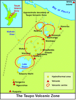
Taupo-Volcanic-Zone-map
Geothermal systems are dynamic with super-heated water and steam being the two main components, along with gases and cooler water. At the ground surface we can see boiling springs and pools, geysers, cooler pools of mixed geothermal water and groundwater, and steam-heated features like mud pools and mud pots. Geothermal systems also support their own ecosystems with specially adapted plants and animals. Normally these systems are fairly stable, but when they become unstable, because of a small pressure increase or drop, then steam-driven hydrothermal eruptions occur.
After the eruption last Saturday, the GeoNet team flew over the area on Monday with a UAV to verify the location, size and impact. This was done in conjunction with DOC and local iwi. The vent formed by this eruption is about 1.6-1.8m across, and appears as a deep vertical shaft in the images. A small ‘mud cone’ has built up around the vent and is about 6-7m across. The total volume of mud erupted is around 5 cubic metres and apart from flooding the nearby shallow pool with fine silt and mud the impact of the eruption was minimal.