
Shaking Layers now available on our GeoNet app
Updated: Thu Nov 16 2023 11:20 AM
An exciting new feature is now available on our GeoNet app. Now when an earthquake occurs with a magnitude of 3.5 or greater, in addition to the Felt Reports, you can also get a measure of ground shaking intensity for different parts of the country.
The maps incorporate data from ground motion sensors and are automatically produced within 10 to 20 minutes of an earthquake.
To view the Shaking Layers map, simply go to any earthquake event in the app with a magnitude of 3.5 or greater and tap the ‘Shaking Layers Map’ tab at the top of the screen. From here, you can zoom in anywhere to get a measure of ground shaking intensity.
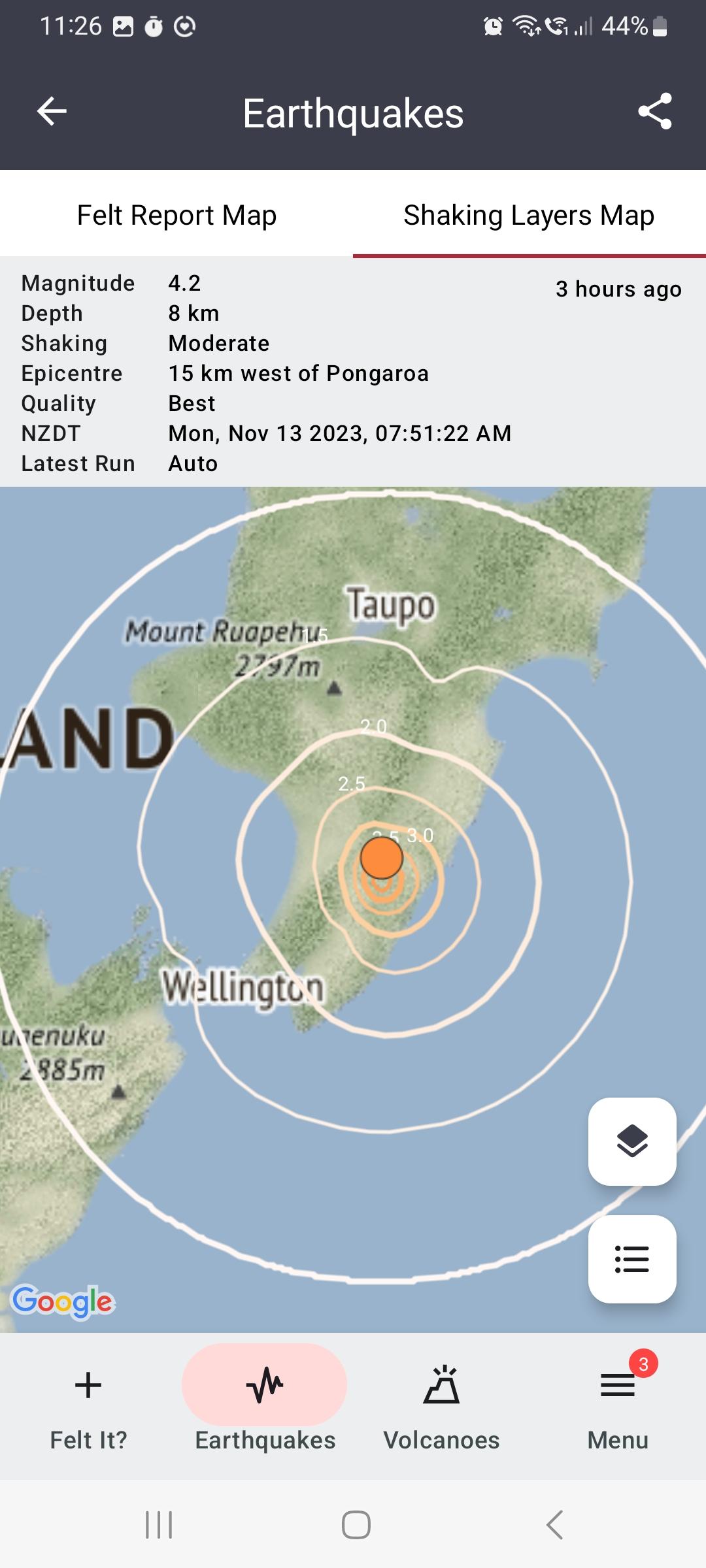
GeoNet app Shaking Layers map of Pongaroa 4.2M earthquake
The maps use coloured contour lines to indicate the bands of shaking intensity. The deeper the red the lines are, the more intense the shaking was in that band.
The measure of shaking intensity is underpinned by the modified Mercalli intensity scale, which indicates the earthquake’s effect on people and their environment. For example, people in an area with a shaking intensity measure of 4 can expect light shaking, where walls may creak, and windows may rattle.
If the maps aren’t showing up, you may need to update the GeoNet app through Google Play or the Apple App Store.
The automated maps may be updated by GNS seismologists as more information becomes available, particularly for large events where an earthquake can rupture the subsurface for tens to hundreds of kilometres, meaning strong shaking may occur far from the epicentre.
Shaking Layers has been developed by GeoNet and the Rapid Characterisation of Earthquakes and Tsunami Endeavour programme.
For more information on how to use Shaking Layers visit the Shaking Layers web page
Watch a video introducing Shaking Layers:
Earthquakes can occur anywhere in New Zealand at any time. In the event of a large earthquake: Drop, Cover and Hold.
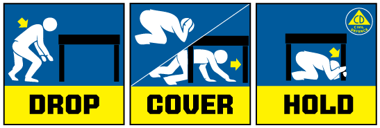
Drop, Cover and Hold
Remember Long or Strong, Get Gone : If you are near the coast, or a lake, and feel a strong earthquake that makes it hard to stand up OR a weak rolling earthquake that lasts a minute or more move immediately to the nearest high ground or as far inland as you can, out of tsunami evacuation zones.
Know what to do?
The National Emergency Management Agency (NEMA) has a great website with information on what to do before, during and after an earthquake.
Prepare your home. Protect your whānau.
There’s a lot we can do to make our homes safer and stronger for natural disasters. Toka Tū Ake EQC’s website has key steps to get you started.
Media Contact: 021 574 541 or media@gns.cri.nz