
A Slippery Week for New Zealand: A Summary of Landslides Triggered by the July 21-23 Storm.
Much of New Zealand felt the winter chill last week, with heavy snowfalls throughout the country and some extremely heavy rain!
Hot on the tail of our coverage of the Ngauranga Gorge debris avalanche, last week saw fierce storm conditions sweep across the country.
Many regions bore the brunt of gale force winds and loads of snow fell in central regions across both islands, which was great news for snowsport fiends, but not so great for the thousands of people in the Central North Island who lost power.
The storm also brought torrential rain, and our GeoNet landslide response team know all too well that with rain as heavy as we saw last week, their work will be cut out for them, because when hillsides become saturated, they often slip.
Our landslide scientists have been working overtime to understand what occurred in the number of landslides triggered across New Zealand by last week's storm, allowing us to provide you with a region-by-region summary of what occurred.
FROM UP NORTH
Coromandel:
In the Coromandel, SH 25a was closed by a large landslide at Hikuai, and a washout reduced SH25 to one lane at Kirita Bay.
Gisborne - East Cape:
In the Gisborne region, East Cape Road was closed by a large landslide, and SH2 from Opotiki to Gisborne, through the Waioeka Gorge has just re-opened from a closure last week.
Bay of Plenty:
In Rotorua the following roads were affected by landslides:
Poutakataka Road - rocks & boulders across the road;
Endean Road - slip covering one lane - about 800m from the Paradise Valley Road turnoff;
Hamurana Road - slip covering one lane near Te Wearenga Road;
Brett Road - slip, down to one lane but signs are up; and
Te Kopia Road - slip, down to one lane.
In Whakatane, SH2 was blocked by a slip on the Matatā straights, near Murphy’s Motor Camp.
Manawatu:
Following recent coverage of ongoing issues, yet another landslide fell on the already closed SH2 through the Manawatu Gorge.
The contractors estimate that about 10,000 cubic metres of material, including large boulders, have fallen onto the road about 500 metres from the Ashhurst end of the gorge.
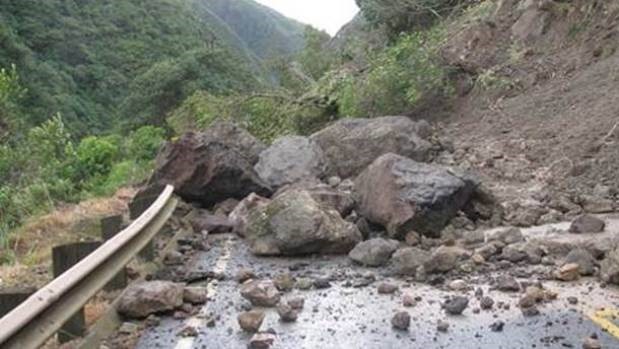
New Manawatu Gorge slip (Photo: Stuff)
This is the third large slip in the Gorge since April.
SH4 between Whanganui to Raetihi was also closed due to a large landslide north of Fields Track at the Hapokopoko Bluffs. The landslide deposited about 500 cubic metres of material on the road.
Wellington:
In Wellington, a car was buried by a landslide in the plush, leafy suburb of Roseneath.
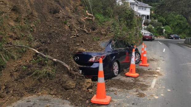
Roseneath slip (Photo: Stuff)
TO DOWN SOUTH
Tasman:
A landslide closed SH6 between Blenheim and Nelson, on the Whangamoa Saddle, between Teal Valley and Slaters Creek Rd.
West Coast:
SH 7 was closed at Maruia due to a slip.
Canterbury:
Route 70, otherwise known as the Inland Kaikoura Rd (from Waiau to Kaikoura), was closed due to multiple slips and rockfalls.
SH75 from Tai Tapu to Akaroa was reduced to one lane due to several slips and dangerous surface flooding.
Beach Road in Akaroa, from Bruce Terrace to the Lighthouse, was closed due to a significant slip.
Many of Christchurch's Port Hills cycling tracks were closed, including the popular Rapaki track due to slips, loose debris and generally dangerous conditions.
In Timaru (quite the metropolitan hub), a landslide caused by the storm, threatened to undermine the foundations of a neighbouring house.
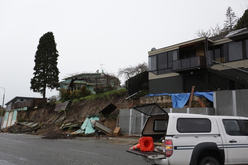
A bank collapse in residential Timaru (Photo: Rebekah Parsons - RNZ)
Otago:
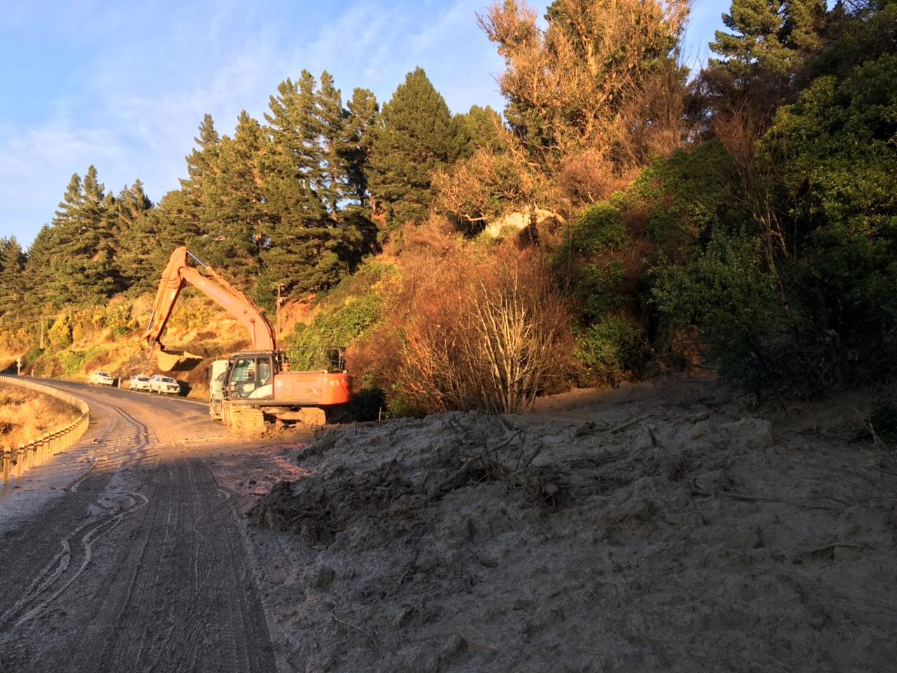
The hilly 'burbs of Dunedin were hard hit by the storm. Dunedin City Council have reported that approximately 25 slips occurred across the city and on the Otago Peninsula.
A landslide in the beachside suburb of St Clair closed Ravenswood Rd and caused 12 houses to be evacuated. Police also reported that several cars had been damaged due to debris falling from the slip... that doesn't explain the baby blue Bedford wagon located at the centre of the slip, only in Scarfie-Ville folks!
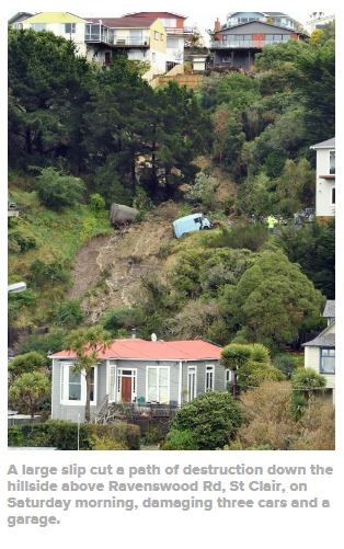
Ravenswood Rd slip (Photo: Stuff)
Several walking tracks were also closed by landslides. This included the closure of Frasers Gully walking track due to two slips, and Second Beach walking track at St Clair.
As shown in the following image, a large landslide cut off residents north of Harwood on the Otago Peninsula. The cleanup is still underway.
Otago Peninsula north of Harwood (photo: Dunedin CDEM)
In summary, Dunedin City Council reported landslides affecting the following roads:
Te Kopia Road - slip, down to one lane.- Reservoir Rd - from Stevenson Ave to the end;
Hatchery Road - from Harington Point Road to the end, Closed;
Cemetery Road - one-way section from Macandrew Road to Harbour Terrace;
District Road - from Reeves St to SH88;
Blanket Bay Road - bottom section only closed from SH88 past St Leonards Drive where it meets SH88 again;
Portobello Road - Doon Street through to Tidewater Drive;
Gladfield and Bush Road;
199 Osborne Road;
Leith Valley Road - closed top end of sealed section slip with power lines down;
Coast Road at Karitane - from the motorway through to Karitane;
Brick Hill Road - from upper Junction Road to Stevensons Ave.
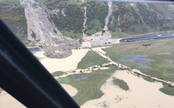
SH88 was also closed due to two slips on the Port Chalmers to Dunedin Highway, one at Roseneath and a larger one at Maia (see the image below). Slips also closed other minor roads in the area.
SH88 at Maia (Photo NZTA)
Further afield, storm caused slips affected other parts of Otago.
SH8 from Raes Junction to Milton was closed due to six slips between Lawrence and the Manuka Gorge.
SH1 was closed by landslides between Mosgiel and Milton, and the main trunk rail line at Hampden in North Otago, as shown below.
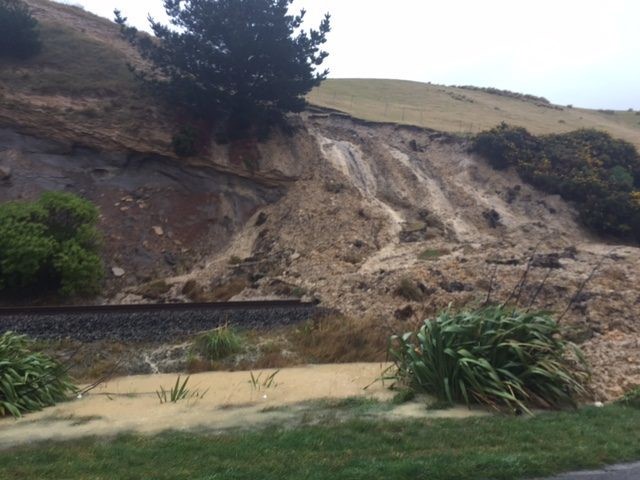
Debris flow at Hampden, North Otago (Photo: NZ Police)
In Oamaru, a bank collapsed onto the back of a house. Two other incidents of landfill or slips collapsing onto the back of homes were also reported in Oamaru, as well as a washout under the Humber Street bridge.
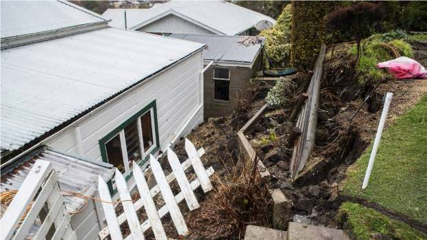
Bank collapse at Oamaru (Photo: George Heard/Stuff)
As with all geological hazards, we are keen for you to keep us informed on local happenings.
For more information please contact our landslide team at: landslides@gns.cri.nz