
1987 Edgecumbe Earthquake: 30 years ago today
At 1:42pm on 2 March 1987 a large earthquake occurred in the northern Bay of Plenty, near the town of Edgecumbe.
The M6.5 event was soon named after the town. It was, with the exception of the Inangahua earthquake in 1968, the most severe and damaging earthquake to hit New Zealand in 45 years.
We sat down with our Brad Scott, who was there at the time. He was one of the first science responders on the scene. Q. How widely was the earthquake felt and what did you feel?
A. The quake was felt over most of the North Island, including Rotorua, Hamilton, Taupo, Napier and Gisborne. An interesting feature of the Edgecumbe event was the foreshock sequence. At the time of the earthquake Steve Sherburn (one of our other volcanologists) and I were installing a portable seismograph in a quarry in the Papamoa Hills to record the earthquakes that were happening near Te Puke. We were bouncing down the 4x4 trail at the time and we didn’t realise it had happened. The VHF radio from the DSIR office soon woke up to inform us, then asked us to head towards Edgecumbe.
Q. What do you think were some interesting facts about Edgecumbe? A. It was preceded by a number of foreshocks in the Matata and Thornton areas. Of the 126 located foreshocks, 93 occurred of these occurred off the Te Puke coast, and the DSIR was focusing its attention in that area. One of the largest foreshocks was of M4.9, and occurred only 7 minutes before the main shock.
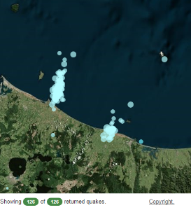
The location of the foreshocks
Q. How much damage was caused by the earthquake and how were people affected? A. Luckily, a number of buildings were evacuated in response to this foreshock and were consequently empty when they were damaged in the main earthquake. There were in fact no fatalities, but 25 injuries requiring medical attention were recorded. One vision I’ll always remember was the large number of holes in roofs where chimneys had fallen through.
Q. What was it like when you went out in the field? What kind of earth movement did you see? A. In the Rangitaiki Plains the quake ruptured the ground to create a spectacular 15 km long surface fault rupture. The fault displaced the ground vertically and up to 3m of height change was measured in places. The Rangitaiki Plains area is part of the Taupo Volcanic Zone (TVZ); a rift ranging from Ruapehu in the south to White Island of the Bay of Plenty. The TVZ rift opened 1.2 m during the Edgecumbe earthquake. That is, the distance between Matata and Whakatane increased by 1.2 m. Today the GeoNet GPS’s record about 9 mm of extension each year across the TVZ in this area. Steve and I spent about 2 hours trying to navigate ourselves into the area, however every road we tried was block by landslides. Eventually we by-passed some down on the coast by driving along the railway line. At Te Teko we could see the fault rupture across the other side of the river but the bridge was moving 6-10 inches from its abutment and we didn’t want to take it on. The bridge is famous as it was one of the first to use the DSIR lead-rubber bearings and was shown to be undamaged.
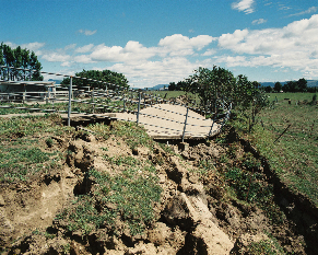
Fault crossing farm yard
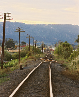
Damaged railway
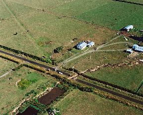
Fault crossing McCracken road
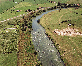
Fault crossing the River
Q. Were there aftershocks after the initial earthquake? A. Yes. Like all large earthquakes the Edgecumbe event was followed by an aftershock sequence. In the 3 years after the main shock over 470 events were located.
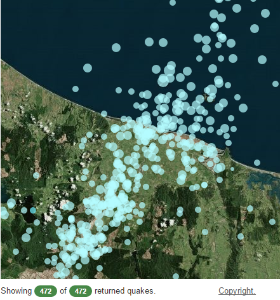
Locations of the aftershocks
Want to know more about Edgecumbe? Find out more here: Links: http://www.geonet.org.nz/quakes/region/newzealand/04228
http://info.geonet.org.nz/display/quake/M+6.5,+Edgecumbe,+2+March+1987