Hunga Tonga-Hunga Ha’apai volcano tsunami, 15 January 2022
A large, impulsive eruption at Hunga Tonga-Hunga Ha’apai volcano in Tonga causing tsunami on coastlines around the Pacific
At around 5:20pm NZDT on Saturday 15 January, a large, impulsive eruption at Hunga Tonga-Hunga Ha’apai volcano in Tonga occurred causing tsunami on coastlines around the Pacific – it was observed as widely as the west coast of the USA, Peru, Japan, and New Zealand (Figure 1).
- Date: 15 January 2022
- Source: Regional
- Cause: Hunga Tonga - Hunga Ha’apai Eruption
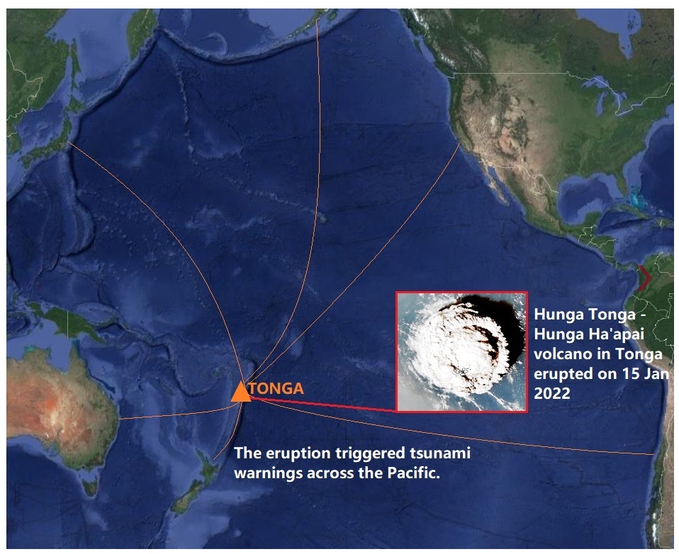
Figure 1: tsunami activity was observed as widely as the west coast of the United States, Peru, Japan and New Zealand.
The volcano is a part of the Tonga-Kermadec arc and is located at 20.57° S and 175.38° W, about ~67 km north-northwest of Nuku’alofa , the capital city of the Kingdom of Tonga.
A volcanic-source tsunami event is rare but not unprecedented. It’s one of those things scientists always talk about as a possibility, but they are far from common.
You can see the tsunami arrive at our coast on our coastal tsunami gauges in Figure 2. The tsunami activity can be identified from regular waves by the longer wave period of several minutes to over an hour. A good example of this is the data from Gisborne, where you can observe longer ups and downs of the tsunami arriving at that sensor. Other northern New Zealand sensors, such as North Cape and Great Barrier Island were significantly impacted by Cyclone Cody, which was occurring during the time the tsunami was expected to arrive, making interpretation of the data nearly impossible in the moment.
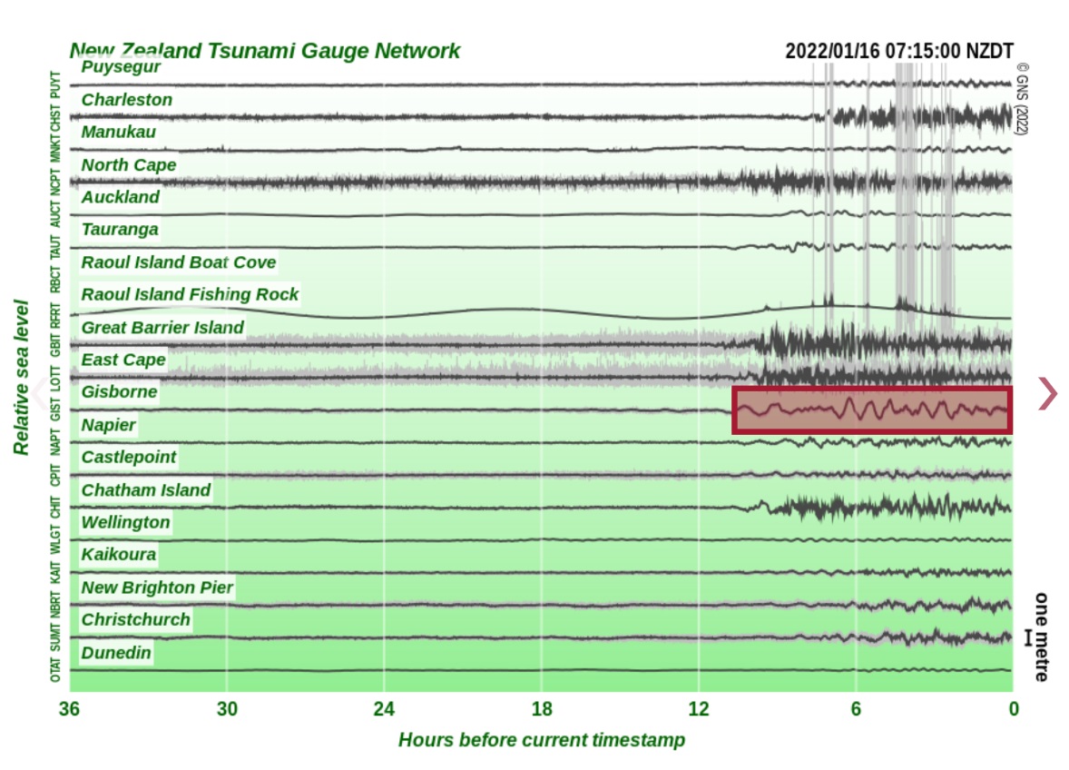
Figure 2: a train of longer period, larger amplitude waves marks tsunami arrivals at the Gisborne coastal tsunami gauge.
Assessing this tsunami was different from assessing earthquake-source tsunamis that occur more frequently. While our experts usually use tools like modelling and forecasting for earthquake-induced tsunami, for this volcano-source event they relied on real-time observations from our tsunami networks: the DART network and coastal tsunami gauges. They also looked at data from international DART stations and tsunami gauges around the Pacific to make expert assessments about the threat posed to New Zealand. The DART network was invaluable in our ability to identify the threat soon after the eruption, and in making assessments about when and where the tsunami might arrive as well as its amplitude, however, the concurrent arrival of Cyclone Cody in the north of New Zealand made it difficult to interpret data from our coastal tsunami gauges the northernmost parts of the country.
The arrival time, and peak amplitude of the first wave recorded at the New Zealand DART stations are shown in Table 1. At DART NZG, the closest New Zealand DART to the volcano, the maximum amplitude was ~20 cm, and the largest crest-to-trough height was ~40 cm. For further information about the event: