Whakaari/White Island: Minor volcanic ash and strong gas signal observed on Sunday, Volcanic Alert Level remains at Level 2.
Web camera images from Whakaari/White Island showed minor ash emission occurred in the crater on Sunday 18 September 2022. Ash was not observed beyond the island, but the overall steam plume could be seen from the Bay of Plenty coast. A strong SO2 gas signal associated with that plume was also detected by satellite on Sunday. No significant ash was observed today and the Volcanic Alert Level remains at 2.
Our North Rim web camera continues to produce intermittent images when the weather is fine. Images from throughout Sunday showed minor ash emission from an active vent behind the lake. The ash was light brown in colour and rose about 600m above the volcano. The TropOMI satellite which tracks SO2 also recorded a signal on Sunday. Web camera images this morning did not show any further ash emission.
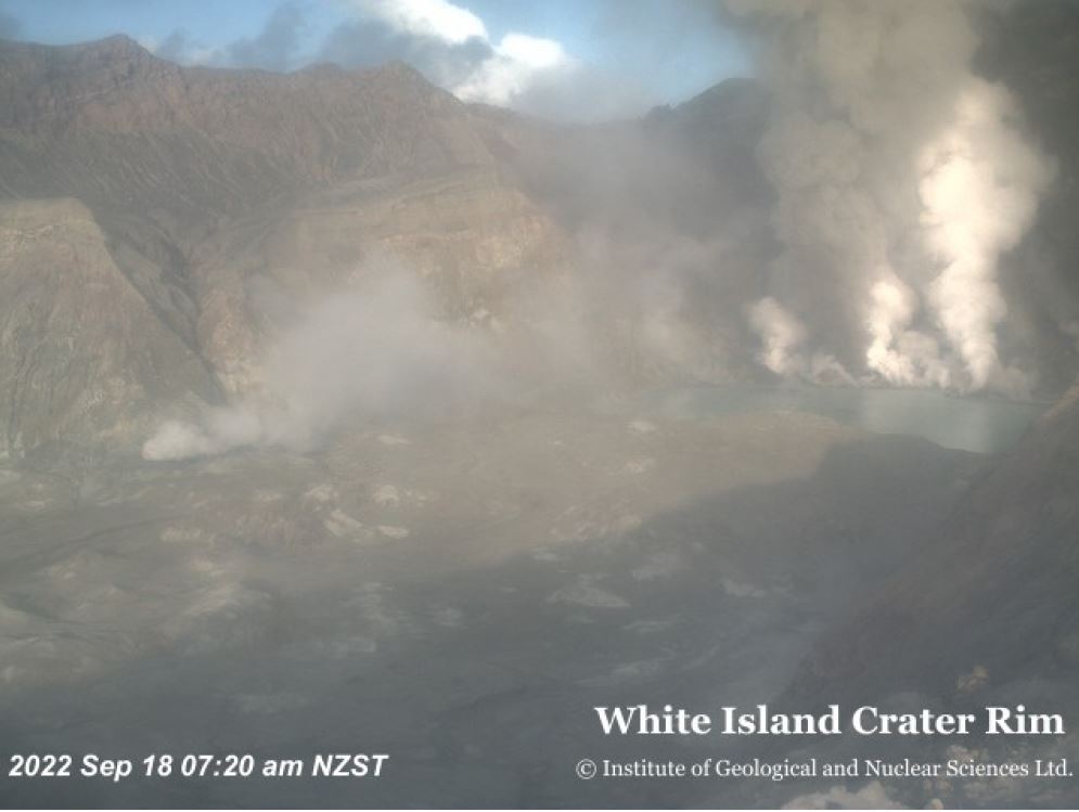
View from North Rim camera showing ash emission from an active vent (brown plume).
One of our seismic recording sites on Whakaari/White Island started working again this morning (19 September) and is showing a typical low level of activity – consistent with no significant ash emission observed on the web cams since this morning. However, the lack of real-time seismic and acoustic data on Sunday prevents us from being definitive about a small eruption having occurred at that time. Similarly, limited data over the last few weeks causes uncertainty around what may be driving this activity. With the data at hand, we believe the most likely explanation for the ash emission and sulphur dioxide (SO2) plume visible on Sunday 18 September was a small batch of magma moving into the shallow part of the volcano.
We are uncertain why our seismic station started to work again, and do not know if it will keep working in the coming days.
The VAL remains at Level 2 (moderate to heightened unrest), acknowledging the current level of activity, but also continuing to acknowledge the greater level of uncertainty in our interpretation due to the current lack of consistent, useful real-time data. The Aviation Colour Code is raised to Orange, which reflects the potential for minor ash emissions.
As the weather allows, we will be increasing the frequency of our gas and observation flights to the island until we can service our on-island equipment and power supplies. We still have intermittent access to webcams images from the island, providing some level of visual monitoring between our flights.
The Volcanic Alert Level reflects the current level of volcanic unrest or activity and is not a forecast of future activity. While Volcanic Alert Level 2 is mostly associated with volcanic unrest hazards (including discharge of steam and hot volcanic gases, earthquakes, landslides, and hydrothermal activity), potential for eruption hazards also exists and eruptions can still occur with little or no warning.
Further information about the Volcanic Alert Levels and what they mean can be found here.
GNS Science’s National Geohazards Monitoring Centre and Volcano Monitoring Group, through the GeoNet programme, continue to monitor Whakaari/White Island for further changes in unrest.
Steven Sherburn
Duty Volcanologist
Media Contact: 021 574541 or media@gns.cri.nz