Low level steam and gas emissions continue at Whakaari/White Island. The Volcanic Alert Level remains at Level 2.
Based on gas and observation flights over the last few months, we conclude activity at Whakaari/White Island remains limited to minor steam and gas emissions. No eruptive activity was detected over the past few months, and changes in the active crater area have been minimal. The Volcanic Alert Level remains at 2.
Recent observation and gas flights show steam and gas plumes continue to originate from the normal cluster of active vent locations on the west shore of the lake. Minor erosion continues to make small changes to the area. Measured gas discharge rates have remained within normal ranges over the last few months. Views from the Whakatāne webcam support these observations, although local atmospheric conditions can sometimes allow tall steam plumes to develop above the island (image below). The regular aerial views of the islands confirm steam and gas vents in the crater have shown no evidence of ash emission or eruptive activity.
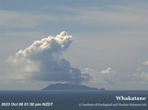
Elevated steam plume over Whakaari seen from Whakatāne on Sunday 8th of October, probably triggered by local atmospheric conditions.
Measurements from regular observation flights have recorded a decline in the temperatures from the larger vents. In March, temperatures were higher than 240 °C, in June-August 120 to 123 °C, and now in October they are 95 °C.
During the 4th of October observation flight a rock fall was observed happening from Troup Head on the eastern end of the island. The fall propagated to the ridge crest and rocks fell to both the southern and northern sides of the ridge (see image below). Although unusual, there is evidence of past rock falls in this area.
Following the failure of our last two on-island monitoring sites, we now have no on-island monitoring capability.
Our webcam from Whakatāne continues to provide near-real time visual monitoring on the plume emitted from Whakaari, and we make regular observation and gas measurement flights. We also monitor the volcano from space. Satellite based ground deformation data retrieved approximately every 10 days allow us to observe long term ground deformation trends. Daily satellite-based Sulphur Dioxide (SO2) emission measurements using TROPOMI, although not as sensitive as our gas measurement flights, allows us to assess the amount of gas emissions. Neither of these satellite techniques have detected significant changes in the overall activity at the volcano over the past few months.
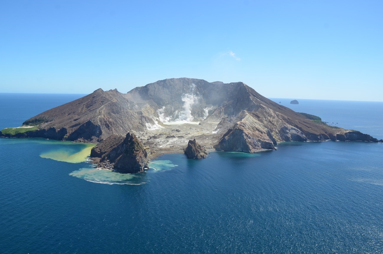
Aerial view of Whakaari/White Island, 4 October 2023 showing active steam and gas plumes from the main vent area (centre) and rock fall from Troup Head (centre left). Photograph credit: Brad Scott, GNS Science.
The Volcanic Alert Level remains at Level 2 (moderate to heightened unrest) and the Aviation Colour Code remains at Yellow, acknowledging the current level of activity, but also continuing to consider the greater level of uncertainty in our interpretation due to the current lack of consistent, useful real-time data.
The Volcanic Alert Level reflects the current level of volcanic unrest or activity and is not a forecast of future activity. While Volcanic Alert Level 2 is mostly associated with volcanic unrest hazards (including discharge of steam and hot volcanic gases, earthquakes, landslides, and hydrothermal activity), potential for eruption hazards also exists and eruptions can still occur with little or no warning.
Further information about the Volcanic Alert Levels and what they mean can be found here.
GNS Science’s National Geohazards Monitoring Centre and Volcano Monitoring Group, through the GeoNet programme, continue to monitor Whakaari/White Island for further changes in unrest.
Cameron Asher
Duty Volcanologist
Media Contact: 021 574541 or media@gns.cri.nz