M 6.7 Te Anau Sat, Jun 4 1988
The earthquake that shook Te Anau in June 1988 triggered numerous landslides, and even cut the power to some southern towns.
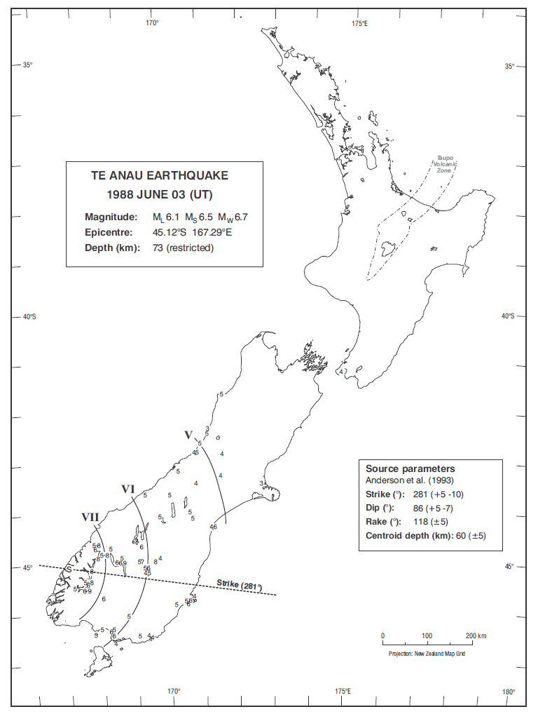
Isoseismal map of the Te Anau earthquake. Courtesy Atlas of isoseismal maps of New Zealand earthquakes (2nd edition): Downes, G.L.; Dowrick, D.J.
- Magnitudes: ML 6.1, MW 6.7, MS 6.5
The earthquake that shook the South Island of New Zealand on 3 June 1988 was felt most strongly in the Milford Sound-Te Anau-Manapouri area, and caused numerous minor landslides and rock falls in the ranges of Fiordland. It was felt across an area that extended from the southern shore of the South Island to Westport, and there was also a report of it being felt as far away as Wellington. Although damaging intensities were only experienced in sparsely populated areas, the earthquake disrupted the electricity supplies to Christchurch and Invercargill when a switch at Manapouri Power Station was tripped1.
1Seismological Observatory [New Zealand] Bulletin E 172, 1988. New Zealand Seismological Report 1988