Raoul Island Maintenance trip
We recently completed critical maintenance on vital monitoring stations on a visit to Raoul Island.
Raoul Island, approximately 1100 km northeast of Auckland, is an important geohazard monitoring station for New Zealand because it is well positioned to detect and measure Kermadec earthquakes.
The monitoring stations also provide the GNS Science National Hazard Monitoring Service with essential information about the size and location of tsunami waves that may put New Zealand and other South Pacific nations at risk.
Our technicians joined the Royal New Zealand Navy’s HMNZS Canterbury crew, along with teams from Ngati Kuri, the Department of Conservation and MetService on the 12-day operation for resupply, conservation, and maintenance mission. A Navy Seasprite helicopter was used to transport personnel and equipment between ship and shore.
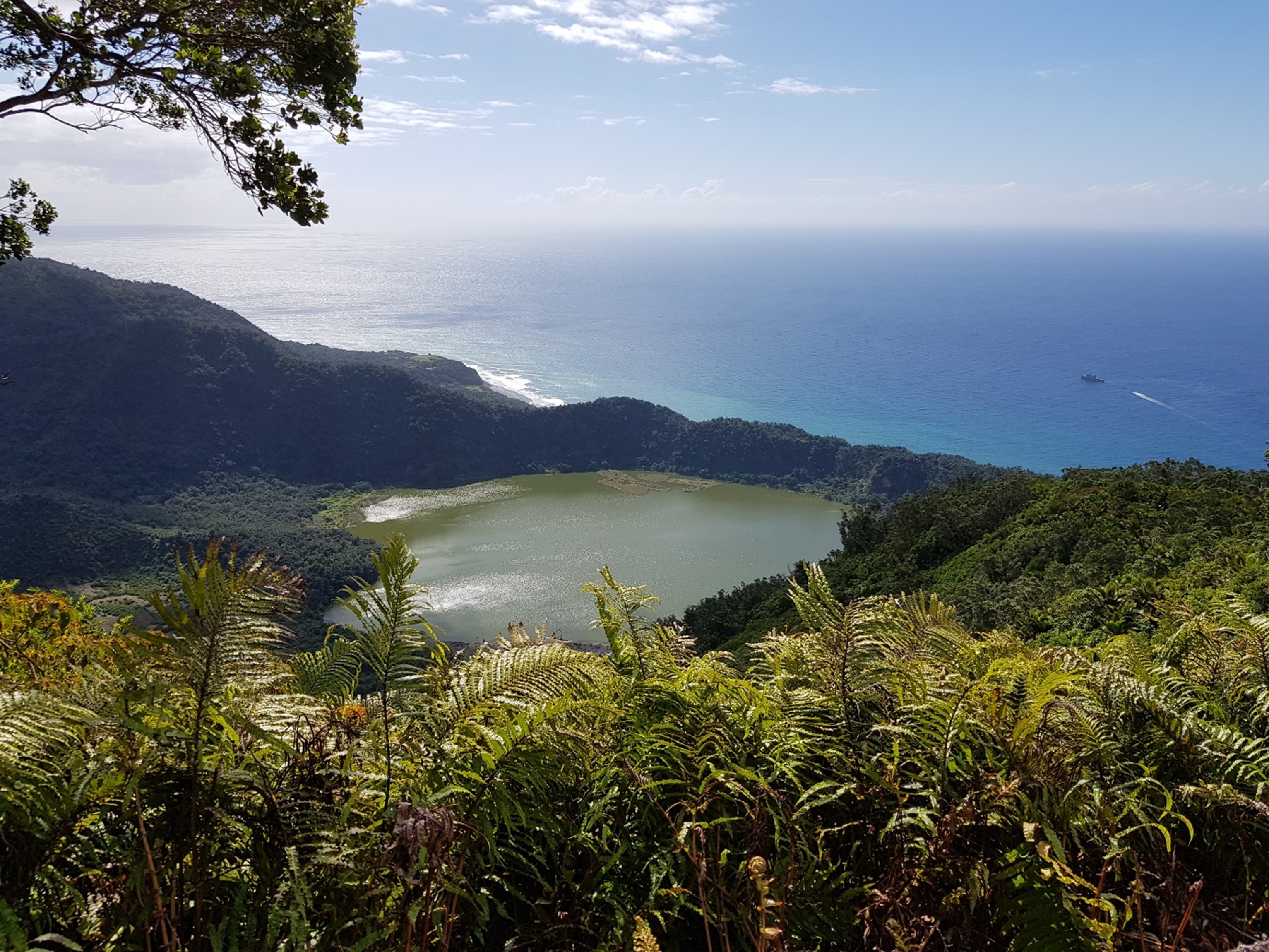
The view from Moumoukai with HMNZS Canterbury in the distance.
The main priority of this trip was installing Broadband Global Area Network Devices (BGAN) and replacing the batteries at our two tsunami monitoring sites (Fishing Rock and Boat Cove). The BGAN devices provide with a direct link from each site back to New Zealand via satellite, rather than the previous setup where data travelled via other stations before eventually being transmit via a MetService satellite connection.
We can now receive data directly from the two tsunami monitoring sites in the event of a system failure at other sites, like the one experienced following the M8.1 Kermadec quake, in March 2021.
Newly installed batteries at the sites also provide increased power capacity, making the stations more robust and resilient going forward.
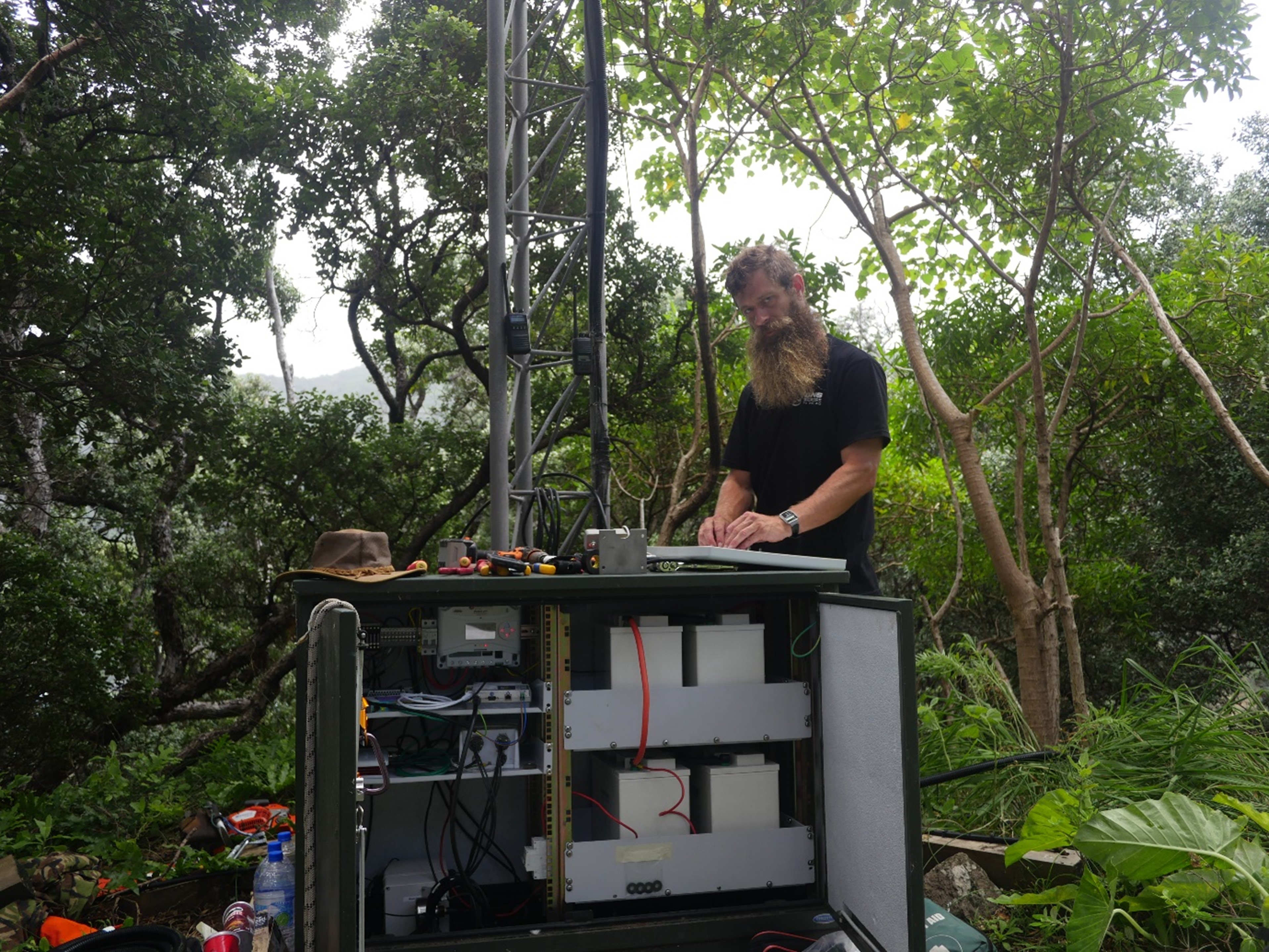
GeoNet technician Dave Whitelaw, installing the BGAN antenna at Boat Cove with the new batteries shown in the cabinet.
The team replaced a radio and did some much-needed gardening on the island’s highest point, Mount Moumoukai, to make sure the ability to generate system power using the installed solar panels isn’t hindered by vegetation overgrowth.
The team also installed a new lake level and temperature sensor at Green Lake to help monitor the volcano.
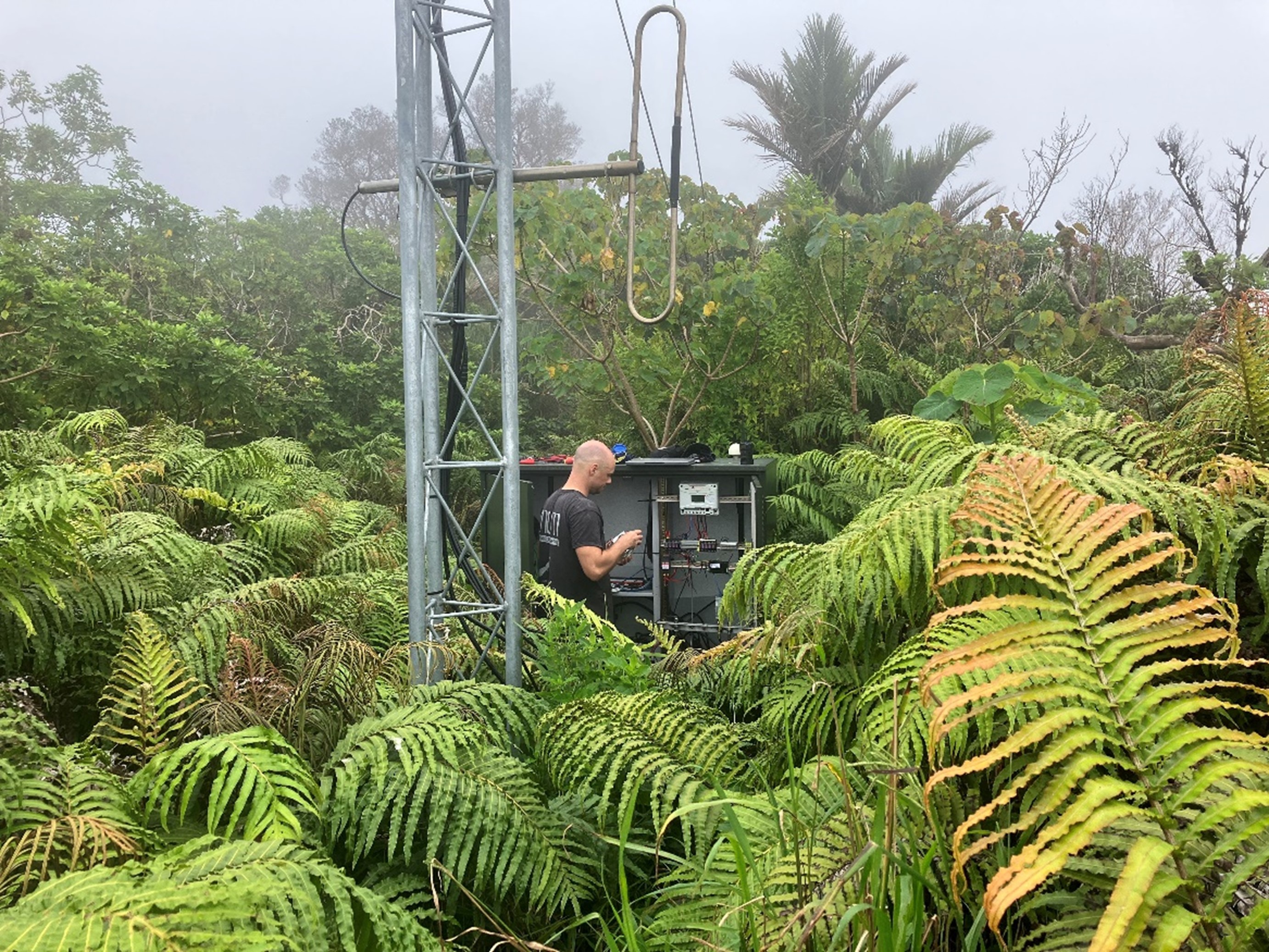
GeoNet technician Matthew Moore working at our overgrown site at Mount Moumoukai.
GeoNet would like to thank NZDF for making our repairs to Raoul Island possible, as well as Ngati Kuri, the Department of Conservation and MetService.
Media contact: media@gns.cri.nz or 021 574 541