
Landslides on Raoul Island from recent earthquakes
The landscape on Raoul Island is dominated by steep forested slopes of the volcanic Raoul caldera and rugged coastal cliffs. Following the March 5 M8.1 earthquake, our team of experts discovered over 300 new landslides on the island.
The ground shaking from the M8.1 earthquake was estimated to be between 0.15g and 0.75g (from software ShakeMap NZ) which triggered more than 300 landslides, that our team have mapped. The mapping was done using photos of Raoul Island captured by the GeoNet and NZDF teams who visited the island after the earthquake as well as a 0.5m resolution image captured by the satellite Pleiades on 9 March 2021 - Figure 1). A combination of pre-earthquake imagery (Google and Sentinel) was used to make sure the landslides were triggered by the earthquake (i.e. weren’t there before the earthquake).
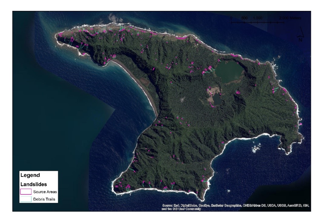
Figure 1. Pleiades Satellite image captured on March 9, 2021 with the mapped landslide distribution overlaid.
The most spectacular landslides were around Blue Lake, and along the rugged coastline (Figures 2 to 6). There was a significant slip at Bells Beach, where about 400 m of coastal cliffs collapsed, leaving a plume of sediment in the ocean. Most of the landslides were relatively small (100-200 m3) rock and soil avalanches and falls, but there were some larger ones up to about 20,000 m3 (think two rugby fields neck-deep in rocks). The largest landslides were on the north-east coast near Hutchison Bluff, and around the crater of Blue Lake, most landslides comprised rock and soil avalanches and falls.
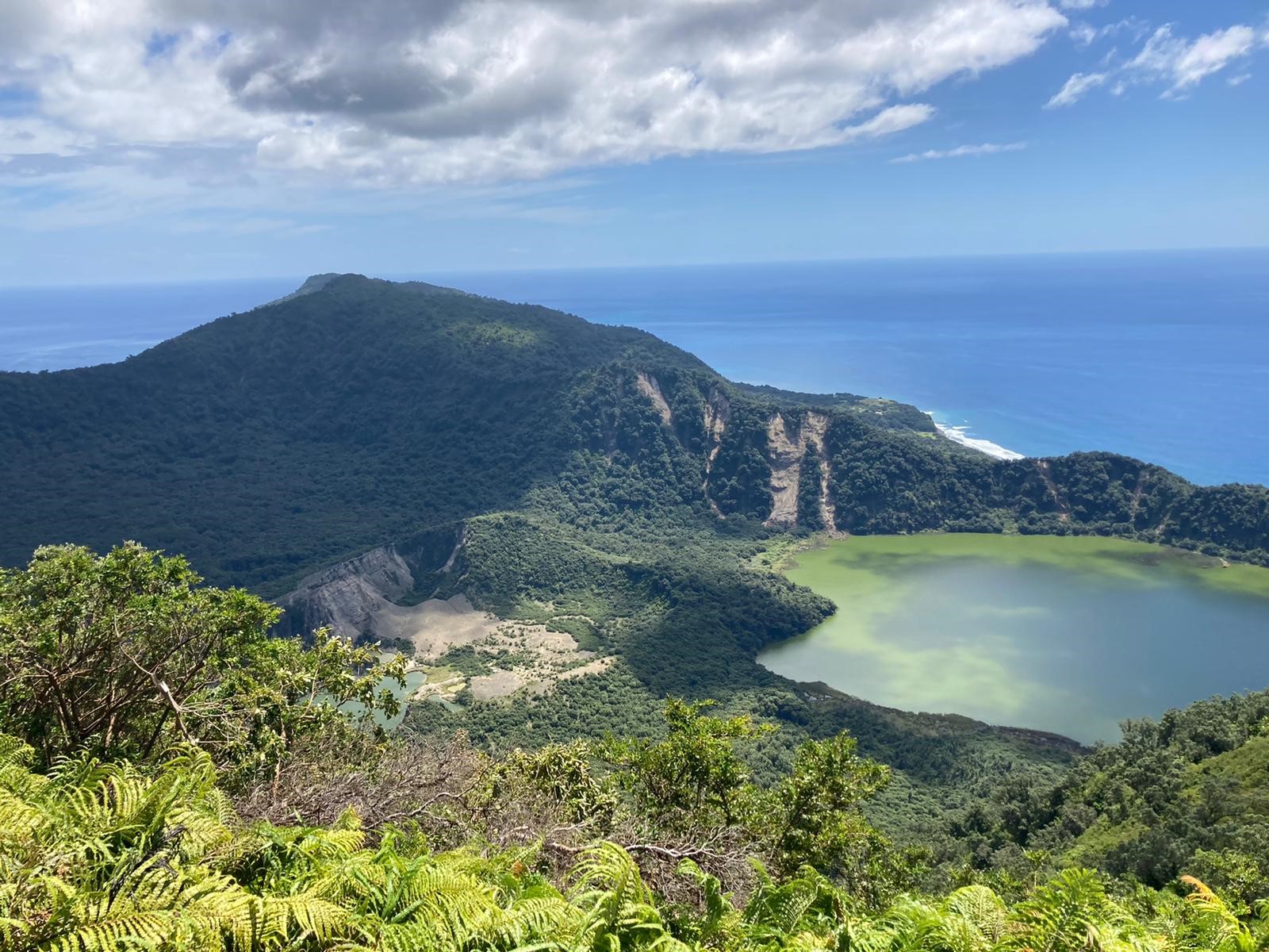
Figure 2. Landslides triggered around the crater rim of Blue Lake
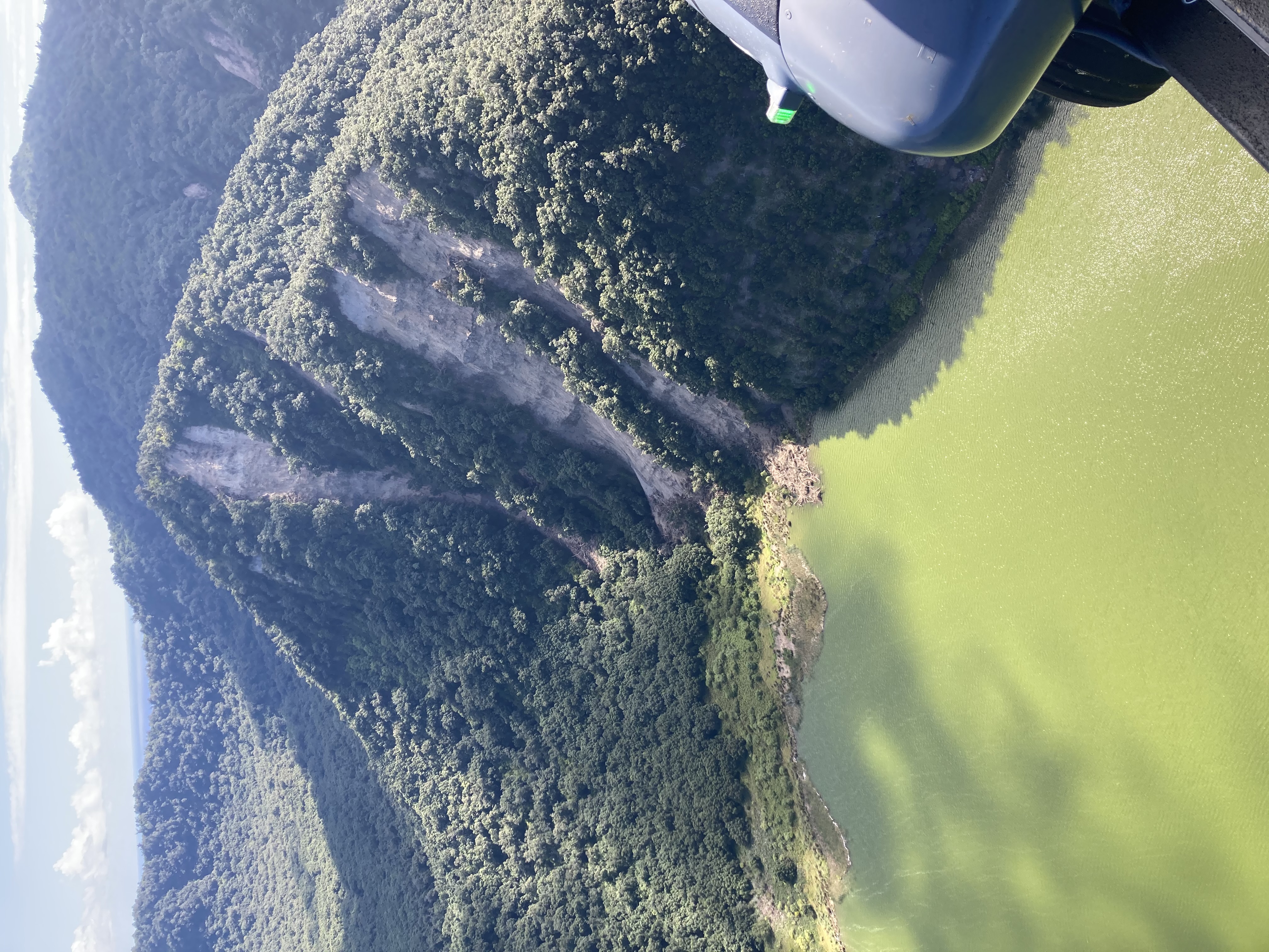
Figure 3. Landslides triggered on the crater rim of Blue Lake
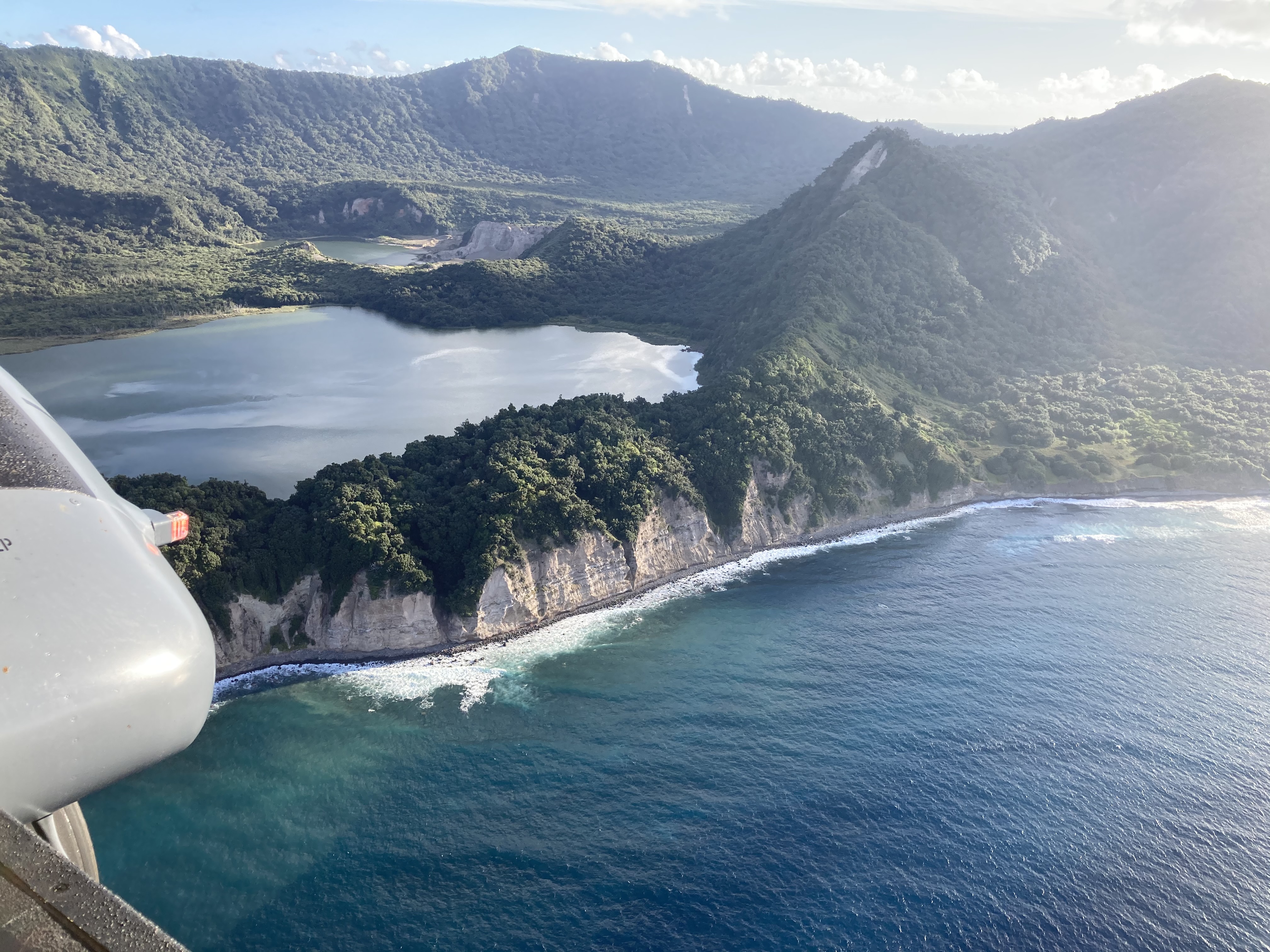
Figure 4. Coastal landslides and rockfalls near Ngaio Bluff, Blue Lake in the background
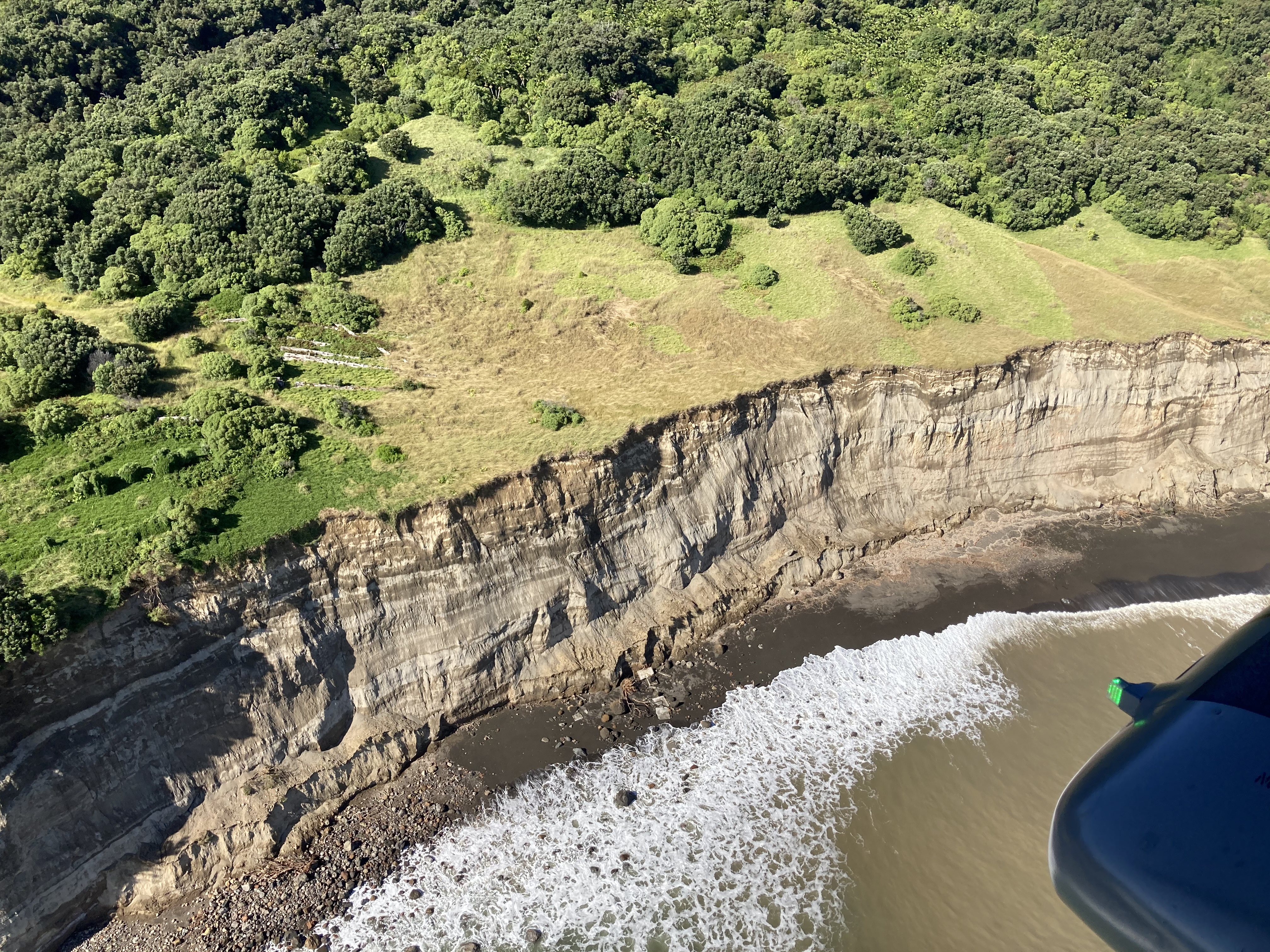
Figure 5. Cliff collapse along Bells Beach, north coast.
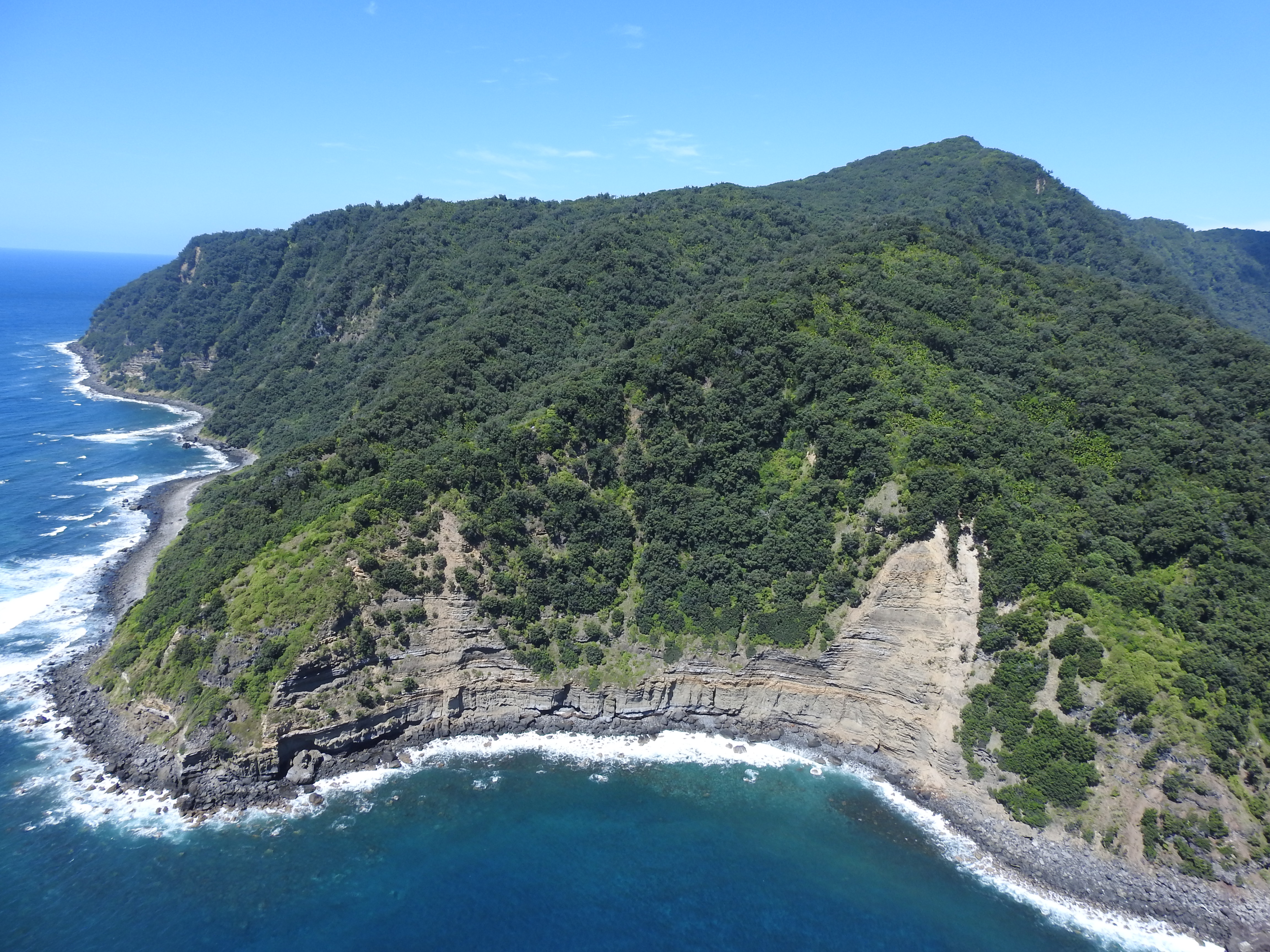
Figure 6. Coastal landslides near Raynor Point
Before the field teams left for Raoul Island, we ran our Earthquake-induced landslide forecast tool (EQIL Tool) (Massey et al 2020) to give them an indication of where to look for landslides and to provide information relating to potential safety risks. The EQIL Tool predicts where landslides are likely to occur given the earthquake shaking (PGA) and the underlying topographic and geologic controls on where landslides occur (distance from fault, slope, geology, elevation, vegetation, aspect, etc.).
The results from the tool (using a PGA of 0.4g) are shown in Figure 7, with the mapped landslide distribution overlaid. The areas in red and orange have a high probability of producing earthquake-induced landslides. Visual comparison of the forecast model results with the mapped landslide distribution (Figure 8), indicate a generally good correlation. The coastal slopes generally have a high simulated landslide probability, and most of the mapped landslides occurred on these slopes. This is because they are generally steeper in angle and higher in local slope relief. Some of the larger landslides occurred on the volcanic crater rim, again corresponding to areas of high simulated landslide probability. Quantification of model accuracy on forecasting landslide occurrence is currently ongoing.
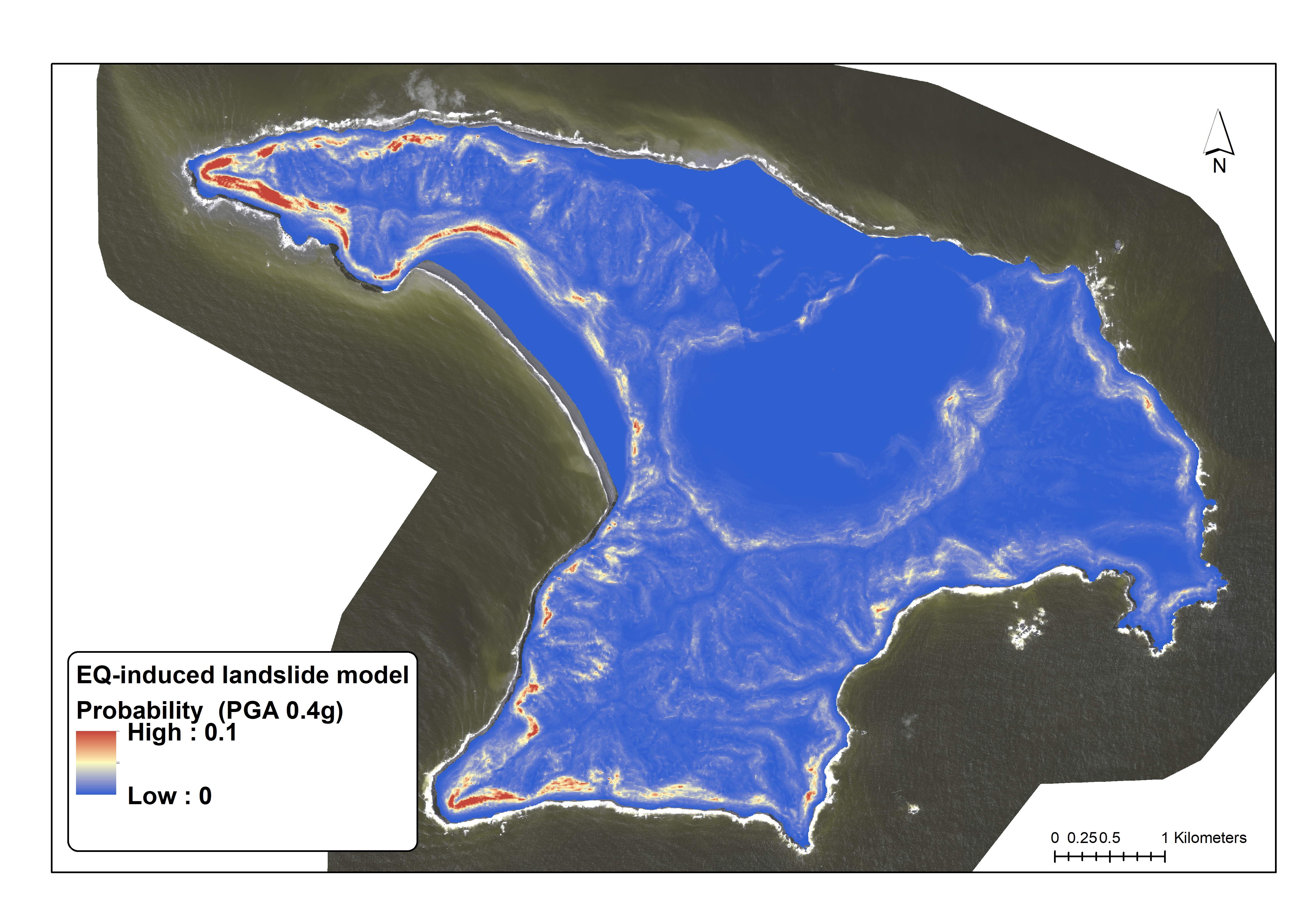
Figure 7. Landslide probability estimated for the M8.1 earthquake assuming a PGA of 0.4g, across the entire island.
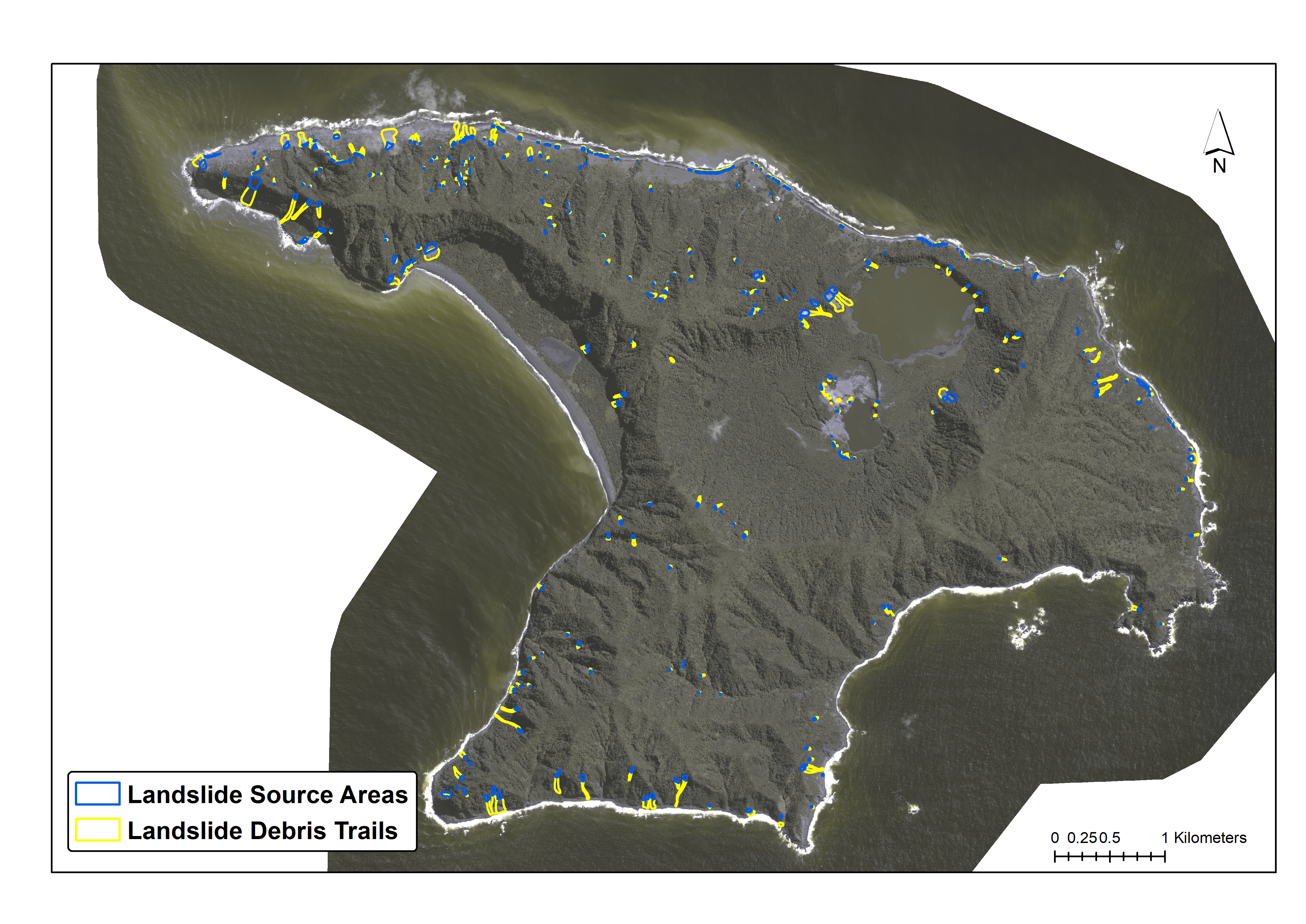
Figure 8. Mapped Landslide Distribution
GeoNet would like to thank NZDF for facilitating the GeoNet team to take aerial oblique photographs of the landslides.
Landslides can happen without warning — often triggered by heavy rain, earthquakes and, in some cases, human activity. Find out what to do before, during and after a landslide here.
Attributable to: Chris Massey, Brenda Rosser and Biljana Lukovic. GNS Science. Media enquiries: media@gns.cri.nz or 021 574 541