
Update on landslide dam at Kaiwhata River
Earlier this month, our landslide team travelled to Kaiwhata River in Wairarapa where a landslide had dammed the river causing a sizeable lake to form. The dam has since failed and around 1,100,000m3 of water flowed downstream over a couple of hours.
In an earlier story, we explained that the landslide happened late on Saturday 1 June 2019 at a site where a smaller landslide occurred a couple of years ago. The base of this existing landslide gave way and the material flowed down the hill to block the Kaiwhata River.
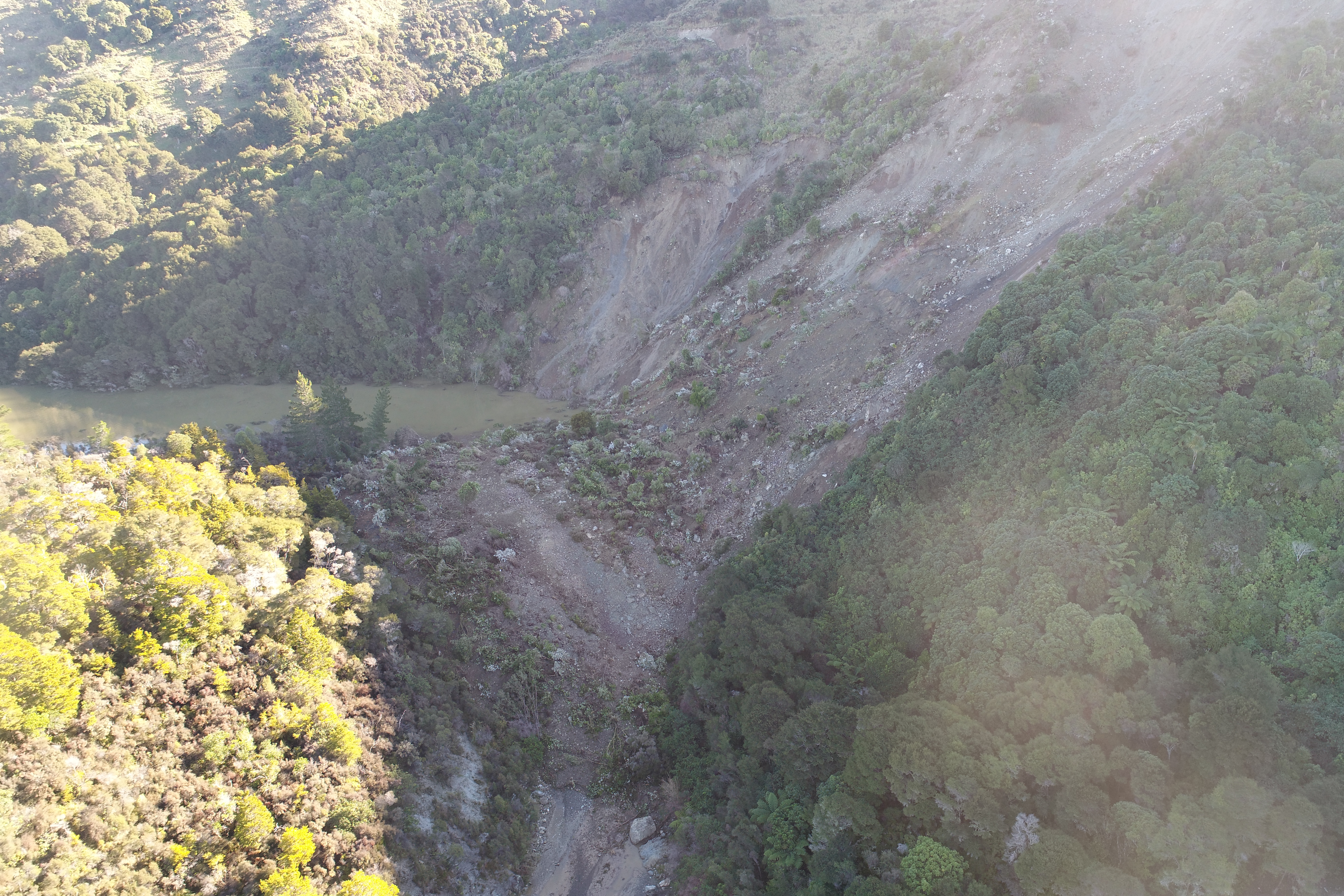
Kaiwhata River dam on 6 June 2019. Photo: Regine Morgenstern - GNS Science
A sizeable lake formed upstream of the dam (we previously reported the volume to be about 600,000m3 on 6 June). Following a period of rain, the lake level reached the top of the dam and overtopped it. This was coupled with slumping and seepage of water through the dam and resulted in a total dam failure on Thursday 13 June.
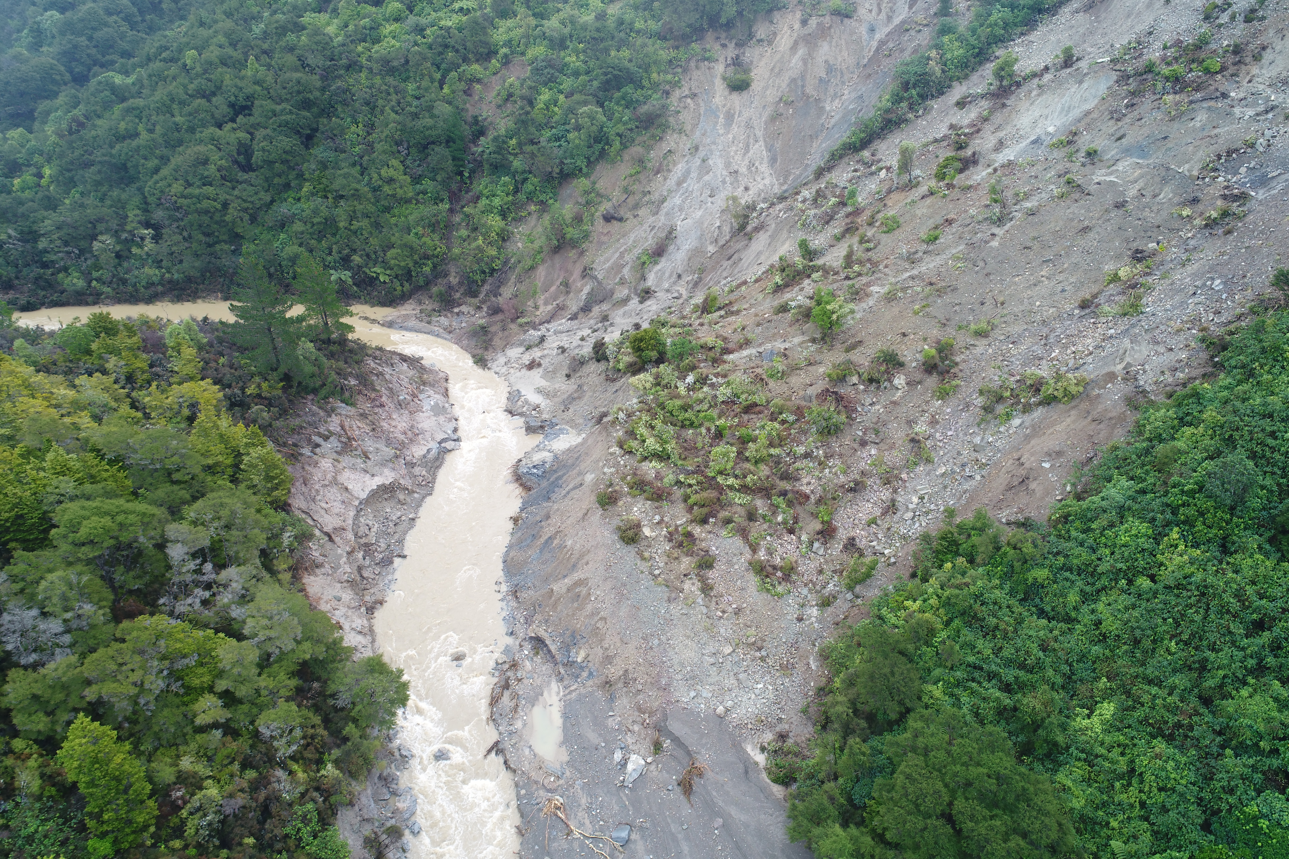
Kaiwhata River on 14 June 2019. The dam has failed and water is flowing freely. Photo: Regine Morgenstern - GNS Science
We’ve calculated that around 1,100,000m3 of water and debris flowed downstream, over the dam site, over a period of about two hours. This is equivalent to the volume of 440 Olympic-size swimming pools. Most of the dam material was removed by the flow. No houses were affected directly by this dam or its failure, but roads were closed, access for locals was hindered and some farmland was damaged. The roads and bridges downstream remain intact.
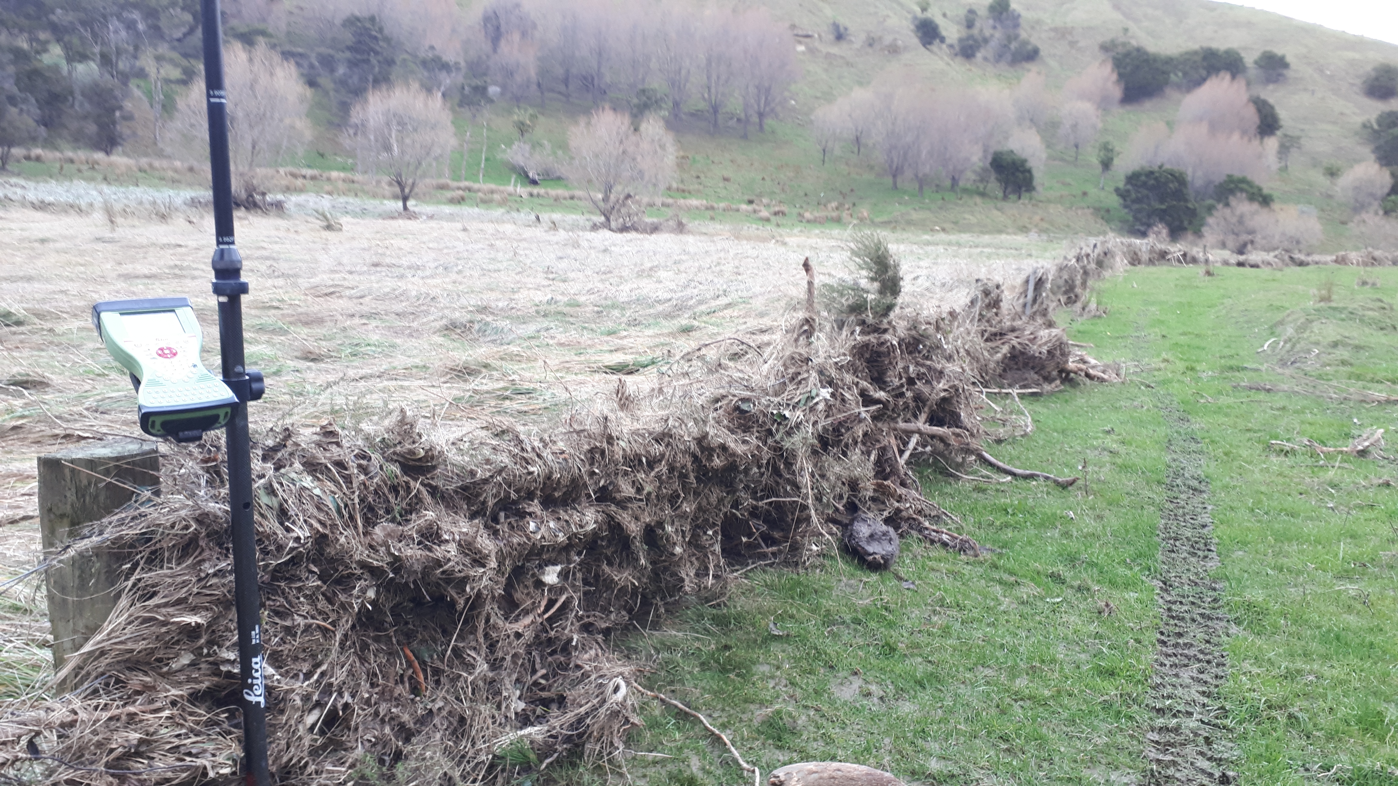
Debris stuck to farm fence after dam failure and draining of the lake. Kaiwhata River area. Photo: Brenda Rosser - GNS Science
This short video about the Kaiwhata River dam explains more about what happened from GNS Science engineering geomorphologist Brenda Rosser.
We were able to gather a lot of quality data because of the proximity of this landslide to our team in Lower Hutt, and because the dam formed and failed within a couple of weeks. This data will help us to understand in detail what happened at this site, and also help us understand and better forecast the behaviour of future landslide dams around the country.
Landslide dams are a common occurrence in New Zealand, with our hilly landscape, frequent earthquakes and high rainfall. Landslide dams are often not preserved on the east coast of the North Island because of the weaker, more erodible rock types in the area. This was one of the reasons for this dam failure.
Lakes formed by landslide dams that have survived a long time include Lake Waikaremoana in Te Urewera and Lake Mangapoike which formed in 2018 on private farmland between Wairoa and Gisborne.
GeoNet maintains a capability to respond rapidly to landslides in New Zealand. The rapid response team uses the knowledge and skills of engineering geologists, geotechnical engineers and surveyors.
Attributable to: Brenda Rosser – GNS Science engineering geomorphologist
Media enquiries: media@gns.cri.nz or 021 574 541