Auckland, Waikato and Bay of Plenty landslide response
Following the extensive flooding and landslides around Auckland, Waikato, and Bay of Plenty at the end of January, our landslide event response team have been working with councils and reporting the most significant impacts.
The work the teams do in the field allows community decision makers to have the best information to hand when providing advice to the region. Rick Liefting, Waikato Regional Council, values this contribution.
“The GNS team have provided an invaluable service to Waikato Regional Council and Thames Coromandel District Council that has enabled a robust and very timely assessment of landslide risk,” he says.
“The GNS field teams' initial assessment has directly guided the Councils’ response when declaring a State of Emergency.”
Identifying landslides, and areas of potential landslides, is important. They can be difficult to identify from the ground, especially if the landslide occurs above a road or property, for example. In such situations there is potential for the debris to move in future rain events, which could impact anything in its path. We sent our field teams out in helicopters to document landslides in these areas.
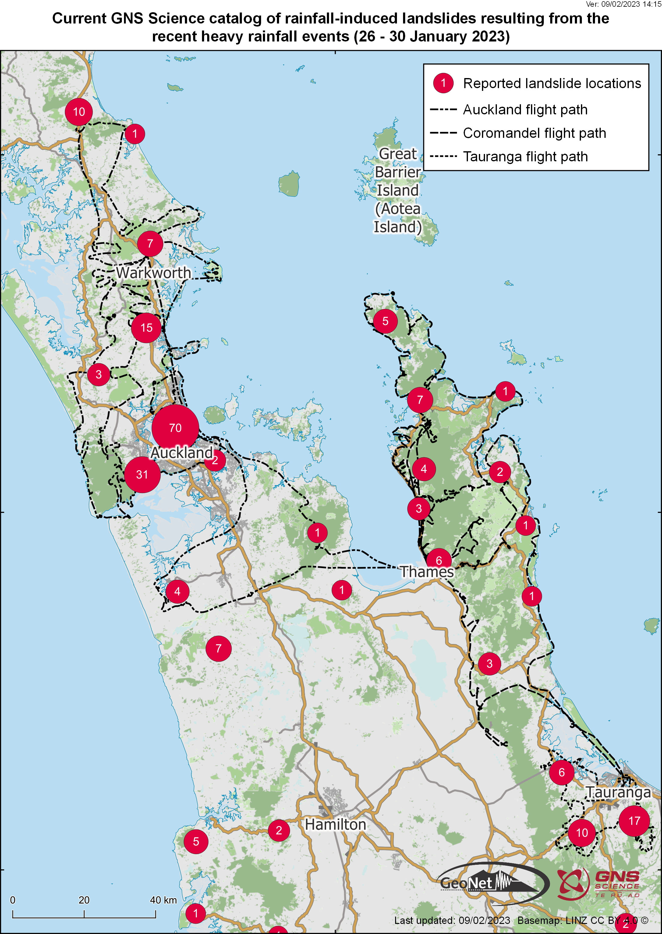
Figure 1: Locations and numbers of landslides reported in social media, news media and by various agencies. Map prepared by Kerry Leith, GNS Science.
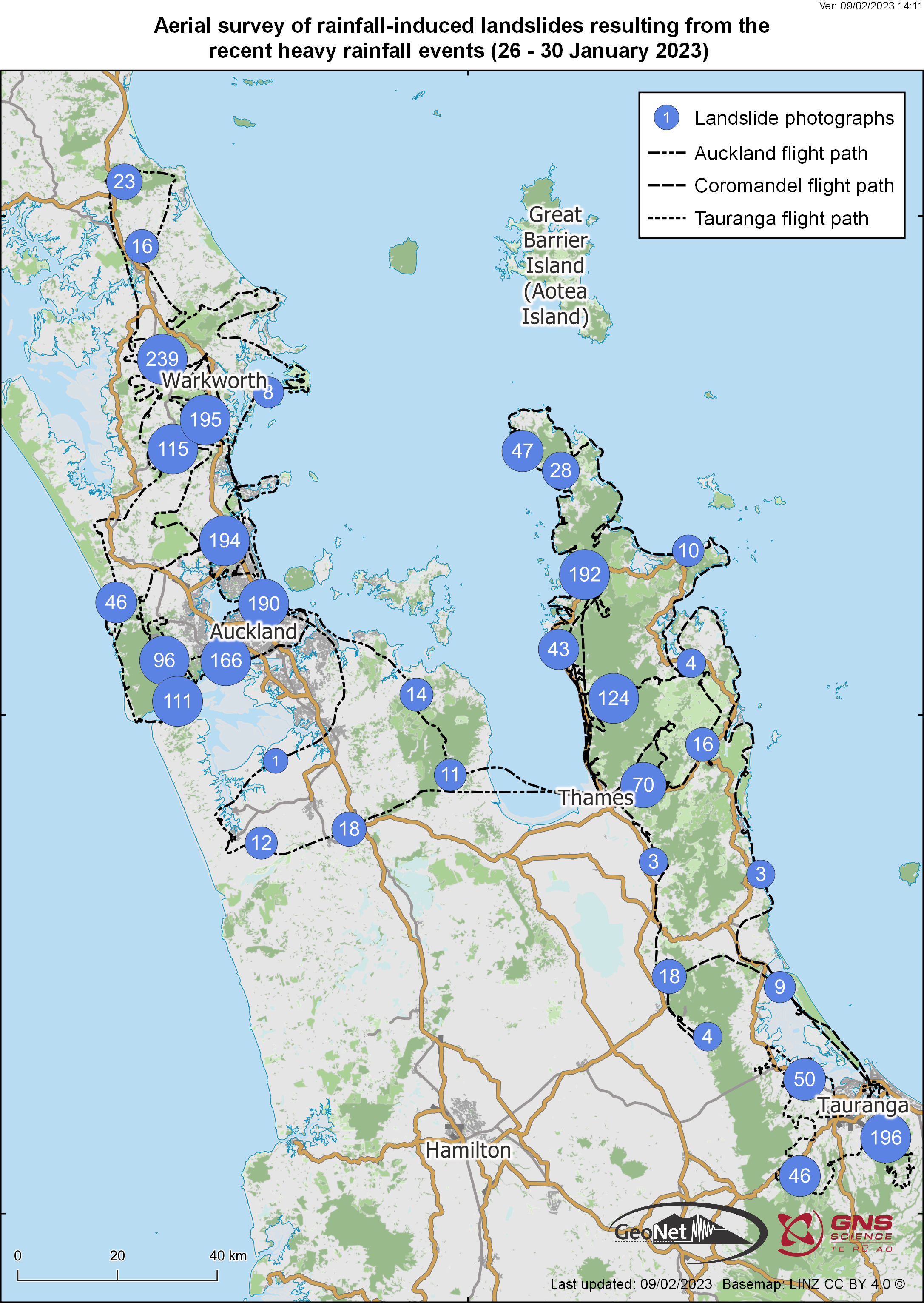
Figure 2: Locations and numbers of landslides photographed during the aerial landslide event reconnaissance. Map prepared by Kerry Leith, GNS Science.
Auckland
On February 4th a helicopter reconnaissance team took off from Warkworth to survey the extent of landslides caused by rainfall across the Auckland region. The team took more than 2000 photos documenting the extent of the damage. They found small shallow landslides to be common across most of the hills, with the occasional larger more impactful landslide. Rockfalls and landslides were frequent across the coastal cliffs of Auckland, with numerous buildings affected. Inland there are multiple buildings impacted by landslides.
Using multiple photos taken during the helicopter reconnaissance, two of the landslides have been turned into 3D models. The first is a landslide dam near Puhoi (Figure 3), and the second is a large slip over the railway line in Tahekeroa (Figure 4).
Explore 3D models here: landslide dam, large slip over the railway line
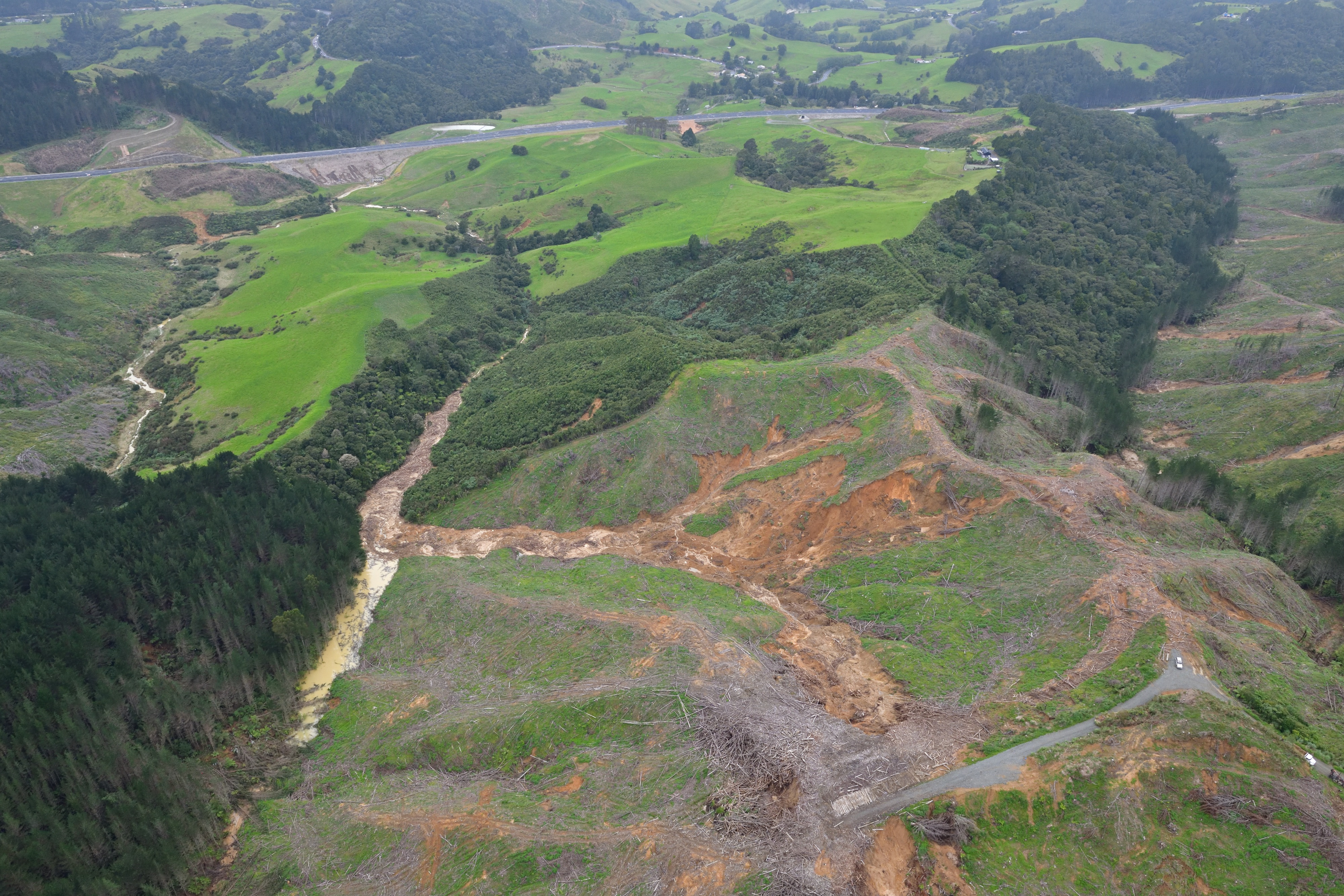
Figure 3: Photo of the small landslide dam near Puhoi. The dam is full of forestry slash and is upstream of culverts passing under SH1. Dougal Townsend, GNS Science
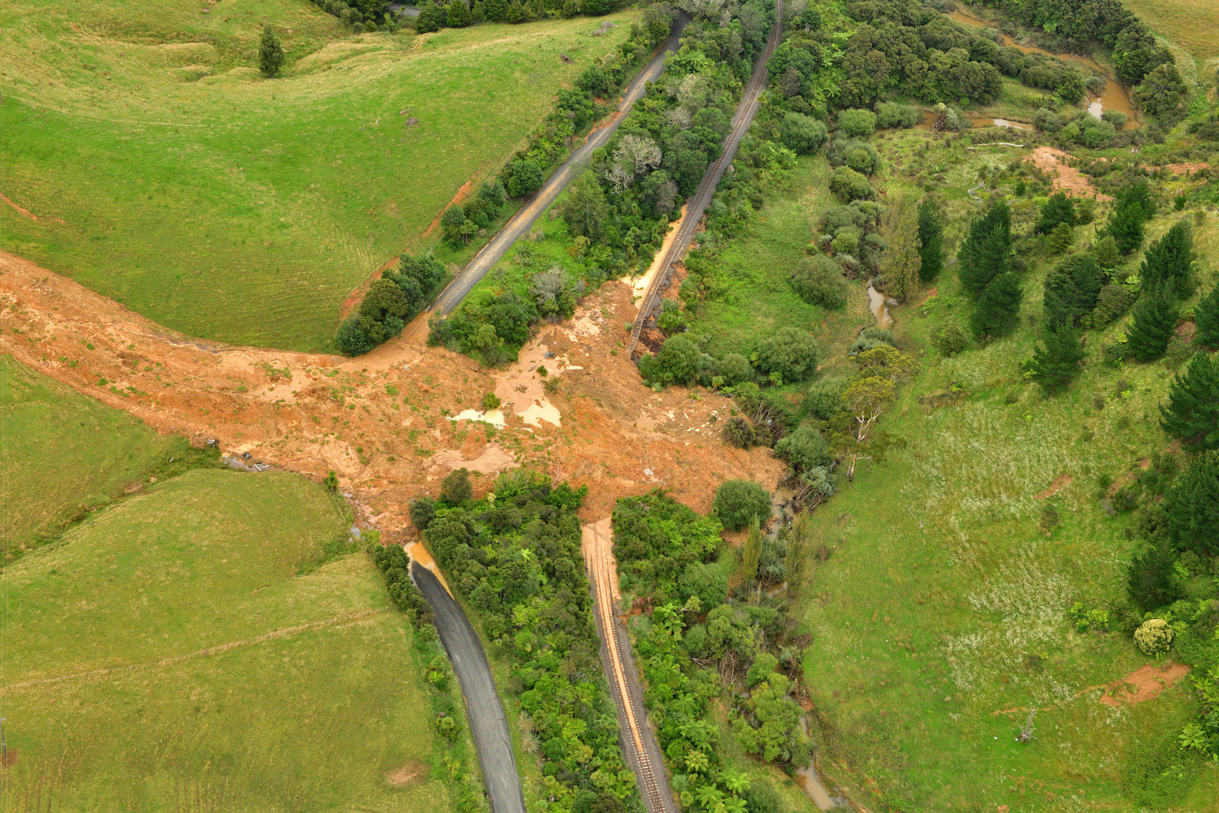
Figure 4: Photo of the large landslide over the Railway and Tahekeroa Road, North of Auckland. Dougal Townsend, GNS Science
Waikato and Bay of Plenty
On the afternoon of February 3rd, a helicopter reconnaissance team left from Tauranga Airport to survey the extent of landslides caused by rainfall in the western Bay of Plenty Region, near Tauranga A second flight on February 4th first observed the north-western Tauranga Harbour, and went on to survey Coromandel Peninsula, Waikato. About 900 photographs were taken, capturing approximately 160 landslides in and around Tauranga, and a further 452 around Coromandel Peninsula.
Many of the landslides around Tauranga Harbour occurred on steep coastal slopes composed of sedimentary deposits. Inland, most of the landslides were associated with road cuts, steep river valleys, forestry clearance, and weathered volcanic rock. Around the Coromandel Peninsula, the spatial occurrence of landslide activity was highly variable, but mostly concentrated in areas with sedimentary rocks, especially where forest cover was absent or where slopes had been steepened by roading or coastal erosion (e.g., Figure 5). In both Tauranga and Coromandel Peninsula, a small number of landslides occurred within native forest cover, associated with particularly steep slopes. Several slopes only partially failed, with large cracks visible above the landslide scars, or with partly displaced debris visible on the slopes (e.g., Figure 6). These ‘incipient’ landslides are likely to become sites of further slippage, especially in subsequent rainfall events.
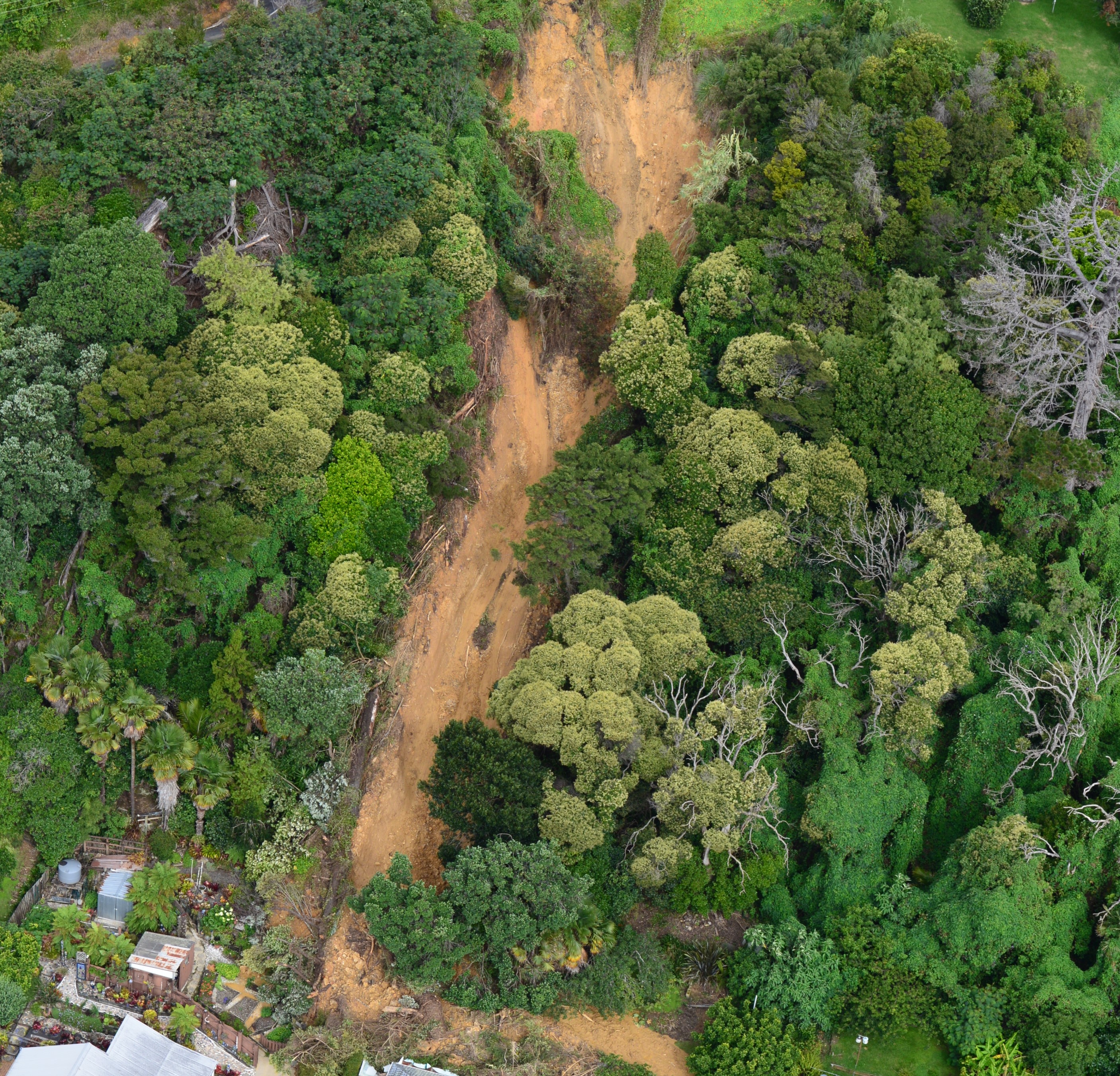
Figure 5: Photo of a damaging landslide in Coromandel Peninsula. Sam McColl, GNS Science
Using multiple photos taken during the helicopter reconnaissance, two of the larger landslides in the Bay of Plenty have also been turned into 3D models. The first is a debris flow in a forestry block, south of Tauranga, and the second is a landslide dam in the southern Kaimai Range (Figure 7).
Explore 3D models here: debris flow in a forestry block, landslide dam
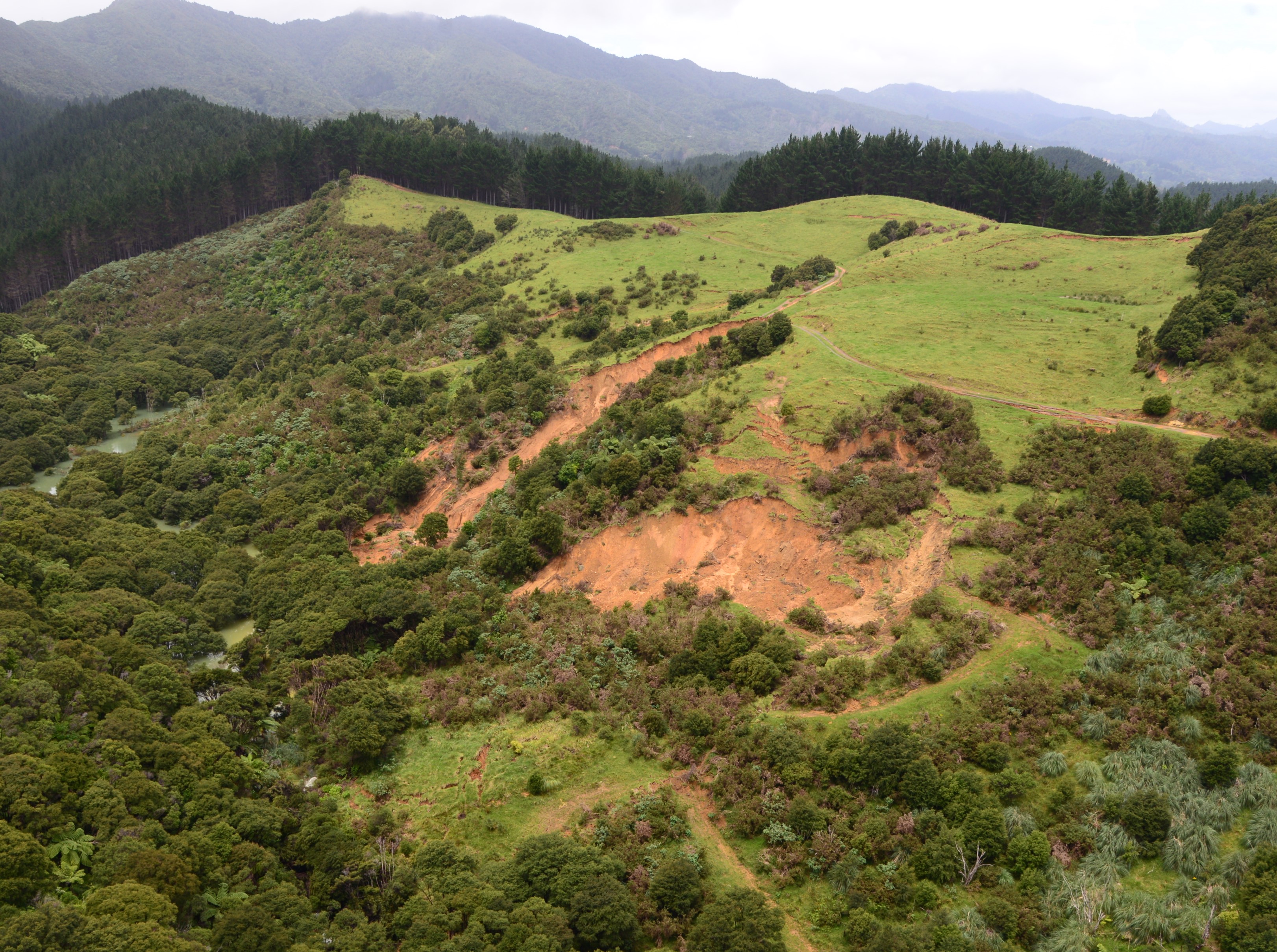
Figure 6: Landslide blockage of the south branch of Waiwhango Stream, above Koputauaki Bay, Coromandel Peninsula. Scarps (displaced cracks) have been identified near the top of the ridge (top of grassy slope in photo) which suggest potential for further displacement of this slope. Sam McColl, GNS Science
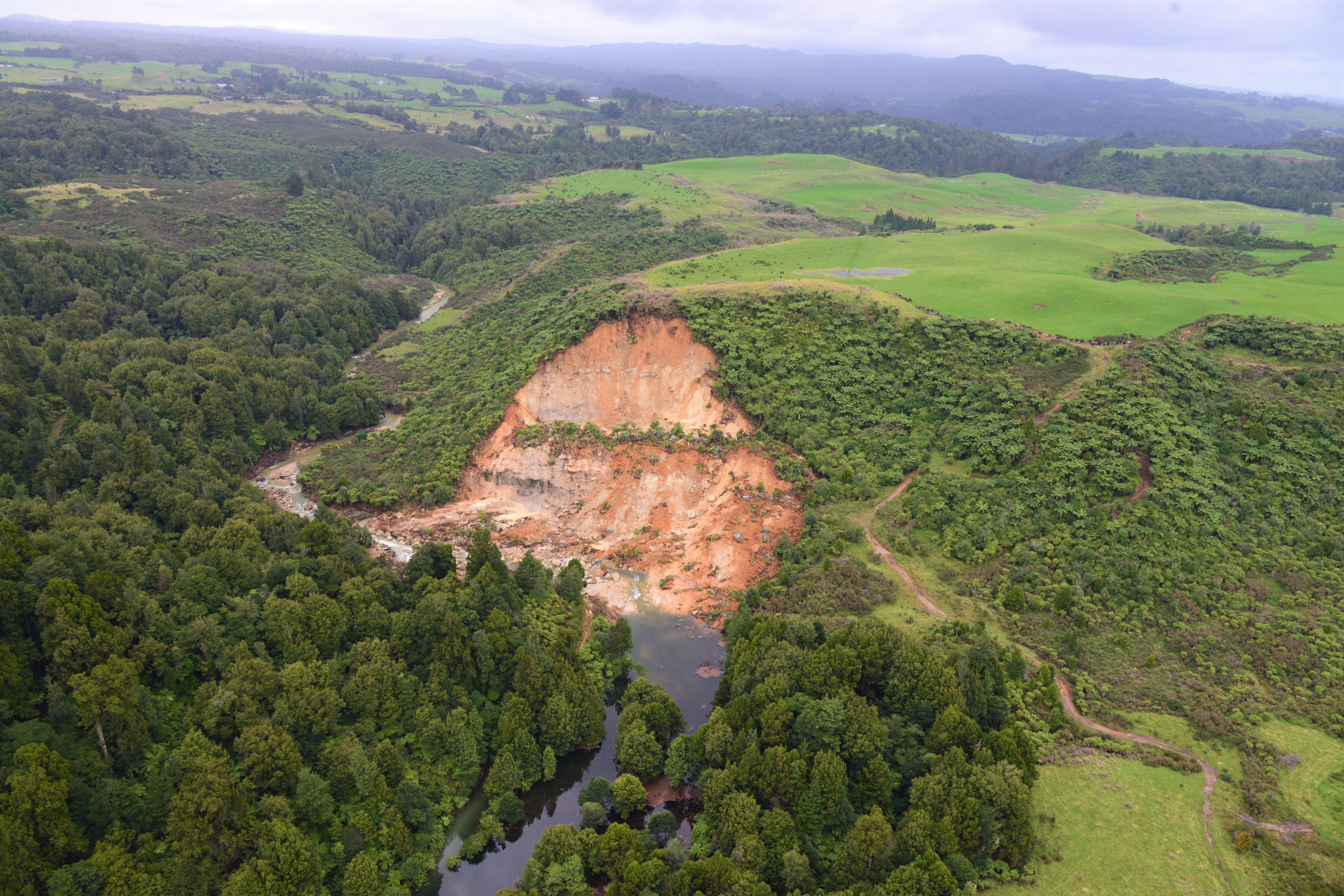
Figure 7: Photo of a large landslide that blocked Kaukaumoutiti Stream, northwest of Tauranga, with a small lake impounded upstream. Sam McColl, GNS Science
Geonet Sea Level Gauge
Our coastal sea level gauge at the Manukau Heads for tidal and tsunami monitoring had stopped sending data after the storm. One of the teams were able to do a flyby and found the cause, a small rockfall had damaged the cable. Our Remote Infrastructure Team are working on a solution to repair the gauge, but it is unlikely that it will be repaired for at least a week or two.
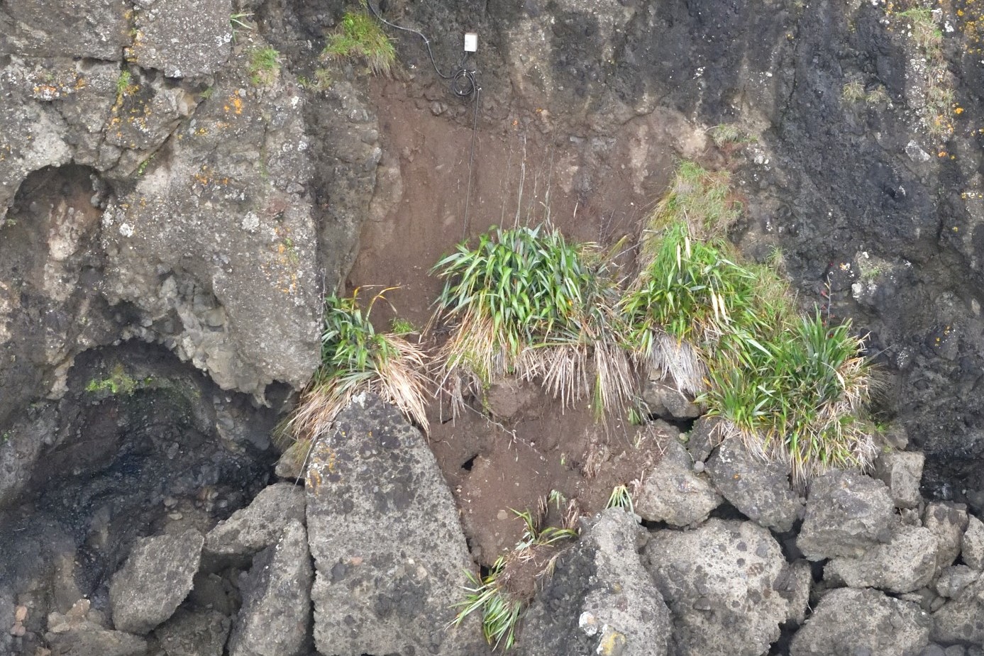
Damaged coastal sea level gauge
A landslide may be triggered by heavy rain or earthquakes, with homes near hills or steep slopes most at risk. If you live near a hill or steep slope, watch out for cracks or movement that could be a warning sign.
Follow Civil Defence’s advice on what warning signs to look out for so you can act quickly if you see them.
Toka Tū Ake EQC has information on how to get your home, apartment, or rental prepared for a natural disaster.
Media contact: media@gns.cri.nz or 021 574 541