
New data on the large Whareongaonga landslide
In late December 2021, some of the GNS Science Engineering Geology team used our new LiDAR (Light Detection and Ranging) drone to capture high resolution, topographic data of the landslides at Whareongaonga, south of Gisborne.
The landslide and others adjacent – caused by heavy rainfall - had undermined the already damaged Wairoa to Gisborne rail line and buried several wahi tapu sites, including a historic Ngāi Tāmanuhiri pā site, Māra kai (food gardens) and taunga ika (fishing grounds).
The new drone uses LiDAR, which is a remote sensing method that uses light in the form of a pulsed laser to measure distances to the Earth surface. It enables us to build a high resolution (1 m) 3D model of the ground surface. (View the 3D visualisation here)
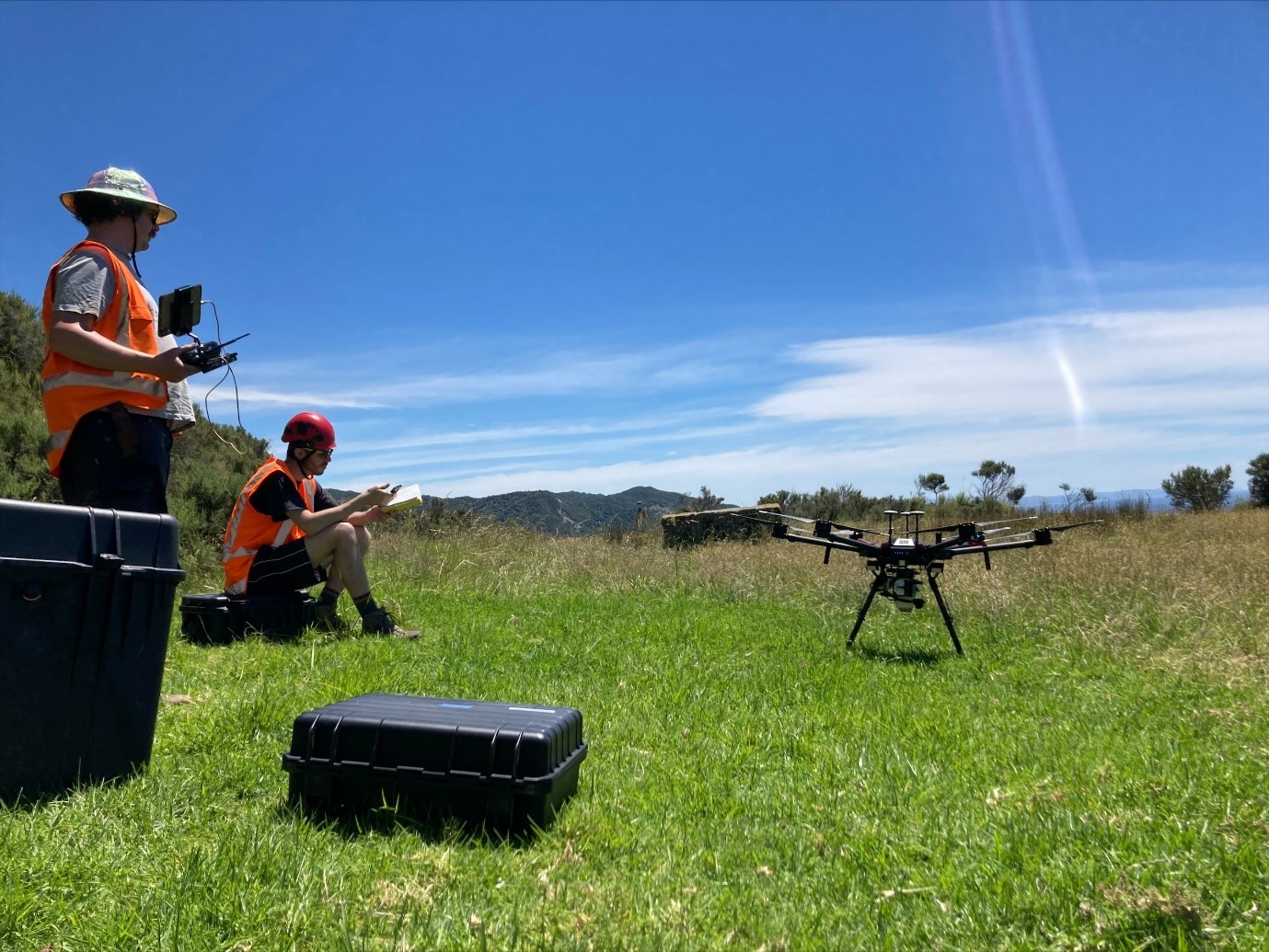
Some of the team operating the LiDAR drone at Whareongaonga.
The data will be used to determine the volume of material involved in the landslide – both the volume evacuated from the source area and deposited downslope and in the sea, and to interpret the processes involved in the landslide initiation and movement. The survey data will also be used as a baseline to map the landslide and tension cracks surrounding the slip, and to monitor changes in the landslide (and deposit) over time as the sea and future rain events erode the landslide and deposit.
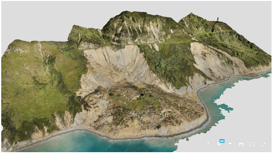
Screenshot of the 3D model of Whareongaonga landslides, December 21, 2021. Andrew Boyes GNS
A 3D difference model was constructed by subtracting a December 2021 UAV digital elevation model from the 2019 regional LiDAR survey, to determine the change in elevation between the two dates. Preliminary results from the 3D difference model show that the volume of material removed by the landslide was approximately 1.3 Million m3 – enough to fill Sky Stadium. The volume of sediment deposited in the sea was approximately 1 Million m3. Between our initial survey in November 2021, and when we returned to survey the site with the LiDAR drone in late December, the toe (lower part) of the landslide had been eroded by the sea by approximately 50 m.
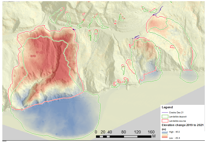
3D difference model showing the elevation change between the 2019 regional LiDAR (pre-event) and the LiDAR survey conducted in December 2021.
In the above image, the red areas show a loss of material (landslide source) and the blue areas show where material was deposited (landslide deposits). Other smaller landslides triggered by the storm, and tension cracks in the ground surrounding the large landslides are also shown. The difference model is overlaid on the 2019 Digital elevation model constructed from the regional LiDAR survey.
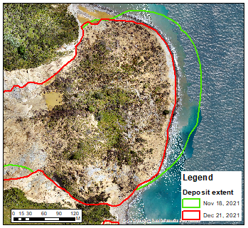
Extent of landslide deposit in November 2021 and on December 21, 2021,
Extent of landslide deposit in November 2021 and on December 21, 2021, showing the extent of erosion of the bottom of the landslide over that month. Approximately 50 m was eroded from the toe of the deposit, shown by the white arrow, which is equivalent to at least 115,000 m3 of material.
This landslide is of high scientific value to our team, as we are not aware of such a large, rapid landslide being triggered by rainfall in the Gisborne region for a long time. We are working with Gisborne District Council and Ngāi Tāmanuhiri on this project.
A landslide may be triggered by heavy rain or earthquakes, with homes near hills or steep slopes most at risk. If you live near a hill or steep slope, watch out for cracks or movement that could be a warning sign. Follow Civil Defence’s advice on what warning signs to look out for, so you can act quickly if you see them.
Attributable to: Brenda Rosser - GNS Science Engineering Geomorphologist
Media contact: media@gns.cri.nz or 021 574 541