
2020 - In Review
2020 was an incredibly challenging year. The rapid spread of the COVID-19 pandemic saw Aotearoa New Zealand plunged into lockdown. But natural hazards don’t respect lockdowns, so our teams continued to work 24/7 monitoring New Zealand’s geological hazards
As strange as it may seem, lockdown did have an effect on our monitoring work. As the country started to #StayHomeNZ to help eliminate the spread of COVID-19 in March we recorded a significant decrease in noise about Auckland City by our seismometers making smaller earthquakes more detectable.
Also during lockdown the GeoNet Community sent in questions about earthquakes, volcanoes, landslides and tsunamis and we created the #AskAnExpert series filmed from our Scientists homes. You can view them here.
No matter the COVID Alert Level our teams will continue to provide all the information you need through our website, social media and the GeoNet app.
Earthquakes
GeoNet located more than 20,600 earthquakes in 2020 in the New Zealand and offshore region (including Kermadecs to the North). The largest earthquakes were a M7.4 earthquake 700km NE of New Zealand, and closer to shore there was a M5.8 off the west coast of the lower North Island followed by a M5.2 felt in Auckland and Bay of Plenty.
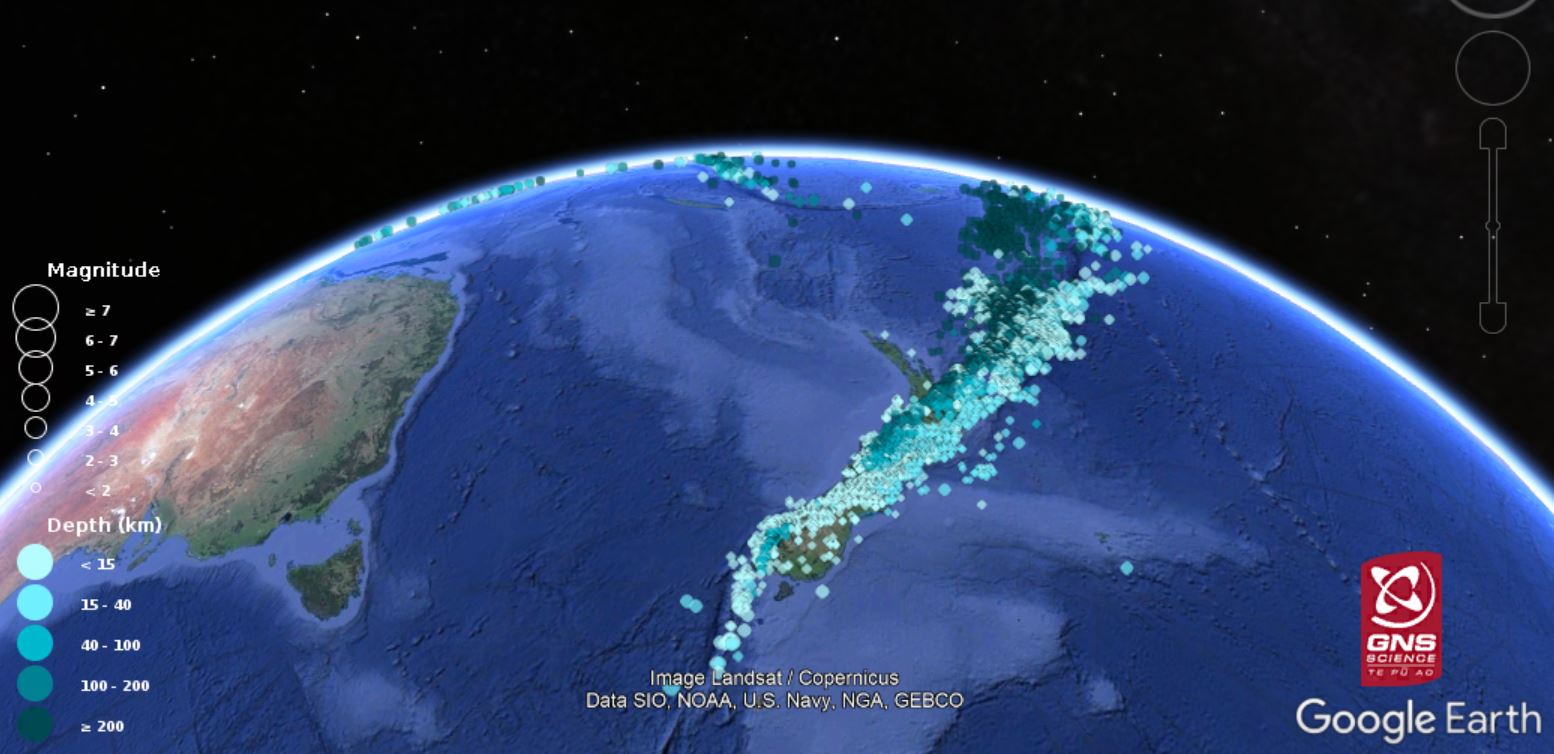
Earthquakes located by GeoNet during 2020.
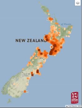
The M5.8 Levin earthquake broke GeoNet’s records with over 36,800 felt reports. At the NGMC “we had to drop, cover and hold and then locate the earthquake”.
M5.8 Levin Earthquake
A M5.2 earthquake in August 120km north-east of Whangamata, was felt in Auckland and Bay of Plenty. The earthquake had more than 80 aftershocks and was unnerving for those in Auckland and the Coromandel as earthquakes are not common in these areas
Tsunami
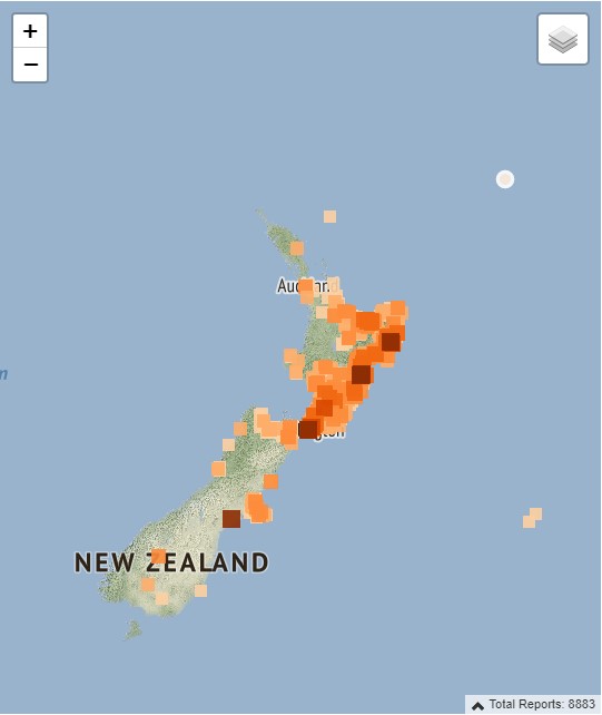
In June there was a M7.4 earthquake in the Kermadec region. The earthquake occurred about 705km km NE of Gisborne, with nearly 9000 reports of people having felt it on the Geonet website and app.
M7.4 Kermadec earthquake on 2020 June 19 12:49am (NZT):
This earthquake generated a small tsunami, with waves of around 10cm above sea level recorded at Geonet tsunami gauges in Raoul Island, North Cape, East Cape and Great Barrier Island. Smaller waves were also recorded at the tsunami gauge in Tauranga. Earthquake/tsunami signals were also recorded by the New Zealand Dart buoy NZE.
Landslides
During 2020 our landslide response team were deployed to multiple events around New Zealand. In February, a severe storm in Fiordland caused flooding and numerous landslides, including one which hit Lake Howden Hut on the Routeburn track.
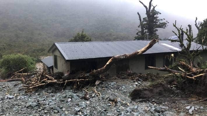
Lake Howden Hut after the landslide. Photo: Grace Houpapa
In July a storm hit Northland, with landslides occurring from south of Whangarei up to Kaitaia. The same weather affected Gisborne, causing numerous landslides, and landslide dams.
In November widespread flooding caused evacuations, landslides, power cuts, as well as damage to multiple properties in Napier. The extreme weather also hit the Wairarapa, causing the 2019 Kaiwhata dam slip to be reactivated. Our team were able to take drone footage and GPS measurements of the dam, and work with local council staff to help inform council risk assessments.
The Alpine Gardens landslide in the Fox Glacier Valley is still one of New Zealand’s largest actively moving landslides, and continues to be monitored by GNS Science alongside the Department of Conservation (DOC).
Volcanoes
Activity at Crater Lake (Te Wai ā-moe) continued with its heating-cooling cycles. A heating phase lasted from April through to September.
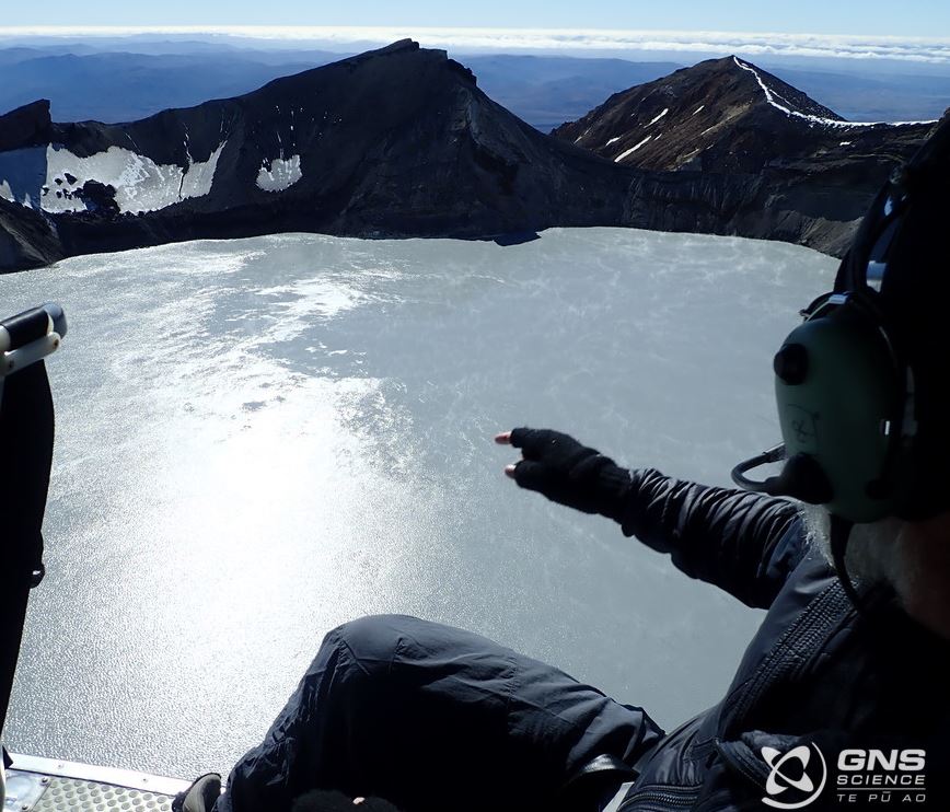
Ruapehu observation trip Dec 2020
A second heating phase from October then saw the lake temperature peak at 43°C in late December. This was accompanied by volcanic tremor, convection and an increase in the gas output through the lake, and was the largest heating phase observed in the past 2 decades.
At Whakaari/White Island, ponding rainwater in February led to small scale jetting activity that lasted into March. By early December observations and monitoring indicated activity was gradually trending back to lower levels of volcanic unrest that are typical of the long-term behaviour. On 9 December, one year on from the tragic eruption, we acknowledged the friends and whānau of those who lost their lives, the survivors of the eruption, the first responders, emergency services, Ngāti Awa and the people of Whakatāne.
Activity at Tongariro and Ngauruhoe volcanoes, within the Tongariro National Park, had minor steam and gas emissions and shallow earthquake activity. More than 700 small earthquakes were located in the Tongariro National Park area.
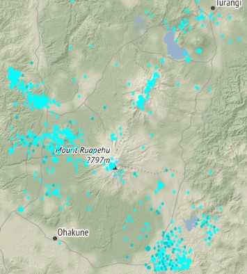
Earthquakes located in Tongariro National Park during 2020, less than 20 km deep.
The central portion of the Taupo Volcanic Zone between Rotorua and Taupo is dominated by the caldera volcanoes of Okataina and Taupo, large geothermal systems and the Taupo Fault Belt (an area of active faulting and earthquakes). During 2020 GeoNet located more than 750 shallow earthquakes in this area. Earthquake activity in this area often occurs in the form of swarms, lasting hours to weeks.
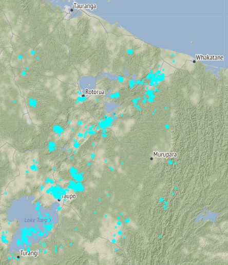
Earthquakes located in the Taupo Volcanic Zone during 2020, less than 20 km deep.
Activity at our other active volcanoes including Raoul Island in the Kermadecs, Auckland volcanic field and Taranaki, remained at background levels during 2020.
NGMC
The National Geohazards Monitoring Centre (NGMC) celebrated its second birthday in December. Since launching in 2018, the team has expanded and the GeoHazard Analysts have reviewed more than 47,000 earthquakes.
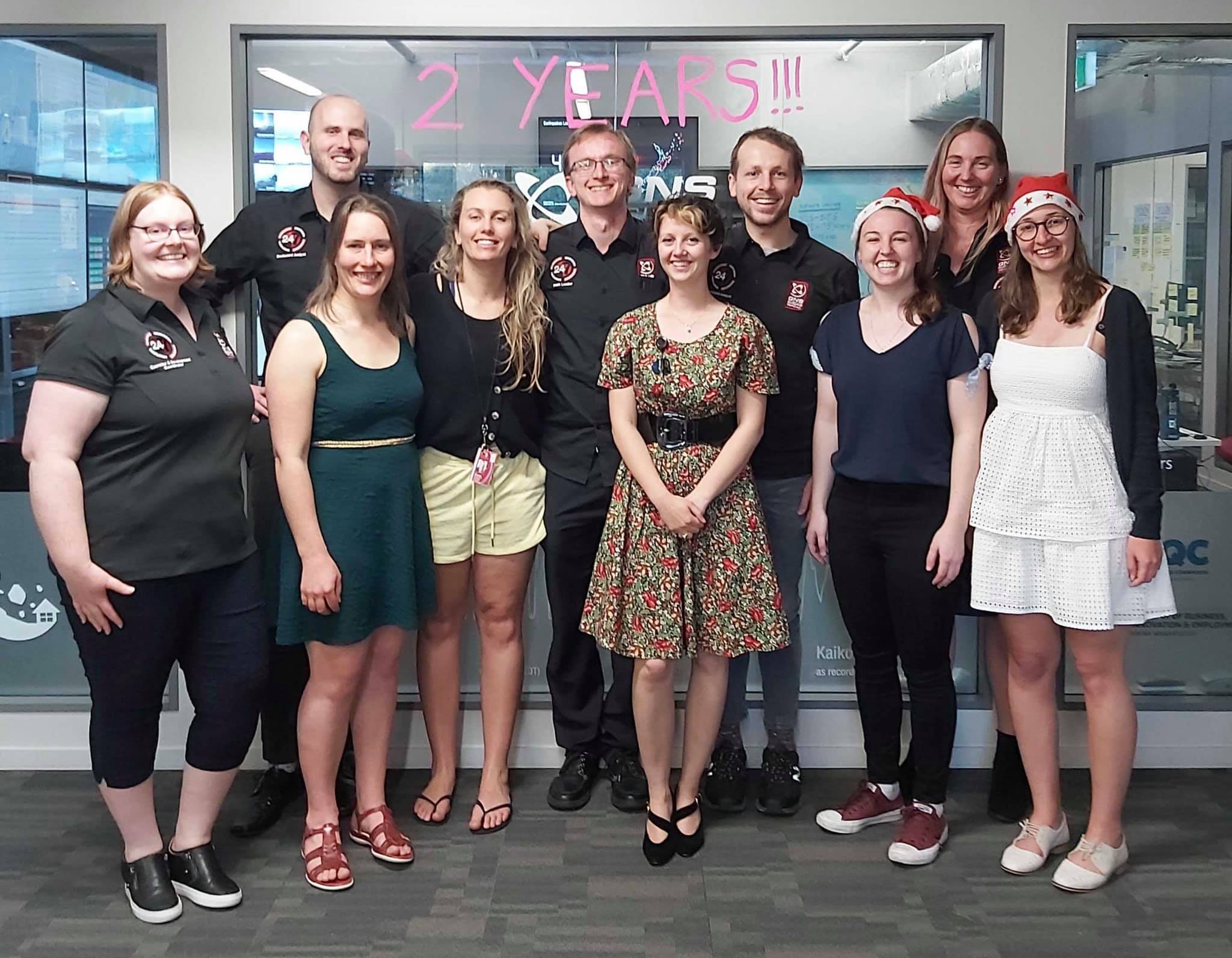
NGMC Team
Although we can’t prevent natural hazards, we can prepare for them – and we should.
NEMA (the National Emergency Management Agency) have a great website with information on what to do before, during and after each type of natural hazard. There you can also find Tsunami evacuation zone maps for around New Zealand and a list of supplies you need in an emergency.
The Earthquake Commission (EQC) has a helpful website with information on how to get your home, apartment, or rental prepared for a natural disaster.
If you use an Alexa device there is a Natural Hazards Alexa Skill, an official collaboration between EQC, GeoNet and NEMA. Check it out on the Amazon Skills Website.
And if you are going to check out the volcanoes in the Tongariro National Park this year, The Department of Conservation (DOC) has lots of information on the hazards in the park and how you can be prepared.