
2021 – in Review
As we look back at 2021 it’s easy to see how our beautiful country and its unique landscape was formed through geological hazards. Although we cannot prevent geohazards from happening, we can prepare and do our part to keep ourselves, and our whānau safe.
Earthquakes
GeoNet located more than 22,000 earthquakes in 2021 in the New Zealand and offshore region (including Kermadecs to the north). The three largest earthquakes this year all occurred on the same day!
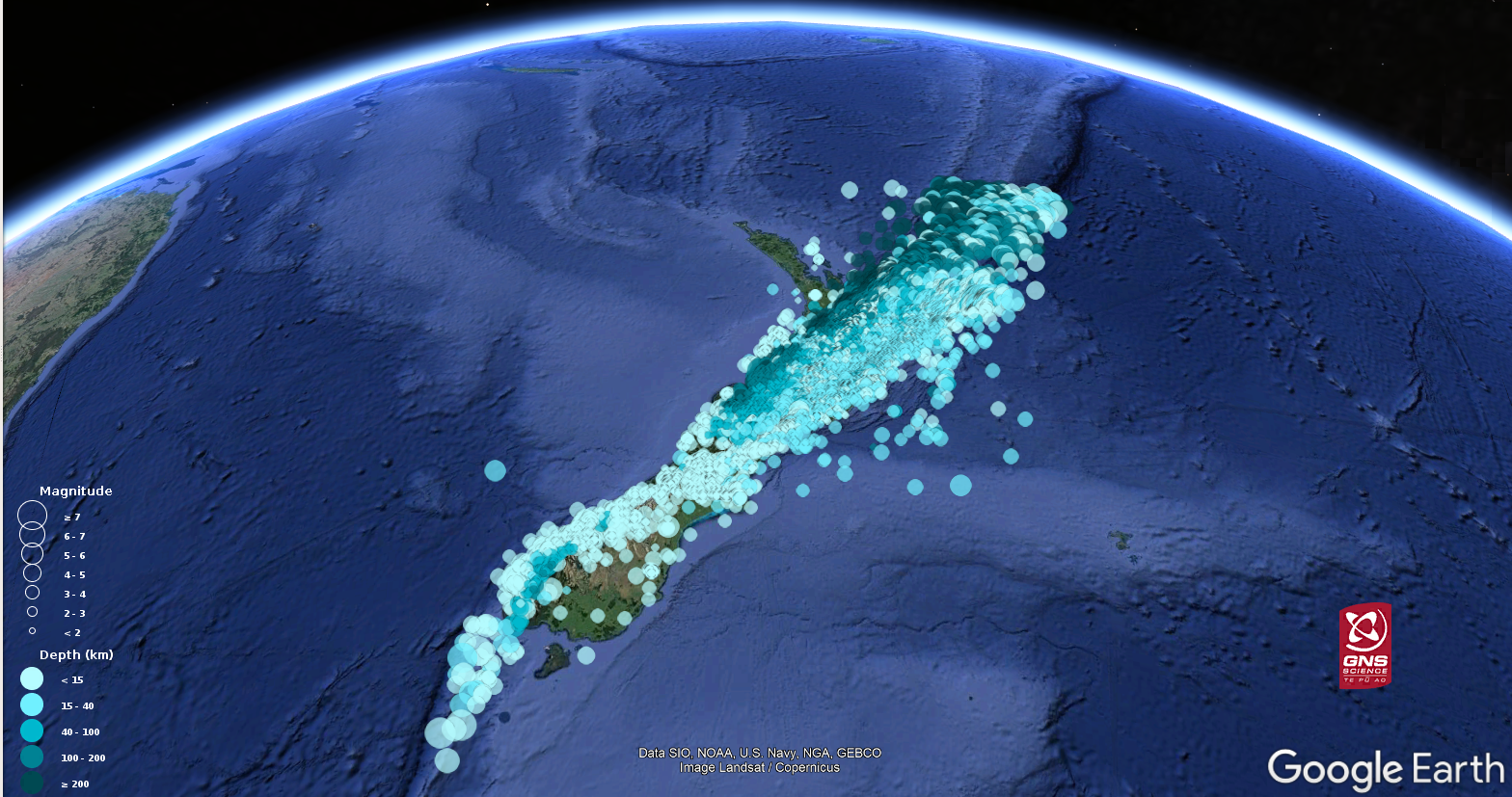
Earthquakes located by GeoNet in 2021
On Friday 5 March at 2:27AM a M7.3 earthquake east of the North Island was felt throughout New Zealand and we received over 52,000 felt reports, easily breaking our last record of 36,867 for a M5.8 earthquake offshore Levin in 2020. The M7.3 was followed a few hours later by a M7.4 and M8.1 earthquakes over 1000km north, in the Kermadec Islands. You can read about the associated tsunamis in the next section.
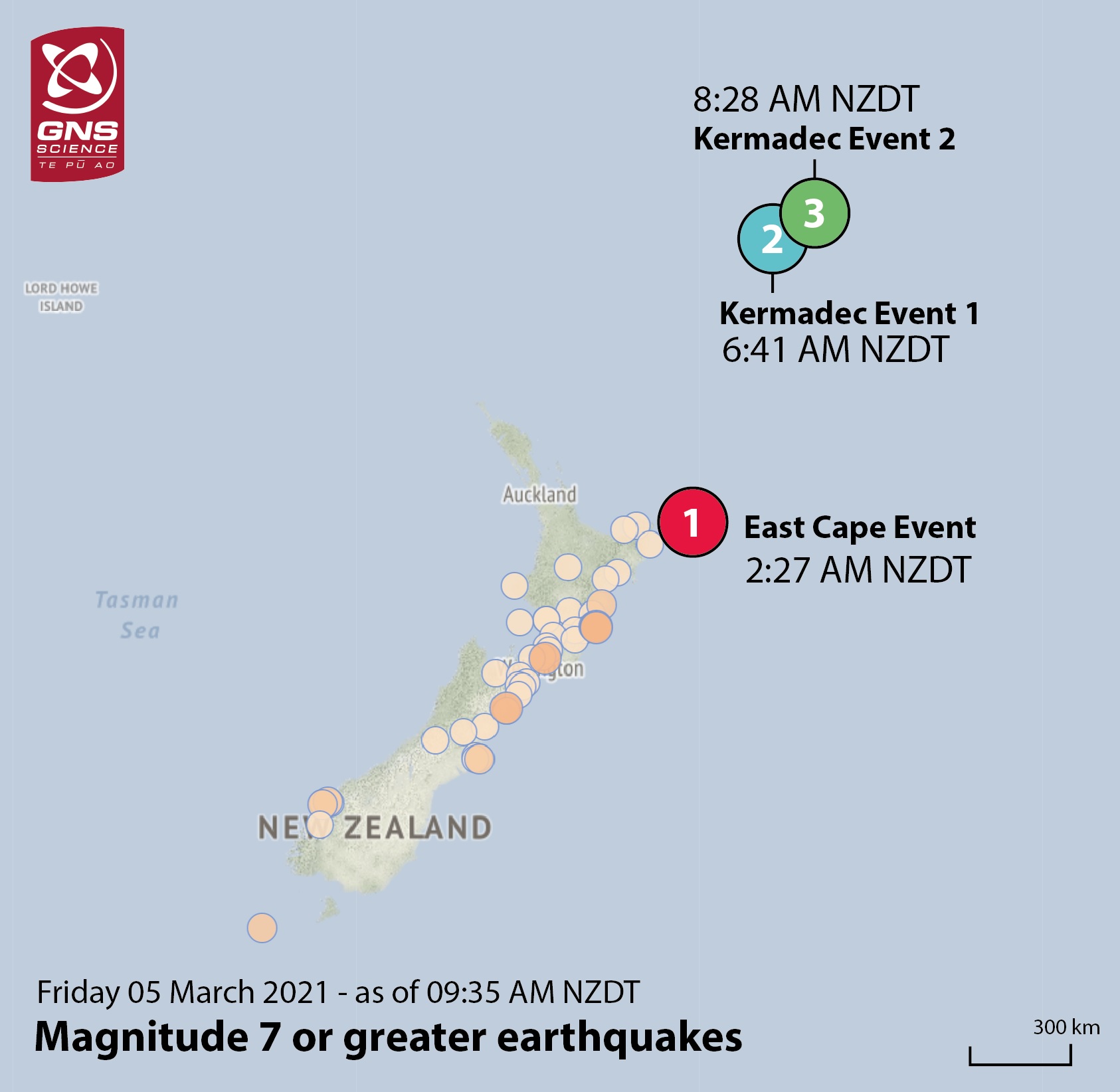
Location of the three large earthquakes
An anticipated slow-slip event began on the East Coast near Pōrangahau in May, this was followed by another event near Gisborne around mid-June. Slow-slip events are undetectable by both humans and our seismograph network because they move faults over weeks to months instead of within seconds like normal earthquakes. Slow-slip events are common in New Zealand and can be associated with increased numbers of small earthquakes, you can check out our slow-slip watch page here.
In December the part of the subducting Pacific Plate 30-50 kilometres beneath Kāpiti started moving slowly again after five years of being ‘stuck’ to the overlying Australian Plate. We see shorter events more frequently offshore the east coast, but these Kāpiti events typically only happen every five years or so and tend to last about a year. The last time a slow-slip event occurred in this area was after the 2016 Kaikōura earthquake.
Tsunami
The first tsunami of the year was in February following a M7.7 earthquake southeast of the Loyalty Islands (over 2000km north of New Zealand). The earthquake produced a tsunami that was recorded at tide gauges around the Pacific, and on our own network we recorded a 63cm wave height at Aotea Great Barrier Island, 29cm at North Cape and 24cm at our East Cape tsunami gauges.
The following month three large earthquakes occurred offshore New Zealand and all three caused tsunamis. We recorded tsunami arrivals from the M7.3 East Cape earthquake as ~32cm at East Cape, and ~13cm at Great Barrier Island. This was closely followed by tsunamis generated by the M7.4 and M8.1 Raoul Island earthquakes. These waves overlapped to produce a tsunami of 26cm in amplitude at Jackson Bay, and 24cm at the Great Barrier Island tsunami gauge, and recorded at many other gauges around New Zealand.
It’s extremely rare for three earthquakes in quick succession to generate three tsunamis that then combine in complicated ways to impact on one country. In fact, it’s so rare that most tsunami scientists cannot recall any similar examples.
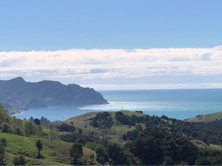
Surges arriving in Tokomaru Bay on the East Cape.
Landslides
Our landslide response team was deployed to multiple events around New Zealand in 2021. Following the March 5 M8.1 earthquake, the ground shaking triggered more than 300 landslides on Raoul Island that our team mapped.
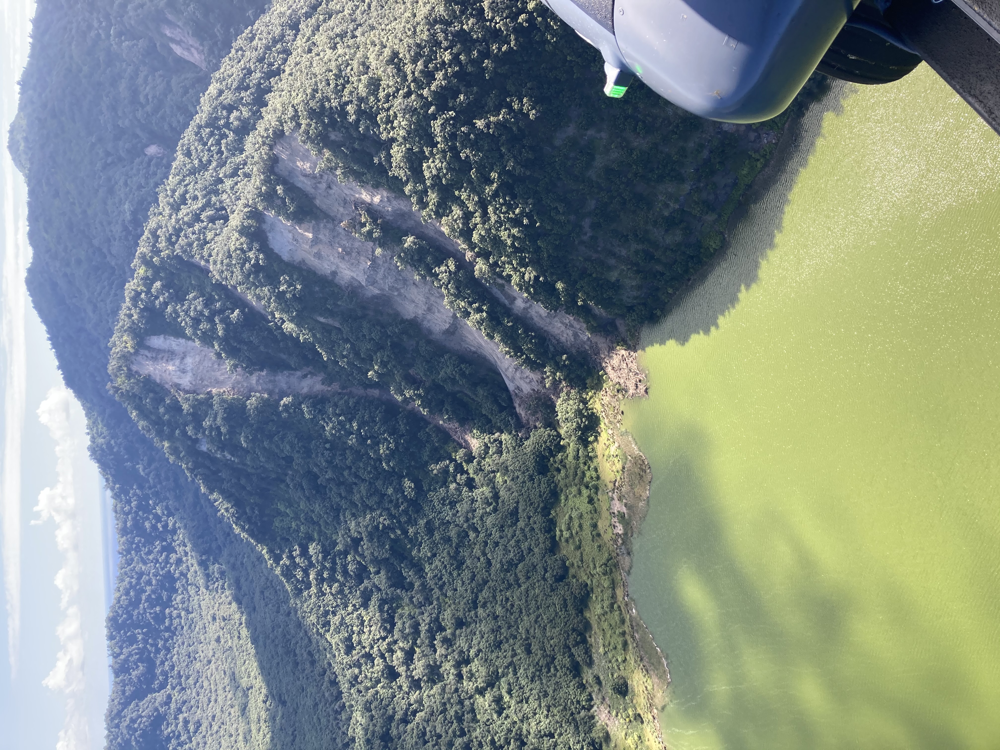
Figure 3. Landslides triggered on the crater rim of Blue Lake
An extreme rainfall event in July caused widespread flooding in the South Island, and our landslide response team travelled down to help the West Coast Regional Council to capture region-wide information about any potential landslides and their impacts.
As well, we did two reconnaissance flights over the Marlborough Sounds, as well as ground investigations to assist Marlborough District Council map and assess the landslide damage to roads and buildings. Of the eighteen houses surveyed, fourteen were damaged and a further four were near misses, where landslides occurred near houses, or the debris stopped before hitting a house. The data on impacts to buildings are being used to help mitigate impact from future events, as part of the Resilience to Nature’s Challenges High Impact Weather programme.
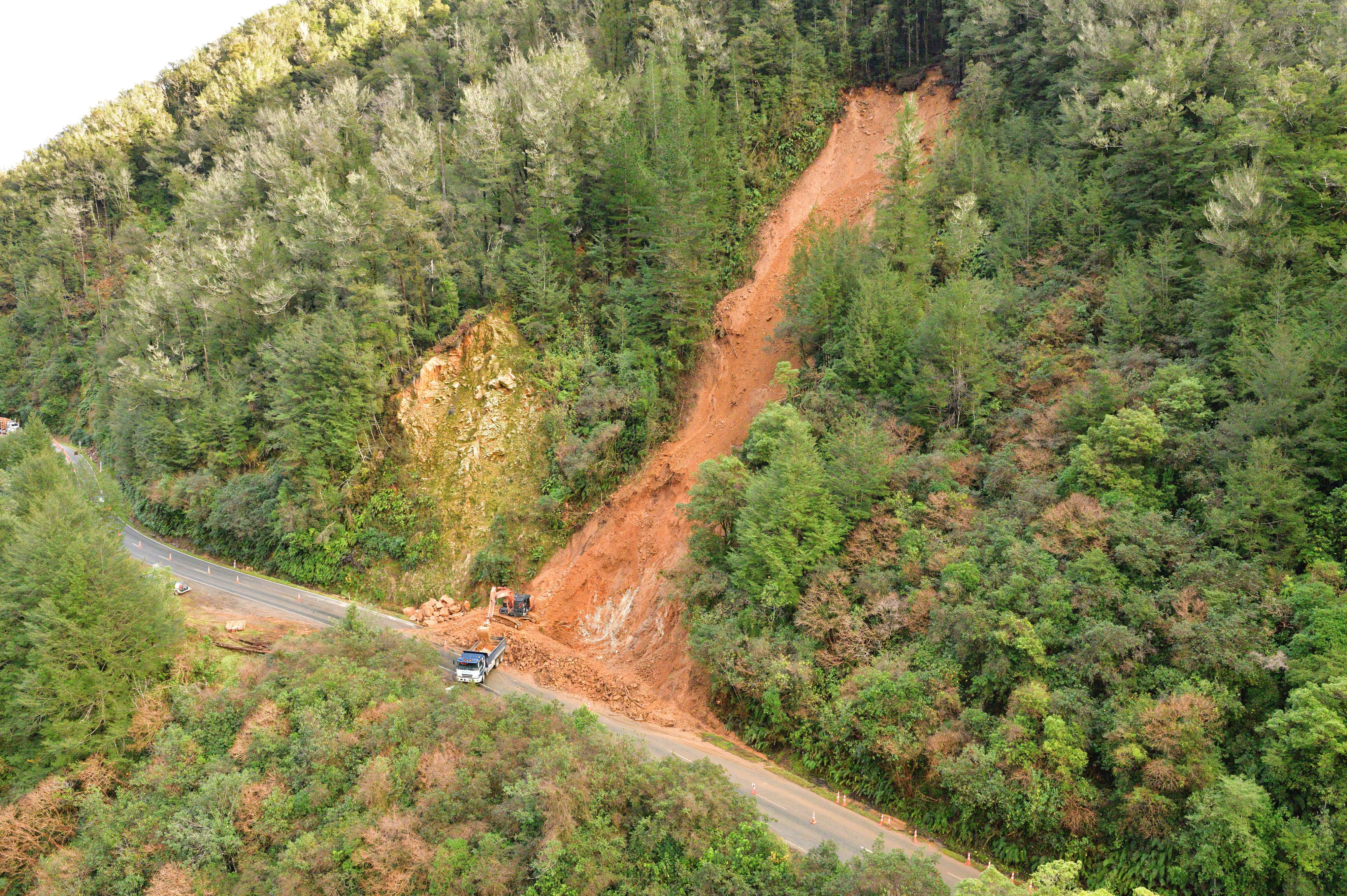
A landslide that blocked SH6 at Lyell on the West Coast.
Heavy rain in November caused landslides in Gisborne. Our team collected information on the landslides and the damage they caused to houses in Gisborne. The landslide team was hosted by Gisborne District Council and local iwi Ngāi Tāmanuhiri, as two of the significant landslides were on Ngāi Tāmanuhiri land.
A large landslide (possibly up to 5-8 million m3 in volume) was triggered on the coast south of Gisborne, near Whareongaonga, and debris deposited into the sea changed the shape of the coastline (pictured). The size of the Whareongaonga landslide is extreme for a rainfall-induced landslide, and it is of high scientific value to our team, as we are not aware of such a large (rapid) landslide being triggered by rainfall in the Gisborne region for a very long time.
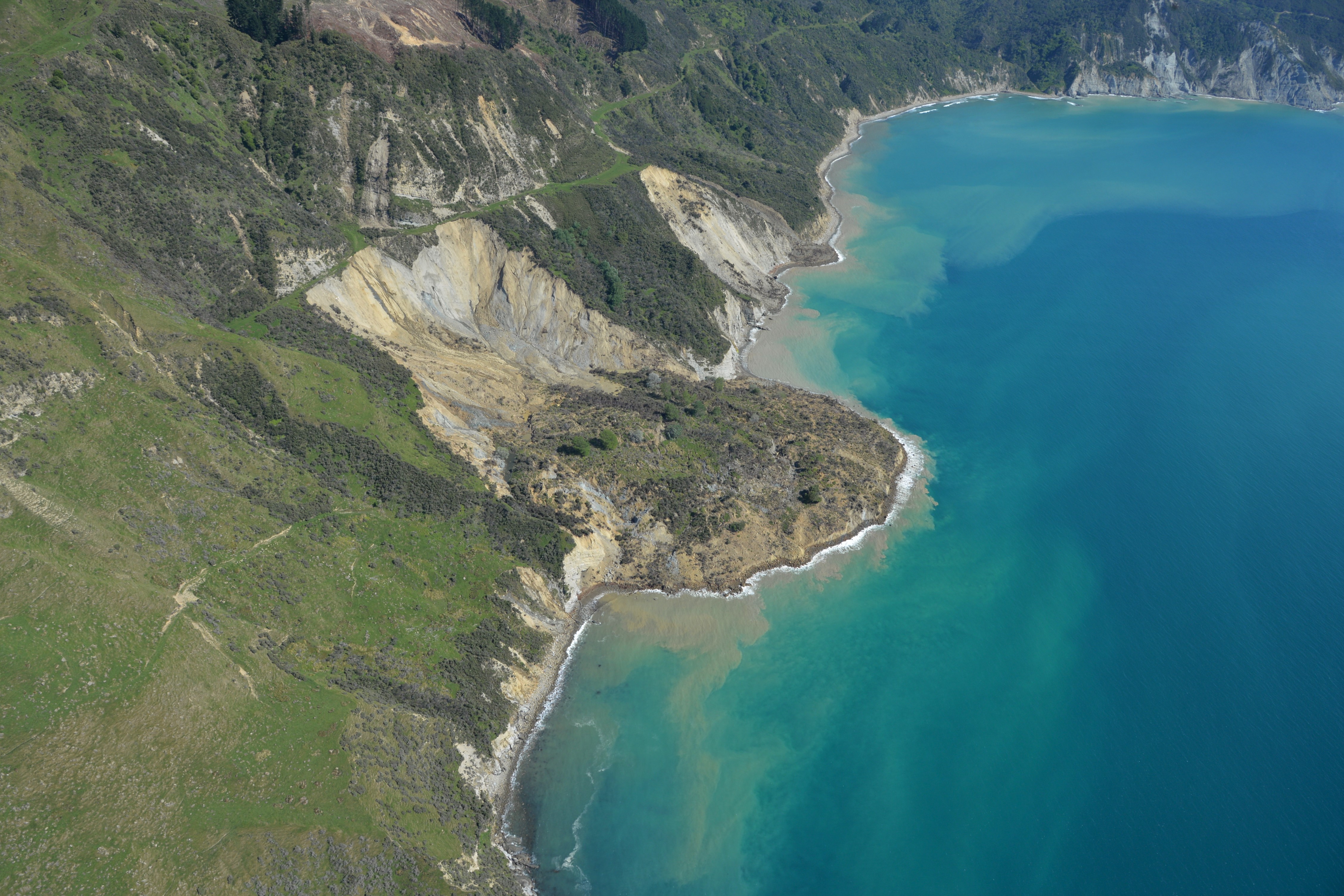
Whareongaonga landslides
Volcanoes
The year started with continuing elevated volcanic unrest at Ruapehu volcano. This unrest that had started in 2020, ended in January and the Volcanic Alert Level (VAL) was lowered to Level 1. Crater Lake (Te Wai ā-moe) had three heating cycles over the year, with temperatures cycling from below 20 °C through to over 40 °C. As is often the case at the start of a heating episode, a few volcanic earthquakes and increase in volcanic tremor preceded the second heating phase in July.
Whakaari/White Island remained our most active volcano during 2021, however the volcanic activity was restricted to intermittent ash emissions and minor steam explosions that typically didn’t extend far from the island. The first of the small steam explosions occurred in February, with further minor steam-gas bursts from the active vent area in March. Changes in the gas data and sustained elevated vent temperatures saw the VAL raised to Level 2 in July. There were further minor-intermittent ash emissions from August through to September with the vent temperatures declining at the month's end. Elevated unrest continued through into December with increasing vent temperatures and continued intermittent-minor ash emissions.
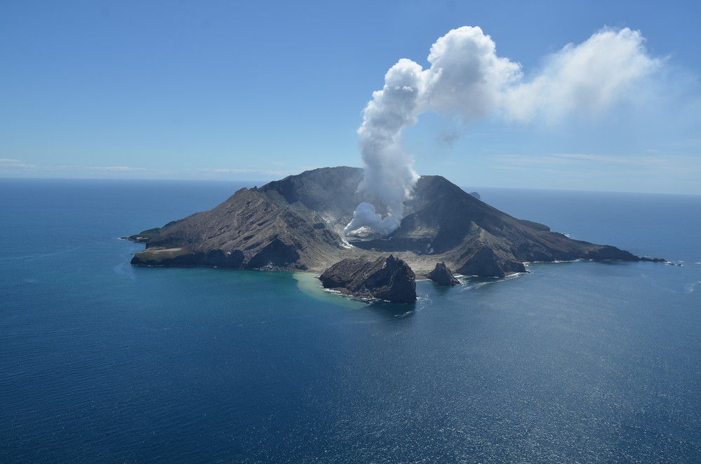
Steam and gas plume at Whakaari/White Island 1 November 2021
Activity at Tongariro and Ngauruhoe volcanoes, within the Tongariro National Park, was restricted to minor steam and gas emissions and shallow earthquake activity. More than 730 small earthquakes were located in the Tongariro National Park area during 2021.
Earthquakes located in Tongariro National Park during 2021, less than 30 km deep.
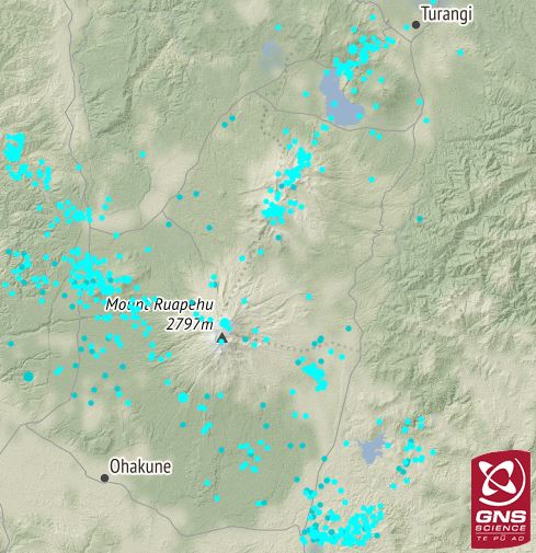
During 2021 GeoNet located more than 1040 shallow earthquakes in the central portion of the Taupo Volcanic Zone (Ahi Tupua), between Rotorua and Taupo. This area is dominated by the caldera volcanoes of Okataina and Taupo, large geothermal systems and the Taupo Fault Belt (an area of active faulting and earthquakes). Earthquake activity in this area often occurs in the form of swarms, lasting hours to weeks.
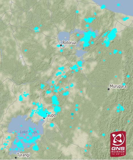
Earthquakes located in the Taupo Volcanic Zone during 2021, less than 30 km deep.
Activity at the other active volcanoes we monitor, including Raoul Island in the Kermadecs, Auckland volcanic field and Taranaki, remained at background levels during 2021.
Although we can’t prevent natural hazards, we can prepare for them – and we should.
NEMA (the National Emergency Management Agency) has a great website with information on what to do before, during and after each type of natural hazard. There you can also find Tsunami evacuation zone maps for around New Zealand and a list of supplies you need in an emergency.
The Earthquake Commission (EQC) has a helpful website with information on how to get your home, apartment, or rental prepared for a natural disaster.
And if you are going to check out the volcanoes in the Tongariro National Park the Department of Conservation (DOC) has lots of information on the hazards in the park and how you can be prepared.
Media contact: 021 574 541 or media@gns.cri.nz